Ring Dike
Total Miles
1.8
Technical Rating
Best Time
Spring, Summer, Fall
Trail Type
Single Track
Accessible By
Trail Overview
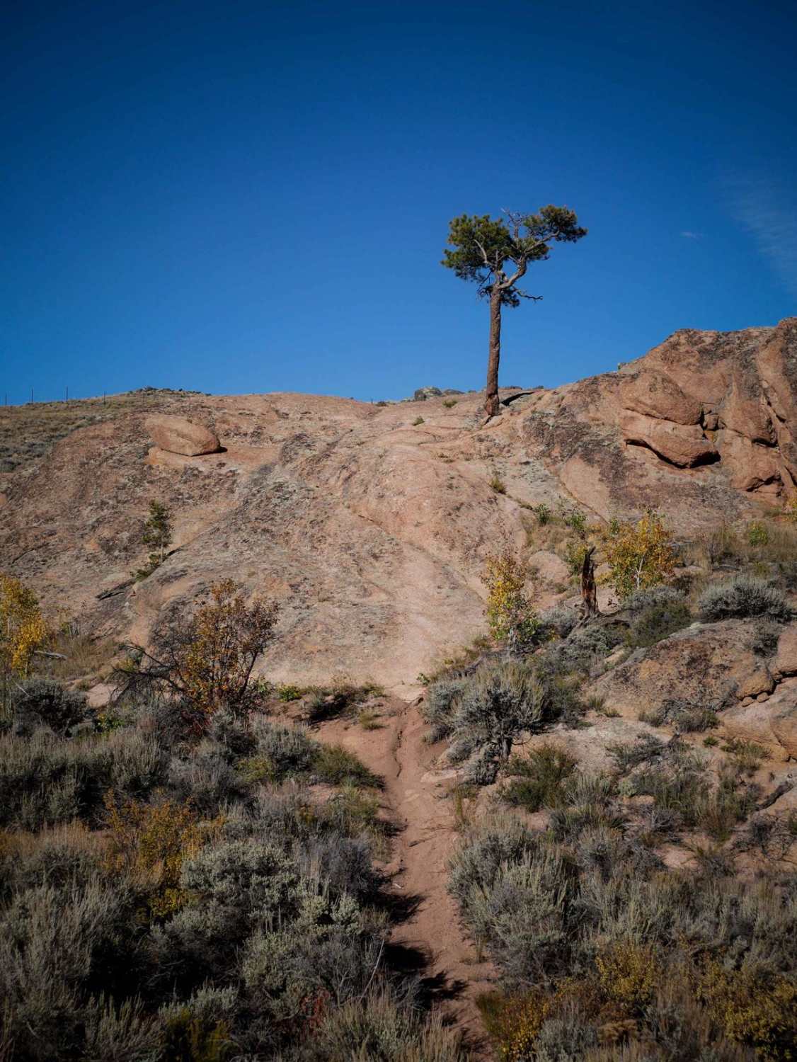
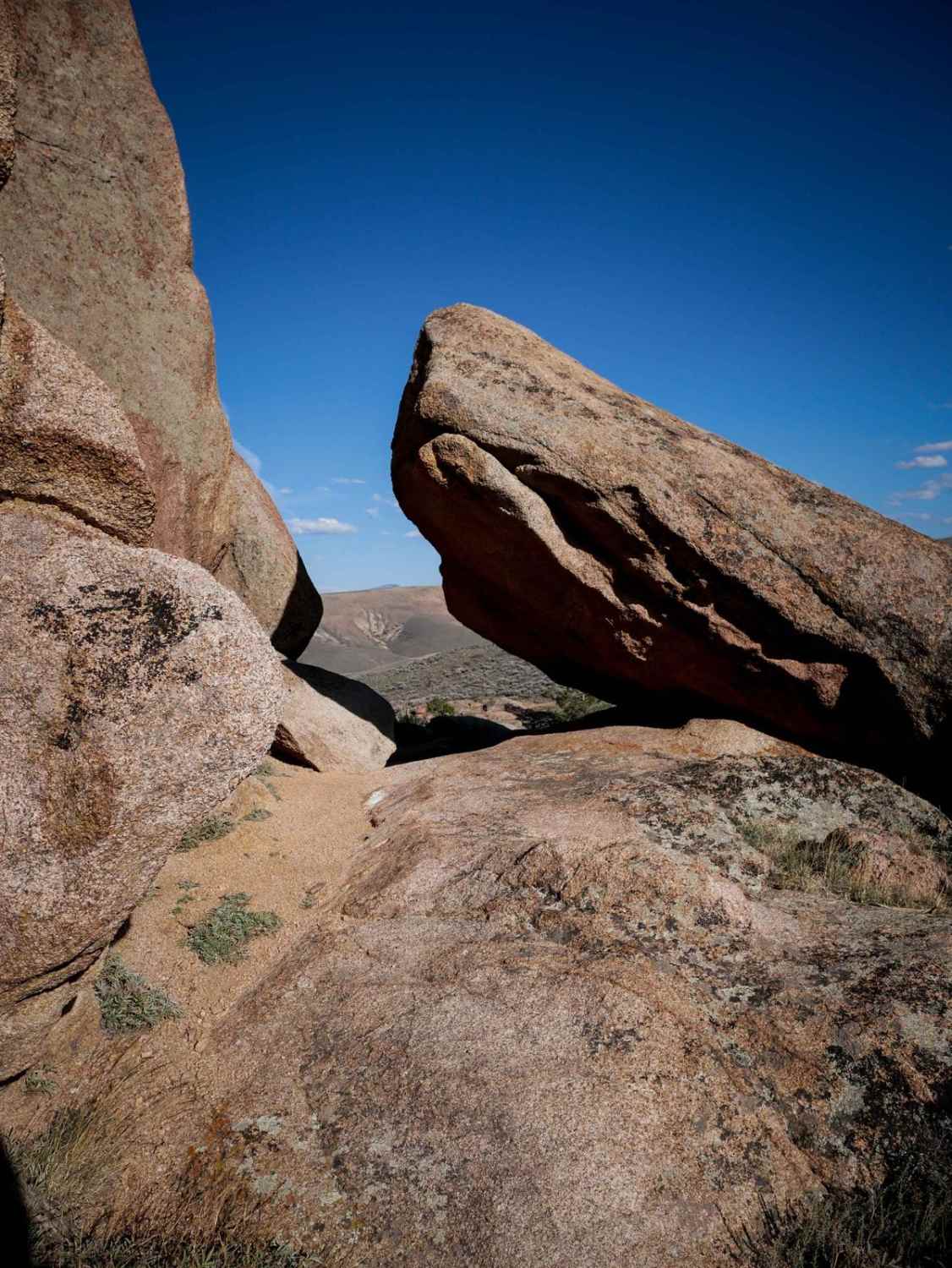
Ring Dike is one of the hardest trails in Hartman Rocks. From the south end, it rides past some scenic rock walls, riding over slick rock and climbing up the rock-covered hills, and steeply descending back down over more slick rock. It meanders between pine trees and giant boulders and has to sidehill down an off-camber rock wall that adds some difficulty. It's a pretty steep descent, going over boulders, with small ledges. It's helpful to have a map here as there are some turns that are easy to miss, especially while riding over the slickrock. You have to go up a steep blunt rock ledge a couple of feet high and climb back up more slab rock that is really steep and will require commitment. It goes through a cool rock pinch between a giant boulder and a rock wall, and then steeply descends. There are several more steep descents and climbs up and down the slickrock as you continue the trail and decent-sized drop-offs at the end of the slab. The north end of the trail meanders through more giant rock boulders and trees and is a bit hard to find as there are lots of tracks from others getting confused too, so a map is helpful here too. It loops around and ends at a parking area on Ring Dike Road. This trail feels like you are riding in Moab over the slickrock, through a really scenic landscape. It's a really fun challenge, and advanced riders won't want to miss it.
Photos of Ring Dike
Difficulty
This trail is for advanced riders only as it has very steep sections of slick rock, off-camber side-hilling on the slick rock, and decent-sized ledges. It requires expertise in clutch control and braking to make sure you don't loop out or endo when going up or down the slick rock.
Status Reports
Ring Dike can be accessed by the following ride types:
- Dirt Bike
Ring Dike Map
Popular Trails
Farwell Mountain ATV Trail

Tiger Trail
Taylor Park Hills & Thrills

The onX Offroad Difference
onX Offroad combines trail photos, descriptions, difficulty ratings, width restrictions, seasonality, and more in a user-friendly interface. Available on all devices, with offline access and full compatibility with CarPlay and Android Auto. Discover what you’re missing today!