Rattlesnake
Total Miles
1.2
Technical Rating
Best Time
Spring, Summer, Fall
Trail Type
Single Track
Accessible By
Trail Overview
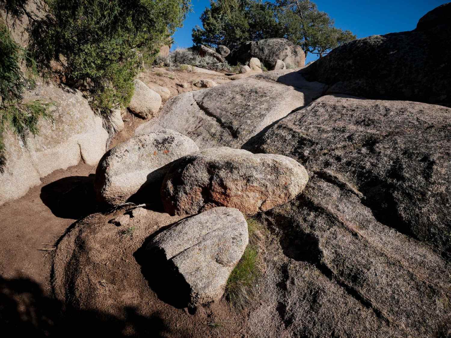
Rattlesnake is full of technical rocky features such as steep slick rock ramps, tall ledges, drop-offs, and big rounded boulders in the trail that you have to ride over. A couple of sections of the trail are more advanced because they are steeper, off-camber, really diagonal, or more blunt. There's one that goes straight up a giant slab with no run-in because you can't tell where the trail goes until you get there and you lose all momentum. Some of the slabs are really diagonal, so you have to be careful not to slide off of them. A lot of the obstacles you have to do from a dig, so you have to give it throttle and slip the clutch up the face of the slab, really working your body position. Be ready to throw your body weight forward and slip the clutch all the way up. You don't want to slam into them. It's a really fun challenge for advanced riders and can be combined with Ring Dike for a really challenging ride.
Photos of Rattlesnake

Difficulty
This is an advanced single track because it has 10 or so advanced rock obstacles throughout the 1.2-mile distance, requiring big technical moves and offroading skills.
Status Reports
Rattlesnake can be accessed by the following ride types:
- Dirt Bike
Rattlesnake Map
Popular Trails


Red Rocks- Night Horse Trail
Pratt Creek Cutoff South
The onX Offroad Difference
onX Offroad combines trail photos, descriptions, difficulty ratings, width restrictions, seasonality, and more in a user-friendly interface. Available on all devices, with offline access and full compatibility with CarPlay and Android Auto. Discover what you’re missing today!