Mount Antero Pass
Total Miles
1.1
Technical Rating
Best Time
Summer, Fall
Trail Type
High-Clearance 4x4 Trail
Accessible By
Trail Overview
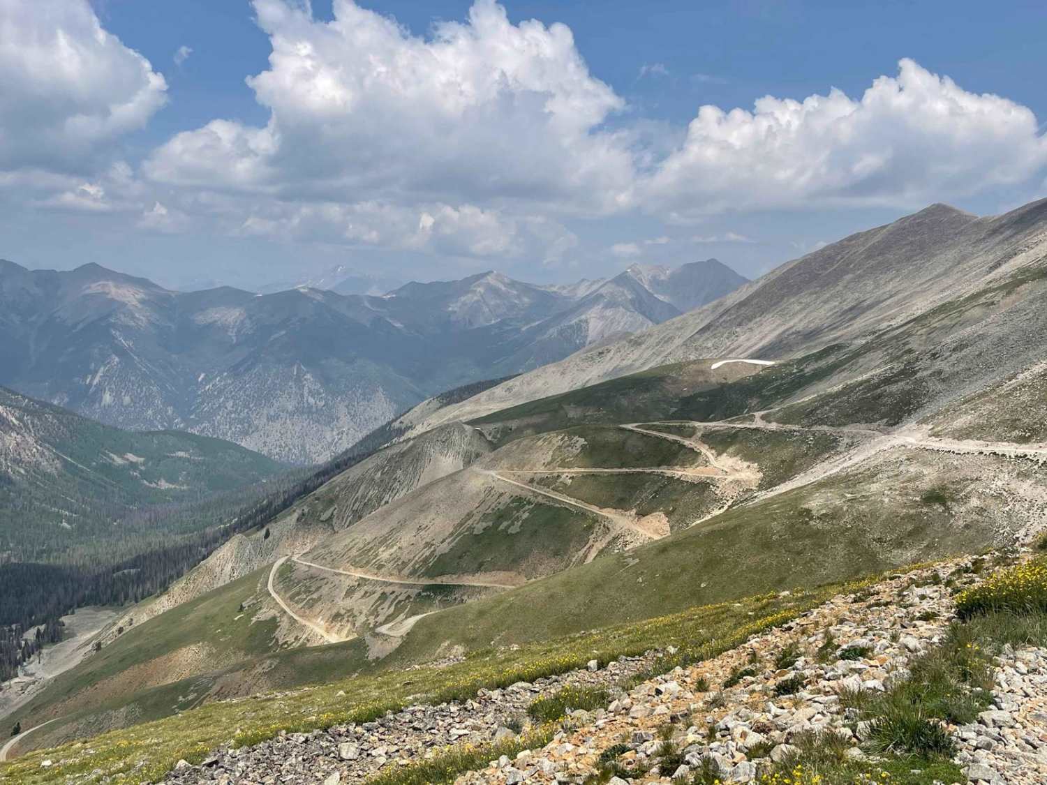
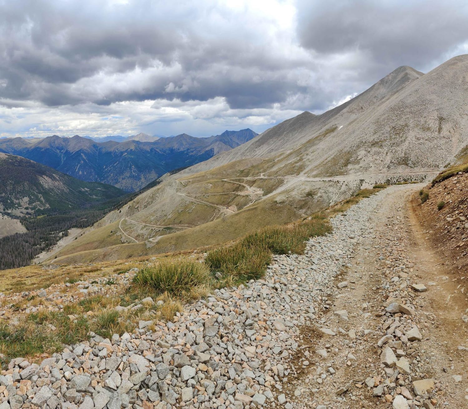
This epic trail to the top of Mount Antero starts off Browns Creek trail. Combine with Mount Antero Access trail and portions of Baldwin Lakes and Browns Creek trails for a full day of off-roading from the trailhead to Mount Antero at over 13,700 feet. The views along the trail are amazing. There is a large parking area at the top. Enjoy lunch and take photos that will certainly make it to your social media pages!
Photos of Mount Antero Pass

Difficulty
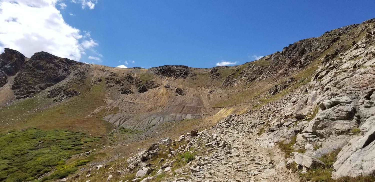
This trail is comprised of narrow trails, significant shelf exposure, and rocky, bumpy terrain. There are very limited areas to pass. The moderate rating is based on shelf exposure.
History
Mount Antero is known for producing the Colorado State gem, Aquamarine. The trail guide noted mining equipment at the top of the trail. Snow was present at the top when mapped, late July.
Status Reports
Mount Antero Pass can be accessed by the following ride types:
- High-Clearance 4x4
- SxS (60")
- ATV (50")
- Dirt Bike
Mount Antero Pass Map
Popular Trails
Browns Creek Trail

The onX Offroad Difference
onX Offroad combines trail photos, descriptions, difficulty ratings, width restrictions, seasonality, and more in a user-friendly interface. Available on all devices, with offline access and full compatibility with CarPlay and Android Auto. Discover what you’re missing today!