Limekiln Peak
Total Miles
2.8
Technical Rating
Best Time
Spring, Summer, Fall
Trail Type
Single Track
Accessible By
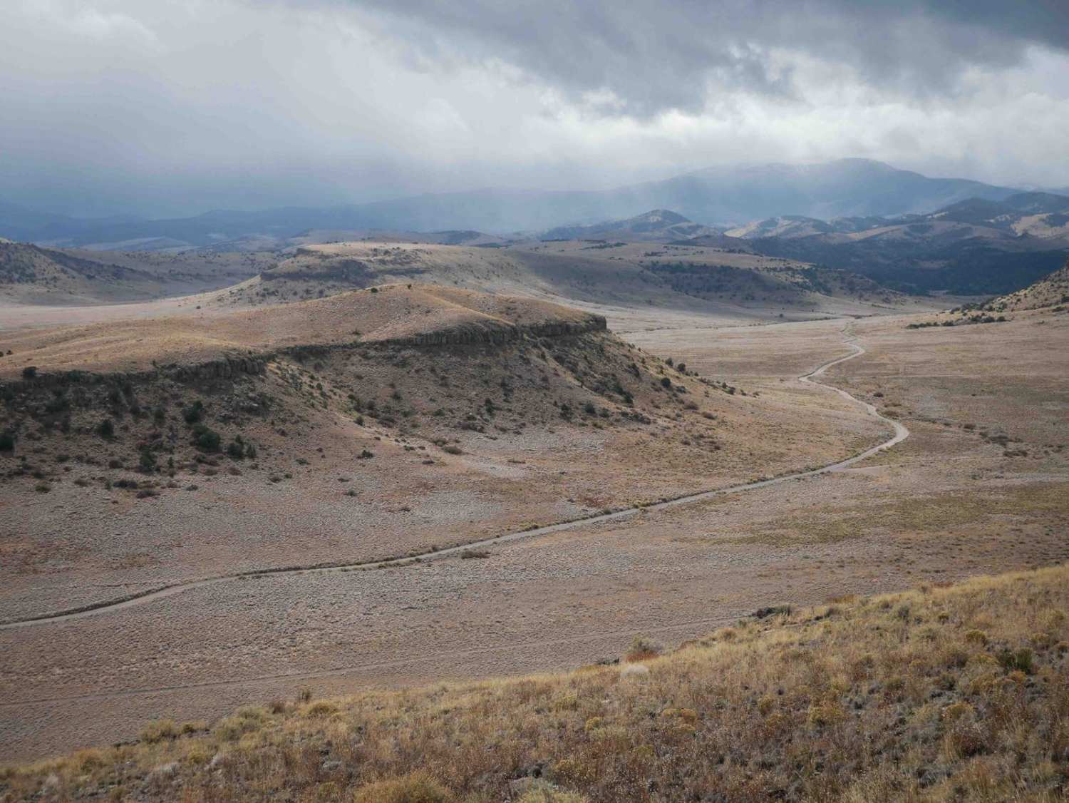
Trail Overview
Limekiln Peak is the most scenic of the trails in the Limekiln area. From the east end, this singletrack starts climbing up the mesa on an easy trail and comes up to a pinch between two small boulders that you can either ride between or pop over the 1-foot tall boulder. There are more trees on the mesa than in the valleys below, and you ride past small pinyon pine. The trail also gets more interesting with flat embedded rock layers across the surface. It traverses across the side of the mesa, with some flat boulders in the trail. It rides right along the edge of the mesa, overlooking some scenic cliffs in front of you, and to the valley a couple hundred feet below you. This trail ends on the Pura Vida trail.
Photos of Limekiln Peak

Difficulty
This is an easy single track that has one easy rock feature, and a little bit of climbing, but should be easy for most average riders.
Status Reports
Limekiln Peak can be accessed by the following ride types:
- Dirt Bike
Limekiln Peak Map
Popular Trails

Hermosa Creek ATV
Red Arrow Scree Shelf
California Gulch
The onX Offroad Difference
onX Offroad combines trail photos, descriptions, difficulty ratings, width restrictions, seasonality, and more in a user-friendly interface. Available on all devices, with offline access and full compatibility with CarPlay and Android Auto. Discover what you’re missing today!