Burns Gulch Road
Total Miles
2.0
Technical Rating
Best Time
Summer, Fall
Trail Type
Full-Width Road
Accessible By
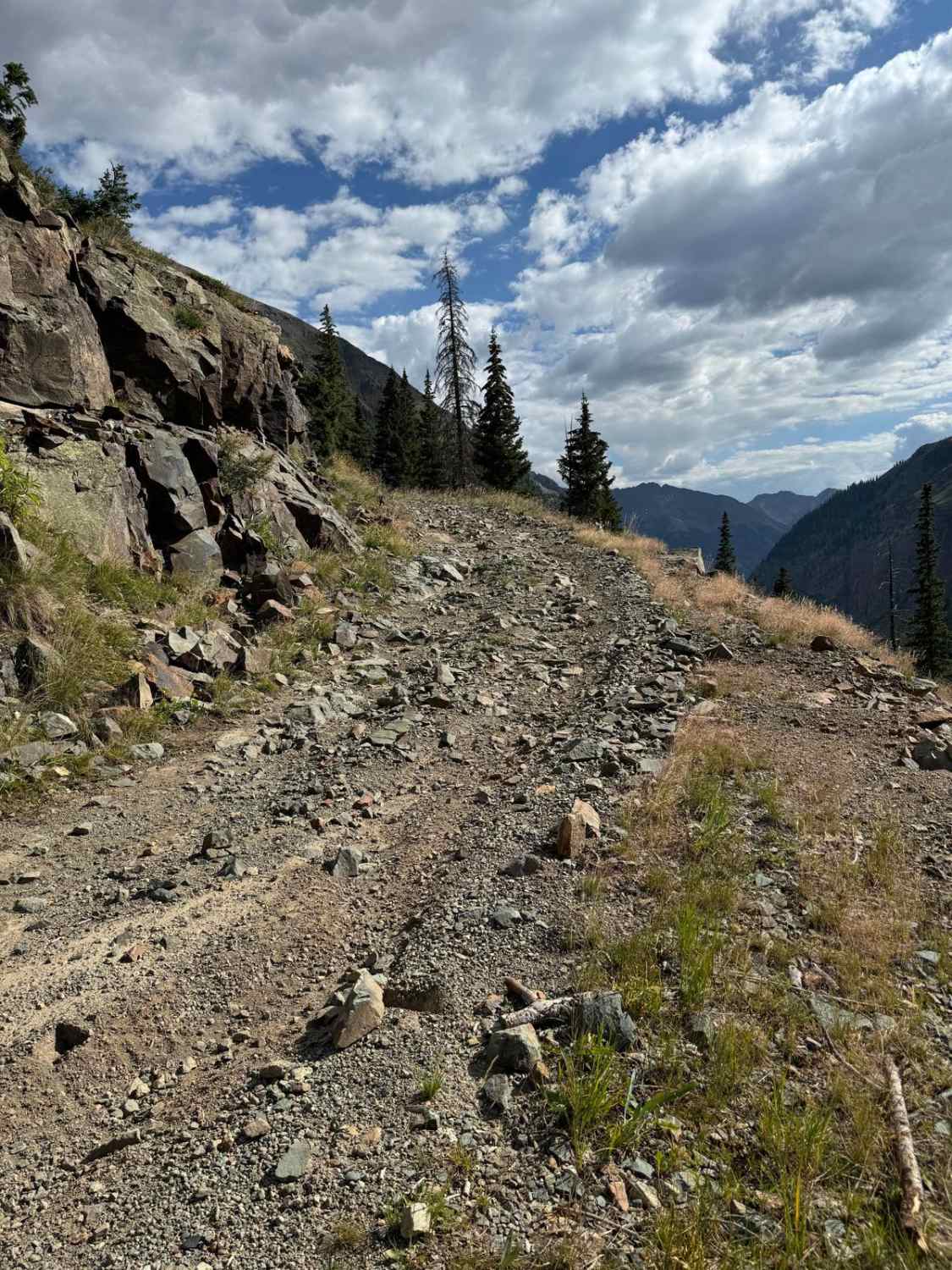
Trail Overview
Drive along the road until you reach an elevation of approximately 11,680 feet. This road is a single-lane, rocky, and moderately rough 4WD track. Lower down, the road follows a shelf, which can present challenges if you encounter another vehicle coming from the opposite direction. Drive along the road until you reach an elevation of approximately 11,680 feet. There is an unnamed mine towards the top that offers a better turnaround point than through the brush where the trails ends. The brush will leave some severe scratches in your paint!
Photos of Burns Gulch Road

Difficulty
This trail is only a single vehicle wide for most of the way. There is a very steep and rocky hill climb to the top.
Status Reports
Burns Gulch Road can be accessed by the following ride types:
- High-Clearance 4x4
- SUV
- SxS (60")
- ATV (50")
- Dirt Bike
Burns Gulch Road Map
Popular Trails

Red Canyon Paradox Trail
Coyote Park North
The onX Offroad Difference
onX Offroad combines trail photos, descriptions, difficulty ratings, width restrictions, seasonality, and more in a user-friendly interface. Available on all devices, with offline access and full compatibility with CarPlay and Android Auto. Discover what you’re missing today!