6102i
Total Miles
0.4
Technical Rating
Best Time
Spring, Summer, Fall, Winter
Trail Type
50" Trail
Accessible By
Trail Overview
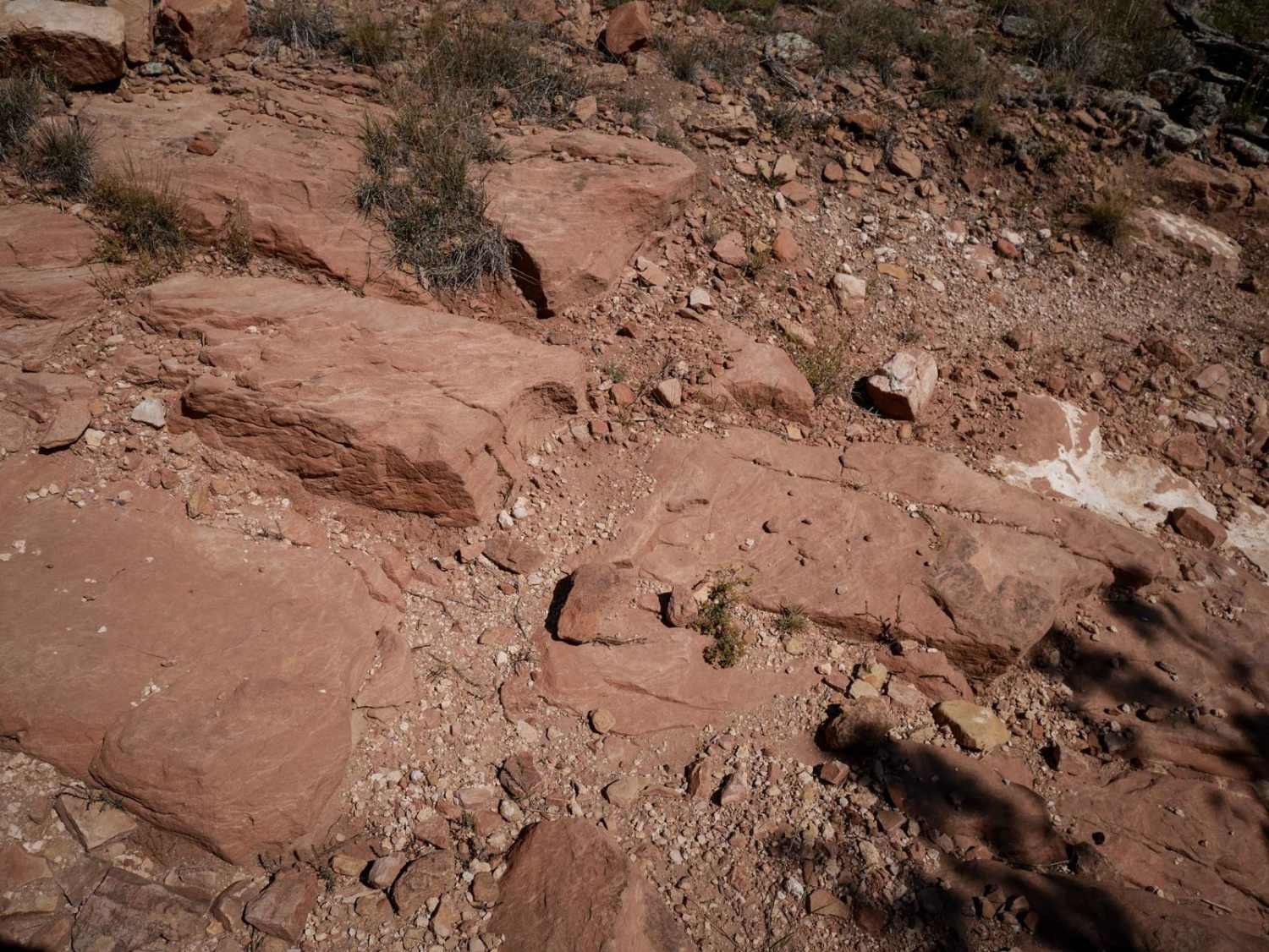
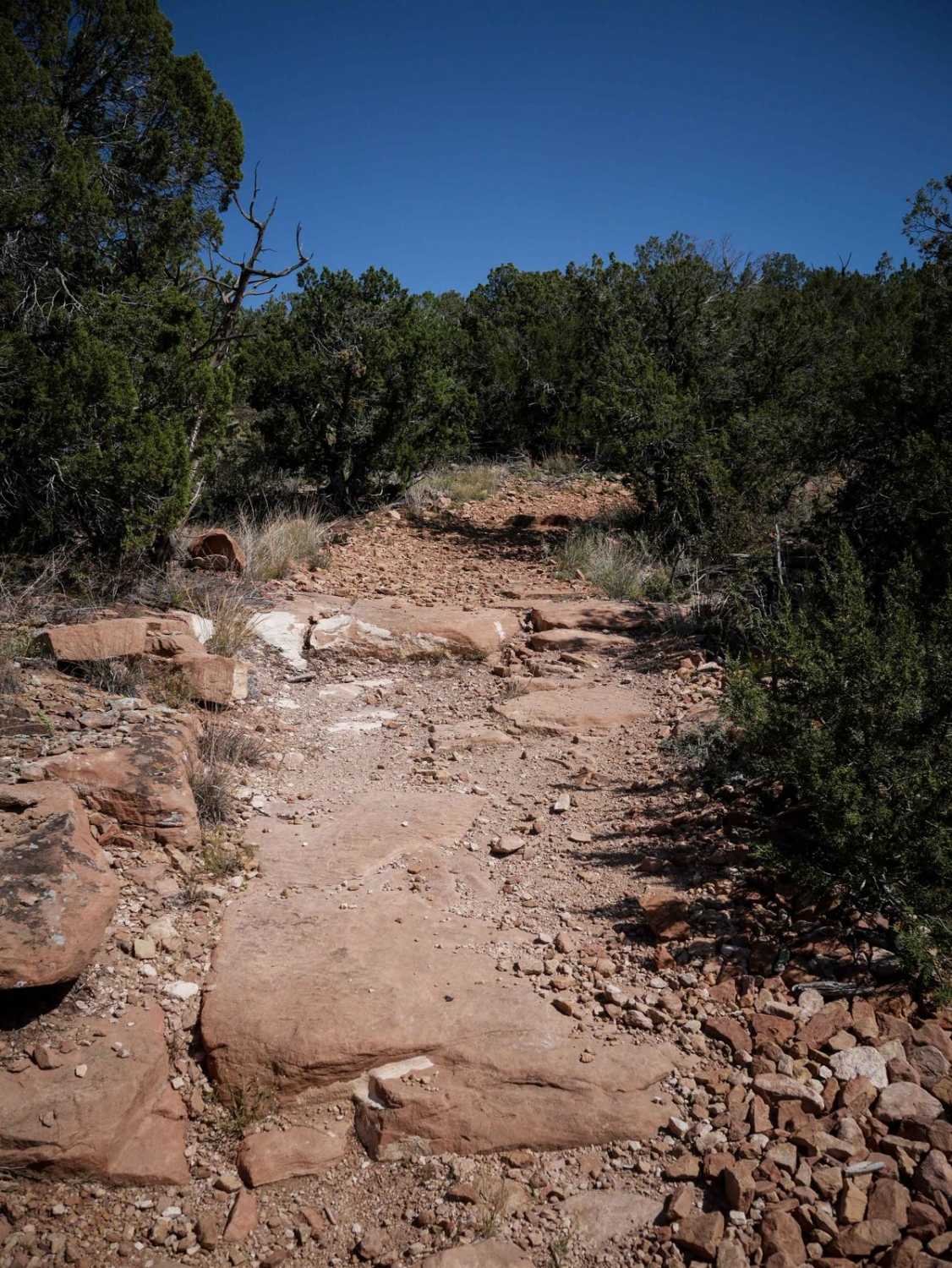
6102i departs from 6201F and goes over a bunch of slick rock layers, with a couple of 6" tall rock ledges right away. The rest of the short trail has small loose rocks, more flat slickrock layers, and a small steeper downhill descent with layers of embedded rock that make it a bit more challenging. The east end is flat and straight through grassy high desert terrain of pinyon pine, and it ends on BLM Route 6102.
Photos of 6102i
Difficulty
This is an easier ATV trail that has a few small rock ledges but is mostly just an easy trail covered in small loose rocks.
Status Reports
6102i can be accessed by the following ride types:
- ATV (50")
- Dirt Bike
6102i Map
Popular Trails

Relay Creek Road
Lost Park Road
East Buffalo Pass

Meadow Divide Road- FSR 325
The onX Offroad Difference
onX Offroad combines trail photos, descriptions, difficulty ratings, width restrictions, seasonality, and more in a user-friendly interface. Available on all devices, with offline access and full compatibility with CarPlay and Android Auto. Discover what you’re missing today!