Gilsonite Trail
Total Miles
3.8
Technical Rating
Best Time
Summer, Fall
Trail Type
Single Track
Accessible By
Trail Overview
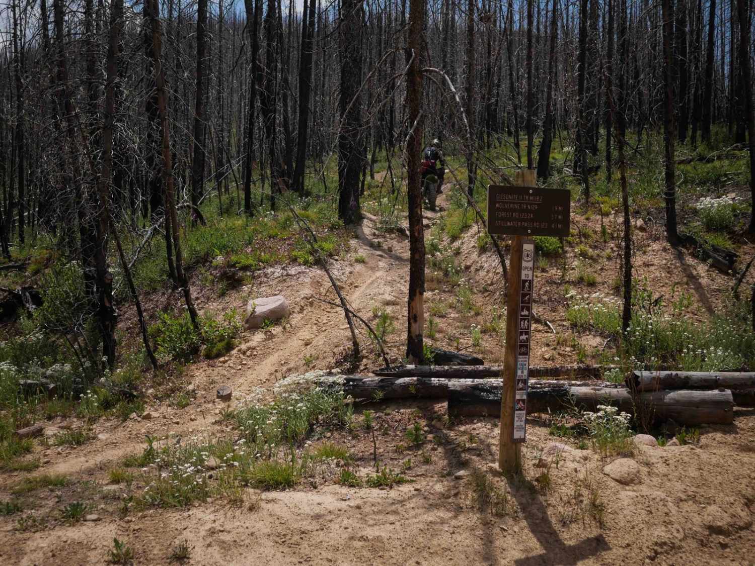
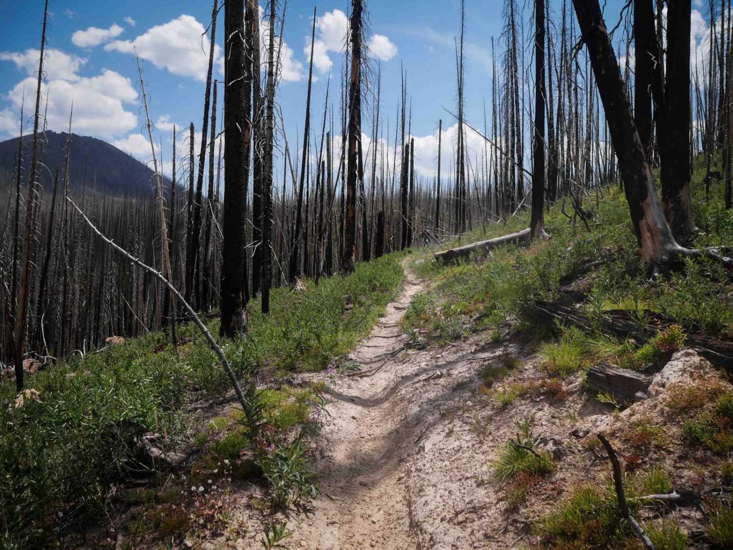
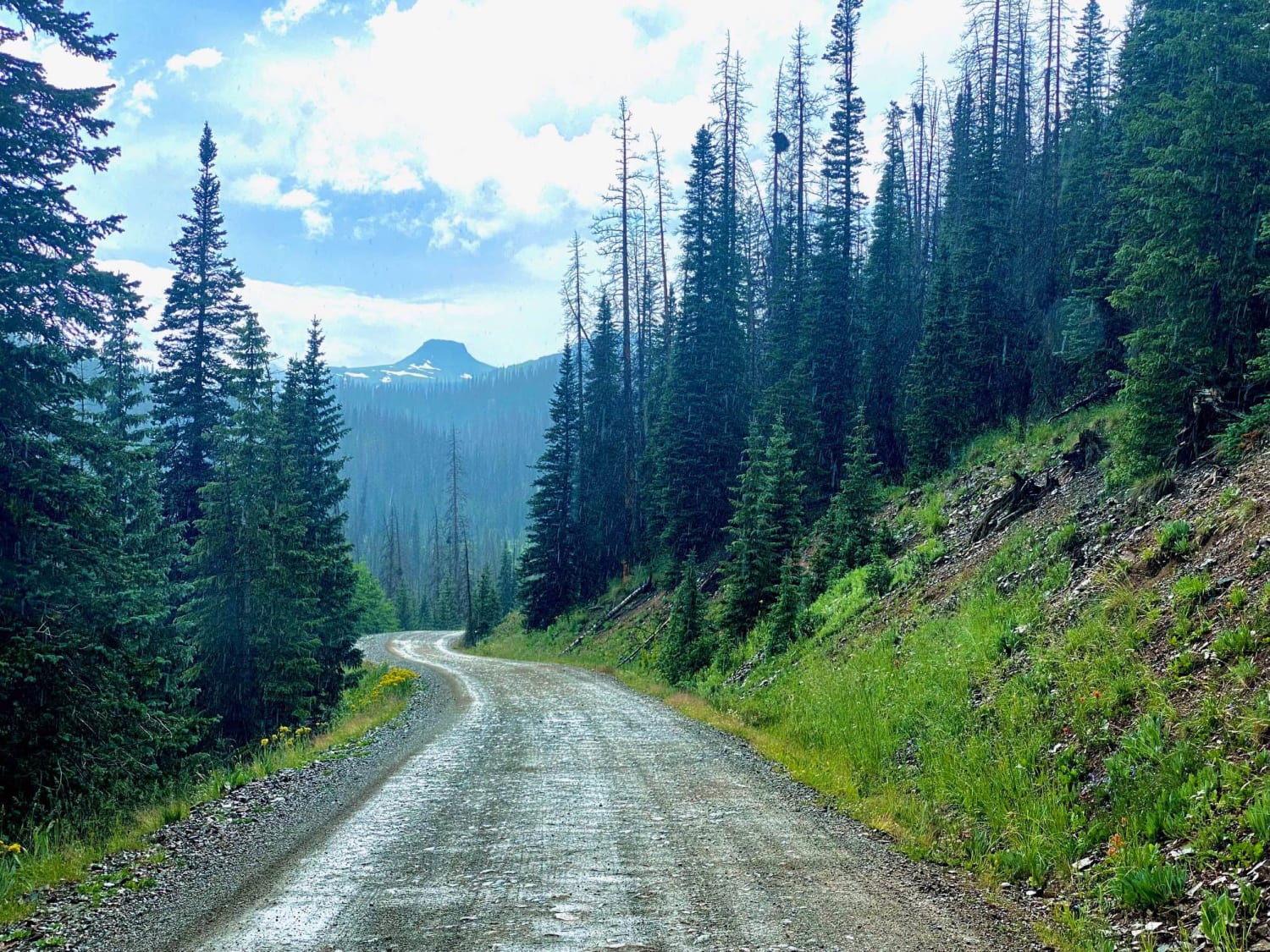
Gilsonite Trail is a 3.8-mile-long single track in the Medicine Bow Mountains of Arapaho National Forest, passing entirely through the 2020 East Troublesome Fire burn area. Significant trail work has been completed to reopen and maintain the route, though riders should remain alert for lingering hazards such as downfall and erosion. The northern half of the trail is fast and flowy, meandering across hillsides with small loose rocks and occasional shelfy stretches. Several small wooden bridges span muddy streams, but it had at least one rutted muddy spot with no bridge that was troughed out and not ideal if you pick the wrong line. About halfway in, the trail becomes rockier, with steeper climbs filled with loose rock and embedded boulders that make it more technical. The southern end returns to a smoother, narrower flowy path through open meadows, offering a break from the rockier middle portion. This trail is closed seasonally from 11/16 to 6/14.
Photos of Gilsonite Trail
Difficulty
This is an intermediate trail due to the steeper rocky spots, muddy ruts, and loose terrain in the middle portion. The beginning and end are easier and more flowy, but the middle of the route is more technical and rocky.
Status Reports
Gilsonite Trail can be accessed by the following ride types:
- Dirt Bike
Gilsonite Trail Map
Popular Trails
Porcupine Gulch
Mount Tilton Spur
Old Monarch Pass
Park Creek South-Fr Rd 380
The onX Offroad Difference
onX Offroad combines trail photos, descriptions, difficulty ratings, width restrictions, seasonality, and more in a user-friendly interface. Available on all devices, with offline access and full compatibility with CarPlay and Android Auto. Discover what you’re missing today!