2 trails found in California
Which "coyote lake" are you looking for?
We found 2 off-road trails in California matching your search. Pick the one you're looking for below.
Learn more about Coyote Lake Trail - FS 31E304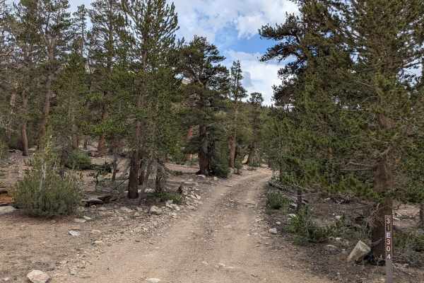
Coyote Lake Trail - FS 31E304
This sand, dirt, and gravel trail begins in a wide meadow before quickly climbing into a dense forest of tall pine trees. After weaving through the forest, the road opens again into a large meadow beneath the surrounding hills. From here, the trail continues toward Coyote Lake, cutting back into the...
Learn more about Coyote Lake Trail - FS 31E304
Total Miles
1.7
Tech Rating
Easy
Best Time
Summer, Fall