Sim's Trail
Total Miles
1.8
Technical Rating
Best Time
Spring, Fall, Winter
Trail Type
Single Track
Accessible By
Trail Overview
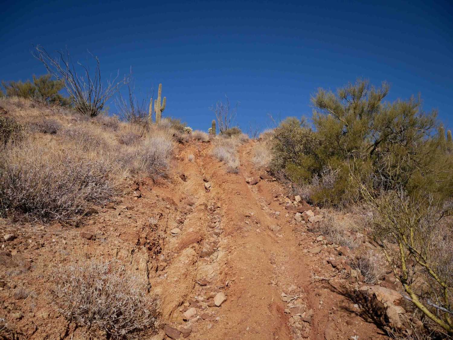
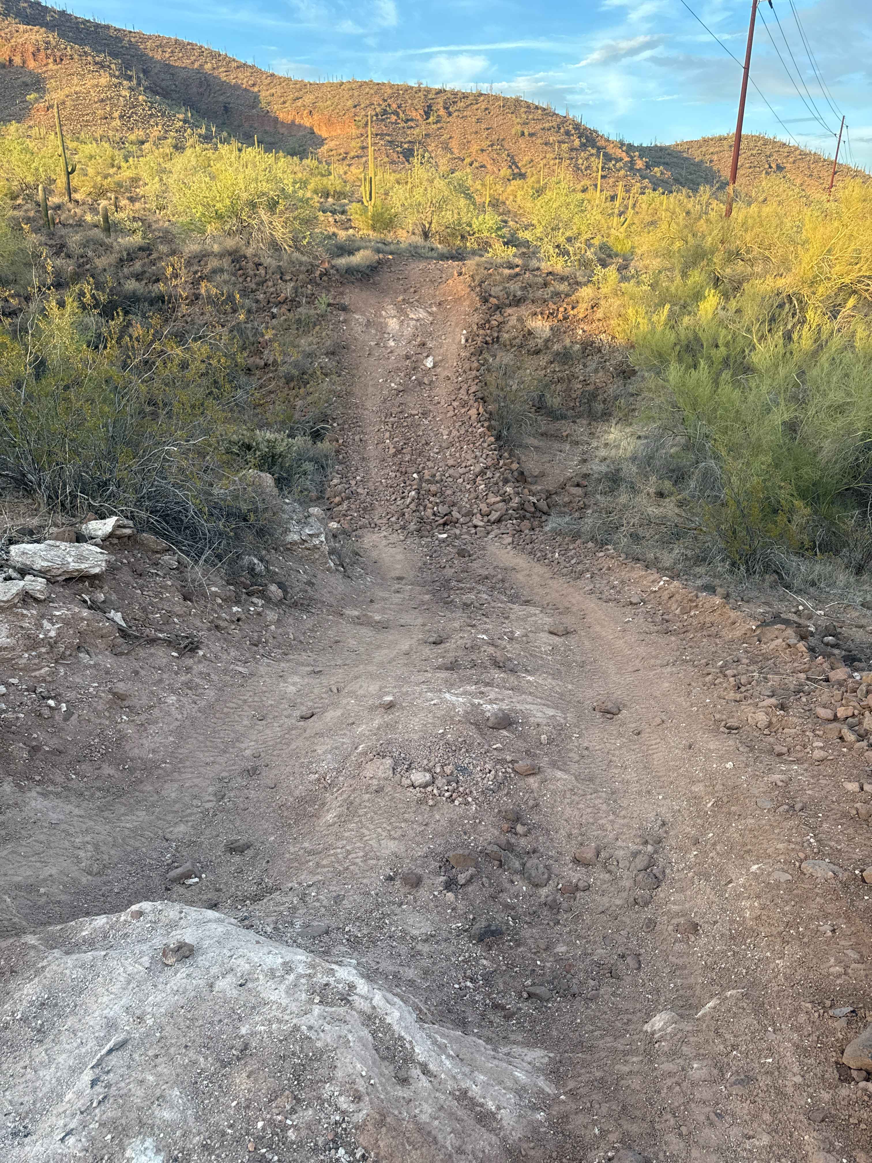
This is a fun desert trail with some good challenges. The south end starts at a sign in the wash, dedicating the trail to Jim Sims. From the sign, it starts with a steep climb up with loose rock, ruts, and embedded rock layers that is pretty technical right away. The trail is deeply troughed and rocky on one of the climbs. It rides atop a ridgeline and goes up a really steep, washed-out climb with deep ruts. This trail seems less trafficked, and the cactus along the route are really overgrown, so you have to watch your arms getting too close to the cactus. The views are pretty incredible throughout the route of these rugged desert mountains.
Photos of Sim's Trail

Difficulty
This is an intermediate trail due to technical hill climbs that are extremely loose, rutted, and steep. There are several rocky sections with embedded rock in the climbs as well.
Sim's Trail can be accessed by the following ride types:
- Dirt Bike
Sim's Trail Map
Popular Trails

Vicksburg Valley
Eloy Canal Trail
Black Canyon Creek
The onX Offroad Difference
onX Offroad combines trail photos, descriptions, difficulty ratings, width restrictions, seasonality, and more in a user-friendly interface. Available on all devices, with offline access and full compatibility with CarPlay and Android Auto. Discover what you’re missing today!