
Off-Road Trails in Arizona
Discover off-road trails in Arizona
Off-Road Trails in Arizona
Discover the best off-road trails in Arizona. Browse trail maps, check difficulty ratings, and find your next adventure — whether you're looking for a quick ride or an all-day expedition.
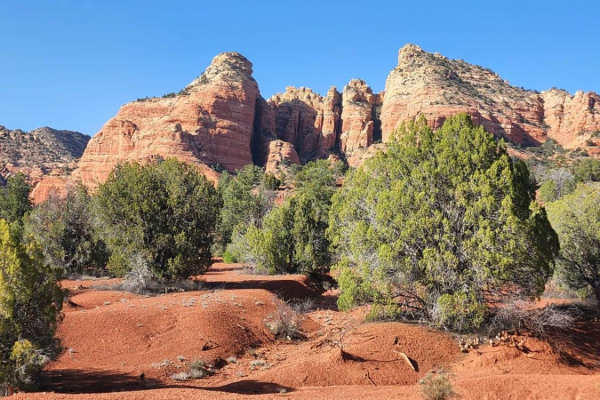
Henderson Flat
This trail is a one-way in (13 miles) and one-way out through pinyon-juniper woodlands. Drive along this two-track road (FR 181) and see wildlife;wildflowers (spring) in the Rafael Fire scar (2021);small canyons;red-rock escarpments;a historic ranch cabin;and good views. The road ends at the Sycamor...
Learn more about Henderson Flat
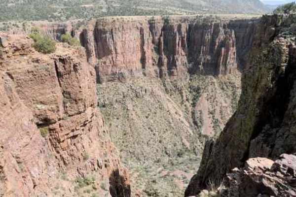
Black Hills Back Country Byway
The Black Hills Back Country Byway is an unpaved road that provides access to thousands of acres of BLM land. There are many areas to camp, hike, mountain bike, or explore side tracks via 4x4. The views are best if the route is traveled from north to south. When recently graded the route would earn ...
Learn more about Black Hills Back Country Byway
Roller Coaster - The Rolls
Avoid the crowds on east/west sections of The Rolls by sticking to the central corridor - this route stays along the mountain ridges for EPIC views. This seldom used route starts off easy with little elevation change as you drive down rutted out roads. As the trail progresses, you can find plenty of...
Learn more about Roller Coaster - The Rolls
Mount Ord
Mount Ord is almost 7,000 feet in elevation, so it is a nice place to be in hot weather, but not so good after a cold winter storm. This trip is an enjoyable way to spend a short day out in the brush--a fairly easy trail with great scenery. It can be done in any direction. Doing it from the north ge...
Learn more about Mount Ord
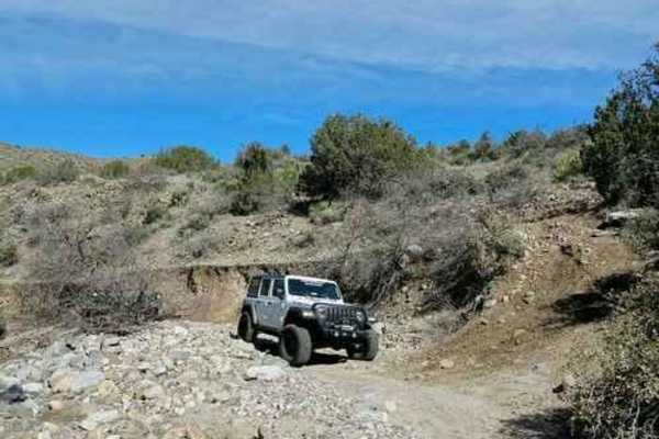
Sunflower Mine
Take a fairly difficult Jeep trail to an abandoned mercury mine in the rugged Mazatal Mountains between Mesa and Payson. The section below the mine is somewhat easier than above the mine. We prefer to run in a clockwise direction, although it is possible to go either way. It works better if all gr...
Learn more about Sunflower Mine
Sawtooth Mountain Loop
AZ State Trust permit required. This scenic trail circles around the Sawtooth Mountains. It is on BLM and AZ State Trust and skirts private land. You will experience forests of cholla, saguaro, and large pear cactus, which are extremely beautiful in their natural setting. After rains, the greenwash ...
Learn more about Sawtooth Mountain Loop
Mushroom Loop
This loop starts and ends on Middle Mountain Road. This loop has been coined the Mushroom Loop because several mushrooms were on display at stops along this loop. Either direction can be traveled individually, with the northern side of the loop being a primitive road lightly used, the southern side ...
Learn more about Mushroom Loop
County Highway 5
This trail is class 2 sand, dirt, and gravel trail traveling south from Colorado City, AZ to Grand Canyon, Toroweap Overlook. A two-dollar permit is required to enter the last six miles of the trail. The last six miles will be a class 3. Tuweep campground is at the end of the trail with ten primitiv...
Learn more about County Highway 5
Parker Canyon East
This trail leads to an eastern overlook of Parker Canyon. The road isn't challenging, but it can offer a good perspective after seeing the west side of the canyon via Natural Drainage Road 488, also known as Parker Canyon West. If you can only do one route, do the west one.
Learn more about Parker Canyon East
Richmond Basin
The Richmond Basin is a large area with a long history of mining for Zinc, Silver, Lead, and Gold. This Jeep trail will take you on a loop through the heart of the area. The eroded hill climbing up into the basin is usually the most difficult part of the trip and can change depending on erosion and ...
Learn more about Richmond Basin
Crown King Road
This is a rough and washboarded gravel road from IH-17 to Crown King via Bumble Bee Road Route. There are several sharp switchbacks and blind corners. Last several miles before Crown King are single-vehicle width. Please observe speed limit signs and proceed cautiously. Severe and inclement weather ...
Learn more about Crown King Road
Rockin' Ram Trail
You can stage at some of the many RV parks in Quartzsite along Highway 95 or on BLM land along the highway. You access this 18-mile trail in the desert on the east side of Highway 95. Follow the track across the desert to the Plomosa Mountains. Plomosa Pass is rocky and narrow, with tight turns and ...
Learn more about Rockin' Ram Trail
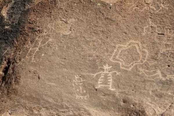
Birthing Place
Legend says this is where Indians went to give birth because there was year-round water and "tubs" that could be used for baths. We do not know if the legend is true, but do believe the site was important to the people of the time, even if just for water. There are many petroglyphs in the area.Ju...
Learn more about Birthing Place
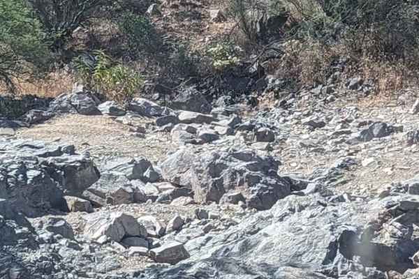
Elvis
Elvis is a rough wash with many difficult obstacles. Most obstacles have bypasses, but even those require a skilled and built Jeep. 33's and lockers are recommended, but not necessary if the more extreme obstacles are bypassed. Some obstacles will require a good spotter and stacking of a few rocks. ...
Learn more about Elvis
Old 2604 Road
Old 2604 Road is a side trail off of Supai Village 328 and consists of deep mud ruts and chalky, light dirt. This 5.5-mile trail is a single-lane with a few scattered primitive camping sites nearer to Supai Village 328. As is typical with the region, this trail is populated with ponderosa pines, elk...
Learn more about Old 2604 Road
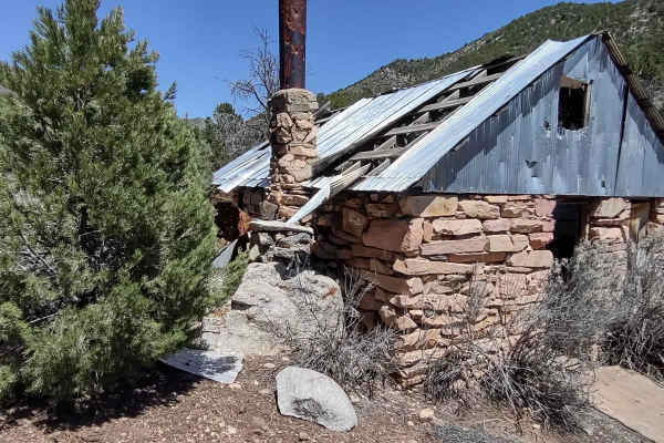
Maple Canyon to Stone Cabin (Black Rock Rd 1004)
This trail climbs 2000 feet in elevation, as you move across the Grand Canyon-Parashant National Monument and through the Paiute Wilderness towards Black Rock Mountain, elevation 7365 feet. After crossing the top of the mountains, the trail drops down into the draw where the cabin is found. The Blac...
Learn more about Maple Canyon to Stone Cabin (Black Rock Rd 1004)
County Hwy 109/Mt. Trumbull Road
The road sign says Antelope Valley. It is a wide dirt, gravel, and sand trail that is rated at class 2. The trail is five miles east of Pipe Springs, AZ, and the South side of Highway 389 in AZ. The trail winds down south towards the Toroweap Ranger Station in The Grand Canyon National Park. There i...
Learn more about County Hwy 109/Mt. Trumbull Road
Elbow Canyon Road-Mohave County 229 (BLM1042)
Elbow Canyon Road-Mohave County 229-BLM1042 is an 11-mile straight-through trail that is ideal for most stock 4x4 vehicles with high clearance and is rated 3 of 10. From Scenic, Arizona Elbow Canyon rises 4600 feet into the Virgin Mountain ending at the intersection with Black Rock Road-BLM1004. At ...
Learn more about Elbow Canyon Road-Mohave County 229 (BLM1042)
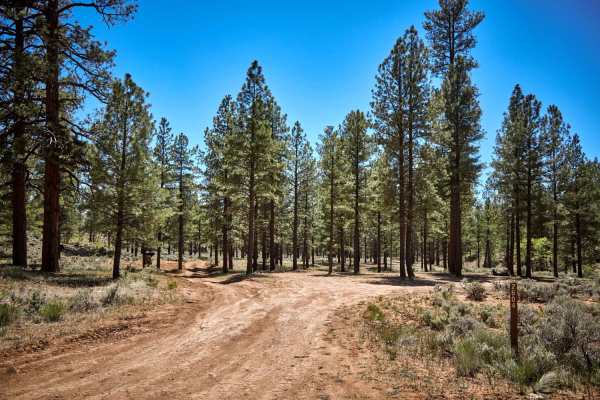
Rim Trail Road
This 1.5/2 lanes wide forest road runs through a beautiful rolling Ponderosa Pine forest sprinkled with meadows and open areas. Large primitive camping sites abound, with most being large enough for 5th wheel trailers and man-made rock fire rings. Please check local fire permits and requirements, as...
Learn more about Rim Trail Road
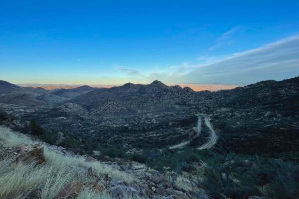
Pioneer Pass
Pioneer Pass starts near the center of Globe, circles the south side of Pinal Peak, and ends on Forest Service Road 651 leading to Pinal Peak. Climb to Pioneer Pass at 6,000' elevation, drop into Pioneer and Bobtail Basins at 5,000' then climb back up to 6,000' on the Pinal Peak Road. An enjoyable...
Learn more about Pioneer Pass
ATV trails in Arizona
Explore ATV-friendly trails in Arizona. These trails are accessible for vehicles up to 50 inches wide, perfect for ATVs and smaller off-road machines.
Henderson Flat
This trail is a one-way in (13 miles) and one-way out through pinyon-juniper woodlands. Drive along this two-track road (FR 181) and see wildlife;wildflowers (spring) in the Rafael Fire scar (2021);small canyons;red-rock escarpments;a historic ranch cabin;and good views. The road ends at the Sycamor...
Learn more about Henderson Flat
Black Hills Back Country Byway
The Black Hills Back Country Byway is an unpaved road that provides access to thousands of acres of BLM land. There are many areas to camp, hike, mountain bike, or explore side tracks via 4x4. The views are best if the route is traveled from north to south. When recently graded the route would earn ...
Learn more about Black Hills Back Country Byway
Roller Coaster - The Rolls
Avoid the crowds on east/west sections of The Rolls by sticking to the central corridor - this route stays along the mountain ridges for EPIC views. This seldom used route starts off easy with little elevation change as you drive down rutted out roads. As the trail progresses, you can find plenty of...
Learn more about Roller Coaster - The Rolls
Mount Ord
Mount Ord is almost 7,000 feet in elevation, so it is a nice place to be in hot weather, but not so good after a cold winter storm. This trip is an enjoyable way to spend a short day out in the brush--a fairly easy trail with great scenery. It can be done in any direction. Doing it from the north ge...
Learn more about Mount Ord
UTV/side-by-side trails in Arizona
Find UTV and side-by-side trails in Arizona. These trails accommodate vehicles up to 60 inches wide, ideal for UTVs, side-by-sides, and wider off-road rigs.
Henderson Flat
This trail is a one-way in (13 miles) and one-way out through pinyon-juniper woodlands. Drive along this two-track road (FR 181) and see wildlife;wildflowers (spring) in the Rafael Fire scar (2021);small canyons;red-rock escarpments;a historic ranch cabin;and good views. The road ends at the Sycamor...
Learn more about Henderson Flat
Black Hills Back Country Byway
The Black Hills Back Country Byway is an unpaved road that provides access to thousands of acres of BLM land. There are many areas to camp, hike, mountain bike, or explore side tracks via 4x4. The views are best if the route is traveled from north to south. When recently graded the route would earn ...
Learn more about Black Hills Back Country Byway
Roller Coaster - The Rolls
Avoid the crowds on east/west sections of The Rolls by sticking to the central corridor - this route stays along the mountain ridges for EPIC views. This seldom used route starts off easy with little elevation change as you drive down rutted out roads. As the trail progresses, you can find plenty of...
Learn more about Roller Coaster - The Rolls
Mount Ord
Mount Ord is almost 7,000 feet in elevation, so it is a nice place to be in hot weather, but not so good after a cold winter storm. This trip is an enjoyable way to spend a short day out in the brush--a fairly easy trail with great scenery. It can be done in any direction. Doing it from the north ge...
Learn more about Mount Ord
The onX Offroad Difference
onX Offroad combines trail photos, descriptions, difficulty ratings, width restrictions, seasonality, and more in a user-friendly interface. Available on all devices, with offline access and full compatibility with CarPlay and Android Auto. Discover what you're missing today!
Open Trail Map