
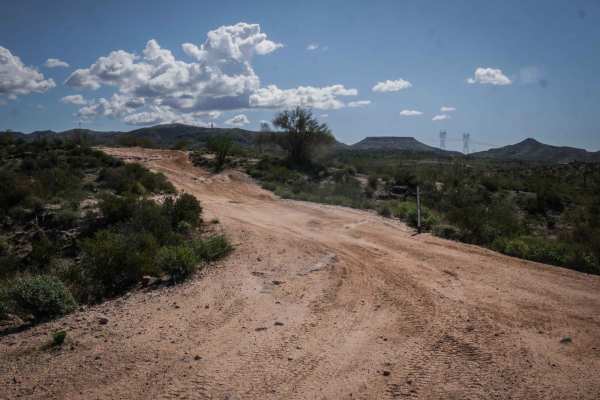
Off-Road Trails
Near Black Canyon City, Arizona
Off-Road Trails Near Black Canyon City, Arizona
Discover the best offroad trails near you. Browse trail maps, check difficulty ratings, and find your next adventure — whether you're looking for a quick ride or an all-day expedition.
Maggie Mine
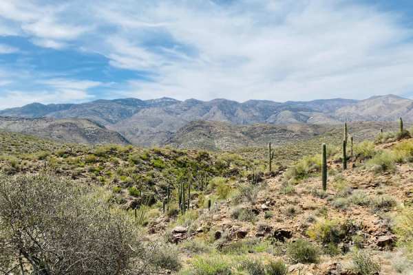
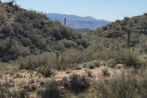
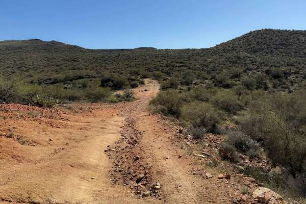
Very scenic trail in the foothills of the Bradshaw Mountains. Although not far from the highway and Black Canyon City, this route feels isolated and offers a chance to spot wildlife, beautiful desert plant life, and sweeping views of the Bradshaw Mountains and Castle Creek Wilderness in the Prescott...
Learn more about Maggie Mine
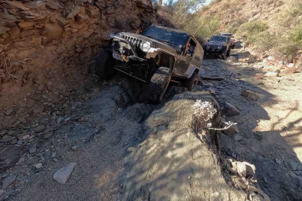
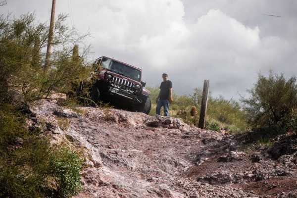
Judgment Day
If your idea of a great day on the trail involves technical rock crawling, challenging obstacles, and putting both your driving skills and your vehicle to the test, Judgment Day delivers. Located in the Table Mesa OHV area north of Phoenix, this demanding trail is best suited for experienced off-roa...
Learn more about Judgment Day
Back Way to Black Canyon City
An off-highway route that winds through the mountains between Black Canyon City and the Table Mesa Recreation Area. Nice scenery and a few eroded, rocky hills add a bit of a challenge. The southern part of the trail is fairly easy 4WD but is slow going due to significant cross erosion. There are a f...
Learn more about Back Way to Black Canyon City
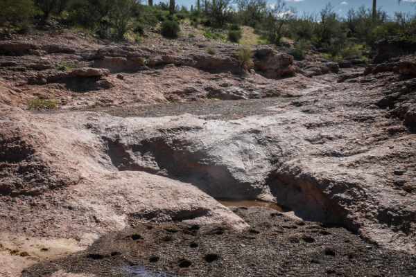
Upper Terminator (TV 3)
This trail is a boulder-strewn wash that is generally mostly dry. In times of heavy runoff, this trail becomes immensely more difficult. It allows you to enjoy the natural formations of the wash. This technical trail will test your vehicle and spotter but is easy enough for well-equipped rigs to get...
Learn more about Upper Terminator (TV 3)
Black Canyon Trail
Black Canyon Trail is 1.2 miles of moderate difficulty ATV trail, full of loose rock and some steep hills. The trail is unmarked and primitive, going through low rolling desert hills, next to giant saguaro cactus and paloverde trees. The trail ranges from a wider two-track to a narrow trail between ...
Learn more about Black Canyon Trail
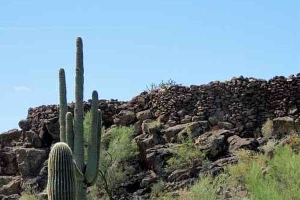
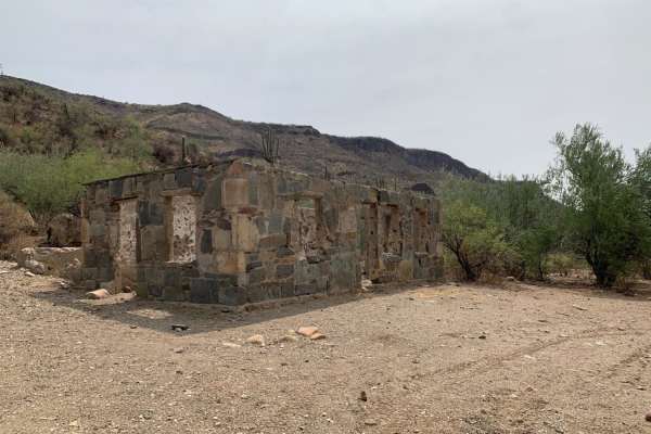
Indian Fort
A stone wall fort on a small flat-top hill just off the Table Mesa North Access Road. Drive to the base of the hill and scramble up an easy climb to enter the fort. Commanding views of the area. Do this in combination with something else in the area. Probably less than a half-hour round trip from...
Learn more about Indian Fort
9008
9008 is reclaimed descending a canyon wall, so your hopes of navigating down to the valley are squashed. The rocky terrain adds texture to the trail without presenting major obstacles. Along the way, campsites are scattered, providing opportunities to set up in a remote and scenic setting. The route...
Learn more about 9008
Black Canyon Creek
This is the first half of a possible loop trail, but due to the drastic difference in ratings, this one can be done as the entrance or as an out-and-back trail. This is the mild portion of the trail with a couple of possible camp spots near the beginning of the trail. It offers beautiful mountain de...
Learn more about Black Canyon Creek
Bc1191
Bc1191 starts off as an unmarked desert trail, riding along a shelf cut into a desert hillside, overlooking a scenic desert valley. The trail is single vehicle width, about 10 feet across, and is mostly hard-packed dirt with a light layer of loose rocks and gravel. It has shallow ruts and uneven lay...
Learn more about Bc1191

Road Between Worlds
This mostly easy out-and-back trail traverses through the beautiful desert grasslands of the Agua Fria National Monument and Tonto National Forest at an elevation too high for saguaros and too low for alpine forests. The first few miles are the easiest but have many deep ruts. There are bypasses pre...
Learn more about Road Between Worlds
Yellow Loop 9990
The Yellow Loop is a 60-inch trail that leaves the staging area by the training loops off of Moores Gulch Road and heads north. It has lots of ruts and uneven sections right from the start, with some rocks and washouts. It's often rutted down one side of the trail and troughed, making it off-camber ...
Learn more about Yellow Loop 9990
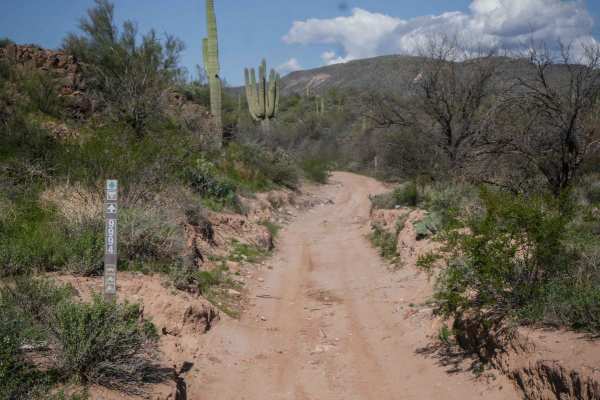
Road to Nowhere
Great day out exploring trying to find the Tip Top Mine - Unfortunately, this is not the way, but it is a road with some great views if you feel like going on a slow putt. This trail is very rocky. Some up and down with a little off-camber. Bring a lunch and make sure you have lots of time - spent a...
Learn more about Road to Nowhere
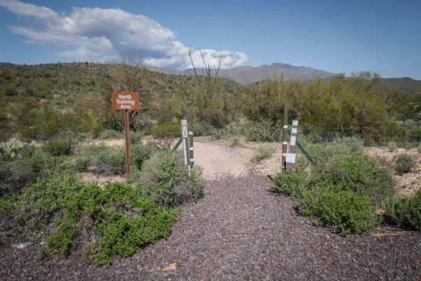
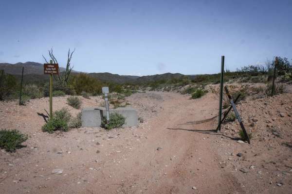
Training Loops
The training loops are a warm-up/practice loop for ATVs and dirt bikes, geared towards helping kids learn to ride. They start at the staging area off of Moores Gulch Road 46, and there are A, B, and C sections that all make a one-mile-long loop. The trail is decently narrow, making good practice for...
Learn more about Training Loops
9991
This is a mile-long section of road that shortcuts between two sections of Moores Gulch Road and will likely be part of a bigger loop in the Table Mesa OHV area. This section is really easy and is well-trafficked, as it looks like UTV tours go through here. It's flat with a bit of embedded rock slab...
Learn more about 9991
Boulder Creek
This trail ascends out of the Agua Fria stream, mostly dry, down Little Grand Canyon Road off of West Table Mesa Road. The ascent is steep, with a few boulders that could hit a differential if a careful line isn't taken. There are a few tight turns that may require backing up to reposition. After a ...
Learn more about Boulder Creek
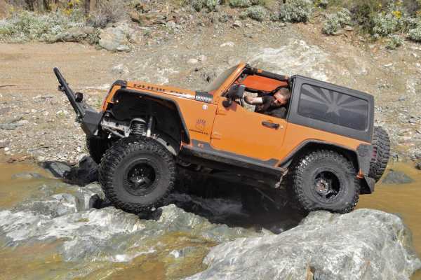
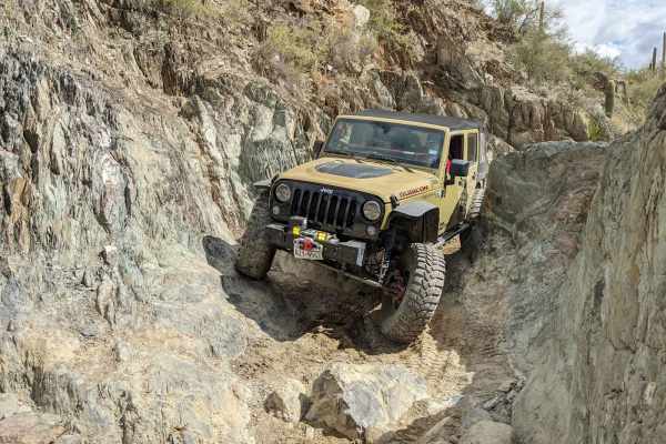
Terminator
This is labeled as a technical vehicle trail, and it lives up to that. 35" tires, lockers and recovery gear is strongly advised as a minimum here. The trail follows a rocky wash, and eventually climbs out.
Learn more about Terminator
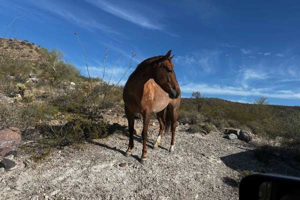
Black Canyon City Overlook
This little shortcut from New River Trail to the Road to Nowhere will not disappoint. There are great views and steep climbs and descents. Some of this trail is a shelf road and has some washouts. High-clearance vehicles are required. Make sure you close the gates and watch out for the horses and co...
Learn more about Black Canyon City Overlook
TV-(Not) Raw Deal
This is an intermediate Jeep trail off of Table Mesa Road that goes up a wash with several rock-ledge obstacles. There's a staging area directly across from the start of the trail, but the entrance to the trail is unmarked. Right away, the wash has lots of embedded slabs of rock but starts pretty fl...
Learn more about TV-(Not) Raw Deal
North Little Grand Canyon 9994
Little Grand Canyon is a feature that runs through the middle of the Table Mesa area filled with cottonwood trees and birds. This is a Jeep trail off of Table Mesa Road that heads north to connect to more trails like Terminator and the Yellow Loop. The beginning of the route goes past many BLM dispe...
Learn more about North Little Grand Canyon 9994
Crapshoot
This trail gets its name from the hill, which has some rolling steps in it. Crapshoot is an advanced trail off of Table Mesa Road due to many steep and loose climbs and descents and several rock-ledge obstacles. The difficulty of this route will totally depend on your type of vehicle and experience ...
Learn more about Crapshoot
ATV trails near Black Canyon City, Arizona
Explore ATV-friendly trails near you. These trails are accessible for vehicles up to 50 inches wide, perfect for ATVs and smaller off-road machines.
Maggie Mine
Very scenic trail in the foothills of the Bradshaw Mountains. Although not far from the highway and Black Canyon City, this route feels isolated and offers a chance to spot wildlife, beautiful desert plant life, and sweeping views of the Bradshaw Mountains and Castle Creek Wilderness in the Prescott...
Learn more about Maggie Mine
Judgment Day
If your idea of a great day on the trail involves technical rock crawling, challenging obstacles, and putting both your driving skills and your vehicle to the test, Judgment Day delivers. Located in the Table Mesa OHV area north of Phoenix, this demanding trail is best suited for experienced off-roa...
Learn more about Judgment Day
Back Way to Black Canyon City
An off-highway route that winds through the mountains between Black Canyon City and the Table Mesa Recreation Area. Nice scenery and a few eroded, rocky hills add a bit of a challenge. The southern part of the trail is fairly easy 4WD but is slow going due to significant cross erosion. There are a f...
Learn more about Back Way to Black Canyon City
Black Canyon Trail
Black Canyon Trail is 1.2 miles of moderate difficulty ATV trail, full of loose rock and some steep hills. The trail is unmarked and primitive, going through low rolling desert hills, next to giant saguaro cactus and paloverde trees. The trail ranges from a wider two-track to a narrow trail between ...
Learn more about Black Canyon Trail
UTV/side-by-side trails near Black Canyon City, Arizona
Find UTV and side-by-side trails near you. These trails accommodate vehicles up to 60 inches wide, ideal for UTVs, side-by-sides, and wider off-road rigs.
Maggie Mine
Very scenic trail in the foothills of the Bradshaw Mountains. Although not far from the highway and Black Canyon City, this route feels isolated and offers a chance to spot wildlife, beautiful desert plant life, and sweeping views of the Bradshaw Mountains and Castle Creek Wilderness in the Prescott...
Learn more about Maggie Mine
Judgment Day
If your idea of a great day on the trail involves technical rock crawling, challenging obstacles, and putting both your driving skills and your vehicle to the test, Judgment Day delivers. Located in the Table Mesa OHV area north of Phoenix, this demanding trail is best suited for experienced off-roa...
Learn more about Judgment Day
Back Way to Black Canyon City
An off-highway route that winds through the mountains between Black Canyon City and the Table Mesa Recreation Area. Nice scenery and a few eroded, rocky hills add a bit of a challenge. The southern part of the trail is fairly easy 4WD but is slow going due to significant cross erosion. There are a f...
Learn more about Back Way to Black Canyon City
Indian Fort
A stone wall fort on a small flat-top hill just off the Table Mesa North Access Road. Drive to the base of the hill and scramble up an easy climb to enter the fort. Commanding views of the area. Do this in combination with something else in the area. Probably less than a half-hour round trip from...
Learn more about Indian Fort
The onX Offroad Difference
onX Offroad combines trail photos, descriptions, difficulty ratings, width restrictions, seasonality, and more in a user-friendly interface. Available on all devices, with offline access and full compatibility with CarPlay and Android Auto. Discover what you're missing today!
Open Trail Map