
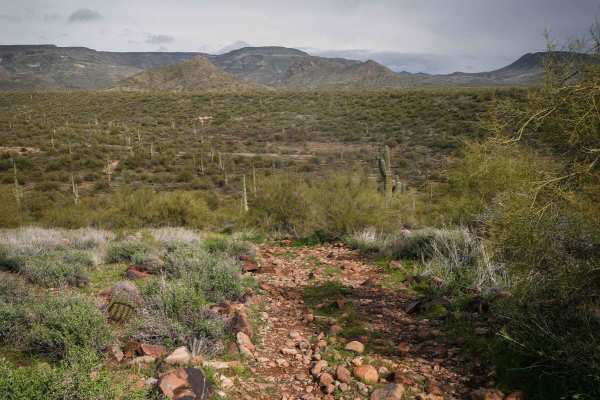
Off-Road Trails
Near New River, Arizona
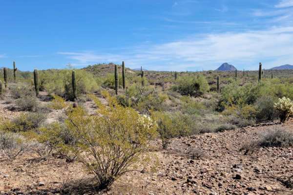
Off-Road Trails Near New River, Arizona
Discover the best offroad trails near you. Browse trail maps, check difficulty ratings, and find your next adventure — whether you're looking for a quick ride or an all-day expedition.

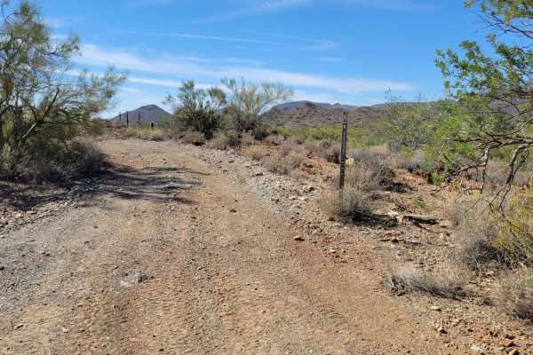
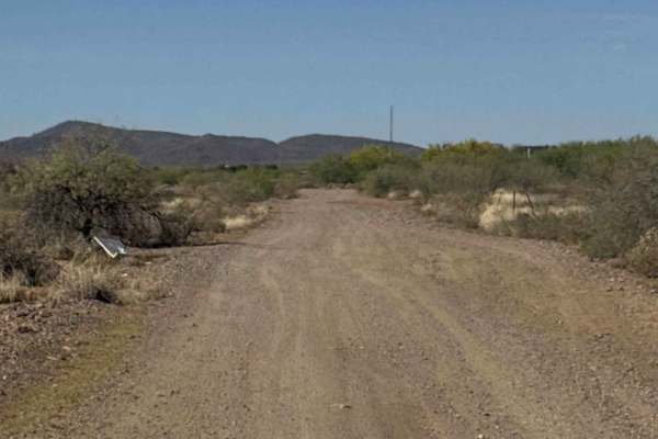
El Paso Pipeline Road
This is a dirt-covered service road that is regularly maintained. It's a fun, easy route for getting to different areas. There's nothing technical about this trail aside from a couple of sandy washes. Note of caution, people tend to drive really fast out here. Trophy trucks and performance side-by-s...
Learn more about El Paso Pipeline Road
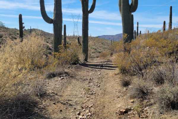
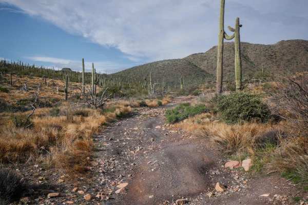
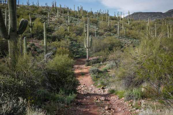
Saguaro Way
This section of trail weaves its way through the beautiful desert and leads to a shooting area at the North end. It also connects to a handful of other trails. There are a couple of short rocky sections to navigate, but aside from that, the trail is a pretty simple dirt trail.
Learn more about Saguaro Way
9949 to Black Canyon Trail
This short section of trail and Black Canyon Trail are closed to vehicles over 60" wide. The west section is in a shooting area, so use caution around that area. There are a couple of short, steep grades and a small river wash section that could have water in flash flood conditions.
Learn more about 9949 to Black Canyon Trail
Cactus Express
A quick, short little section of trail that connects Lake Pleasant road to Saguaro Way trail, which leads to a shooting area. There is nothing terribly technical about this route aside from a couple of rocky sections to navigate, one of which is on a slight grade. There is also a short sandy wash to...
Learn more about Cactus Express
Trail 9949
This short section of trail is more narrow and therefore is only open to small utility SXS and smaller. No full-size trucks or SXS's. Nothing too technical on this trail, aside from one section with a short steep grade with loose rocks. Vegetation overgrowth is possibly, so just be careful not get p...
Learn more about Trail 9949
Shoemaker Spring Access Trail
This is a short high-clearance primitive road that starts off of North New River Road and connects to Shoemaker Spring. It's uneven and bumpy, with deep ruts that are filled in with round softball-sized rocks. Loose rocks are strewn about the trail for much of it. It's mostly flat in a green desert ...
Learn more about Shoemaker Spring Access Trail
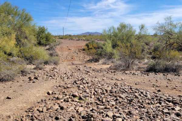
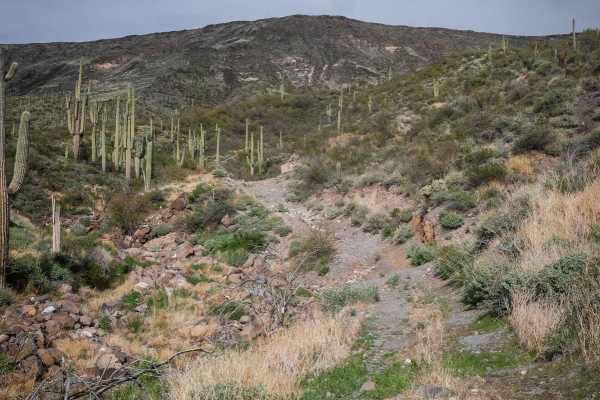
New River Trail
This 18.9-mile point-to-point trail takes you along the New River Valley up into the Tonto National Forest. This trail starts easy as a maintained two-vehicle road for the first mile. Then the trail narrows to one vehicle and you start to get some washed-out sections. You will cross New River three ...
Learn more about New River Trail
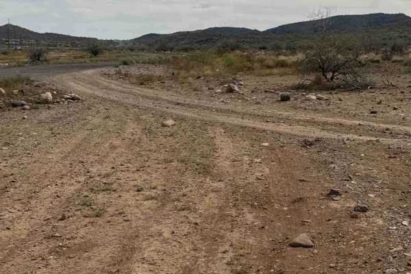
West Rockaway Hills Road
West Rockaway Hills Road serves as a connector trail leading toward the Opportunity Trail. It runs east–west as a point-to-point route and provides a fun drive through the desert. The trail features large ruts formed from past rainfall, so drivers should watch their speed and line choice while trave...
Learn more about West Rockaway Hills Road
King Well 497
497 is a wider dirt trail with lots of small and medium-sized loose rocks on the surface for much of the route. It goes through wide open desert terrain, with ruts running down the road, often filled in with loose rocks like a trough. It goes past great big saguaro cacti and a couple of spots to bac...
Learn more about King Well 497
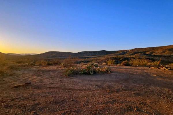
Photographic Hill
This is a side trail off the New River Trail that ends atop a beautiful hill with unlimited photographic possibilities. It is a great place for a stop to stretch legs, take pictures, have a bonfire during sunset (if / when allowed), and take in some of the most breathtaking scenic views of the area ...
Learn more about Photographic Hill
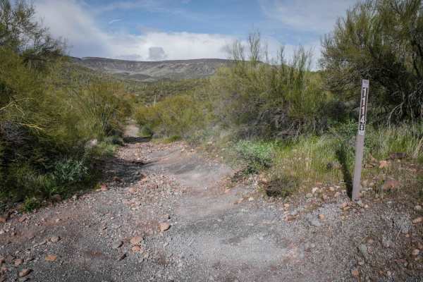
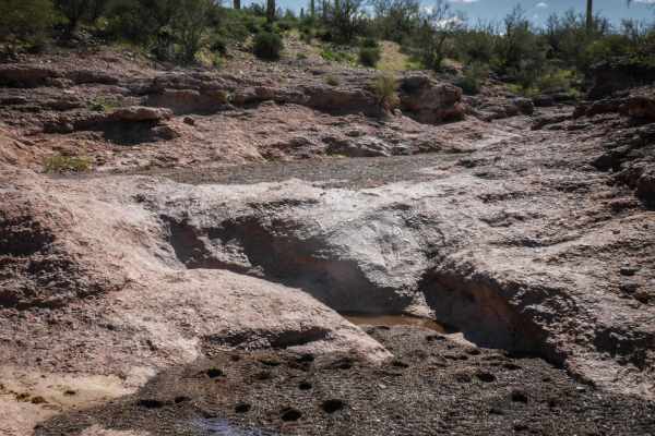
Shoemaker Spring
Shoemaker Spring runs south to north at the edge of the Tonto National Forest near New River, Arizona. It's a primitive route in a lightly used OHV area that is accessed off of North New River Road. This one is intermediate difficulty because it crosses several washes, and it's rocky in spots with l...
Learn more about Shoemaker Spring
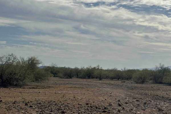
Trail of Opportunity
Trail of Opportunity is a point-to-point connector trail that runs primarily east–west through the desert before turning as it approaches the wash. The route is a dirt and gravel road that is generally easy to drive but can be bumpy with a few scattered rocks along the way. The trail is easy to navi...
Learn more about Trail of Opportunity
West Desert Hills Trail
West Desert Hills Trail is a bumpy dirt route with many scattered rocks that eventually leads out to a popular shooting area. While the trail is rough in places, there are no technical sections or major obstacles, making it relatively easy to navigate. The trail is lined with desert creosote and cho...
Learn more about West Desert Hills Trail
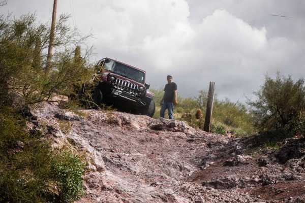
TV-(Not) Raw Deal
This is an intermediate Jeep trail off of Table Mesa Road that goes up a wash with several rock-ledge obstacles. There's a staging area directly across from the start of the trail, but the entrance to the trail is unmarked. Right away, the wash has lots of embedded slabs of rock but starts pretty fl...
Learn more about TV-(Not) Raw Deal
Fence Line Connector
Fence Line Connector is a north–south connector trail linking the Trail of Opportunity with the West Desert Hills Trail. The connection point also serves as an entry access into the surrounding trail system. The route travels over a few small hills with occasional ruts and minor washouts, but there ...
Learn more about Fence Line Connector
Crapshoot
This trail gets its name from the hill, which has some rolling steps in it. Crapshoot is an advanced trail off of Table Mesa Road due to many steep and loose climbs and descents and several rock-ledge obstacles. The difficulty of this route will totally depend on your type of vehicle and experience ...
Learn more about Crapshoot
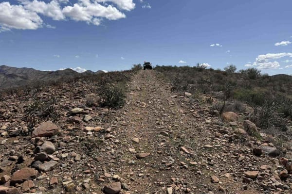
Table Rock Lookout
After making the climb as described on Black Canyon City Overlook, the trail to the left is a short, flat shale road offering stunning 360-degree scenic views. As you travel, you'll enjoy sweeping vistas of surrounding landscapes--distant mountains and expansive valleys. The route is easy to navigat...
Learn more about Table Rock Lookout
3197
3197 runs west-east in the Tonto National Forest near New River and is an intermediate Jeep trail in a lightly used OHV area. The west end departs from the neighborhood from West Mingus Road and heads east for 1.8 miles. The trail is pretty beat in and used, with frequent signage. The easternmost po...
Learn more about 3197
North Little Grand Canyon 9994
Little Grand Canyon is a feature that runs through the middle of the Table Mesa area filled with cottonwood trees and birds. This is a Jeep trail off of Table Mesa Road that heads north to connect to more trails like Terminator and the Yellow Loop. The beginning of the route goes past many BLM dispe...
Learn more about North Little Grand Canyon 9994
Shoemaker Connector
This 1.7-mile segment of trail runs north-south between 3197 and the Quail Springs Loop in this primitive OHV area near New River, Arizona. This trail is more of a main thoroughfare compared to Shoemaker Springs. It's a wider, well-used road that has some challenges such as deep ruts filled in with ...
Learn more about Shoemaker Connector
ATV trails near New River, Arizona
Explore ATV-friendly trails near you. These trails are accessible for vehicles up to 50 inches wide, perfect for ATVs and smaller off-road machines.
El Paso Pipeline Road
This is a dirt-covered service road that is regularly maintained. It's a fun, easy route for getting to different areas. There's nothing technical about this trail aside from a couple of sandy washes. Note of caution, people tend to drive really fast out here. Trophy trucks and performance side-by-s...
Learn more about El Paso Pipeline Road
Saguaro Way
This section of trail weaves its way through the beautiful desert and leads to a shooting area at the North end. It also connects to a handful of other trails. There are a couple of short rocky sections to navigate, but aside from that, the trail is a pretty simple dirt trail.
Learn more about Saguaro Way
9949 to Black Canyon Trail
This short section of trail and Black Canyon Trail are closed to vehicles over 60" wide. The west section is in a shooting area, so use caution around that area. There are a couple of short, steep grades and a small river wash section that could have water in flash flood conditions.
Learn more about 9949 to Black Canyon Trail
Cactus Express
A quick, short little section of trail that connects Lake Pleasant road to Saguaro Way trail, which leads to a shooting area. There is nothing terribly technical about this route aside from a couple of rocky sections to navigate, one of which is on a slight grade. There is also a short sandy wash to...
Learn more about Cactus Express
UTV/side-by-side trails near New River, Arizona
Find UTV and side-by-side trails near you. These trails accommodate vehicles up to 60 inches wide, ideal for UTVs, side-by-sides, and wider off-road rigs.
El Paso Pipeline Road
This is a dirt-covered service road that is regularly maintained. It's a fun, easy route for getting to different areas. There's nothing technical about this trail aside from a couple of sandy washes. Note of caution, people tend to drive really fast out here. Trophy trucks and performance side-by-s...
Learn more about El Paso Pipeline Road
Saguaro Way
This section of trail weaves its way through the beautiful desert and leads to a shooting area at the North end. It also connects to a handful of other trails. There are a couple of short rocky sections to navigate, but aside from that, the trail is a pretty simple dirt trail.
Learn more about Saguaro Way
9949 to Black Canyon Trail
This short section of trail and Black Canyon Trail are closed to vehicles over 60" wide. The west section is in a shooting area, so use caution around that area. There are a couple of short, steep grades and a small river wash section that could have water in flash flood conditions.
Learn more about 9949 to Black Canyon Trail
Cactus Express
A quick, short little section of trail that connects Lake Pleasant road to Saguaro Way trail, which leads to a shooting area. There is nothing terribly technical about this route aside from a couple of rocky sections to navigate, one of which is on a slight grade. There is also a short sandy wash to...
Learn more about Cactus Express
The onX Offroad Difference
onX Offroad combines trail photos, descriptions, difficulty ratings, width restrictions, seasonality, and more in a user-friendly interface. Available on all devices, with offline access and full compatibility with CarPlay and Android Auto. Discover what you're missing today!
Open Trail Map