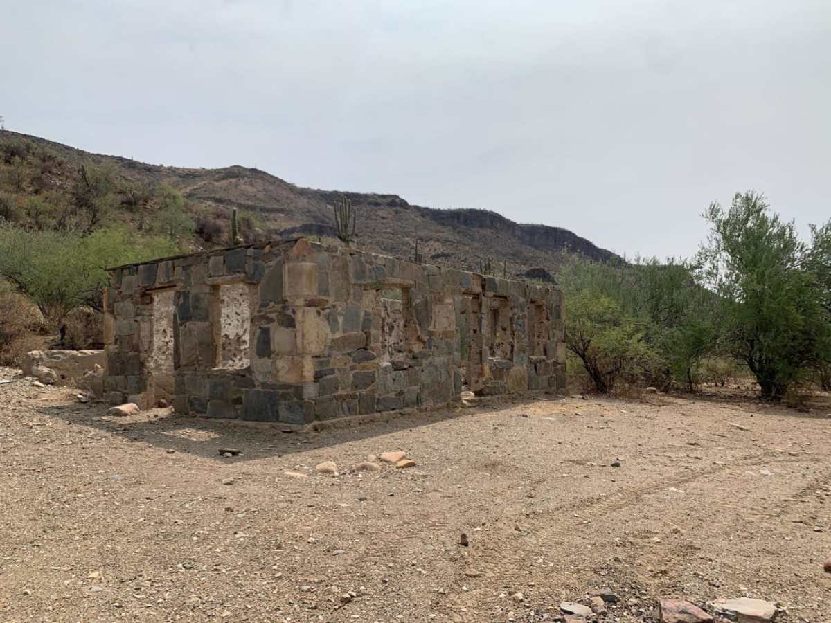
Boulder Creek

Total Miles 6.1
Technical Rating
4 Moderate
Best Time Spring, Summer, Fall
Trail Type High-Clearance 4x4 Trail
Accessible By
Open Trail Map

Trail Overview

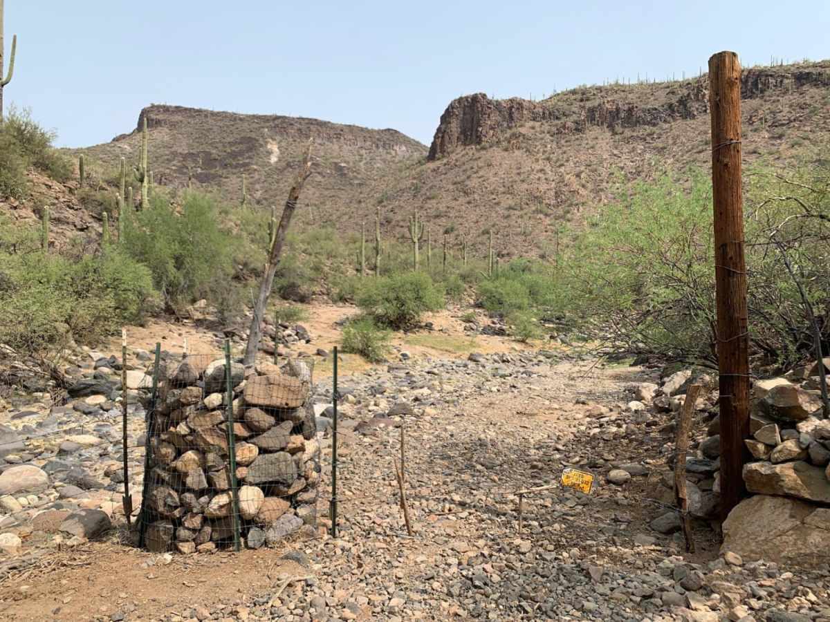
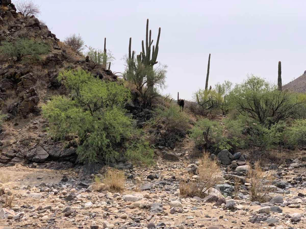
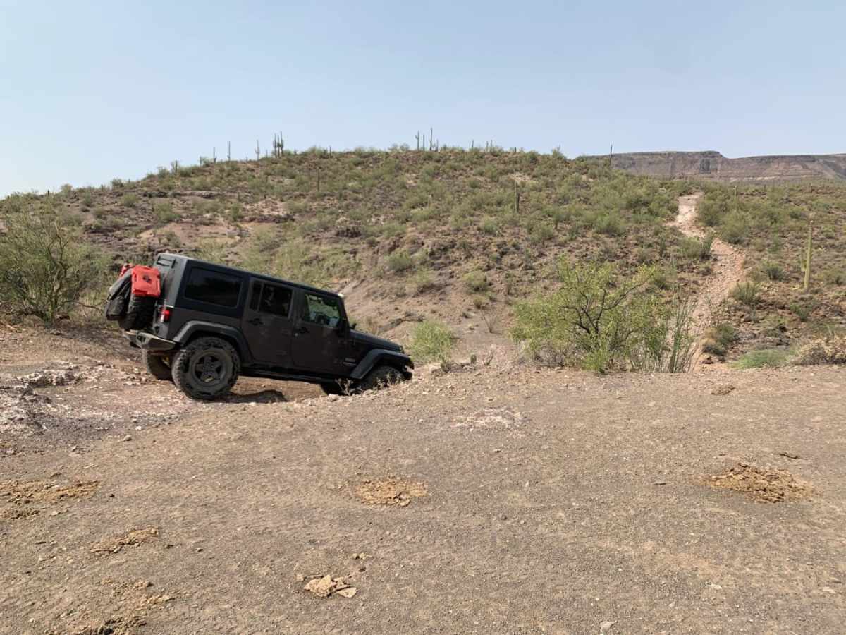
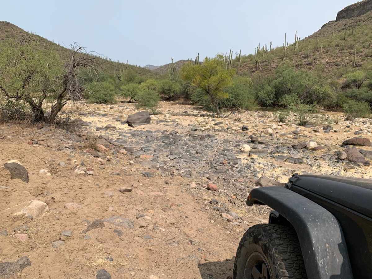
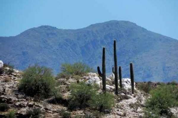
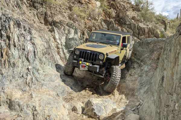
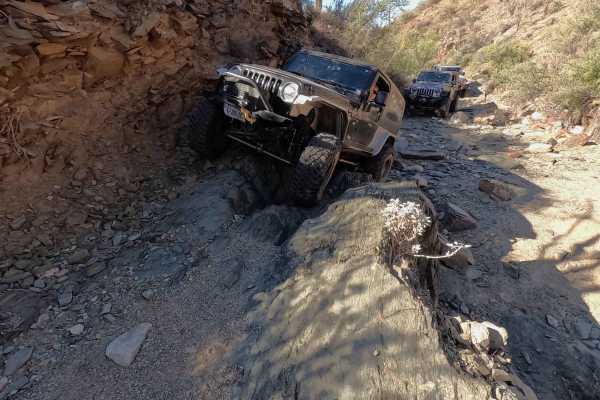
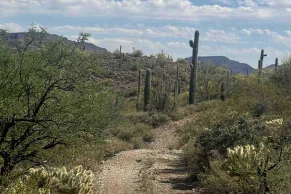
This trail ascends out of the Agua Fria stream, mostly dry, down Little Grand Canyon Road off of West Table Mesa Road. The ascent is steep, with a few boulders that could hit a differential if a careful line isn't taken. There are a few tight turns that may require backing up to reposition. After a few hills, the trail descends into the Boulder Creek area. There is a gate at the creek that will need to be opened and re-closed. The road weaves across the creek several times after this, with gravel along the straights between the crossings. The trail is mostly easy to see, with the creek crossings being the most unclear part. Expect boulders up to 12" in the creek crossing sections. Would not recommend when raining, as Boulder Creek can get to be about 1 to 2 feet deep. Scenic desert canyon and saguaro cactus views along the trails with a unique perspective on the desert from the middle of the creek. Some low brush, expect minor pin-stripes for full size 4x4s on the sides and top. There is no cell service on the trail. The trail is mostly one vehicle wide, but could be run in either direction with passing at the creek crossings. Lots of other trails branch out of this area to explore. Watch for large and small animals on the trail, as burros and cattle have been spotted on this run.

Photos of Boulder Creek

Difficulty

There are steep and loose rocky ascents and descents at the beginning, with periodic dry lake, small boulder crossings in the later half.

Technical Rating

4

Status Reports

Add Status Report
Nick Muscolino
Mar 25, 2025
Open
SEVERE WASHOUT ON CLIFF. (Only reason not marking blocked is it is passable if extremely careful)This trail is 100% misrated and there is a severe washout about 3/4 of the trail if going North to South that leads into a cliff which also is extremely off camber, this was very sketchy for taller vehicles to the point where you may tip and roll about 600 feet down. Be very careful on this trail and do not underestimate it because of the ratings as they are not updated. Very rocky descents as well would recommend 33s minimum. If going North to South and just want a scenic ride i’d say get to the ruins and turn back after that it’s tight and rocky.
Jesse Ayers
Nov 02, 2024
Open
Me and a friend went out in a 2008 LC200 and a 2011 2-dr JK, both with stock suspension and 33" tires. Getting to the trail we used the Table Mesa Rd exit off of I-17. There is a depressing amount of garbage along the easy stretches of Table Mesa Rd heading west. Once we made our way down to and accross the Agua Fria, the trail did not seem well travelled, and was rougher than we expected. We turned around early on and my LC200 got stuck on an obstacle on the way out. We brought basic recovery gear, but ultimately were not able to get it unstuck ourselves. I ultimately paid to have an off-road recovery company get it out. Be prepared, it could have gone worse.
Wyatt Pace
Sep 01, 2024
Open
Trail is back and out unless you take 12X to the east to exit, 29003 is blocked for private land
Wyatt Pace
Aug 20, 2024
Open
AJ Carr
Apr 15, 2023
Open

Boulder Creek Trail can be accessed by the following ride types:

  • Single Track
  • 50 Inch
  • 60 Inch
  • High Clearance

Boulder Creek Map

The onX Offroad Difference

onX Offroad combines trail photos, descriptions, difficulty ratings, width restrictions, seasonality, and more in a user-friendly interface. Available on all devices, with offline access and full compatibility with CarPlay and Android Auto. Discover what you're missing today!

Open Trail Map