
Off-Road Trails
Near Cordes Lakes, Arizona
Off-Road Trails Near Cordes Lakes, Arizona
Discover the best offroad trails near you. Browse trail maps, check difficulty ratings, and find your next adventure — whether you're looking for a quick ride or an all-day expedition.
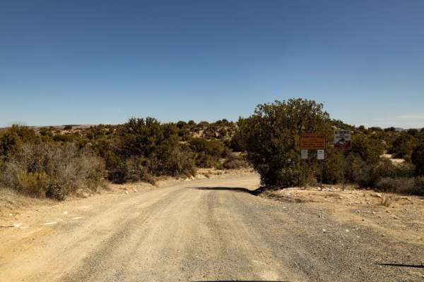
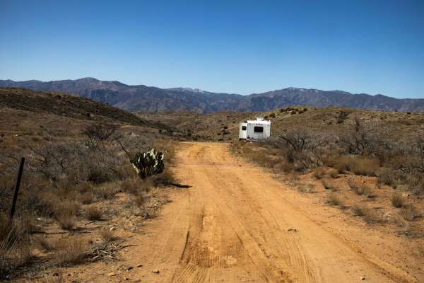
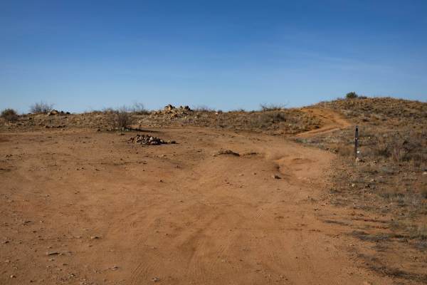
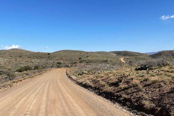
3M Ranch Road
3M Ranch Road is a wide, curvy trail with no obstacles, making for an easy and enjoyable drive. It provides access to other trails and has several campsites along the way for convenient stops. The route eventually ends at private property, so plan accordingly. Along the way you'll pass the historic ...
Learn more about 3M Ranch Road
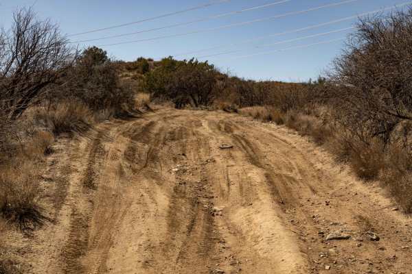
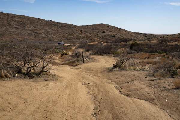
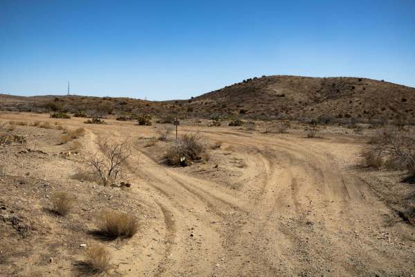
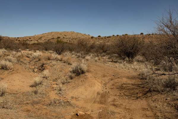
J-Train
J-Train begins as a narrow trail with off-camber erosion before gradually widening into a more established ranch road. The shifting terrain requires careful driving early on, but the route eases up as it connects to the wider path. With no cell service in the area, be sure to download offline maps b...
Learn more about J-Train
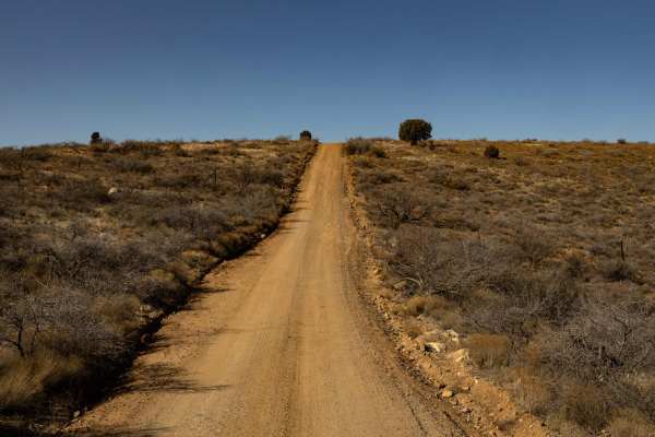
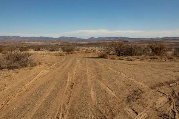
Backway To Bloody Basin
Backway to Bloody Basin is a wide and easily navigable trail with no obstacles, making for a smooth and scenic ride. It's important to note that this route stems from a neighborhood, so traffic rules apply - please be courteous and travel safely as this is a residential area. Also, this is NOT a byp...
Learn more about Backway To Bloody Basin
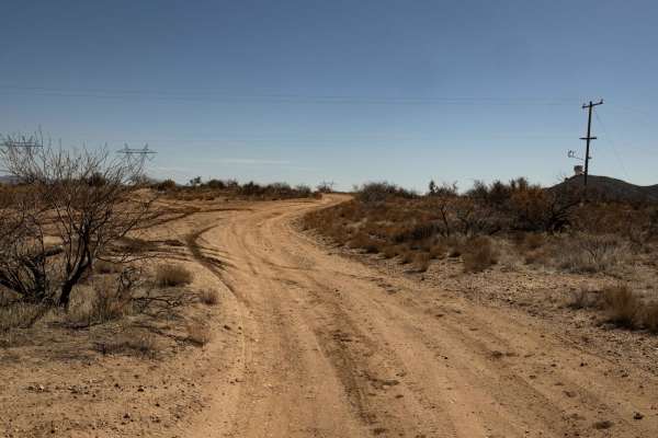
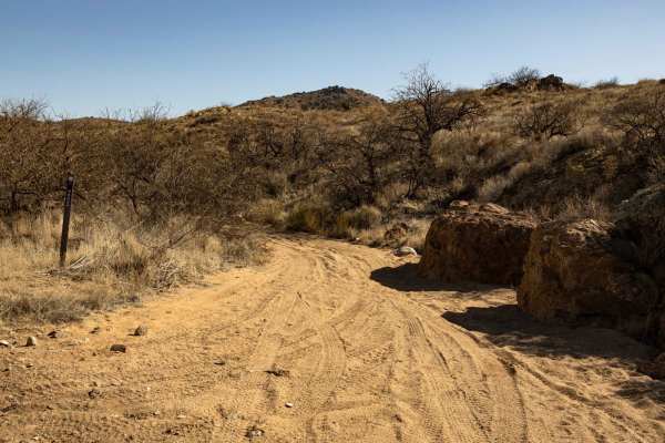
Jolly's Jostle
Jolly's Jostle is a rugged one-lane trail featuring sections of shelf road, heavy erosion, and off-camber terrain. The route is consistently bumpy, with multiple wash crossings that have steep entrances and exits. Several intersecting trails provide access to different routes, making it a key connec...
Learn more about Jolly's Jostle
Rock Pasture
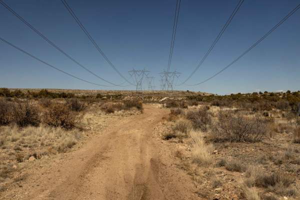
Rock Pasture traverses a rugged landscape of rocky pastureland with multiple camping opportunities along the route. A powerline follows portions of the trail, while a steep wash crossing with challenging entrances and exits adds to the terrain's complexity. Expect rocky uphills, ruts, and a final st...
Learn more about Rock Pasture

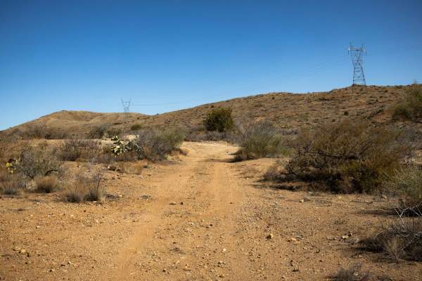
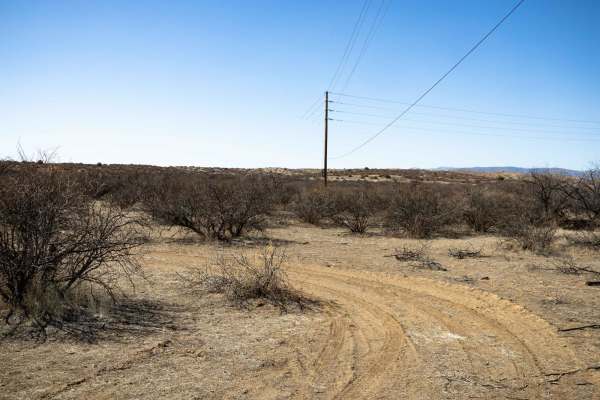
Power Bc1096
This narrow, one-lane dirt trail winds through rolling hills, featuring multiple wash crossings and sections of erosion. The terrain varies, with some uneven spots requiring careful navigation, but overall, the route offers a scenic and engaging ride. While there is cell service in the area, it's st...
Learn more about Power Bc1096
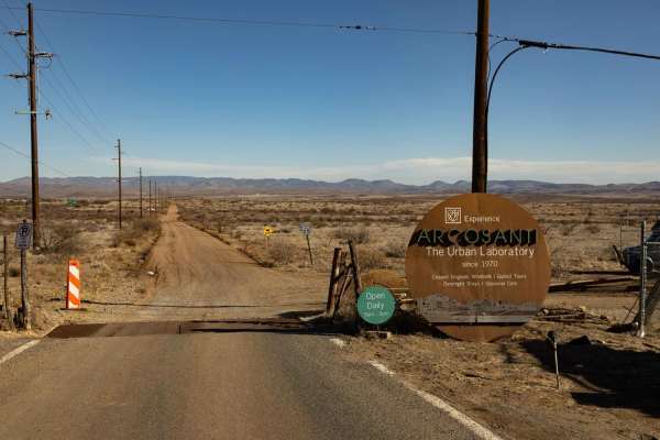
Arcosanti
Arcosanti is a wide and easily accessible trail with no obstacles, making it a great option for a smooth ride. Scattered campsites along the route provide convenient spots to stop and enjoy the surroundings. With 5G service available, staying connected won't be an issue. This trail leads to the Arco...
Learn more about Arcosanti
Bloody Basin Road
Bloody Basin Road is a forest road that goes through the Agua Fria National Monument and Tonto National Forest in Arizona. This road takes you by archaeological sites and petroglyphs as you wind up and down the ranges and hills. The trail is an out-and-back that terminates at a large turnaround by t...
Learn more about Bloody Basin Road
Backway to 69
Backway to 69 is a narrow, one-lane trail that winds through multiple wash crossings and typical rugged desert terrain. Erosion and ruts are present throughout, but there are no major obstacles, making it a manageable route for most vehicles. There is cell service in the area, but it's always a good...
Learn more about Backway to 69
Creek to Peak
Creek to Peak Trail is a narrow and technical route that climbs steeply from the wash into rugged hills. There are many campsites of varying sizes along this route, capable of accommodating many vehicles and trailers. Once you drop into the wash, rocks, ledges and off-camber sections make for a chal...
Learn more about Creek to Peak
Ranch Road
Ranch Road features a steep wash crossing that serves as the primary obstacle along the route. The trail narrows in sections, requiring careful navigation, but a campsite along the way offers a convenient stopping point. With no cell service in the area, be sure to download offline maps before headi...
Learn more about Ranch Road
Uphill Battle
Uphill Battle lives up to its name, starting in a soft sandy wash before transitioning into steep, loose climbs with heavy erosion and off-camber sections. Tight turns and unavoidable brush guarantee paint damage, while tricky line choices and off-camber spots may leave a tire hanging. The terrain v...
Learn more about Uphill Battle
Bc1150
This narrow, one-lane trail offers sporadic turnarounds along the route, making passing and/or turning around a breeze. This trail is pretty straightforward, with no major obstacles along this route. There are places to camp along this trail, but there are many better sites on adjacent trails furthe...
Learn more about Bc1150
23C
Trail 23C is a rugged one-lane route that follows a wash that has large boulders and rock sections. Climbing in and out of this wash, this trail features multiple crossings and steep short hills with loose rock, ruts, and off-camber sections. Erosion is present throughout, making for a challenging r...
Learn more about 23C
9021
The 9021 offers a challenging yet scenic drive, with many off-camber sections and erosion-prone areas that require careful attention. This one-lane trail winds in and out of varying terrain, with steep climbs and descents adding to the adventure. Wash crossings and ditches punctuate the route, deman...
Learn more about 9021
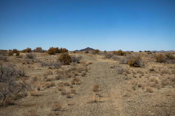
The Way Out
The Way Out is a scenic ridgeline connector trail with curvy gravel terrain and an easygoing drive. With no obstacles along the route, it provides a smooth transition between trails. Cell service is available in some areas with around two bars, but it's still a good idea to have offline maps downloa...
Learn more about The Way Out
Misled Wash
The Misled Wash Trail is a mellow trail with varying terrain. This trail drops into a sandy wash, but only for a short time. It pops back out into a tight turned section between the overgrown thorny bushes that make their home here in the desert. There are no major obstacles on this trail, though th...
Learn more about Misled Wash
Bloody Basin Road West
This maintained gravel road connects I-17 to the north entrance to the Crown King Road. This short 3.3-mile road has lots of boondocking sites and a big area for OHV loading and unloading. There are a lot of free-range cattle in this area, so watch out for livestock. There are parts of this road tha...
Learn more about Bloody Basin Road West
Bc1099
BC1099 is a pretty straightforward trail with no major obstacles on it. There are some narrow and eroded, off camber sections, as well as dips and curves, but nothing that is too out of the ordinary. The trail is one-lane trail featuring a couple of deep ruts but nothing that will ruin your day. The...
Learn more about Bc1099
Sheep Gulch
Sheep Gulch is a narrow trail where tight brush guarantees paint damage. It terminates at the Agua Fria River, with the trail continuing down steep embankments and across water crossings. The route features a mix of humps and bumps, with sections of off-camber erosion adding to the challenge. A soli...
Learn more about Sheep Gulch
ATV trails near Cordes Lakes, Arizona
Explore ATV-friendly trails near you. These trails are accessible for vehicles up to 50 inches wide, perfect for ATVs and smaller off-road machines.
3M Ranch Road
3M Ranch Road is a wide, curvy trail with no obstacles, making for an easy and enjoyable drive. It provides access to other trails and has several campsites along the way for convenient stops. The route eventually ends at private property, so plan accordingly. Along the way you'll pass the historic ...
Learn more about 3M Ranch Road
J-Train
J-Train begins as a narrow trail with off-camber erosion before gradually widening into a more established ranch road. The shifting terrain requires careful driving early on, but the route eases up as it connects to the wider path. With no cell service in the area, be sure to download offline maps b...
Learn more about J-Train
Backway To Bloody Basin
Backway to Bloody Basin is a wide and easily navigable trail with no obstacles, making for a smooth and scenic ride. It's important to note that this route stems from a neighborhood, so traffic rules apply - please be courteous and travel safely as this is a residential area. Also, this is NOT a byp...
Learn more about Backway To Bloody Basin
Jolly's Jostle
Jolly's Jostle is a rugged one-lane trail featuring sections of shelf road, heavy erosion, and off-camber terrain. The route is consistently bumpy, with multiple wash crossings that have steep entrances and exits. Several intersecting trails provide access to different routes, making it a key connec...
Learn more about Jolly's Jostle
UTV/side-by-side trails near Cordes Lakes, Arizona
Find UTV and side-by-side trails near you. These trails accommodate vehicles up to 60 inches wide, ideal for UTVs, side-by-sides, and wider off-road rigs.
3M Ranch Road
3M Ranch Road is a wide, curvy trail with no obstacles, making for an easy and enjoyable drive. It provides access to other trails and has several campsites along the way for convenient stops. The route eventually ends at private property, so plan accordingly. Along the way you'll pass the historic ...
Learn more about 3M Ranch Road
J-Train
J-Train begins as a narrow trail with off-camber erosion before gradually widening into a more established ranch road. The shifting terrain requires careful driving early on, but the route eases up as it connects to the wider path. With no cell service in the area, be sure to download offline maps b...
Learn more about J-Train
Backway To Bloody Basin
Backway to Bloody Basin is a wide and easily navigable trail with no obstacles, making for a smooth and scenic ride. It's important to note that this route stems from a neighborhood, so traffic rules apply - please be courteous and travel safely as this is a residential area. Also, this is NOT a byp...
Learn more about Backway To Bloody Basin
Jolly's Jostle
Jolly's Jostle is a rugged one-lane trail featuring sections of shelf road, heavy erosion, and off-camber terrain. The route is consistently bumpy, with multiple wash crossings that have steep entrances and exits. Several intersecting trails provide access to different routes, making it a key connec...
Learn more about Jolly's Jostle
The onX Offroad Difference
onX Offroad combines trail photos, descriptions, difficulty ratings, width restrictions, seasonality, and more in a user-friendly interface. Available on all devices, with offline access and full compatibility with CarPlay and Android Auto. Discover what you're missing today!
Open Trail Map