Steve B
Oct 02, 2025
2024 Toyota 4Runner
Open
NormalRough/Deteriorated
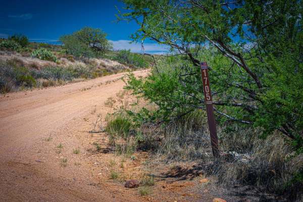
This trail is rated wrong on the app. At least the route I took to Mount Peele. Maybe the back way to the Sunflower Mine might get rough but I took 201 to the trailhead. Not sure why the map has this colored black. Very scenic and beautiful.
WarPig k
Jul 05, 2025
Open
Normal
We ran the loop clockwise and the first half of the trail is really fun and slightly challenging. I would recommend having a high clearance 4x4 with lockers even though I only use them once. But the second half really sucks, overgrown bushes really make me regret going. Seriously bad AZ pinstripes for 3 miles about.
Jenn D
Jun 22, 2025
Open
Normal
I went on a solo adventure to this location, my lifted Jeep made it to the crevice deep in the canyon and I decided to park in the shaded tree area prior to the 8/9 trail rating area due to being by myself and unsure of the trail ahead, which ended up being pretty knarly but I could have made it to the top. Some deep crevices and sharp pointy rocks along the creek at the base of the first noticable mine shaft right before the bridge, then the trail gets fairly smooth. Lots of pretty mine trailings and incredibly unique area once youre up the the crevice, BUT PLEASE BE AWARE OF SNAKES & A MOUNTAIN LION LIVING IN THE WATERFALL AREA. I noticed the droppings on my hike back down to my Jeep through the waterfall area, and I did come face to face with a decent sized mountain lion 100 yards away from my Jeep along the jagged cliff area... I am thankful to be able to write this trail report. I can not stress enough to be vigilant and aware of your surroundings & dont explore alone lol
John Furman
Jun 19, 2025
2018 Jeep Wrangler
Open
Rough/Deteriorated
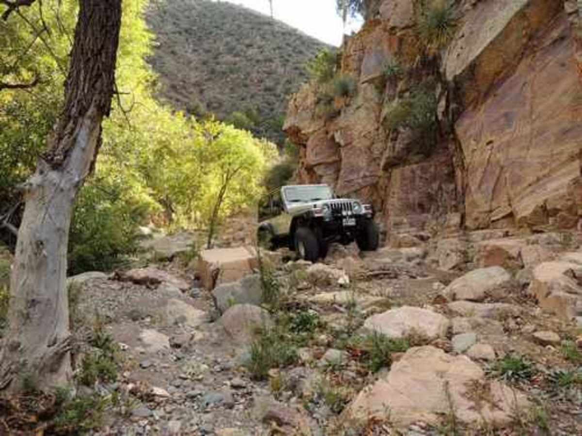
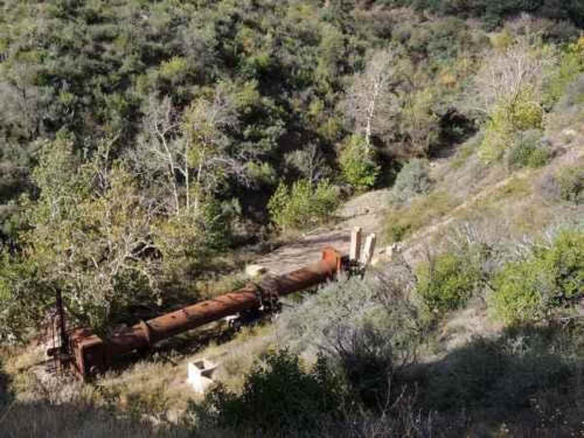
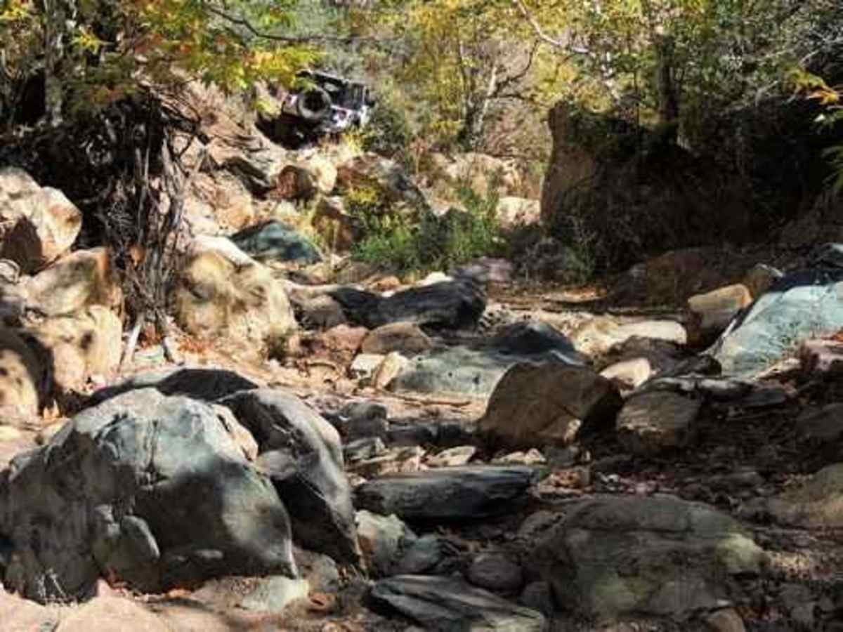
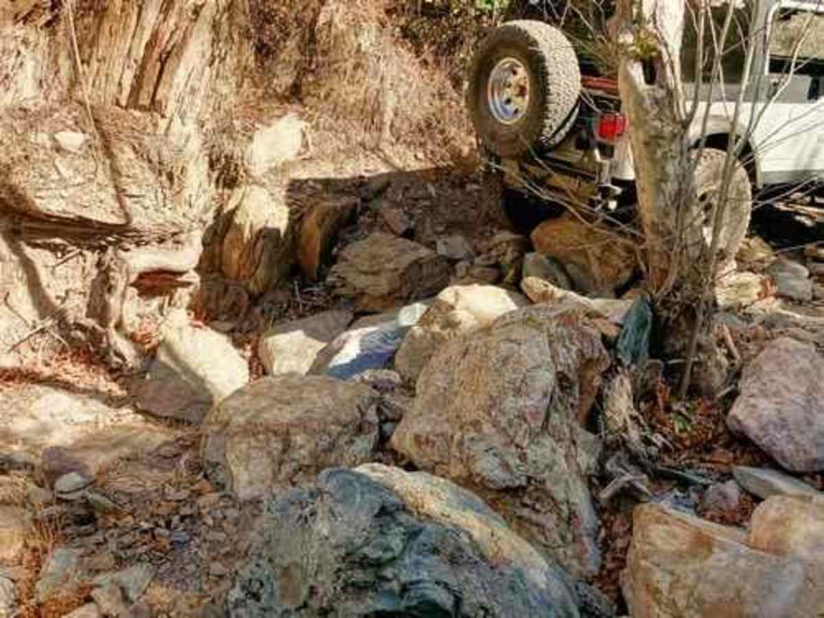
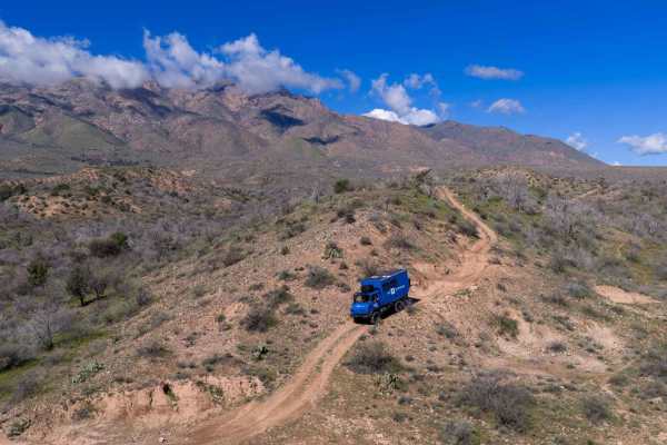
This is an awesome trail with breathtaking views. This drive can be dangerous though, so only experienced wheelers should attempt it (if you're unsure then it's not for you). If you're in a JK or JL Jeep, then 35s, lockers, rock sliders, and skid plates are highly recommended. I was able to complete this run without lockers though. Running it clockwise is probably the best direction. Make sure you take the little side road to the left of the shaft entrance (you can't miss it) and check out what's left of the Sunflower Mine's processing plant. Some areas of the creek bed have standing water which can make the bigger boulders challenging due to wheel slippage. You will almost certainly tap your rock sliders a time or two in the creek bed. Be careful if your diffs.
Graham Taylor
May 24, 2025
2023 Ford Bronco
Open
Rough/Deteriorated
This trail truly lives up to its reputation. It took our group of nine rigs (7 Broncos, 2 Jeeps) about 6 hours to complete, including a lunch break. Be prepared for a long, grueling rock garden, plenty of pinstripes, and some technical challenges throughout.
I wouldn’t recommend attempting it with anything less than a 2" lift and 35" tires. While our group consisted of experienced drivers and didn’t require much spotting, precise tire placement—especially in the rock gardens—is absolutely critical. Your skid plates and rock sliders will definitely earn their keep here.
There are a few bypasses available, but don’t expect them to be easy—most are still quite demanding. We had our share of carnage: one broken tie rod, a de-beaded tire, and two slashed sidewalls. Bring tools and be prepared for trail repairs.
Highly recommend this trail for anyone looking to test their vehicle and off-road driving skills. It’s challenging, rewarding, and a ton of fun.
Jonathan iza
Feb 03, 2025
2024 Can-Am Outlander Pro HD5
Open
Dusty
Great place, we went there myself and 3 friends, 2 of them had small motorcycles, they struggled a bit but they were able to complete the route and there was a part of the place that was frozen
Eric Speck
Dec 07, 2024
2020 Jeep Wrangler
Open
NormalDustyRough/Deteriorated
Great day on the trail! Met several hikers on the trail, but no other vehicles.
Wyatt Pace
Sep 01, 2024
2020 Jeep Wrangler
Open
Rough/Deteriorated
Jason Nace
Jul 06, 2024
Open
Normal
Came through with my 4 seater and another 2 seater. There was only two spots where I dragged skid plates. Super fun trail and doable for most. Weather was surprisingly cool down in the ravine.
Sam McAnelly
May 04, 2024
Open
Normal
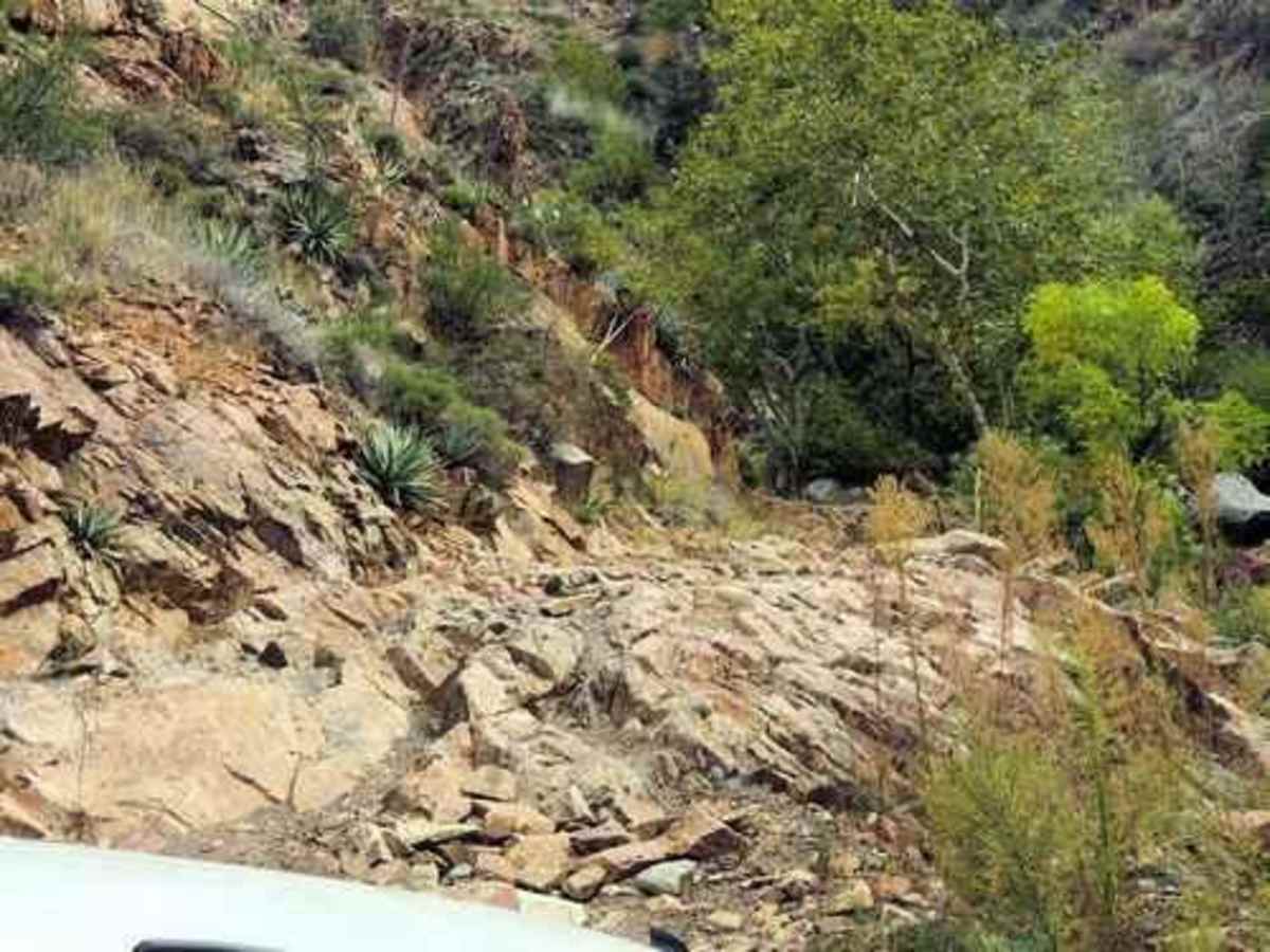
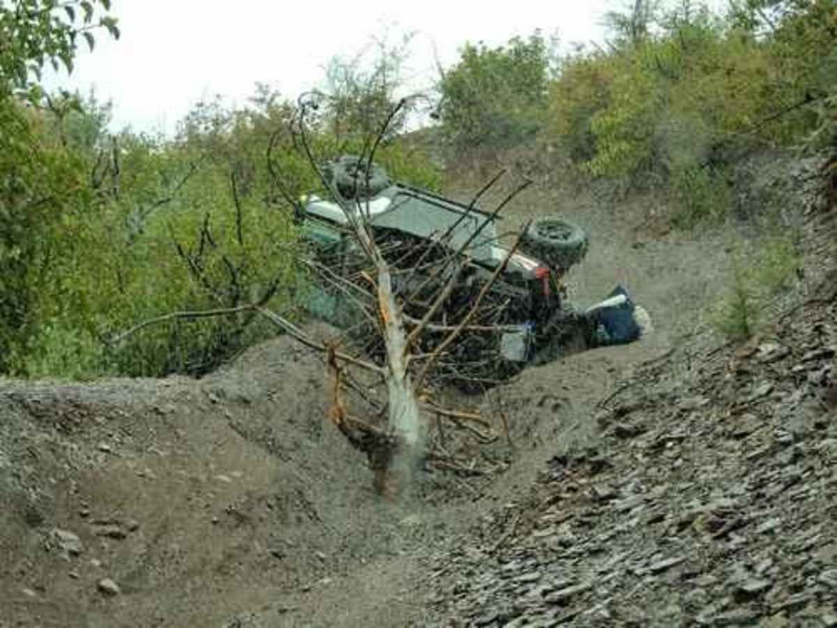
Took the trail clockwise. Starts out fairly easy then gets more technical after the first path through the creek. Took just over five hours to complete. Sliders, skid plates, and a locker are a necessity for this trail especially in the creek. Highly recommend a winch if you’re going solo. Trail gets very sketchy once it leaves the creek and climbs up the mountain. It’s very eroded in some places with a high chance of body damage or a rollover.
Jack Sharpe
Apr 21, 2024
Open
Rough/Deteriorated
Going clockwise you get dumped right into a shallow river, which you wind in and out of. The river was not very deep, only 10" at the most. The rocky up and down hill section after the mine was farily deteriorated with lots of loose rock.
Sue Russell
Mar 04, 2024
Open
NormalDustyWashboard
Todd C Menard
Dec 30, 2023
2019 Toyota Tacoma
Open
Mostly boulder fields and two waterfalls 3-4’ tall. Took the loop trail counterclockwise. Had no issues. Note that the trail was completed using a 2019 Tacoma TRD off-road 4x4 with 3” lift and 33” Cooper STTs. This trail is tight and technical.
D. garcia
Sep 30, 2023
2018 Jeep Wrangler
Open
Rough/Deteriorated
Andrew Abrams
Jul 14, 2023
Obstructed
Downed Tree