1043 Lees Ferry Overlook
Total Miles
6.1
Technical Rating
Best Time
Spring, Winter, Fall
Trail Type
Full-Width Road
Accessible By
Trail Overview
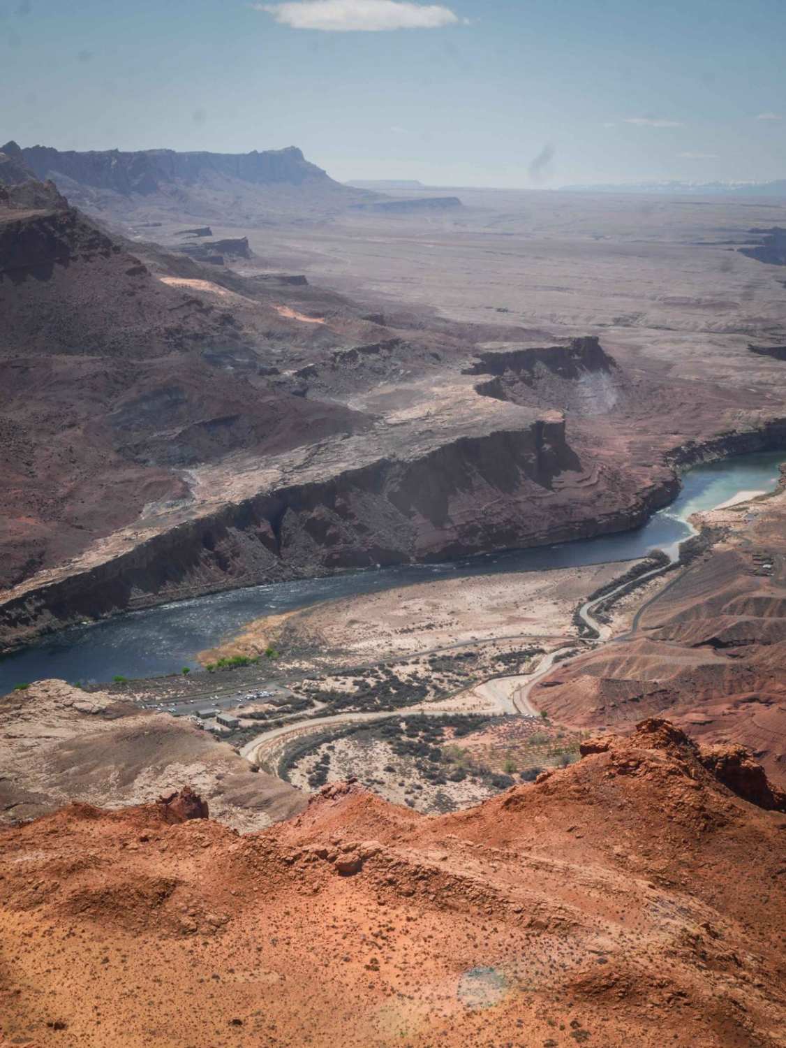
1043 is a fun and scenic route through the Vermillion Cliffs with a bit more challenge compared to the rest of the roads in the area, and it leads to the incredible Lees Ferry Overlook in the Glen Canyon National Recreation Area. The trail is 6 miles long, starting on the north end on BLM land. As it goes south, it goes through the Vermillion Cliffs National Monument. The trail is full of scenic views, going right next to really neat red rock cliffs. It has some more technical rock ledges, with layers of embedded slab rock making small ledges, cut-up layers, and bigger ledges up to a couple of feet tall. It's also sandy in a lot of sections, with fast corners around the rock formations, but also straight easy sections. It has sections that are more rutted with loose rocks in the trail, and small climbs with loose rock and slab rock. The road gains 1,100 feet from north to south as it heads towards the Colorado River. There's a long climb on a hill following the powerlines with nice views out towards the canyons and some steeper sections on the slab rock that are more difficult. This trail is a highlight of visiting this area, as the ending view out over the Colorado River is pretty incredible. The last 1.4 miles of this trail are in the Glen Canyon National Recreation Area and are designated as open to conventional vehicles, OHVs, and street-legal ATVs/dirt bikes. As of April 2024, a permit system for ORV routes within Glen Canyon National Recreation Area is being developed, and ORV permits will be required in the future.
Photos of 1043 Lees Ferry Overlook
Difficulty
This trail is a 4 difficulty for several slab rock ledges that are a couple of feet tall and sandy sections. The rock ledges are not off-camber and pretty ramped, so they aren't overly technical.
Status Reports
1043 Lees Ferry Overlook can be accessed by the following ride types:
- High-Clearance 4x4
- SUV
- SxS (60")
- ATV (50")
- Dirt Bike
1043 Lees Ferry Overlook Map
Popular Trails
East Verde River

Dead Horse Wash
Northview Cutoff
Painted Mountains
The onX Offroad Difference
onX Offroad combines trail photos, descriptions, difficulty ratings, width restrictions, seasonality, and more in a user-friendly interface. Available on all devices, with offline access and full compatibility with CarPlay and Android Auto. Discover what you’re missing today!
