El Rosario Connection
Total Kilometers
25.1
Technical Rating
Best Time
Spring, Summer, Fall, Winter
Trail Type
Full-Width Road
Accessible By
Trail Overview
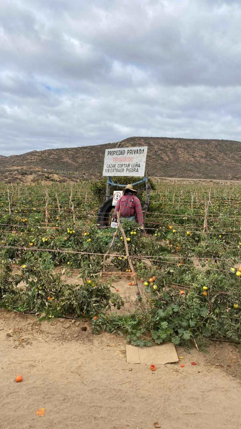
From Highway 1, the trail begins as a relatively easy ranch road, frequently traveled, passing farmland where you'll see crops like tomatoes and other vegetables. Just beyond a scarecrow, turn right at an intersection--continuing straight leads to a private ranch that prohibits trespassing. The trail immediately presents two dips requiring a high-clearance vehicle, after which it splits frequently over the next three miles, likely due to seasonal conditions. As you ascend out of the arroyo, the road becomes rockier, with sections of rockslides that may necessitate four-wheel drive. The most challenging parts feature deep crevices on the right, some up to 3-4 feet, so it's crucial to stay clear of the unstable edges, though there's enough room to navigate safely. Along the way, you'll notice various birds and small wildlife. Upon reaching the plateau, the trail joins a smoother road that leads either right to El Rosario or left back to El Pabellon.
Photos of El Rosario Connection

Difficulty
The trail features only a few challenging sections. After the intersection, you'll encounter dips about two feet deep and four feet wide, followed by a few rock piles that need to be cleared. Additionally, there are some deep crevices that require careful navigation. Other than these obstacles, the route is fairly straightforward in dry conditions.
Status Reports
El Rosario Connection can be accessed by the following ride types:
- High-Clearance 4x4
- SUV
- SxS (60")
- ATV (50")
- Dirt Bike
El Rosario Connection Map
Popular Trails

Las Alturas

Old Road to Rancho Venados
Control Tower Trail

Scenic Road to Rancho Alamar
The onX Offroad Difference
onX Offroad combines trail photos, descriptions, difficulty ratings, width restrictions, seasonality, and more in a user-friendly interface. Available on all devices, with offline access and full compatibility with CarPlay and Android Auto. Discover what you’re missing today!