
Off-Road Trails in Baja California
Discover off-road trails in Baja California
Off-Road Trails in Baja California
Discover the best off-road trails in Baja California. Browse trail maps, check difficulty ratings, and find your next adventure — whether you're looking for a quick ride or an all-day expedition.
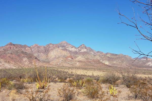
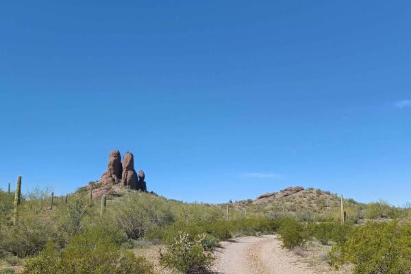
Valle de los Cirios
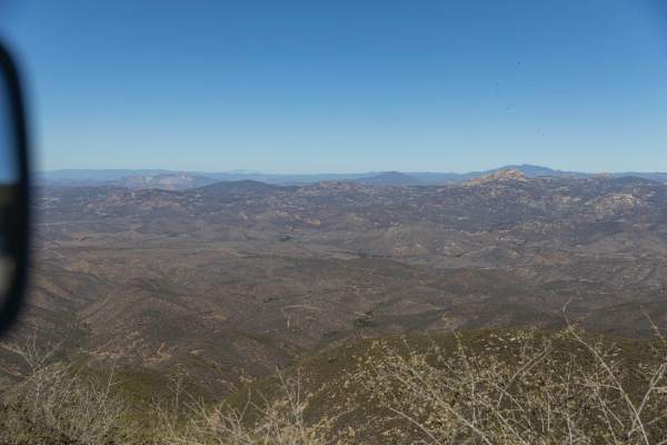
Traveling from Bahia de los Angeles back to the 1 near Benito Juarez. This route follows some old Baja 1000 tracks at points and terrain varies from rough rocky sections to sand. The route passes by Bahia San Rafael near the midpoint with beach access opportunities. No cell service, fuel or resupply...
Learn more about Valle de los Cirios
Mision Santa Gertrudis La Magna
This scenic offroad trail leads to Mision Santa Gertrudis La Magna from Valle de Los Cirrios. The trail terrain changes frequently, from sand, rocks, dirt, to pebbles and even a little bit of rock crawling. The trail winds a bit, but there is only one truly challenging section with rock obstacles, s...
Learn more about Mision Santa Gertrudis La Magna
La Mision - Valle de Guadalupe
Traveling from La Mision to wine country in Valle de Guadalupe. This route passes farmland, valleys, and great views of the pacific ocean, at points and terrain, varies from rocky sections to smooth dirt roads. The route passes by the Kumias Indigenous Town near the midpoint. This trail is easy when...
Learn more about La Mision - Valle de Guadalupe
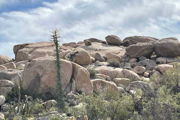
El Marmolito
The starting point of this trail is Mina Marmolita, where the Enchanted Valley trail concludes. It's crucial to note that what lies ahead is considerably more challenging and remote compared to the terrain you have already traversed. Solo travel is not advised. The initial stretch of the trail combi...
Learn more about El Marmolito

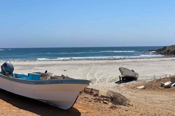
Catavina - San Jose del Faro
Remote dirt road route connecting Catavina to the tiny fishing village of San Jose del Faro on the Pacific Coast. This route is popular with the dual-sport touring motorcycle crowd as well as surfers looking to access parts of the famous Seven Sisters surf breaks. This route is easy when dry and can...
Learn more about Catavina - San Jose del Faro
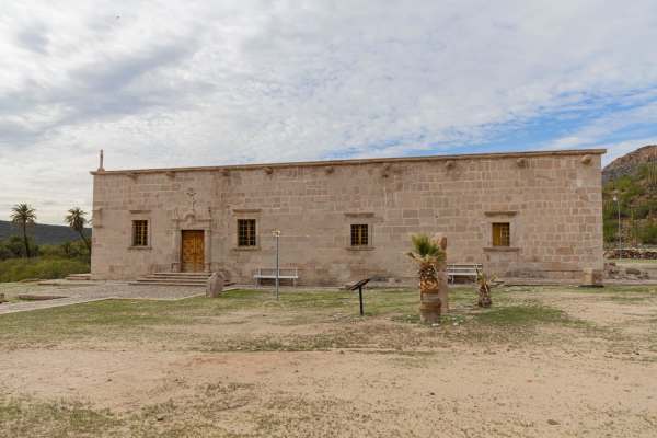
Mision San Borja
This is a dirt road accessing Mission de San Franciso Borja. This can be traveled as an out-and-back to the mission, back from either access point, or as a through route when coming in or out of Bahia de Los Angeles. Air down when leaving pavement and give yourself time for an hour visiting the miss...
Learn more about Mision San Borja

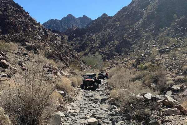
Jesters Trailhead
This trail is an excellent access point up into the hills and the network of trails in the area. It's a popular hiking area with dogs, so be on the lookout for furry friends running around. There are quite a few options to get into the hills, and one should use caution with some selections. They hav...
Learn more about Jesters Trailhead
Santo Tomas to Vicente Guerrero
This dirt road and sometimes trail leads you through rough mountains and along the Pacific coast of Baja California. The uneven road is manageable by most, but how long it takes depends on your equipment and skill. The trek south, while passing through a few small villages, provides beautiful view...
Learn more about Santo Tomas to Vicente Guerrero
Hidden Camp
Hidden camp is a beautiful road that runs through Bureau of Land Management property, it is an out and back, sections of this road are gravel while others are very overgrown and rocky, but when you get to the end you will have a very remote camp spot big enough for one or two vehicles. It is a prett...
Learn more about Hidden Camp
Canyon de Guadalupe High Road
When this road through the lake bed is wet and muddy, this is the safe route to access the Canyon de Guadalupe Hot Springs. It is long and bumpy, so it's wise to air down for comfort and to ease wear and tear on your gear. Watch for and follow the handmade signs. On the last couple of miles, the cor...
Learn more about Canyon de Guadalupe High Road
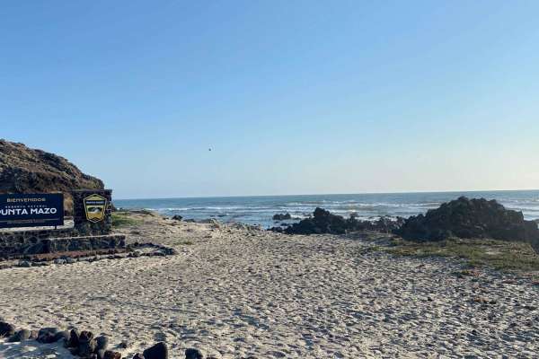
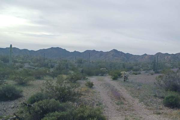
Valley of the Volcanoes to Punta Mazo Natural Reserve
The journey begins at Ejido Chapala, where the paved road transitions into a dirt path. While the road may be uncomfortably bumpy due to washboard patterns, it should not discourage adventurous travelers. You have the option to air down your tires or consider an alternative route provided by onX, wh...
Learn more about Valley of the Volcanoes to Punta Mazo Natural Reserve
Coco's Corner
This is the last bit of an iconic trail, a new highway was built to connect Mex 5 to Mex 1, and this is what's left; a hope not to be forgotten trail that passes the original Coco Corner. Coming down from San Felipe you will arrive at the new Coco's Corner which is a relocation of the original, from...
Learn more about Coco's Corner
Dripping Springs
Rocky, technical, and very scenic unimproved trail through the heart of SW NM's Barry Goldwater aerial gunnery range SE of Yuma. Range permits from the Luke AFB Range Control Office are required, however, they're free and easily obtainable online at HTTPS://luke.isportsman.net. This is a very harsh,...
Learn more about Dripping Springs
Muggins Mountain West
This is a fun desert mountain trail that includes a combination of wide sand washes to very narrow, deep, meandering sand washes. There are vertical 20-foot side walls, sheer rock cliffs (some with petroglyphs), a section of tight, steep, rocky switchbacks, desert mountain ridge trails with lots of ...
Learn more about Muggins Mountain West
Otay Mountain Truck Trail
This route goes up and over Otay Mountain with sweeping views over the San Ysidro Mountains, and a little bit of San Diego in the distance. The road is made up entirely of dirt and gravel and stays relatively even throughout. This is a great trail on hazy/foggy days as it is well above the marine la...
Learn more about Otay Mountain Truck Trail
San Vicente to Ejido Erendira
This trail takes you from San Vicente to Ejido Erendira, following the wash. After leaving Highway One, you'll exit San Vicente in around 5 or 6 blocks and start making your way through ranches and small towns. As you continue, the surroundings become more remote, but you'll always be within a mile ...
Learn more about San Vicente to Ejido Erendira
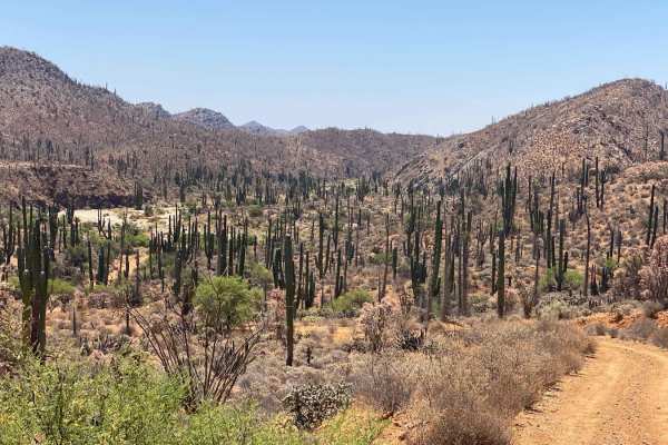
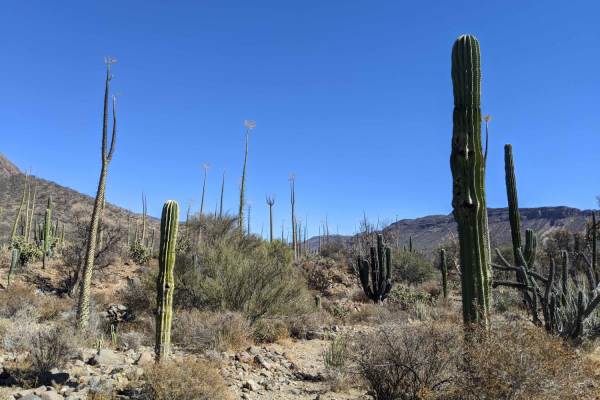
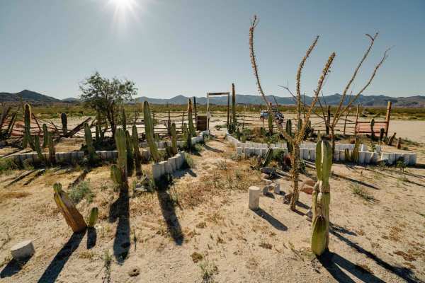
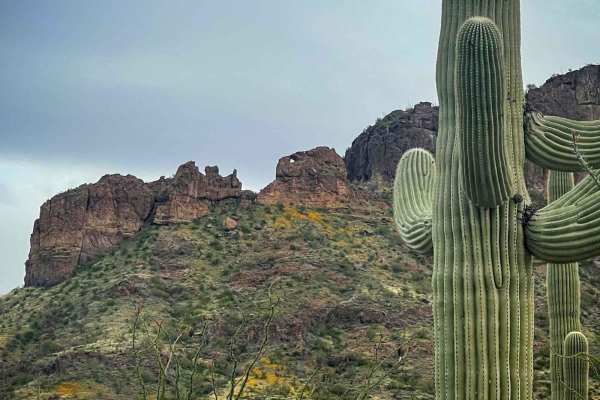
Enchanted Valley to Mina Marmolito
This trail offers a captivating experience as you journey through an impressive Cardon forest, making it likely the most remarkable sight of its kind. Some Cardon cacti reach over 40 feet in height, leaving a lasting impression. The sheer abundance of these cacti creates a dense forest-like atmosphe...
Learn more about Enchanted Valley to Mina Marmolito
Intermittent
Rough, rocky road between Laguna Chapala (Hwy 1 / Hwy 5 junction) and the Pacific Coast. This passes through an unnamed dry lakebed labeled as Laguna Intermittent. This lakebed and the silt beds nearby would be impassable when wet. The rocky bits are rough and slow, and this road sees very little us...
Learn more about Intermittent
Locomotive Rock
Locomotive Rock Road is easy at the beginning, any 2-wheel drive vehicle can access the area. You can park and hike to Locomotive Rock. There are camping spots on either side of the road big enough for large rigs or a couple of vehicles. Once you pass Locomotive Rock the trail becomes tight, rocky, ...
Learn more about Locomotive Rock
Pipeline Trail
Pipeline Trail starts as a rocky two-track that runs near an open pit Copper mine, and off into the distance to the East. Though this road may seem like your typical easy trail, with some points being two or even three vehicles wide, it quickly deteriorates into a rough trail with long, steep, loose...
Learn more about Pipeline Trail
ATV trails in Baja California
Explore ATV-friendly trails in Baja California. These trails are accessible for vehicles up to 50 inches wide, perfect for ATVs and smaller off-road machines.
Mision Santa Gertrudis La Magna
This scenic offroad trail leads to Mision Santa Gertrudis La Magna from Valle de Los Cirrios. The trail terrain changes frequently, from sand, rocks, dirt, to pebbles and even a little bit of rock crawling. The trail winds a bit, but there is only one truly challenging section with rock obstacles, s...
Learn more about Mision Santa Gertrudis La Magna
La Mision - Valle de Guadalupe
Traveling from La Mision to wine country in Valle de Guadalupe. This route passes farmland, valleys, and great views of the pacific ocean, at points and terrain, varies from rocky sections to smooth dirt roads. The route passes by the Kumias Indigenous Town near the midpoint. This trail is easy when...
Learn more about La Mision - Valle de Guadalupe
El Marmolito
The starting point of this trail is Mina Marmolita, where the Enchanted Valley trail concludes. It's crucial to note that what lies ahead is considerably more challenging and remote compared to the terrain you have already traversed. Solo travel is not advised. The initial stretch of the trail combi...
Learn more about El Marmolito
Catavina - San Jose del Faro
Remote dirt road route connecting Catavina to the tiny fishing village of San Jose del Faro on the Pacific Coast. This route is popular with the dual-sport touring motorcycle crowd as well as surfers looking to access parts of the famous Seven Sisters surf breaks. This route is easy when dry and can...
Learn more about Catavina - San Jose del Faro
UTV/side-by-side trails in Baja California
Find UTV and side-by-side trails in Baja California. These trails accommodate vehicles up to 60 inches wide, ideal for UTVs, side-by-sides, and wider off-road rigs.
Mision Santa Gertrudis La Magna
This scenic offroad trail leads to Mision Santa Gertrudis La Magna from Valle de Los Cirrios. The trail terrain changes frequently, from sand, rocks, dirt, to pebbles and even a little bit of rock crawling. The trail winds a bit, but there is only one truly challenging section with rock obstacles, s...
Learn more about Mision Santa Gertrudis La Magna
La Mision - Valle de Guadalupe
Traveling from La Mision to wine country in Valle de Guadalupe. This route passes farmland, valleys, and great views of the pacific ocean, at points and terrain, varies from rocky sections to smooth dirt roads. The route passes by the Kumias Indigenous Town near the midpoint. This trail is easy when...
Learn more about La Mision - Valle de Guadalupe
El Marmolito
The starting point of this trail is Mina Marmolita, where the Enchanted Valley trail concludes. It's crucial to note that what lies ahead is considerably more challenging and remote compared to the terrain you have already traversed. Solo travel is not advised. The initial stretch of the trail combi...
Learn more about El Marmolito
Catavina - San Jose del Faro
Remote dirt road route connecting Catavina to the tiny fishing village of San Jose del Faro on the Pacific Coast. This route is popular with the dual-sport touring motorcycle crowd as well as surfers looking to access parts of the famous Seven Sisters surf breaks. This route is easy when dry and can...
Learn more about Catavina - San Jose del Faro
The onX Offroad Difference
onX Offroad combines trail photos, descriptions, difficulty ratings, width restrictions, seasonality, and more in a user-friendly interface. Available on all devices, with offline access and full compatibility with CarPlay and Android Auto. Discover what you're missing today!
Open Trail Map