Bahia San Quintin
Total Kilometers
16.6
Technical Rating
Best Time
Spring, Summer, Winter
Trail Type
Full-Width Road
Accessible By
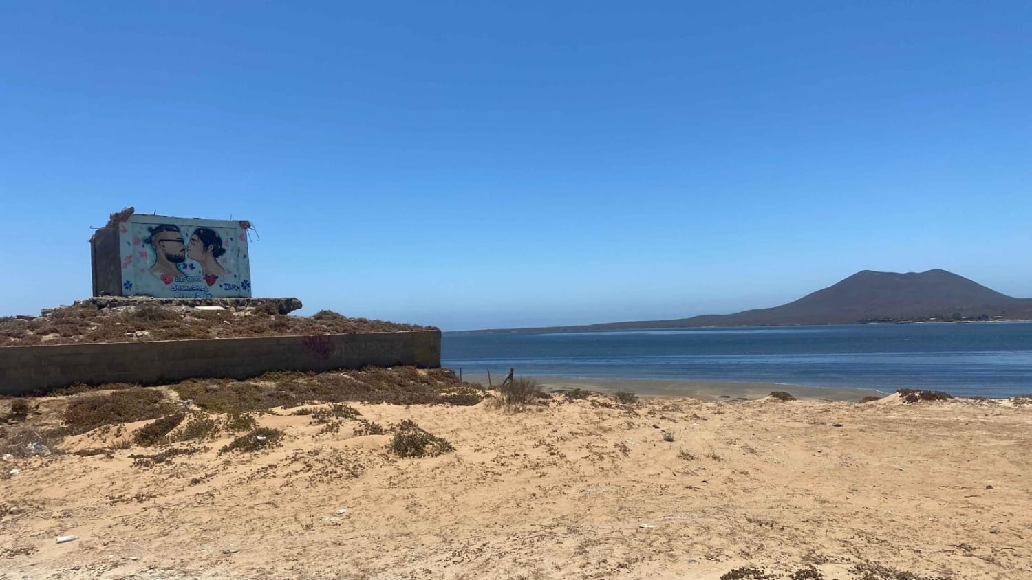
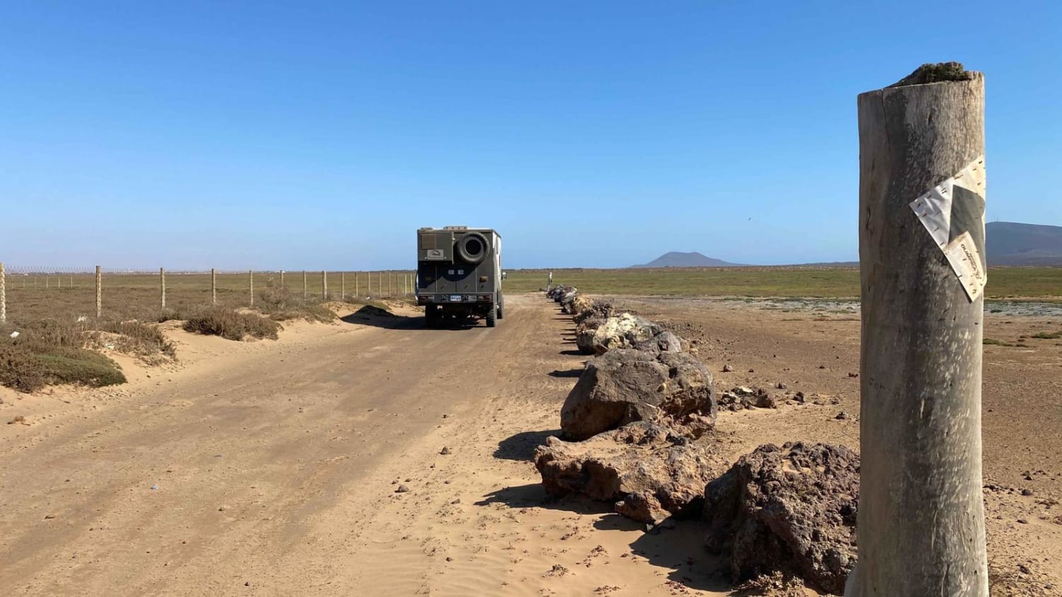
Trail Overview
Starting from Ejido Chapala, this route traces the closest passable contour along the backside of Bahia San Quintin. Along the way, you may encounter various reptiles, unique bird species, and possibly snakes. Initially, for about 15-20 minutes, the trail will consist of mostly hard-packed terrain, which was once part of a Baja race route. Expect continuous wave-like whoops until you reach the Fish Taco place, where you'll cross a paved road leading to Campo Lorenzo Sky Park and Don Eddies on the right. Once past this point, the trail quickly transitions into the sand, and as you progress, the sand becomes progressively deeper. It's advisable to have a 4x4 vehicle and be prepared to lower your tire pressure (air down) to navigate this section effectively. After passing the old San Carlos Pier, a recommended lunch stop, you'll make a left turn, moving closer to the wetlands. While the region should generally be dry, except during the rainy season, be cautious of any wet areas. Upon reaching the English Cemetery, you can opt to exit the route to the left to avoid the deepest sand, minimizing the risk of vehicle damage (pinstriping). Continuing on, remain vigilant about the sand depth and the possibility of encountering wet spots. Missing the next 90-degree left turn could lead you down a road that terminates at the water, making it challenging to reverse out. From there, you'll navigate through dense brush and eventually encounter another 90-degree left turn, leading you into a wash. The most challenging section of sand lies within the last half-mile before reaching the bridge, so maintaining an adequate speed is crucial for a smoother ride.
Photos of Bahia San Quintin
Difficulty
There are some deep areas of sand, especially in the wash at the end. The last third of the route could be impassible at any time due to the rainy season or recent heavy rain or hurricane tides. In these wetland areas of Mexico always look for fresh tire tracks even in dry basin areas as there could be deep mud under a crusty dry surface. Walking ahead to check these areas when in doubt is always a good choice.
Status Reports
Bahia San Quintin can be accessed by the following ride types:
- High-Clearance 4x4
- SUV
- SxS (60")
- ATV (50")
- Dirt Bike
Bahia San Quintin Map
Popular Trails

Monte Ceniza Nature Reserve

Rancho Estela High Road
La Rumorosa to Laguna Hanson Trail
The onX Offroad Difference
onX Offroad combines trail photos, descriptions, difficulty ratings, width restrictions, seasonality, and more in a user-friendly interface. Available on all devices, with offline access and full compatibility with CarPlay and Android Auto. Discover what you’re missing today!