Ruta La Presa
Total Kilometers
16.8
Technical Rating
Best Time
Spring, Fall, Winter, Summer
Trail Type
Full-Width Road
Accessible By
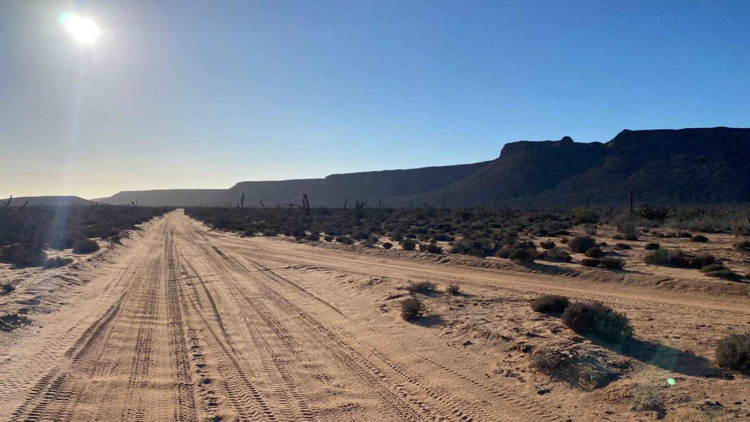
Trail Overview
This off-road trail, located east of San Fernando and accessible via the San Fernando to Sleeping Bag Trail route, offers a challenging and rugged adventure for experienced drivers. Initially, the path is manageable, with scattered small rocks, but it quickly becomes more difficult as the terrain grows rougher. The trail weaves through low hills before reaching the mountains, where 3 to 4 steep, rutted sections--up to 60 yards long--pose significant challenges, with deep silt and large, exposed rocks churned up by high-powered vehicles. While there are bypasses around the toughest sections, they are often only marginally easier. The trail does offer brief stretches of smoother ground, allowing a break from constant tire navigation, but as you progress inland, temperatures rise significantly, and shade is scarce until the final portion. After 10 miles, the trail culminates in a half-mile descent to the reservoir, where lush greenery surrounds the lake. A left turn from here extends the journey another 10 miles toward the Cascabel MTB area, though the last mapped section on onX is about 5 miles in, leaving part of the route unrated unless you return the way you came. Though no wildlife was encountered aside from rabbits and birds, there were several fresh cat tracks imprinted in the powdery sections of the trail, hinting at the presence of more elusive creatures.
Photos of Ruta La Presa


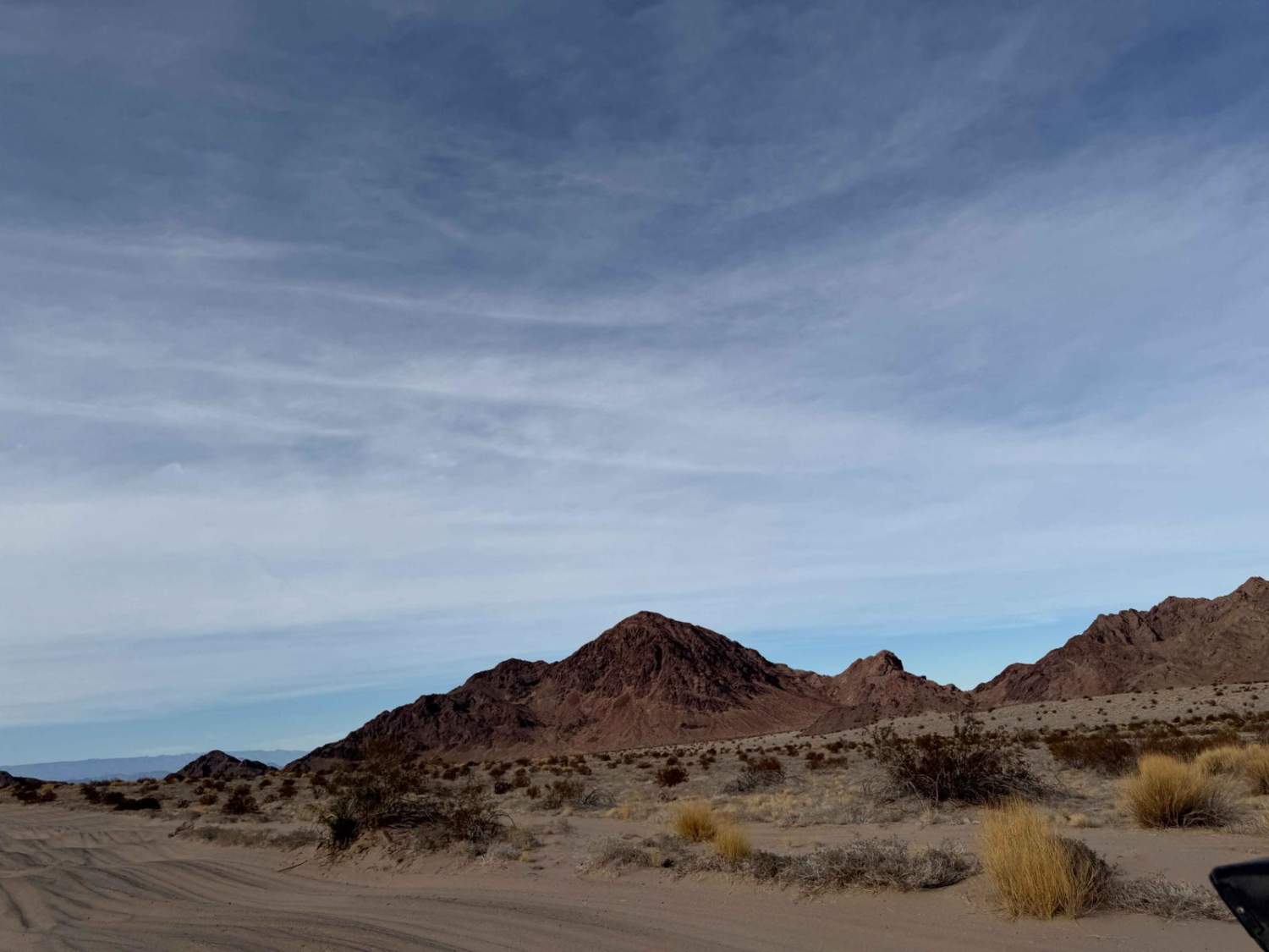
Difficulty
The trail features three or four sections rated as level 3 difficulty, with one particularly challenging section pushing it to level 4, even in dry conditions. This area is remote, extremely hot, and offers no shade, so be sure to bring plenty of water. The tire shown in the photos is one of two that recently split on the trail, likely from vehicles racing through the rocky terrain. The most difficult section is a steep grade with numerous silt-covered rocks the size of volleyballs, and some even larger. The alternate route, while offering a different path, is equally tough with deep ruts and its own set of challenges. The two portrait images in this description display both options for this section, although the incline is steeper than it appears in the photos. Air down for this adventure and be sure to have good recovery gear available. After a storm or rain, this trail will become significantly more difficult.
Status Reports
Ruta La Presa can be accessed by the following ride types:
- High-Clearance 4x4
- SUV
- SxS (60")
- ATV (50")
- Dirt Bike
Ruta La Presa Map
Popular Trails
Four Corners West

San Fernando West
Salt Flat Loop 1000 Course

West Crossover
The onX Offroad Difference
onX Offroad combines trail photos, descriptions, difficulty ratings, width restrictions, seasonality, and more in a user-friendly interface. Available on all devices, with offline access and full compatibility with CarPlay and Android Auto. Discover what you’re missing today!