Hatfield McCoy Trails
Location: 180 Appalachian Outpost Trail, Man, WV 25635
Range of Trail Difficulty: All Ranges
Ride Types Allowed: Dirt Bikes, ATVs, and SxS
Miles of Trails: 1,000+
Acres of Riding: 1,000,000+
Location: 180 Appalachian Outpost Trail, Man, WV 25635
Range of Trail Difficulty: All Ranges
Ride Types Allowed: Dirt Bikes, ATVs, and SxS
Miles of Trails: 1,000+
Acres of Riding: 1,000,000+
About Hatfield McCoy Trails
Encompassing more than a million acres in southern West Virginia, the Hatfield-McCoy Trails system is one of the largest and most well-known off-highway vehicle trail networks in the world. Located in Man, West Virginia, this riding mecca is roughly 100 miles from Charleston, and within three hours of Roanoke, Virginia; Columbus, Ohio; and Lexington, Kentucky. With over 1,000 miles of trails, riders can explore scenic ridgelines, technical woods with singletrack, and everything in between, with trails that cater to nearly every skill level.
Many routes on the Hatfield-McCoy Trails system connect to nearby towns, where riders can fuel up, grab a bite to eat, and experience the area’s off-road-friendly hospitality. Whether one wants a luxury accommodation or a place to pitch a tent, the area offers a host of options. With unmatched trail mileage and Appalachian charm in every town, the Hatfield-McCoy Trails is a world-renowned bucket-list destination for off-road enthusiasts.
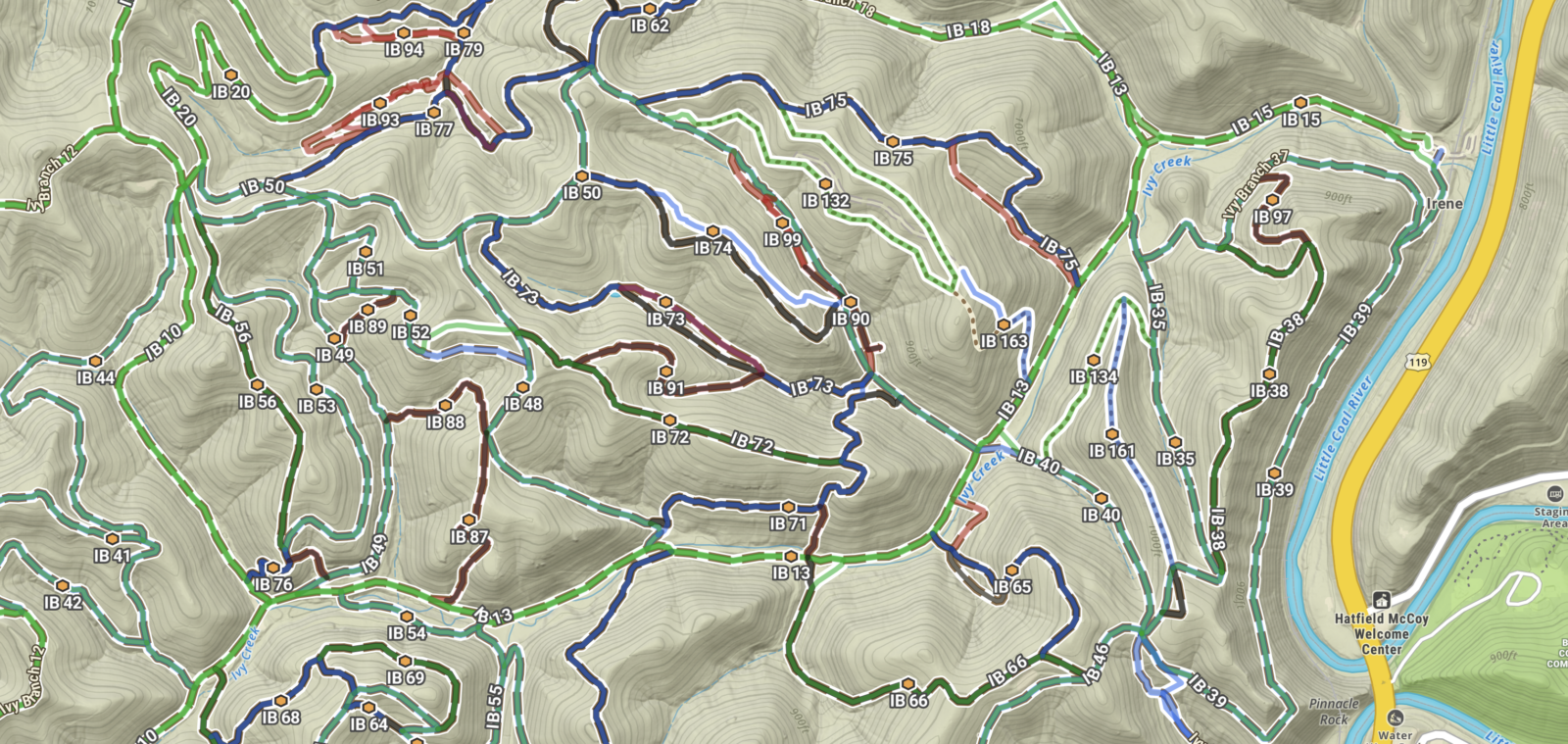
Trail Map of Hatfield McCoy System
Hatfield McCoy Trails and onX Offroad
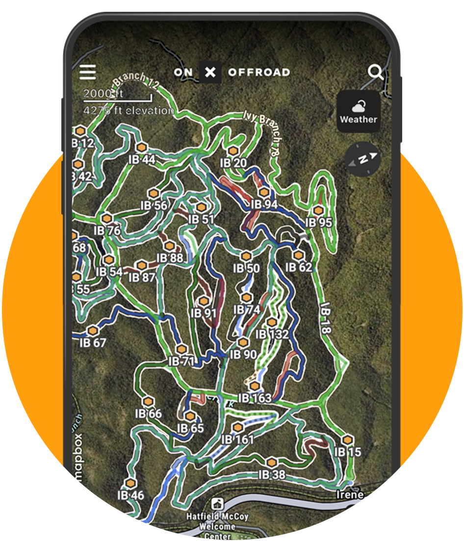
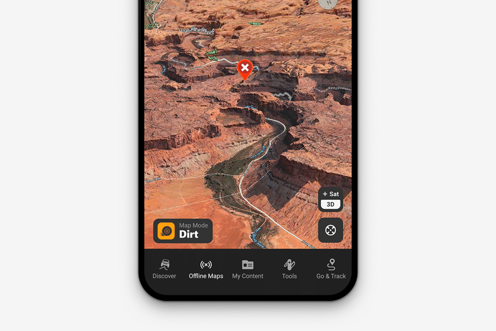
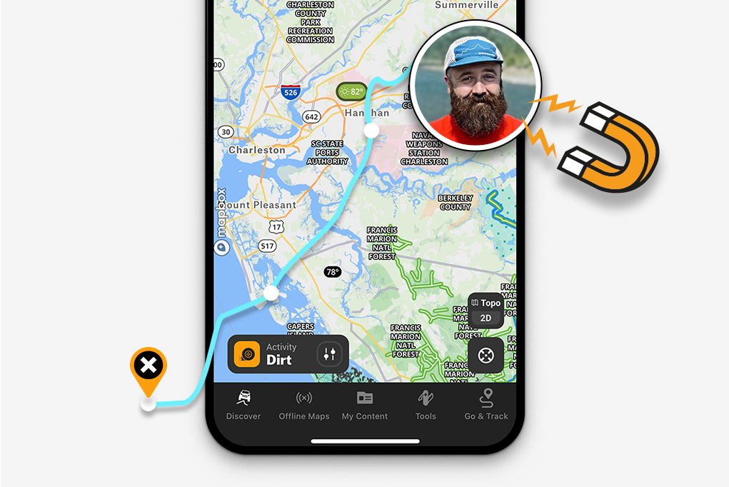
Our partnership with Hatfield McCoy will elevate your off-road experience to a new level of navigation accuracy and on-the-trail confidence. onX Offroad’s detailed maps, trail data, and GPS tracking make exploring and discovering more at Hatfield McCoy easier. With the powerful onX Offroad suite of tools in your pocket or on your dash, tackle every adventure confidently, knowing you’re prepared for whatever the trail ahead throws your way.
OHV Park Trail Maps
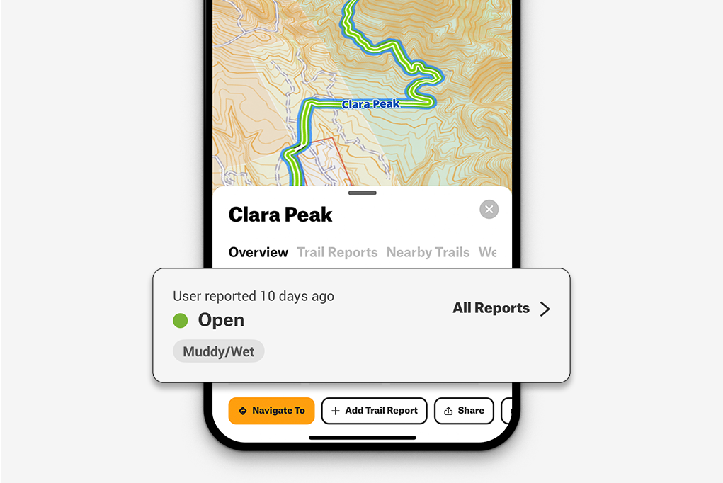
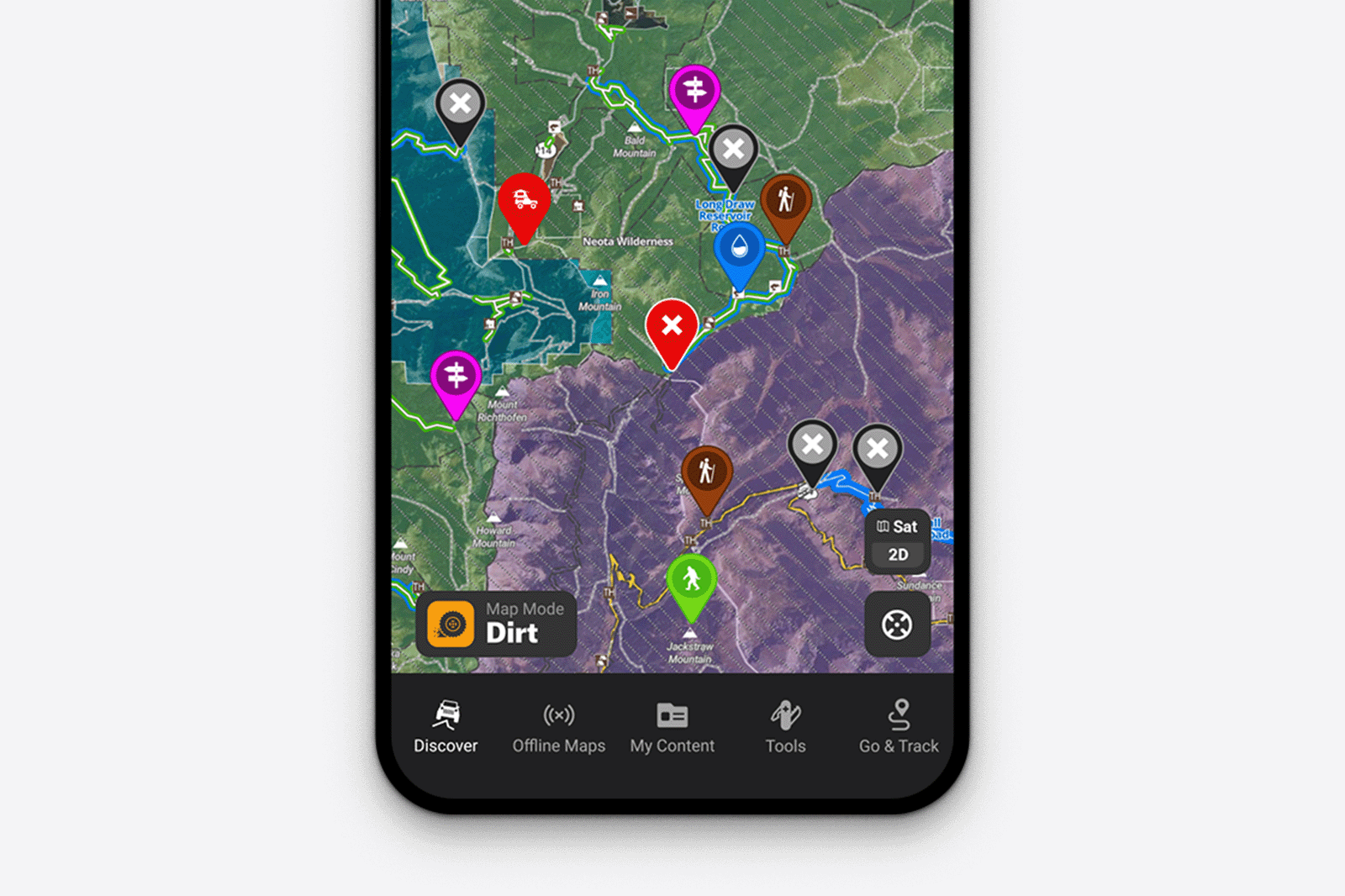
The onX Offroad App will simplify navigation when visiting Hatfield McCoy! Each trail has been carefully mapped to offer a better understanding of where to drive or ride, with trails color-coded in the app by difficulty level. Use onX Offroad to help plan your off-road journey and select the perfect route to navigate Hatfield McCoy confidently.
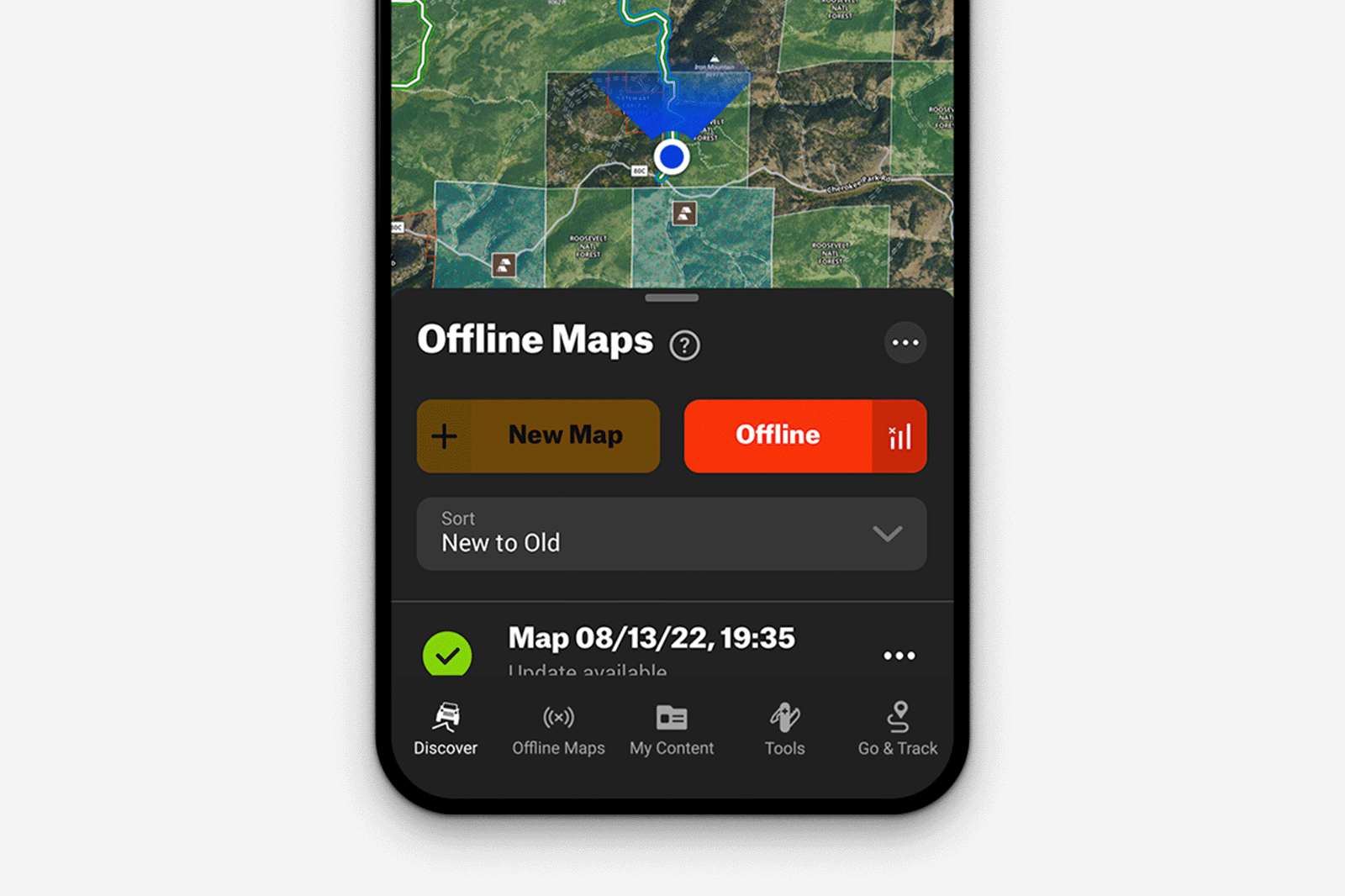

Get the map to your favorite Off-road park
Or find off-road parks near you with onX Offroad.