
Dirt Bike Trails
Near Macdoel, California
Explore All Dirt Bike Trails Near Macdoel, California
Dirt Bike Trails Near Macdoel, California
Discover the best dirt bike trails near you. Browse trail maps, check difficulty ratings, and find your next adventure — whether you're looking for a quick ride or an all-day expedition.
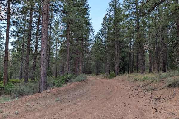
Three Sisters - FS 45N03
This trail serves as one of the main north-south routes in the area, running parallel to Highway 15. The trail is one and a half vehicles wide with a hard-packed dirt surface that remains relatively smooth throughout the journey. The route travels through a forest of healthy pine trees, scattered wi...
Learn more about Three Sisters - FS 45N03
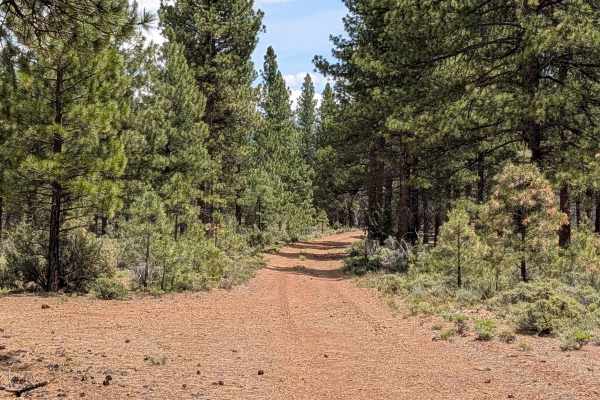
Tigers Tail - FS 44N87
This 4.5-mile point-to-point trail starts on Long Prairie Road and ends at Ragwort Trail, traveling through a mature pine forest within the Klamath National Forest. The surface consists of compact dirt with some of pine needles and pine cones. There is abundant sagebrush and other flora throughout t...
Learn more about Tigers Tail - FS 44N87
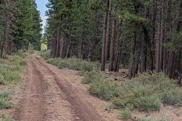
Antelope Well - FS 45N04
This route provides a seamless and accessible transit from Highway 15 to the Three Sisters area. Following extensive forest remediation efforts related to past wildfire activity, the trail has undergone significant grading, resulting in a smooth, well-maintained surface that stands in contrast to th...
Learn more about Antelope Well - FS 45N04
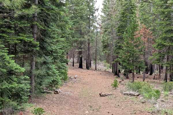
Ragwort Cut Off
This 1.6-mile point-to-point trail serves as a strategic shortcut linking the Ragwort - FS 44N12 and Purple Pit - FS 44N22Y trails. It winds through a healthy, mature stand of pine trees within the Klamath National Forest. For the majority of the route, the path is exceptionally smooth, featuring a ...
Learn more about Ragwort Cut Off
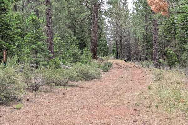
Ragwort - FS 44N12
This 7-mile point-to-point trail starts at the junction of Three Sisters and Rainbow Well and ends at Long Prairie Road, serving as one of the main east-west 4x4 trails in the Klamath National Forest. The trail cuts through a healthy and mature pine forest lined with different brush species and pine...
Learn more about Ragwort - FS 44N12
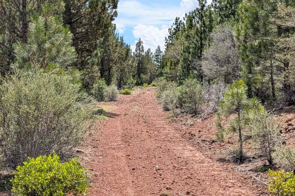
Ragwort Spur A - FS 44N12A
This 1.5-mile out-and-back trail serves as a scenic access route to a prominent viewpoint within the Klamath National Forest. Starting and ending on the Ragwort (FS44N12) trail, the route winds through a mature forest of pine trees and sagebrush, offering a classic high-country experience. The highl...
Learn more about Ragwort Spur A - FS 44N12A
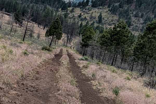
Sisters - FS 45N24Y
This route begins off Highway 15 and serves as a direct line toward the Three Sisters landmark. The first mile of the journey traverses the aftermath of the 2021 Antelope Fire, where you will pass through a landscape defined by charred, standing timber; please note that the trail has been officially...
Learn more about Sisters - FS 45N24Y
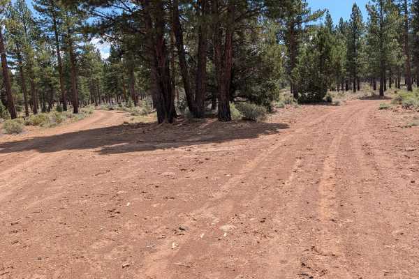
Cutoff - FS 44N13
This 2.4-mile point-to-point trail acts as a connector between the Ragwort (FS44N12) trail and Long Prairie Road within the Klamath National Forest. The route is characterized by its utilitarian function, serving as a passage through forest segments that have undergone prescribed control burns. Thes...
Learn more about Cutoff - FS 44N13
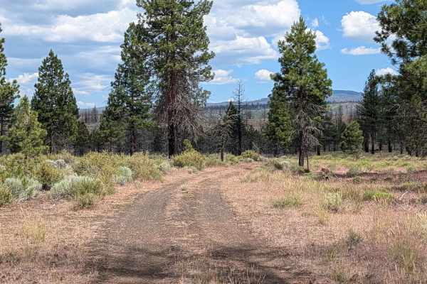
Kopi North - FS 45N14Y
This 3-mile point-to-point route serves as a functional and scenic corridor running north to south, paralleling Highway 10 through the Modoc National Forest. The trail connects Highway 15 to the Dock Wells area FS 44N05 and traverses an area that marks the edge of the 2021 Antelope Fire, offering a ...
Learn more about Kopi North - FS 45N14Y
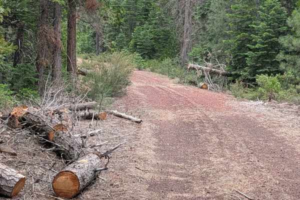
Purple Pit - FS 44N22Y
This 2-mile point-to-point trail is a scenic connector running between Cheatgrass - FS44N10 and the Railroad Grade 77 road. It traverses a beautiful, mature stand of tall pine trees within the Klamath National Forest. The area shows clear evidence of active forest management; prescribed burns have b...
Learn more about Purple Pit - FS 44N22Y
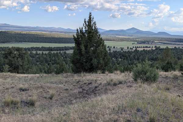
C33 Wild Horse Mountain - FS 44N11
This 9-mile point-to-point route serves as a picturesque loop, beginning and ending on the Three Sisters Trail within the Klamath National Forest. The path winds through a mature, serene pine forest, with the forest floor richly lined by sagebrush and a variety of native flora. During the spring and...
Learn more about C33 Wild Horse Mountain - FS 44N11
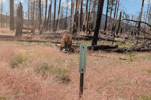
Bob Cat - FS 44N08Y
This route serves as an efficient and recently improved connector, beginning at Highway 15 and terminating at the Kopi South Trail. Its primary utility lies in its connectivity; it allows travelers to easily link into the Kopi South route and continue to the Dock Well loop, creating a cohesive circu...
Learn more about Bob Cat - FS 44N08Y
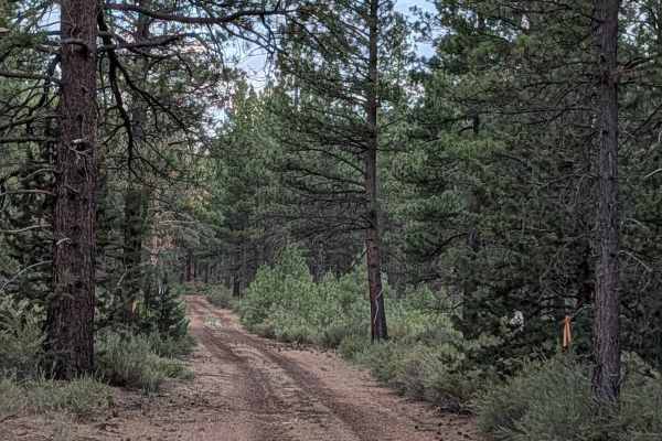
Antelope - FS 43N83
This 2-mile point-to-point trail serves as a scenic connector between Highway 15 and the Three Sisters Trail within the Klamath National Forest. The first half of the route passes through the significant scar of the 2021 Antelope Forest Fire; while extensive logging and cleanup efforts have removed ...
Learn more about Antelope - FS 43N83
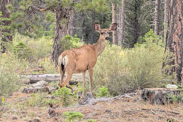
Rainbow Well - FS 44N06
This 3-mile point-to-point trail acts as a scenic connector between Highway 10 and the Three Sisters Trail within the Klamath National Forest. The eastern portion of the route runs directly through the footprint of the 2021 Antelope Forest Fire. While most of the damaged timber has been cleared, sma...
Learn more about Rainbow Well - FS 44N06
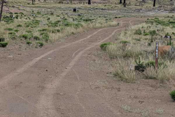
Chipmonk - FS 43N43
This 2-mile loop trail begins and ends on Railroad Grade 77, serving as an accessible route through a landscape defined by the 2021 Antelope Forest Fire. The first section traverses a vast clear-cut area where the fire’s intensity necessitated significant removal of timber, leaving behind expansive ...
Learn more about Chipmonk - FS 43N43
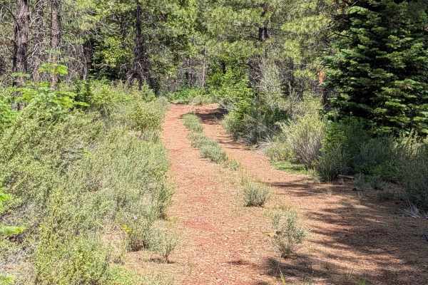
Cheat Grass - FS 44N10
This 2-mile point-to-point trail acts as a vital link between Railroad Grade 77 road and the Ragwort - FS 44N12 trail. Located within the Klamath National Forest, it sits precisely on the border of the 2021 Antelope Forest Fire zone, providing a fascinating look at the contrast between the fire-impa...
Learn more about Cheat Grass - FS 44N10

Railroad Grade 77
This 10-mile point-to-point trail starts on the east side at Highway 77 and ends in the village of Tennant, traveling through the Klamath National Forest as a well-graded dirt and gravel road. The trail maintains a width of 1.5 to 2 vehicles. The trail bears evidence of the 2021 Antelope Fire, which...
Learn more about Railroad Grade 77
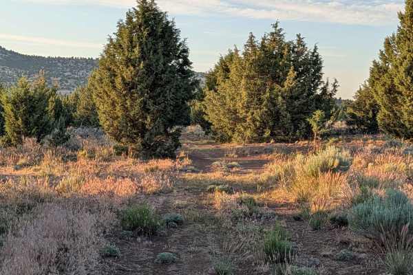
Panhandle Lake - FS 47N21
This short point-to-point route serves as an efficient and scenic shortcut connecting the Bonito Butte area with Gold Digger Pass. The trail traverses a healthy, vibrant section of the Modoc National Forest, characterized by thick stands of pine trees interspersed with patches of sagebrush. As you p...
Learn more about Panhandle Lake - FS 47N21
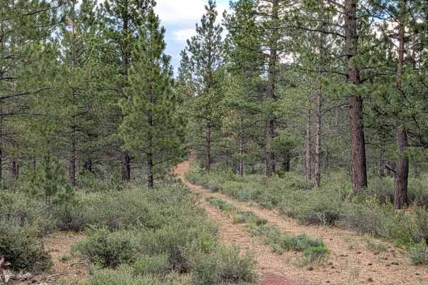
Playa - FS 44N84
This 3-mile point-to-point trail starts on Highway 15, crosses Highway 77, and ends at Three Sisters Trail, providing a convenient connecting trail between major routes in the Klamath National Forest. The trail cuts through a mature pine forest with lots of sagebrush and other flora lining the track...
Learn more about Playa - FS 44N84
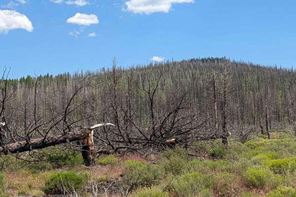
Kopi South - FS 45N14Y
This route provides a clear, accessible path through a landscape heavily altered by the 2021 Antelope Forest Fire. The area has undergone significant remediation, with the trail recently cleared and adjacent timber logged, creating a series of open meadows that contrast with the remaining burnt fore...
Learn more about Kopi South - FS 45N14Y
ATV trails near Macdoel, California
Explore ATV-friendly trails near you. These trails are accessible for vehicles up to 50 inches wide, perfect for ATVs and smaller off-road machines.
Three Sisters - FS 45N03
This trail serves as one of the main north-south routes in the area, running parallel to Highway 15. The trail is one and a half vehicles wide with a hard-packed dirt surface that remains relatively smooth throughout the journey. The route travels through a forest of healthy pine trees, scattered wi...
Learn more about Three Sisters - FS 45N03
Tigers Tail - FS 44N87
This 4.5-mile point-to-point trail starts on Long Prairie Road and ends at Ragwort Trail, traveling through a mature pine forest within the Klamath National Forest. The surface consists of compact dirt with some of pine needles and pine cones. There is abundant sagebrush and other flora throughout t...
Learn more about Tigers Tail - FS 44N87
Antelope Well - FS 45N04
This route provides a seamless and accessible transit from Highway 15 to the Three Sisters area. Following extensive forest remediation efforts related to past wildfire activity, the trail has undergone significant grading, resulting in a smooth, well-maintained surface that stands in contrast to th...
Learn more about Antelope Well - FS 45N04
Ragwort Cut Off
This 1.6-mile point-to-point trail serves as a strategic shortcut linking the Ragwort - FS 44N12 and Purple Pit - FS 44N22Y trails. It winds through a healthy, mature stand of pine trees within the Klamath National Forest. For the majority of the route, the path is exceptionally smooth, featuring a ...
Learn more about Ragwort Cut Off
UTV/side-by-side trails near Macdoel, California
Find UTV and side-by-side trails near you. These trails accommodate vehicles up to 60 inches wide, ideal for UTVs, side-by-sides, and wider off-road rigs.
Three Sisters - FS 45N03
This trail serves as one of the main north-south routes in the area, running parallel to Highway 15. The trail is one and a half vehicles wide with a hard-packed dirt surface that remains relatively smooth throughout the journey. The route travels through a forest of healthy pine trees, scattered wi...
Learn more about Three Sisters - FS 45N03
Tigers Tail - FS 44N87
This 4.5-mile point-to-point trail starts on Long Prairie Road and ends at Ragwort Trail, traveling through a mature pine forest within the Klamath National Forest. The surface consists of compact dirt with some of pine needles and pine cones. There is abundant sagebrush and other flora throughout t...
Learn more about Tigers Tail - FS 44N87
Antelope Well - FS 45N04
This route provides a seamless and accessible transit from Highway 15 to the Three Sisters area. Following extensive forest remediation efforts related to past wildfire activity, the trail has undergone significant grading, resulting in a smooth, well-maintained surface that stands in contrast to th...
Learn more about Antelope Well - FS 45N04
Ragwort Cut Off
This 1.6-mile point-to-point trail serves as a strategic shortcut linking the Ragwort - FS 44N12 and Purple Pit - FS 44N22Y trails. It winds through a healthy, mature stand of pine trees within the Klamath National Forest. For the majority of the route, the path is exceptionally smooth, featuring a ...
Learn more about Ragwort Cut Off
The onX Offroad Difference
onX Offroad combines trail photos, descriptions, difficulty ratings, width restrictions, seasonality, and more in a user-friendly interface. Available on all devices, with offline access and full compatibility with CarPlay and Android Auto. Discover what you're missing today!
Open Trail Map