
onX Hunt at Pheasant Fest – Booth #1418 & 1421
Get 1-Month of onX Hunt Elite for Free
An onX Hunt Elite Membership provides detailed maps for all 50 states and Canada and includes access to onX Hunt’s proprietary Basemaps, property lines, landowner information, GPS Map Tools (Waypoints, Tracker, Line Distance, Area Shape, and more), Wind & Weather, Offline Maps for use without cell service, Sharing, and hundreds of hunt-specific layers. Put the nation’s most accurate land ownership information in the palm of your hand with onX Hunt Elite.

onX Hunt “Reign of the Quail”
Friday, March 7th, 9:00 PM CST
Kansas City Convention Center Hall #1501
Join us for a night of live music, camaraderie, and conservation.
You’ll go home with onX Hunt Quail Conservation Hat, and Coffee from Gun Dog Grind and learn more about how the new PATH program is going national. Live music by Big Time Grain Co.
Schedule
- Thursday, March 6th
- Concert for Conservation
- 6:30 pm – Uptown Theater
- Concert for Conservation
- Friday
- onX Hunt 101 – Jack Hedlund
- Public Lands Stage
- 2:30PM
- Quail Battleship Panel
- Ben Brettingen, Ryan Sparks, Kali Parmley, & Tyler Webster
- Quail Classic Stage
- 4:30 PM
- Essentials for the Traveling DIY Bird Hunter
- Nate Akey
- Public Lands Stage
- 4:30PM
- onX Hunt 101 – Jack Hedlund
- Saturday
- Essentials for the Traveling DIY Bird Hunter
- Nate Akey
- Public Lands Stage
- 10:00 AM
- Public Access to Habitat (PATH) National Program Launch
- Public Lands Pavilion
- 11:00 AM
- onX Hunt 101
- Jack Hedlund
- Public Lands Stage
- 2:30 PM
- E-Scouting for Public Land Quail
- Ben Brettingen
- Path to the Uplands Stage
- 4:00PM
- Essentials for the Traveling DIY Bird Hunter
- Sunday
- Essentials for the Traveling DIY Bird Hunter
- Nate Akey
- Public Lands Stage
- 9:30 AM
- E-Scouting for Public Land Quail
- Ben Brettingen
- Path to the Uplands Stage
- 11:00 AM
- Public Land Quail Coast-to-Coast Panel
- Ben Brettingen
- Public Lands Stage
- 12:00PM
- onX Hunt 101
- Jack Hedlund
- Public Lands Stage
- 2:30 PM
- Essentials for the Traveling DIY Bird Hunter
onX Hunt Partner Booths
Birds, Booze and Buds Podcast: 2702
Federal Premium Ammunition: 1813
Final Rise: 2015
Her Upland: 813
Hunting Dog Podcast: 615
Lucky Duck: 2113
North American Grouse Partnership: 2072
Public Land Tees: 2601
Rob Roberts Custom Gun Works: 3208
Ruffed Grouse Society: 2602
Sharing the Land: 2908
Silencer Central: 1713
Sound Gear: 1613
The Flush: 811
Upland Gun Company: 2019
Key Features
Use these features to find more success.

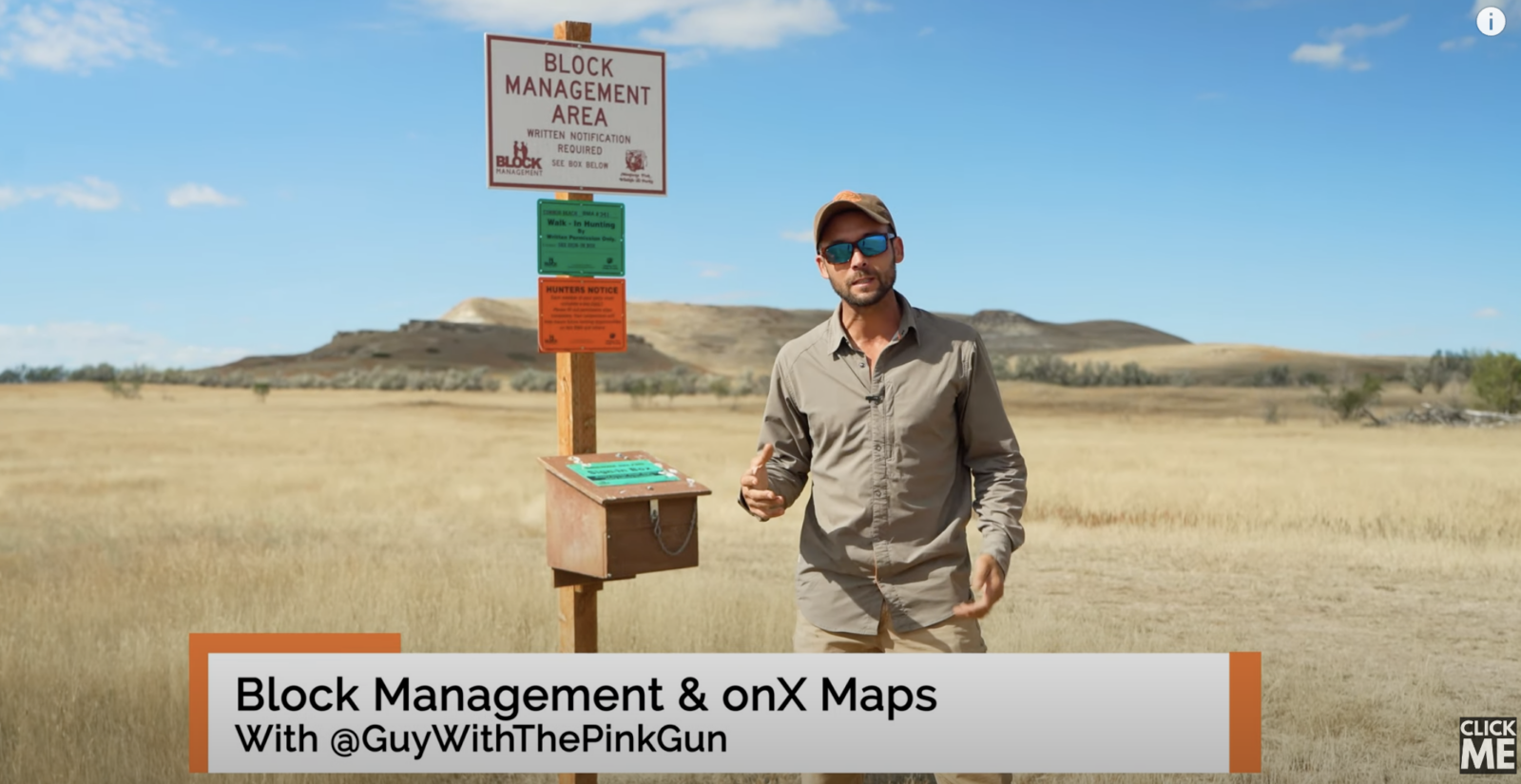
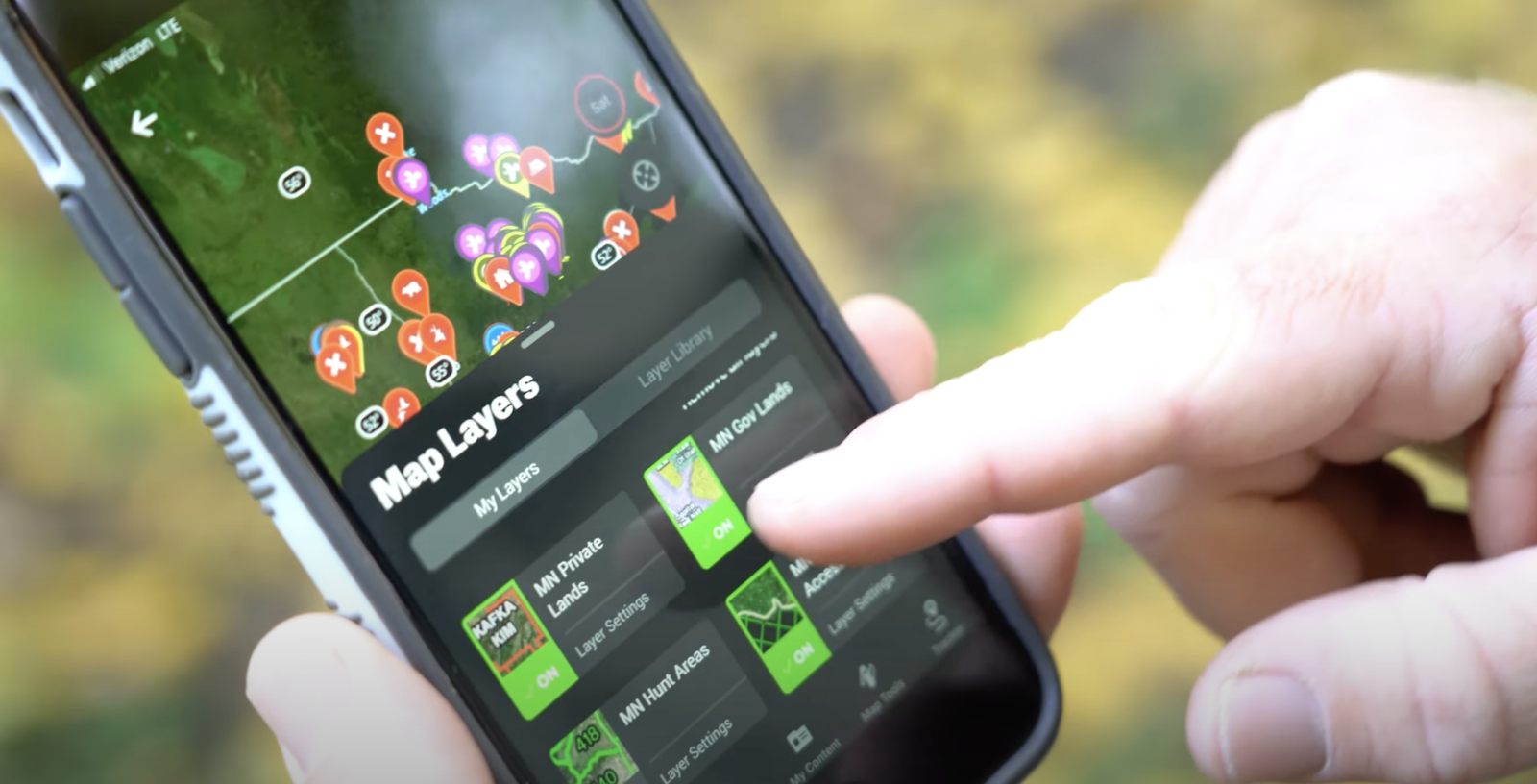
Nationwide Public & Private Land Boundaries
Color-coded public and private land ownership boundaries allow you to easily find your own property, public ground, and land ownership information including names and tax addresses. Learn More.
Compass Mode
The Compass Mode tool allows you to find your orientation and distance from features on the map and add Waypoints at specific distances and directions from your location. Learn More.

Custom Map Tools
Customizable Waypoints, Lines, and Tracks will help you build out every detail of your property. From managing your trail cameras, sharing an entrance or exit route with you hunting partner, or searching for that perfect next set to hang, the onX Hunt App has tools for every aspect of managing the property you hunt. Learn More.
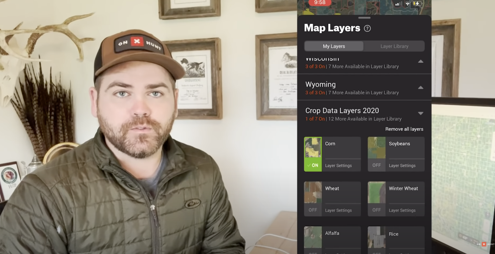
Crop Data Layers
Agricultural crops provide valuable, diverse, and widespread food sources for a wide variety of huntable species, including whitetail deer, waterfowl, pheasant, turkey, elk, and antelope. Now with a suite of onX Crop Data Layers, you can find 19 different color-coded crop types that were present on the ground the previous growing season. Learn More.
3D Maps, Recent Imagery and More
Understand the lay of the land like never before with fully functional 3D maps. Use 3D exaggeration in less terrain laden areas to easily see nuanced terrain features. On top of that, highly recent, low resolution imagery is now also available to get an up-to-date look at the ground and vegetation across the country. Learn More.

Offline Maps
No service needed. Save detailed maps of the property you hunt to ensure you always have the tools you need at your fingertips. Learn More.
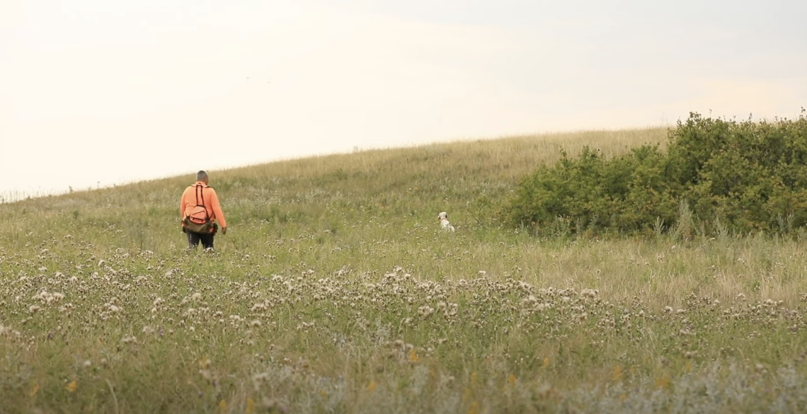
the ultimate Upland bird scouting tool
From start to finish, make the most of your time in the field with onX Hunt

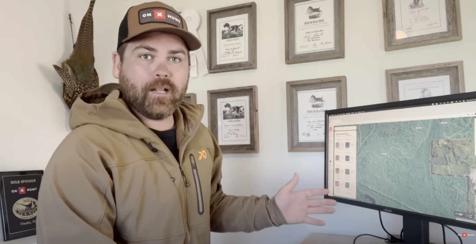
Masterclasses
Our onX Hunt Masterclasses connect you directly with our team, our partners, and our ambassadors, so you can watch and learn in a live environment. This unique setting unlocks a whole new way of learning, giving you the confidence and tools you need to be a better hunter.
Upland Bird Scouting Tips
Upland Bird Scouting Tips
5 Tips For Finding More Birds Using onX Hunt
How To Find Ruffed Grouse & Woodcock
OnX Hunt Map Tools for Upland Hunters with Pheasants Forever
E-Scouting for Sharptails with ON X