Property lines are public information available thanks to the zoning department of local municipalities. Getting all this information in one place isn’t difficult if you have the right tool.
onX uses public information, along with other proprietary data, as the foundation for its house-built Private Lands Layer in onX Hunt. Pulling data from over 3,100 counties in the U.S., our GIS team builds accurate maps that include boundary lines and private landowner information.
TL;DR: Property lines are public information, but finding and understanding them can be tricky without the right tools. The onX Hunt App pulls data from over 3,100 U.S. counties to display private property boundaries and landowner information. While fences, survey pins, or bearing trees can hint at boundaries, only a licensed surveyor can legally mark property lines. Plat maps and deeds from county offices provide additional resources, but apps like onX make it easy to see parcel lines and ownership info from your phone—even offline in the field. Hunters use property line data for e-scouting, asking permission, land management, recovery, and corner-crossing awareness, ensuring they always know where they stand.
How Property Lines Are Marked and Updated
How To Get Property Lines Marked
If you want to have property lines marked on any size property, the only reliable method is hiring a licensed land surveyor. These are trained professionals, and a surveyor’s work is crucial for legal and financial transactions, notably property sales, development projects, and disputes.
If you’re planning to build a fence or a structure on your land, most building and fence permits require you to show the property line on your plan. If no existing surveyed plat or Certificate of Survey exists (more on that below), then hiring a surveyor may be your only option.
How Do Surveyors Find Property Lines?
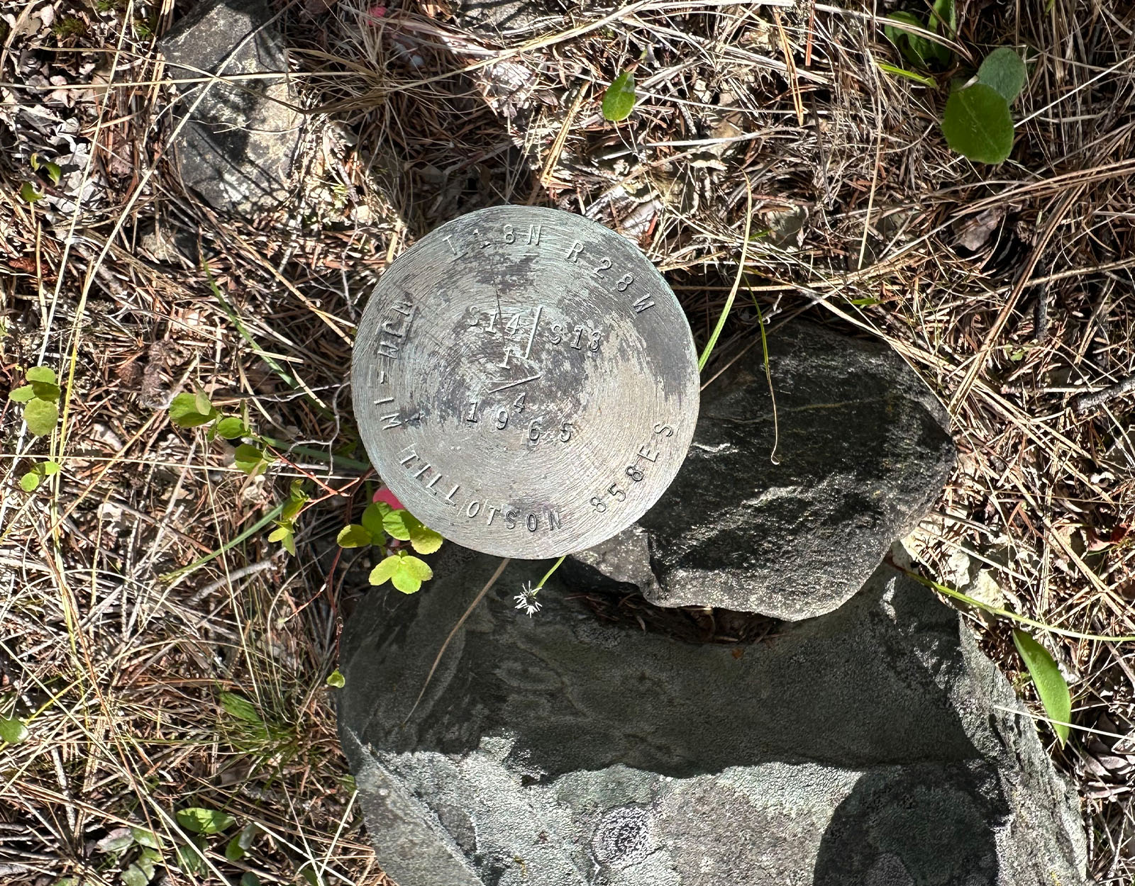
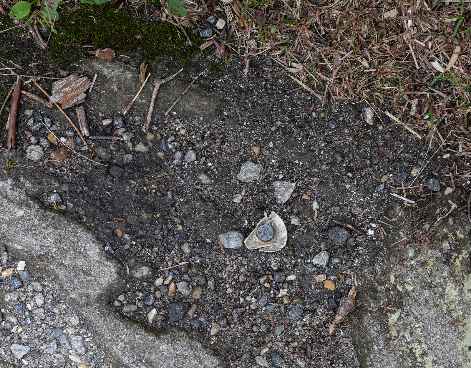
A licensed surveyor can find property lines by searching for existing property markers, such as metal rods or caps embedded in the ground, looking over previous surveys or plat maps, and using specialized survey tools to measure and establish boundaries of a property.
The survey tools most often used are a total station, which allows surveyors to precisely measure angles and distances between points, and a prism, which is placed on a rod and used with the total station to establish a line of reference.
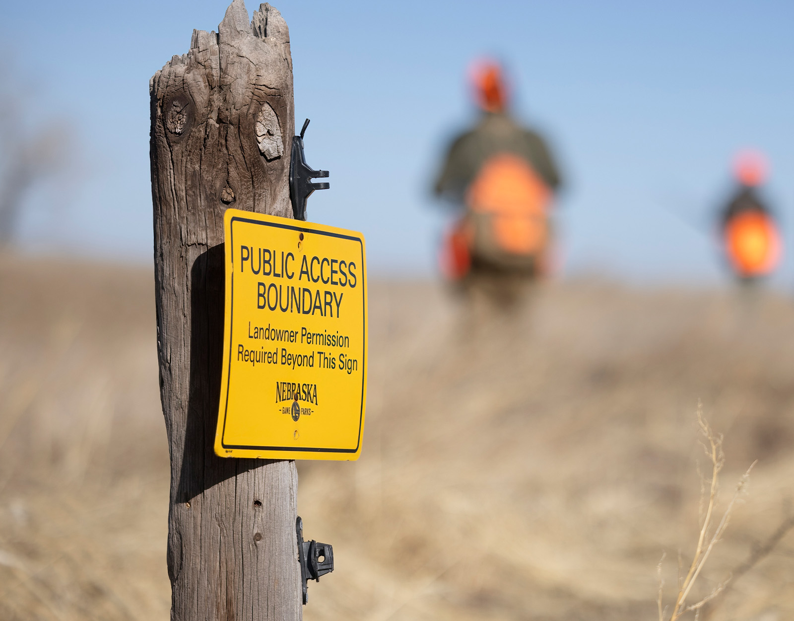
How To See Property Lines: Physical Markers
To see property lines and boundaries, look for physical markers already on the property, which can include survey pins, fence lines, utility boxes, and bearing trees.
Survey pins are either metal rods or stakes that are placed at the corners of property boundaries by licensed surveyors. If the survey pins are not obvious to the naked eye, you may need to use a metal detector to locate them. Or, you can check with the local County Clerk and Recorder’s Office, which typically maintains filed property marker records.
Fence lines can give you a general idea of a property line, but they are not always accurate. It’s possible that previous landowners or neighbors built those fences without a precise survey or with an agreement to place the fence inside one or the other’s property lines.
A bearing tree is one that a surveyor marks with a sign to indicate a surveyed corner or boundary. You will find these are common in national forest or BLM lands. Bearing trees have been used as far back as the early 19th century.
Fence lines are not always accurate. It’s possible that previous landowners or neighbors built those fences without a precise survey or with an agreement to place the fence inside one or the other’s property lines.
What Are Grandfathered Property Lines?
Grandfathered property lines are a type of property rights that show when a property is exempt from new regulations because it existed before those rules were enacted.
Examples of grandfathered property lines might include a driveway, which would not be allowed if you wanted to build it today, but is allowed to be there because it was built before new laws were enacted.
The value of grandfathered rights is protecting a landowner from being forced to comply with new regulations that could make their property less valuable or usable.
How Do I Find Out My Property Lines?
If you want to find your existing property lines and don’t have a need to hire a licensed surveyor to mark or validate them, there are several options.
Free Property Lines Map: Check Plat Maps and Deed Info
Property lines are noted on plat maps that should accompany your deed or any previous survey paperwork. By visiting your local county record or assessor’s office, or checking on their respective websites, you can request a plat, which are maps drawn to scale that provide exact dimensions and show land divisions. These are typically available for homes built less than 100 years ago, and in many jurisdictions, plat maps can be accessed online for free from county or municipal websites. However, some may require a small fee for printing or accessing specific versions.
Note that it’s also important to ask the Clerk and Recorder’s Office if there are existing easement records or any other documents that might affect your property lines.
In many jurisdictions, plat maps can be accessed online for free from county or municipal websites.
View Property Lines With a Property Line App Like onX Hunt
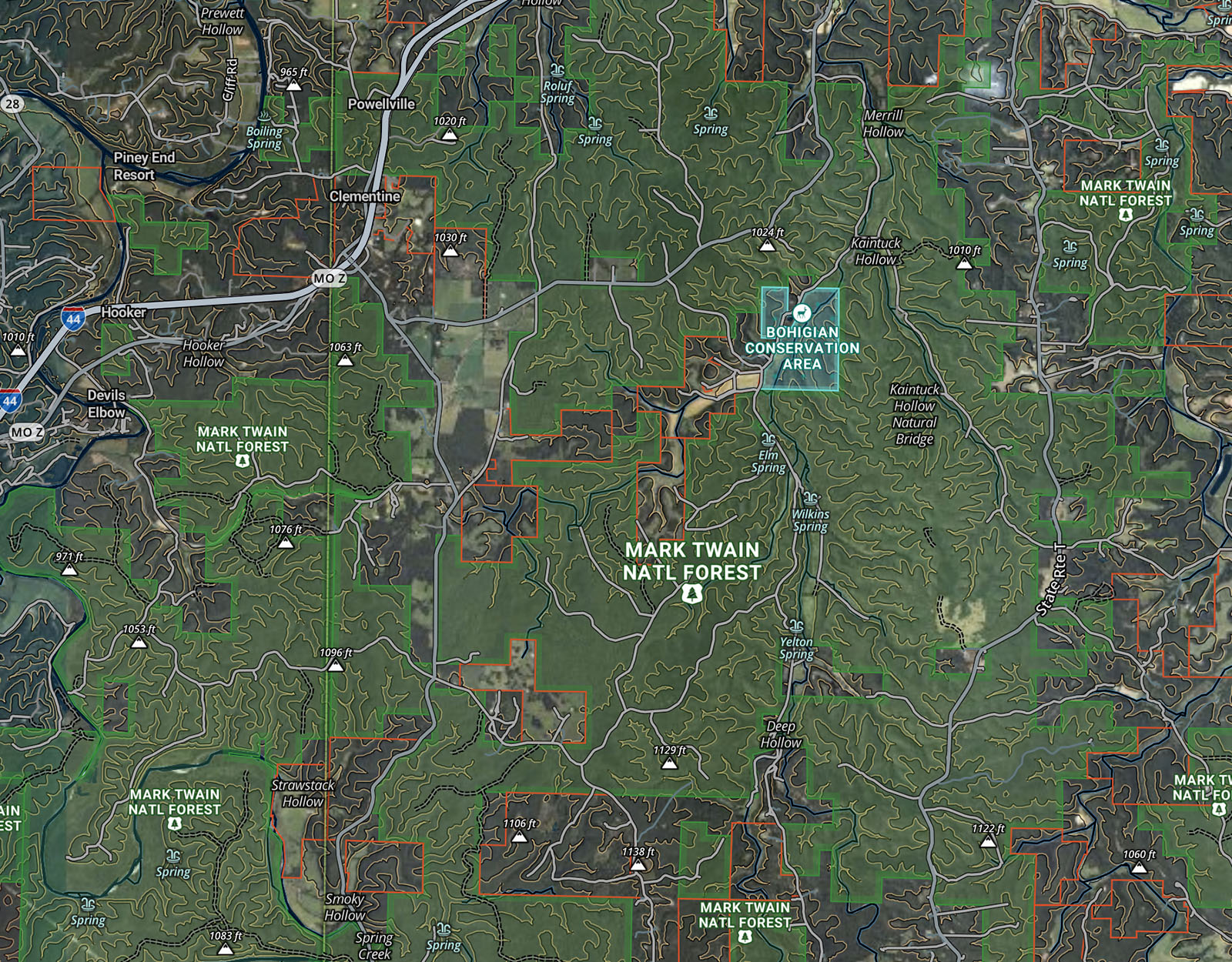
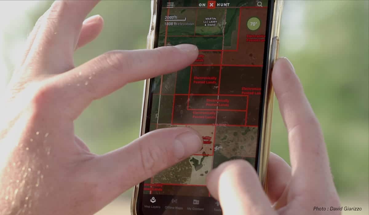
Finding and viewing property lines can be as simple as pulling out your smartphone while walking your property or scrolling on a desktop computer from home. Premium and Elite onX Hunt members have access to property lines and landowner information as part of their membership. onX has information for over 161 million private properties.
Private property boundaries are displayed with a red outline when the Private Lands Layer is turned on. Clicking on any private property or landowner name, additional information will be shown that includes the landowner’s contact information, tax address, and the property size.
Find Property Lines By Address
To make it easy to find the property lines you’re looking for, you can simply type the address in the App’s search bar and pull up that address on the map.
To search, tap the magnifying glass in the upper-right corner of the map, type the address, and select the result. It’s that simple.
Note on Accuracy: As with any consumer-grade mapping app, property lines in onX Hunt are accurate to within about 16 feet, which is more than enough for scouting, navigation, and general awareness in the field. However, these lines are not a legal survey. For official use—like building a fence, resolving a property dispute, or filing a deed—you’ll need a licensed land surveyor.
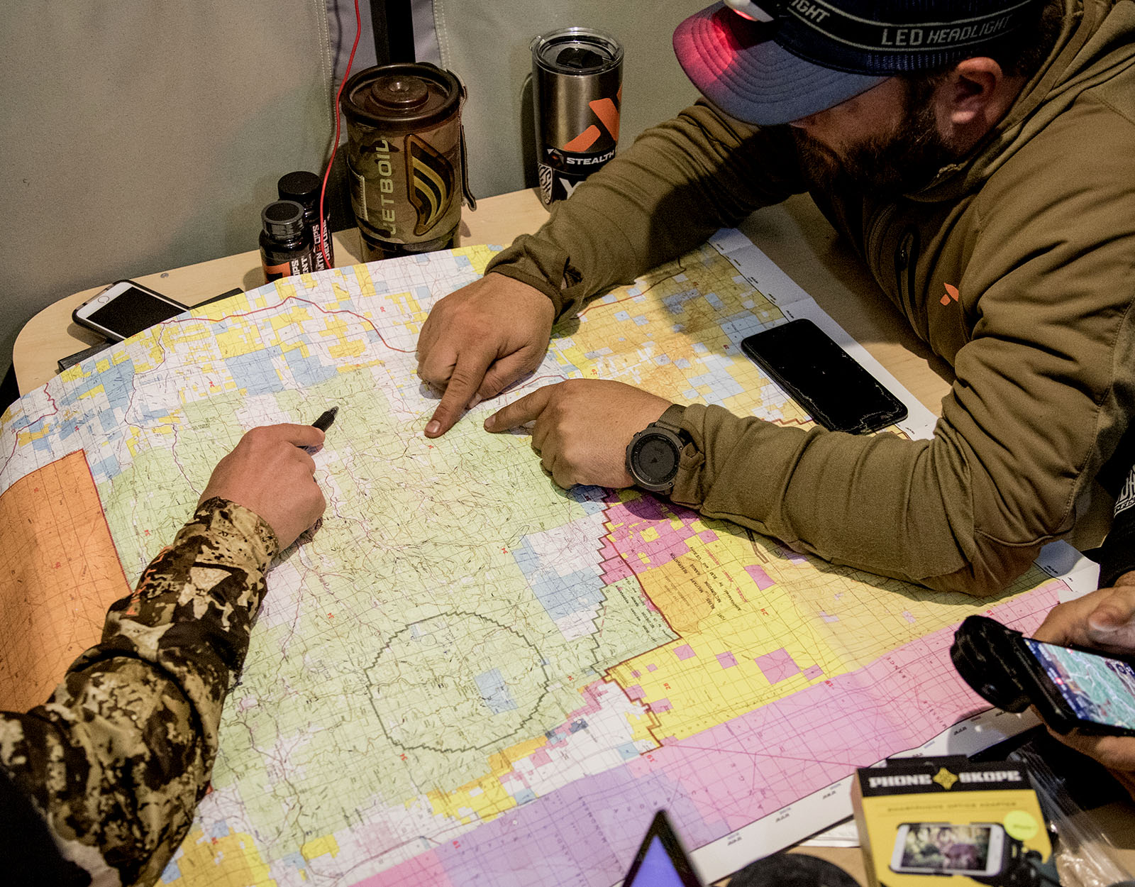
Use Cases: How Hunters Use Property Lines in the Field

If you’re in the field or on a hunt, it would be cumbersome to lug around paper maps and find every hidden survey pin to make sure you’re within the boundaries you want to be. Here are a few ways hunters use the Hunt App’s property line info in the field:
- Land Management: If you’re managing land, perhaps needing to plot timber cuts, prescribed burns, or food plots, you’ll want to view boundaries and draw Area Shapes for the areas you want to work.
- E-Scouting: Knowing property lines is crucial for e-scouting and access planning before the next hunting season rolls around. Just because you’ve always hunted a public property in the past doesn’t mean that the boundaries are the same. Whether through land swaps or land acquisitions, boundaries might have changed.
- Corner-Crossing Awareness: For every corner of land, there could be four different landowners who have a vested interest in their respective boundaries. It’s easy to pull up owner information with onX Hunt. Of course, you’ll want to be aware of the latest corner-crossing information.
- Asking for Hunting Permission: Knowing boundaries and who’s next door could open up opportunities to ask permission to hunt new land.
- Recovery: Especially important is if an animal is wounded and travels to private land, having landowner information and knowing where you need to legally stop tracking that animal can save you from a trespass ticket and potentially aid you in recovering your game.
Demo the interactive map below to preview how the Hunt App helps you prepare for the season with property lines in mind.
Common Questions About Property Lines
Start your 7-day free trial and use onX Hunt to view property lines for free. While some apps may show some property lines, not all can show you property lines while offline and in the field. The Hunt App’s satellite, hybrid, and topo maps all show property lines, whether you’re in service or off the grid.
Most Clerk and Recorder’s Offices will provide free access to plat maps, either in person or online, but some may require a small fee.
Survey costs depend on location, terrain, the type of survey you need, and how many acres you need surveyed. A basic boundary survey can range from $800 to $5,500. Larger, complex surveys can cost thousands.
Generally, property lines on waterfront property do not extend into the water itself. Water rights and property rights are governed by specific laws, and can differ by waterbody type. In many states, water is considered public, but there may also be rules related to high water marks and whether or not you can touch bottomland. Always check with local authorities.
Never assume a fence is a precise, legal boundary. Fences may be placed with special permissions or easements. It’s best to double-check with all landowners involved. Use the Hunt App to find the appropriate landowner contact information.
Generally, the owner of the property where the tree’s trunk is located is considered the owner of the tree and responsible for its maintenance.
onX Hunt contains property line details for every state. Members can toggle the Private Lands Map Layer on and see individual parcels outlined in red, along with property owner information.
Yes, download the onX Hunt App to use your phone to find property lines.
Final Thoughts: Know Where You Stand
Remember, property line information within onX is based on third-party data, which may contain inaccuracies or change at any time. It does not constitute a legal survey. You are responsible for verifying all information via official records. Always obey property line postings and use common sense regarding boundaries, roads, and paths.
Think you’ve found an error in the property lines shown in onX Hunt? Here’s how to report errors in the App.