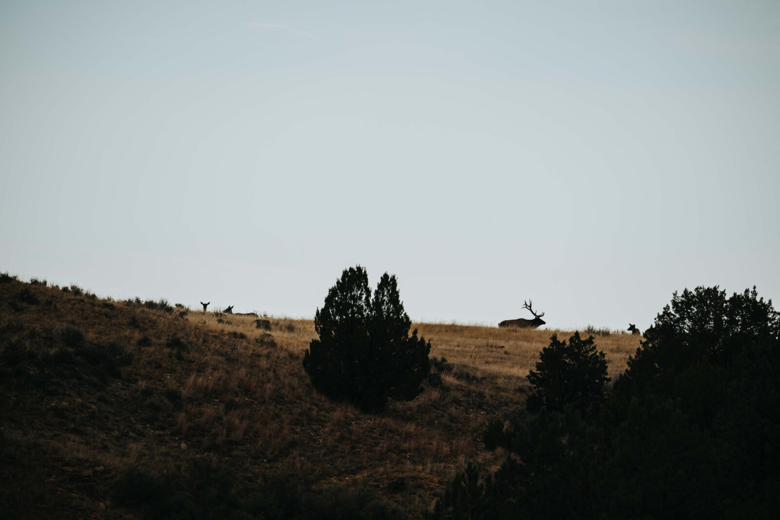
All hunters want to find a good piece of hunting land. Finding a new hunting spot is not as hard as you might think. Between public land and private parcels, you can find places to hunt with a few tools and resources—and the courage to ask permission. Here are our tips for how to find a new piece of hunting land.
TL;DR: Finding new hunting land is easier than most hunters think. Public options include national forests, BLM lands, wildlife refuges, wilderness areas, and state-managed properties—many of which can be explored using the onX Hunt App’s Public Land, GMU, and Wildlife Layers. Hunters can also pursue private land access through state-sponsored programs (like Block Management or Walk-In Access), asking landowners directly, leasing land, joining hunting clubs, or booking outfitters. The key is combining tools, research, and outreach: scout with onX Hunt, contact local wildlife agencies for intel, evaluate accessibility, and secure permissions well before the season.

How To Find Public Hunting Land
Review the following tips to help you find your next hunting spot.
Establish How Far You’re Willing To Travel
Knowing how far you’re willing to travel and where the best, nearest public lands are for hunting will be the first step in making a plan. Create your “home range,” if you will. You may already live in the West and want to find new public lands to hunt, or you might live in the East and be planning an extended hunting trip in a new state.
We’re often asked how to find public hunting land near me. To do this, try a free trial of onX Hunt. Elite members can view all 50 U.S. states and Canada. Premium members can view maps of up to two states, depending on membership level. These detailed maps will allow you to complete the next step easily. Explore a map below.
How To Find a Good Spot To Hunt on Public Land
To find a good public land hunting spot, use onX to find overlooked terrain like ridges, thickets, and water features, which serve as wildlife sanctuaries. Elite Members can access Lidar Maps that give unprecedented views of terrain features without tree canopies blocking the view of Satellite Maps.
Turn On Public Land and GMU Map Layers
Once you have a few specific areas in mind, use the Hunt App’s Government Lands Map Layer to understand which parcels are public versus private. The federal government owns about 28% of the land in the United States, while state and local governments own approximately 9%. The remaining land is privately owned. The federal government manages about 95% of public land through four main agencies: the Bureau of Land Management (BLM), the National Park Service, the Fish and Wildlife Service, and the United States Forest Service.
As you look for your next hunting spot, explore the following types of public land:
- National Forests: Most national forests that are legally accessible via a public road, navigable waterway, or adjacent state or federal land are open to hunting. Some areas may have land-use restrictions, so check with the local Ranger District Office before hunting in a particular national forest.
- The Bureau of Land Management (BLM) is another excellent resource for public land hunting. Nationally, BLM manages 43 million acres of elk habitat, 131 million acres of mule deer habitat, and 23 million acres of bighorn sheep habitat, and unless otherwise posted, all BLM land is open to hunting.
- National Parks: In all, 76 of the total 419 units managed by the National Park Service allow some form of recreational, subsistence, or tribal hunting.
- National Wildlife Refuges: Managed by the US Department of Fish & Wildlife, these areas often provide overlooked hunting spots.
- Wilderness Areas: Spanning over 110 million acres, wilderness areas offer a primitive and challenging hunt due to restrictions on motor vehicles, bikes, game carts, and trail cameras.
- State Lands: Hunting accessibility and regulations on state lands vary considerably. Always do state-specific research. Generally, look to state parks, state recreation sites, and state trust lands for potential access.
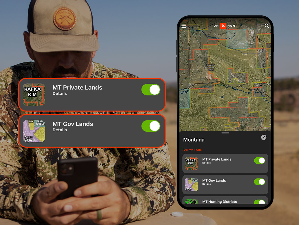
As you narrow down your search for public hunting land, turn on the Hunt App’s Hunting Districts Layer to pencil out specific GMU boundaries and regulations for species in those districts.
BLM manages 43 million acres of elk habitat, 131 million acres of mule deer habitat, and 23 million acres of bighorn sheep habitat. Unless otherwise posted, BLM land is open to hunting.
Review Permitting and Hunting Restrictions
To fully explore each GMU’s license allotments, restrictions, draw odds, and harvest rates Elite Members can turn to Hunt Research Tools. This will set you in the right direction in putting in the right applications for the districts you want to target.
Of course, always double-check any information you research to make sure you’ll have the right tags and legal access to the lands you’re researching.

Hunting Regs Without the Hassle
Compliance shouldn’t be the hard part. FieldRegs is a free app from the team behind onX Hunt that helps you quickly find hunting regulations, seasons, and legal requirements without digging through agency websites and PDFs. No credit card required.


Assess Whether the Land Can Hold Game Animal Populations
Next, ask yourself whether there will be game to pursue on those public lands. Every hunter should have basic knowledge of the animals they intend to hunt, such as bedding and feeding habits, preferred cover, movement times, and breeding periods.
Look into specific animals’ ranges with the Hunt App. From Hunt Map Layers, look under the Wildlife Layers subfolder. There, you’ll find everything from Boone and Crockett Whitetail Trends to Mule Deer and Elk Distribution maps. There’s even a National Wild Turkey Federation (NWTF) Wild Turkey Subspecies Distribution Layer that will tell you if there are Easterns or Merriam’s in the area.
Connect With Your State Wildlife Agency for Intel
State wildlife agencies exist, in part, to provide valuable information for hunters. They can often provide stats on the animals taken in the area and what special licenses or permits are required.
Getting to know, even if just by phone, the wardens and biologists who work in the area you plan to hunt can pay dividends. Ask questions about:
- Preferred food sources.
- Migration routes and seasonal tendencies.
- Possible access points and which ones are most heavily used.
- How droughts, if any, will affect movements and distribution.
- Hunting pressure trends.
- Population trends and bull-to-cow or buck-to-doe ratios.
Be honest about what you want out of the hunt, and ask them if certain areas realistically align with your expectations.
Evaluate Accessibility
The last step is to firm up your plan for access. You might have received some tips from the local wildlife agency and gleaned tips from the Hunt App’s Possible Access Layer, but you’ll want to have a primary entry point and one to two backups (in case other hunters have gotten there before you).
Lastly, you’ll need to download the area to your Offline Maps before you head out.
How To Find Private Land To Hunt
Finding private land to hunt can be challenging, but isn’t impossible. Here are a few tips for how to start.
Find Public Access to Private Lands
More than 20 states now offer programs where landowners allow hunters on their property in exchange for cash or incentives from state agencies. These popular programs have various names such as North Dakota’s Private Land Open to Sportsmen, Georgia’s Voluntary Public Access, Montana’s Block Management Areas, Kansas’s Walk-in Hunting Access, and others.
To find state-sponsored lands in the Hunt App, turn on the State-Sponsored Land Access Program Layers (if your state manages a program like this). You can find a list of the states with programs in the link above. These are lands open to hunting but managed for access at the state level.
More than 20 states now offer programs where landowners allow hunters on their property in exchange for cash or incentives from state agencies.
Ask a Landowner for Permission To Hunt Private Land
Any private land may be open to you if you just ask the landowner. onX Hunt shows contact information for private landowners all over the US. If you see a piece of private property that looks good for hunting, reach out to the landowner to see what they say.
Also, turn on the Private Lands Layer, found in Hunt Map Layers. For the state(s) for which you have an onX Hunt Membership, you’ll find the toggle to turn on/off Private Lands. With the Layer turned on, you’ll see private land boundaries outlined in red. Selecting any spot within a boundary will bring up an information card with the landowner name or group at the top. You’ll also see the tax address, county, and area acreage for that parcel.
Research Hunting Leases
Hunting leases may be another option for private land hunting. Hunting leases are agreements between a hunter and a landowner, or a land-holding entity, that allow access to and the right to hunt land for a defined period. A hunter may pay on a per-acre basis, per-season fee, or per-hunt situation (read more about how hunting leases work).
Explore Hunting Clubs and Outfitters
Similar to hunting leases, joining a hunting club can be a fun, social option for private land hunting. Hunting clubs generally have or manage private lands for small groups of hunters. Each hunter may be assigned certain days and/or stands one can hunt during the season. Explore hunting clubs by researching online the areas you want to hunt. Forums and social media sites may also point you in the right direction.
Some hunters take a more direct approach to finding new land to hunt by hiring an outfitter for the game animal they want to hunt. Huntin’ Fool is one place to look to book hunts like this.
Summary
Finding hunting land, whether public or private, takes time and research. Don’t wait until the week before the season opens to start. Using the tools and resources from onX Hunt will help make the process more efficient, and you could discover amazing new places that hold animals. If you have found new lands to hunt, reach out and let us know. Happy hunting.
Use the onX Hunt App to view public/private boundaries, GMU layers, and wildlife distribution maps. You can also check with your state wildlife agency for official access maps and regulations.
Check local ranger districts, BLM offices, or state wildlife agencies. Regulations differ by agency and location, and some areas may have seasonal or species-specific restrictions.
Turn on the Private Lands Layer in onX Hunt to see parcel boundaries and landowner info, then respectfully contact landowners to request permission.