Hunting aerial maps add a critical dimension to any hunter’s arsenal with a bird’s-eye view that can illuminate obstacles, opportunities, and realities of the landscape in ways other maps cannot. With the ability to spot terrain traps, funnels, promising bedding areas, food and water sources, and more from the sky, the data offered using satellite and aerial imagery elevate a map’s utility whether e-scouting from home or navigating on the ground.
Combined with a topographic map (on its own or overlaid on aerial imagery as a Hybrid Basemap), onX Hunt App Aerial Maps add understanding to any landscape and give hunters an invaluable tool to get one step closer to success. Learn more about Basemaps here.
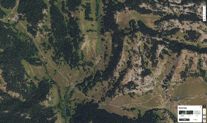
Aerial Hunting Maps
The onX Hunt Aerial Basemap uses satellite imagery to provide a clear image of the terrain. Users can identify major features like roads and trail networks. Low and medium zoom levels are almost completely cloud-free with up-to-date imagery. The map provides details that allow users to identify tree cover, rocky outcroppings, and other terrain features.
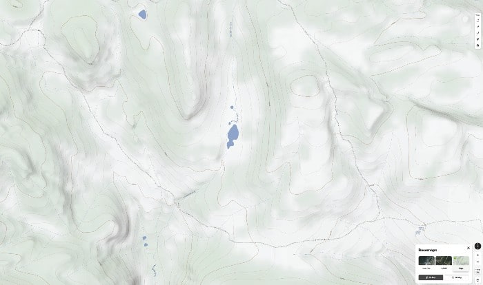
Topographic Hunting Maps
onX Hunt has incorporated the design of the Topo Basemap with the style of classic topo maps that have been used by hunters for years. This allows users to enjoy the updated technology with a familiar rendering of the landscape. The map features a two-dimensional representation of Earth’s landscape and gives users different information than what satellite imagery alone offers. Topo Map features include the steepness of an obstacle ahead and exactly how high you’ll climb to reach a ridge top.
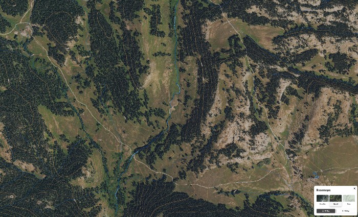
Hybrid Hunting Maps
True to the name, the Hybrid Basemap is a mix of Aerial and Topo, where contour lines overlay satellite imagery. The combination results in a highly functional display of the landscape to give hunters a clear view. The Hybrid Basemap presents users with the information needed to make important decisions about where they want their hunt to take them, whether making plans in the field or the living room.
Aerial Map Alternatives
Google Maps and Google Earth
While Google Maps and Google Earth are free and well-known, they do not feature unique hunting features that other services provide. However, scouting is possible with Google Earth. With Google Earth, hunters can spot trails through grassy parts of the terrain. Google Earth features tools that can help hunters find and mark areas where wild game is likely to eat and rest.
Rugged Maps
Not all hunters want to use a map on a screen. Some aerial maps for hunting come in physical form for those who still prefer to hunt without technology at their side. Rugged Maps work for those who prefer a physical map but want an advanced level of detail. These are not paper maps that will wear out shortly after being used; Rugged Maps are built for whatever nature throws at them. They can guide hunters in Alaska, Arizona, California, Idaho, Colorado, Nevada, Montana, New Mexico, Oregon, Utah, Washington, and Wyoming.
Northwoods Mapping
Creating custom maps with up-to-date aerial photography, Northwoods Mapping creates maps that can work alongside a free GPS app for a smartphone or tablet. These maps include high-resolution images for every state. They provide options over which aerial photography a hunter prefers. They also include 24k elevation contour lines to give accurate depictions of elevation.
How To Use Aerial Maps
The best aerial maps for hunting stand out from what other maps offer with their enhanced images. However, users should know the basics of how to use aerial maps for a successful hunt.
Aerial maps allow hunters to see exactly what kind of areas lie ahead. The maps will show them where to anticipate water sources, ditches, hills, and other distinct parts of a terrain. Knowing where these areas are and when to expect them helps hunters predict animal movement and better understand where to position themselves in relation to terrain features animals commonly use.
Looking at an aerial map before setting foot on the terrain can save you time and energy. The map can also help you find the best spots to place cameras or establish food plots in preparation for the season.
Time is also saved using aerial maps to help you get to a spot the fastest way possible. No more crossing your fingers and hoping your path is the best one.
The aerial imagery provided by onX Hunt allows hunters to make the most of every step. With the Hybrid Map, you can identify peaks and ridge tops, and with custom Waypoints, you can mark exactly where you spot deer sign. You can also use the Line Distance Tool to get a measurement of exactly how far away your stand is from a food plot or to measure range. Advanced images with reliable metrics provide the insight needed for the most efficient hunt possible.
Frequently Asked Questions
Keep your eye out for important features on the map. Aerial maps for deer hunting should tell you the tone, texture, shape, size, shadow, characteristics, and patterns of a landscape. Once you can identify these features, reading the map should become second nature.
A topographic map will allow you to see ridges and contour lines. By looking at the contour lines, you can determine where deer are likely to roam and sleep and how they’re likely to move between hot spots. Areas that offer protection are good places to look.
Rugged Maps makes highly durable hunting maps made to be used outdoors. Maps are 34”x 44” and cost about $40 each.
There are some reliable ways to find nearby places where you can hunt. You should visit your state wildlife agency’s website, which will let you know if you need special permits or if there are specific seasons when hunting is permitted. You can find places to hunt on recreation.gov, which will show land administered by the Bureau of Land Management, National Forest Service, and Bureau of Reclamation. Also, onX Hunt displays public and private land ownership data so there is no confusion about who owns the land you are on.
The USGS lets you download free satellite images of the area of your choice. The high-resolution original file can be downloaded as well as geo-referenced images.