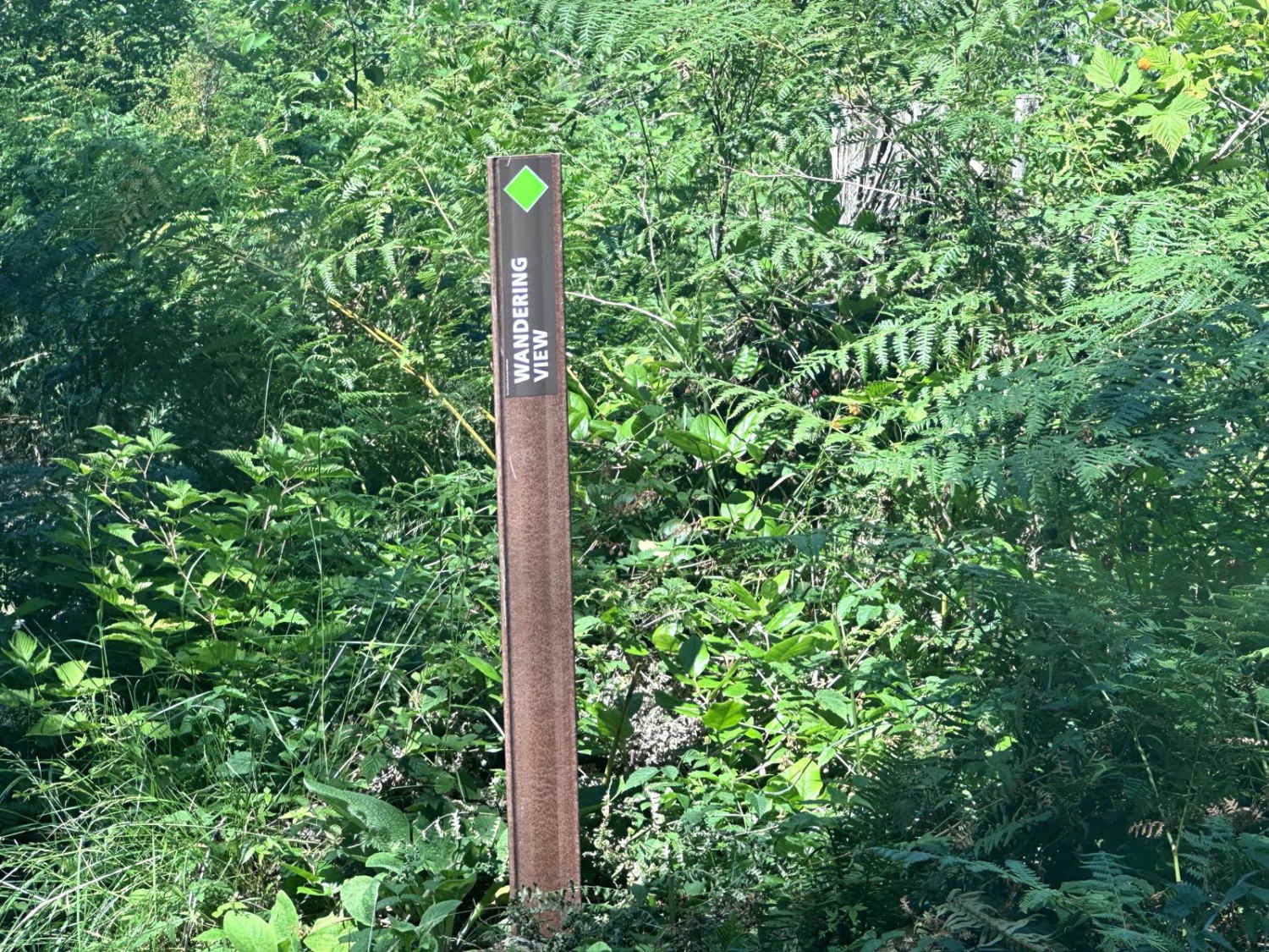
Wandering View
Total Miles
0.7
Technical Rating
Best Time
Spring, Summer, Fall
Trail Type
Full-Width Road
Accessible By
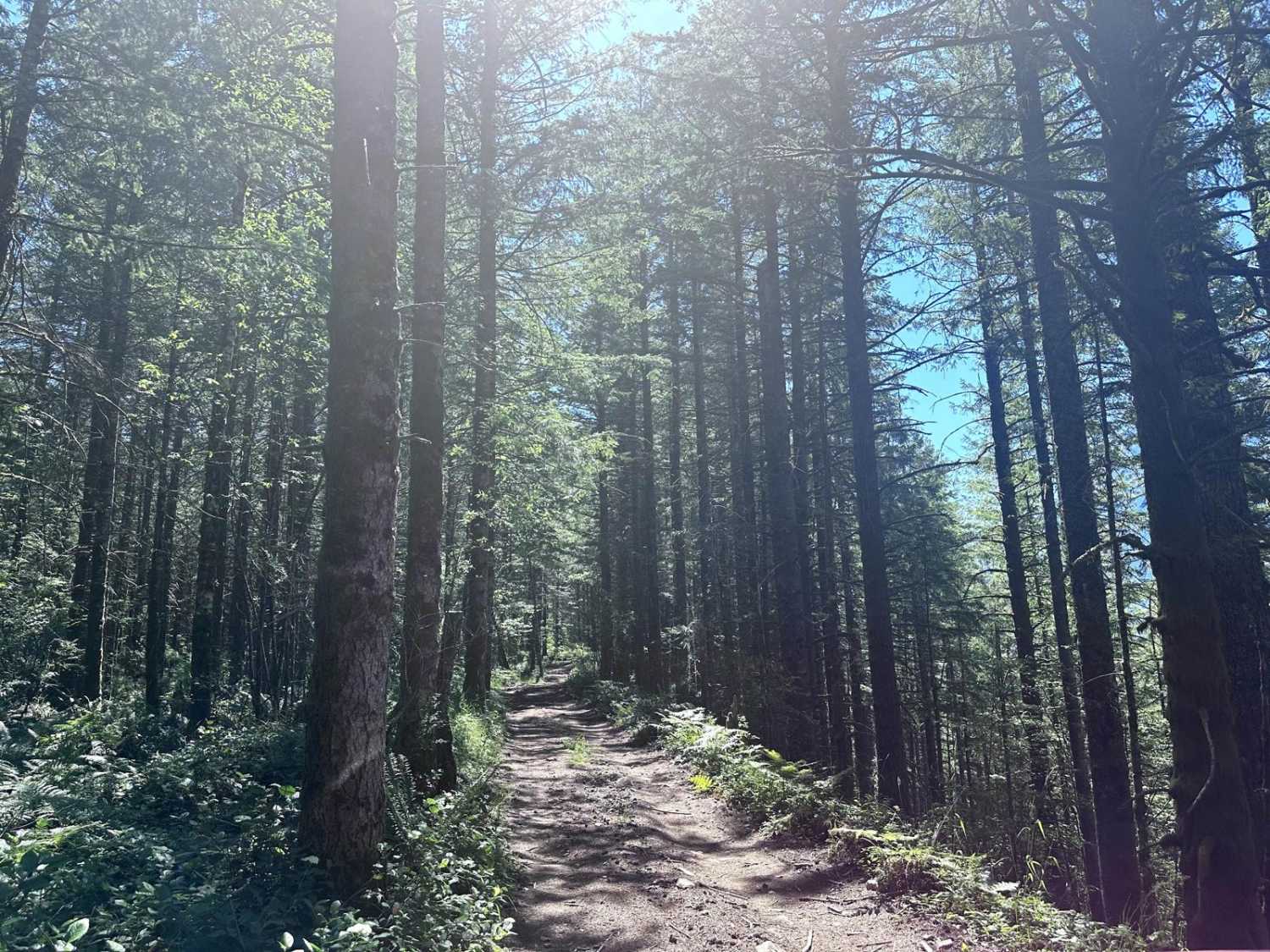
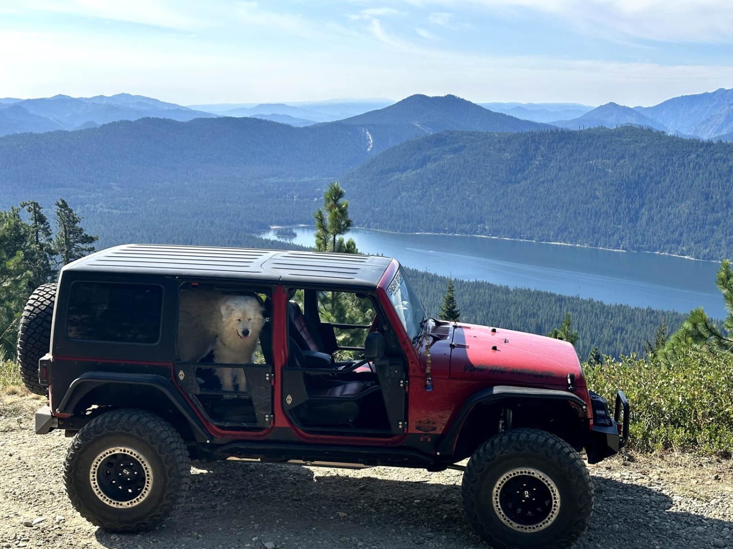
Trail Overview
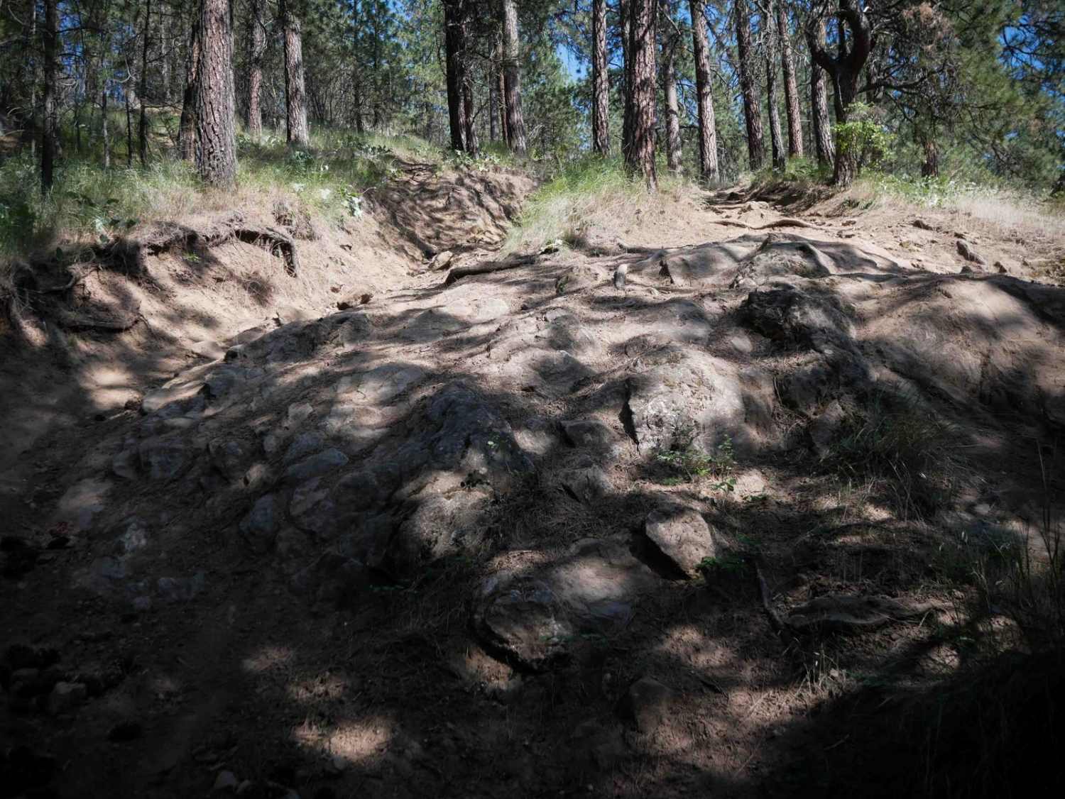
This 1-mile point-to-point trail takes you along the border of Reiter Foothills State Forest. This trail is easily passable by stock 4x4 vehicles. There is a steep section with loose rocks, dirt and mud holes less than 12" in depth. There are some good views of the surrounding mountains from this trail.
Photos of Wandering View
Difficulty
Rock obstacles less than 12" in height. Single vehicle trail.
History
The 10,000 acre Reiter Foothills Forest is a continuous block of forest land located between the towns of Gold Bar and Index providing over 4 miles of single track motorcycle trails, 2 miles of ATV trails, and over 2 miles of challenging 4X4 trails with a high density of rock obstacles.
Wandering View can be accessed by the following ride types:
- High-Clearance 4x4
- SUV
- SxS (60")
Wandering View Map
Popular Trails
Russell Ridge - FS 1306
Sepp's Point (Pole Ridge Trail)
The onX Offroad Difference
onX Offroad combines trail photos, descriptions, difficulty ratings, width restrictions, seasonality, and more in a user-friendly interface. Available on all devices, with offline access and full compatibility with CarPlay and Android Auto. Discover what you’re missing today!