Wilberg Road - Prickly Pear Flat
Total Miles
4.7
Technical Rating
Best Time
Spring, Summer, Fall, Winter
Trail Type
Full-Width Road
Accessible By
Trail Overview
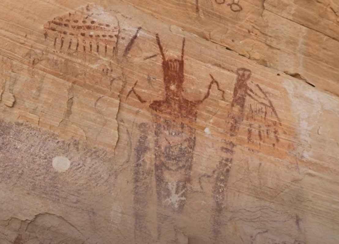
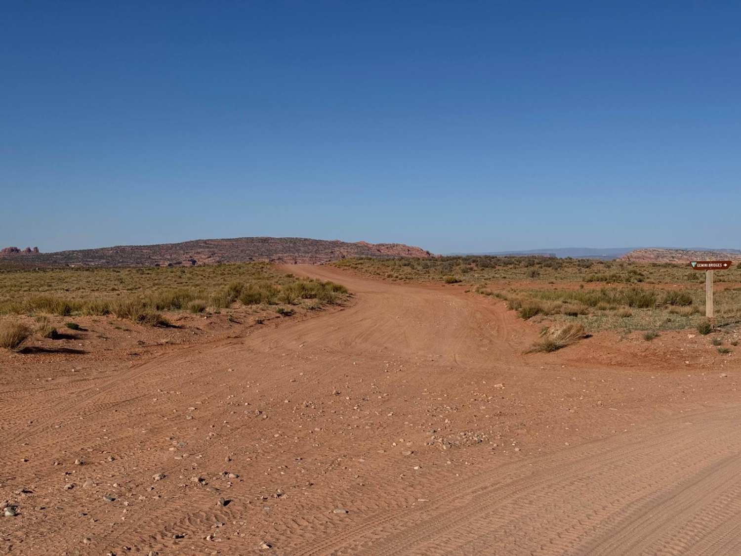
Wilberg Road-Prickly Pear Flat is a 4.8-mile out-and-back (9.6-mile round trip) trail rated 3 of 10 located in Emery County. Prickly Pear Flat is a very remote area of the San Rafael Swell and is located northwest of Green River. The easiest way to access this area is from US 191/Hwy 6 by taking the Green River Cutoff Road-Emery County 401 west for 20 miles, then taking East Box Flat Road-Emery County 410 south to the trailhead. The trailhead is located just south of the fence/cattle guard separating the Utah State Trust Lands from the BLM land. The trail itself is a scenic two-track crossing several open grass-covered prairies. The trail remains on BLM land while bordering the Mexican Mountain Wilderness Study Area (passenger side). The trail starts as an easy two-track, and while there are no major obstacles on the trail, it does get rougher the further along the track. Several well-worn trails in the area can mislead, as they seem to be more direct routes to the Prickly Flat area. Stay on the track and watch for the brown carbonite signs marking the WSA. Prickly Pear Flat follows the WSA boundary as it works west, where there is a scenic view of Calf Canyon. Turning south, the trail crosses in and out of the shallow washes. A little before the trail reaches the rock art site, it passes the double alcove of Prickly Pear Flat Arch. The alcoves show signs of habitation, whether ancient or more modern is unclear; however, the smoke-stained roof of the arch and the grinding stone grooves in the large boulder do demonstrate ancient inhabitants. The highlight of this trail is the final destination of ancient native rock art sites. At the end of the trail is a fenced alcove. The fencing was installed to stop grazing cattle from rubbing up against and destroying the rock art. The protected rock art site is located at 39.09776, -110.62139. There is no cell phone service, and the nearest services are located in Green River, about 50 miles from the trail's end.
Photos of Wilberg Road - Prickly Pear Flat

Difficulty
Trail consisting of loose rocks, dirt, and sand with some slickrock surfaces, mud holes possible, no steps higher than 12 inches. 4WD may be required; aggressive tires are a plus.
History
Hiking, dispersed camping, rockhounding, and equestrian opportunities all within is region.
Status Reports
Wilberg Road - Prickly Pear Flat can be accessed by the following ride types:
- High-Clearance 4x4
- SUV
- SxS (60")
- ATV (50")
- Dirt Bike
Wilberg Road - Prickly Pear Flat Map
Popular Trails
County Road 118
Spring Creek Trail No. 159

Weiss Highway
The onX Offroad Difference
onX Offroad combines trail photos, descriptions, difficulty ratings, width restrictions, seasonality, and more in a user-friendly interface. Available on all devices, with offline access and full compatibility with CarPlay and Android Auto. Discover what you’re missing today!