Peterson Point-NFR30697
Total Miles
2.6
Technical Rating
Best Time
Spring, Summer, Fall
Trail Type
Full-Width Road
Accessible By
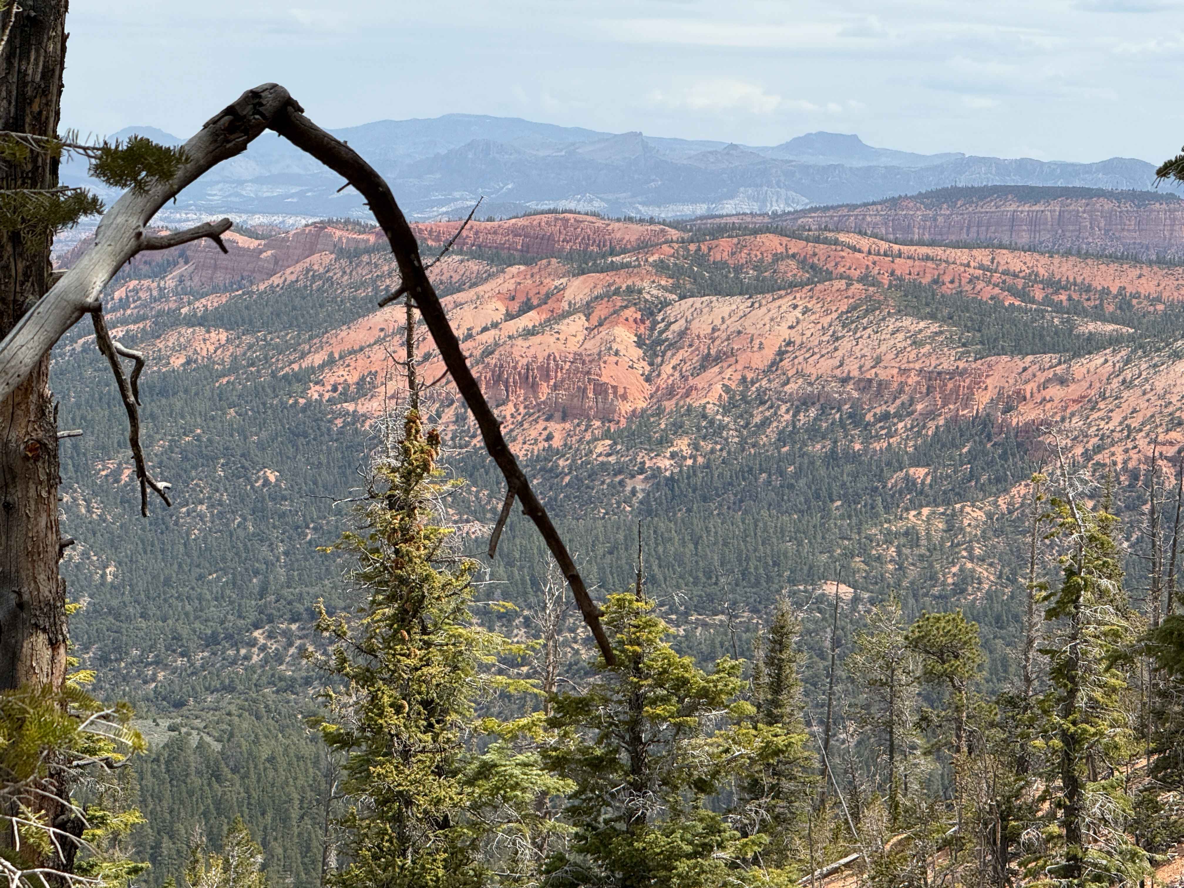
Trail Overview
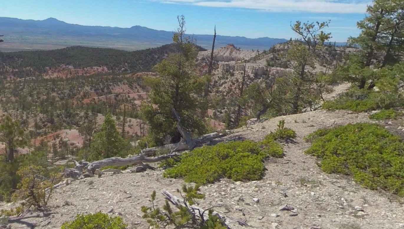
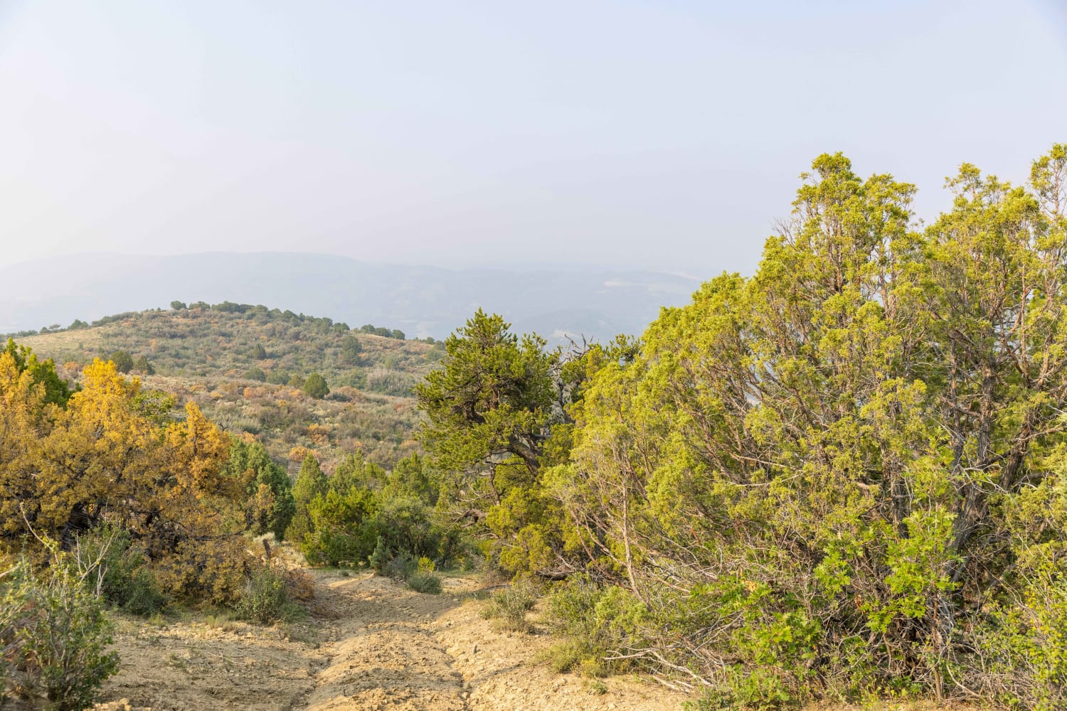
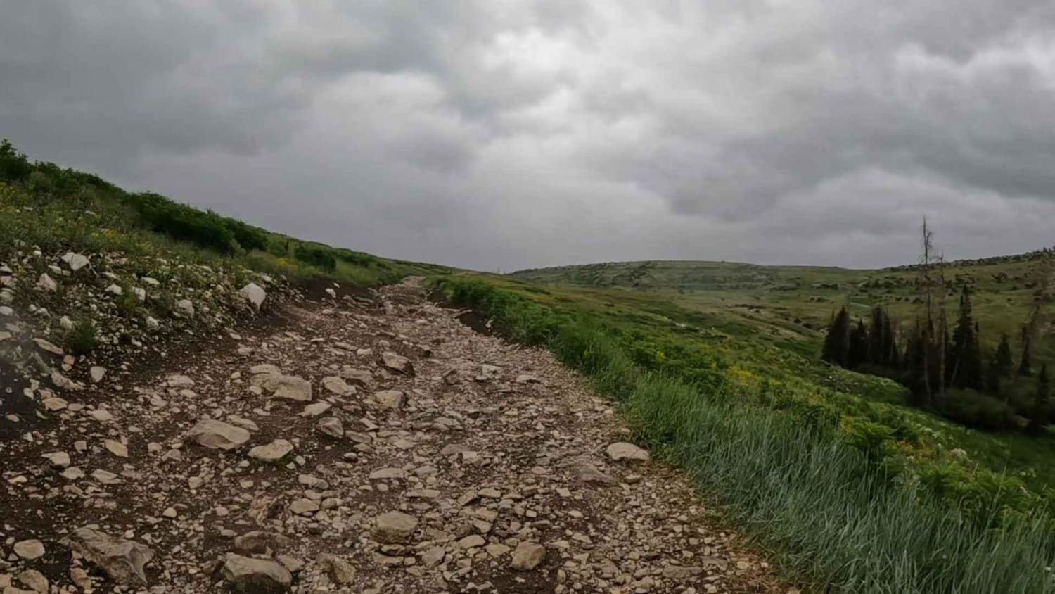
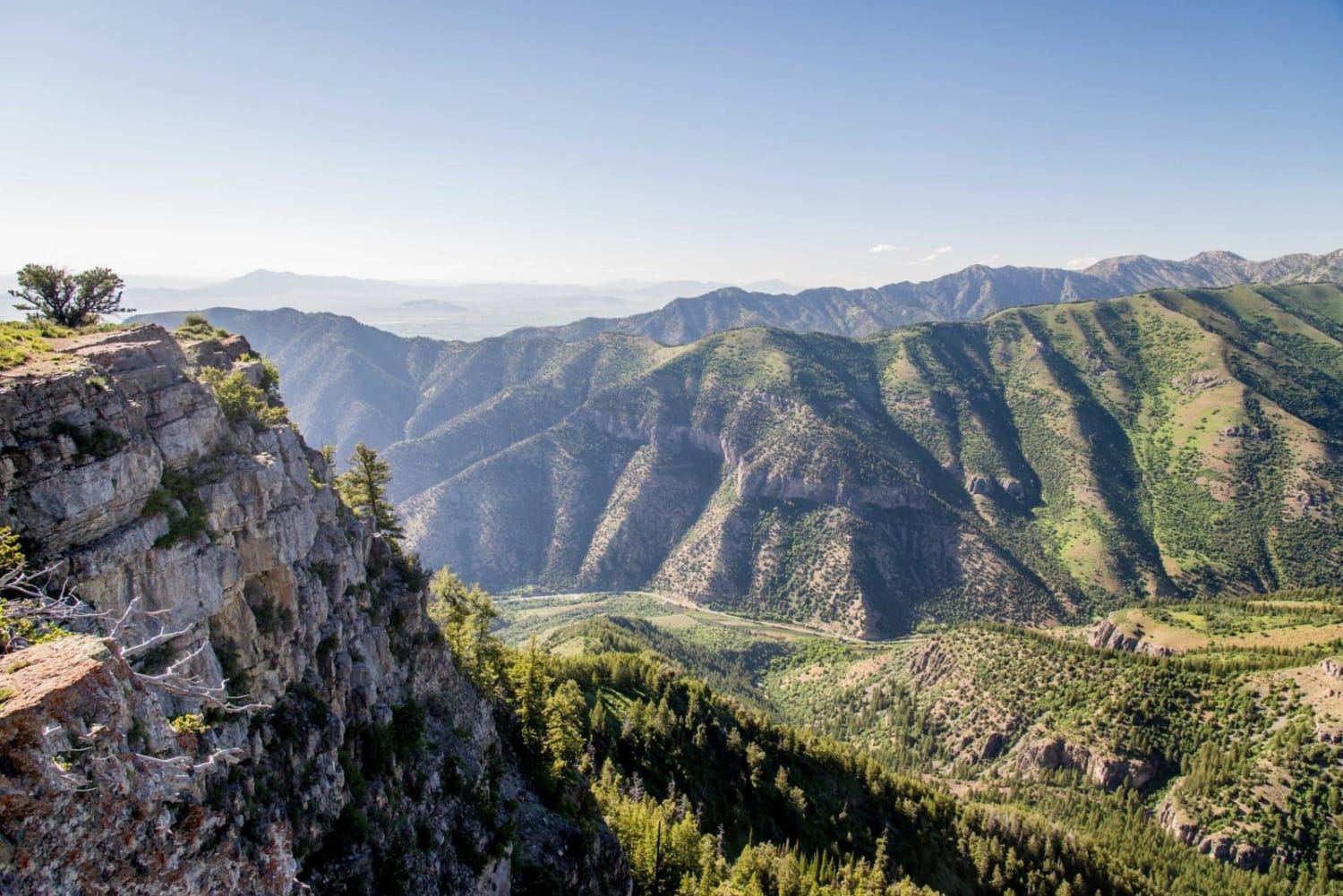
Peterson Point-NFR30697 is a 2.6-mile (5.2-mile) out-and-back trail rated 3 of 10 located within the Powell Ranger District of the Dixie National Forest. This dirt track forest road can be reached from Limekiln Road-BLM2350. The first half of this trail runs through the valley floor before ascending the ridge and turning south to Peterson Point. The trail has several scenic view points before reaching the end of the trail and the turn-around point. Peterson's Point offers a view overlooking the city of Panguitch to the west as well as Castro Canyon to the south. Care needs to be taken as there are some tight spots between trees on this easy two-track dirt trail. The trees are the only real obstacle on this trail. Cell phone service is intermittent and the nearest services are located in Panguitch.
Photos of Peterson Point-NFR30697

Difficulty
Trail consisting of loose rocks, dirt, and sand with some slickrock surfaces, mud holes possible, no steps higher than 12". 4WD may be required, aggressive tires a plus.
Status Reports
Peterson Point-NFR30697 can be accessed by the following ride types:
- High-Clearance 4x4
- SUV
- SxS (60")
- ATV (50")
- Dirt Bike
Peterson Point-NFR30697 Map
Popular Trails
Mount Logan Right Hand Fork
Proctor Canyon - FS 30109
The onX Offroad Difference
onX Offroad combines trail photos, descriptions, difficulty ratings, width restrictions, seasonality, and more in a user-friendly interface. Available on all devices, with offline access and full compatibility with CarPlay and Android Auto. Discover what you’re missing today!