Chalk Creek Road/PST 03A
Total Miles
18.9
Technical Rating
Best Time
Spring, Summer, Fall
Trail Type
High-Clearance 4x4 Trail
Accessible By
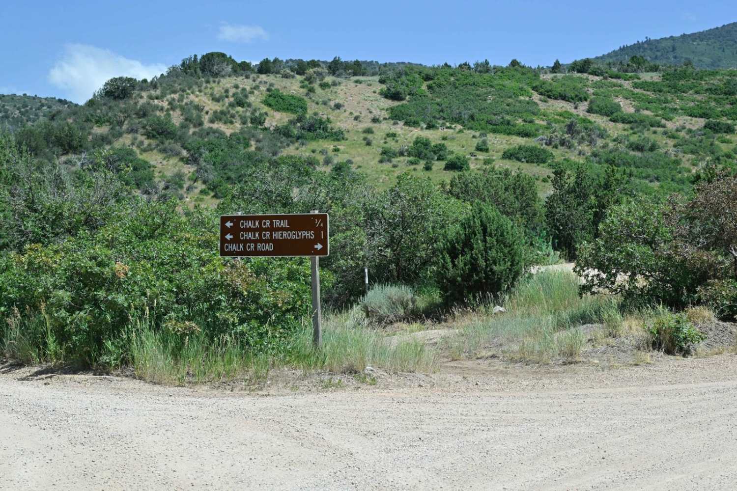
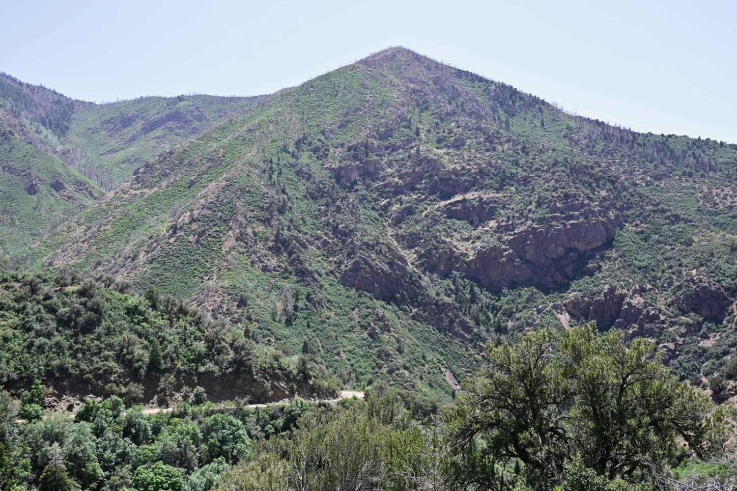
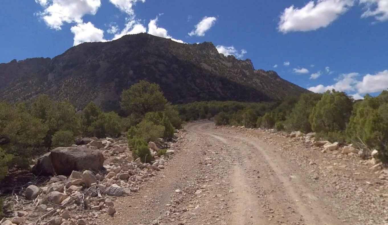
Trail Overview
It is a stunning canyon trail that runs between Fillmore, UT, to the west and connects with Paiute01 near Indian Springs USFS Guard Station to the east. This trail initially starts as a well-improved dirt road from west to east due to access to several USFS picnic areas interspersed along the creek at the bottom of the canyon. East of the last picnic area, the trail becomes much more of a trail and less of a road, and is signed for no passenger cars or vehicles with trailers. This is because many areas beyond the signage are barely wide enough for two full-sized cars to pass. The trail winds up through a stunning canyon, but be advised that you may not want to peer over the downhill side if you fear heights. The trail from west to east hugs and climbs the canyon wall over 4000 feet to the top. Cell signal is intermittent but generally unavailable for much of the trail due to the terrain.
Photos of Chalk Creek Road/PST 03A
Difficulty
No real technical obstacles, but many spots that are difficult for two vehicles to pass, and backing to a wide spot could be a bit unnerving.
Status Reports
Chalk Creek Road/PST 03A can be accessed by the following ride types:
- High-Clearance 4x4
- SxS (60")
- ATV (50")
- Dirt Bike
Chalk Creek Road/PST 03A Map
Popular Trails

Hog Canyon 2 - Antenna Hill (BLM HC2)

Brian Head Peak Observatory

Hog Canyon 1 East - Mosdell Hill+ (BLM HC1Z)
Fairview Ranch - Lonesome Beaver Rd
The onX Offroad Difference
onX Offroad combines trail photos, descriptions, difficulty ratings, width restrictions, seasonality, and more in a user-friendly interface. Available on all devices, with offline access and full compatibility with CarPlay and Android Auto. Discover what you’re missing today!