R59
Total Miles
1.6
Technical Rating
Best Time
Spring, Summer, Fall, Winter
Trail Type
Full-Width Road
Accessible By
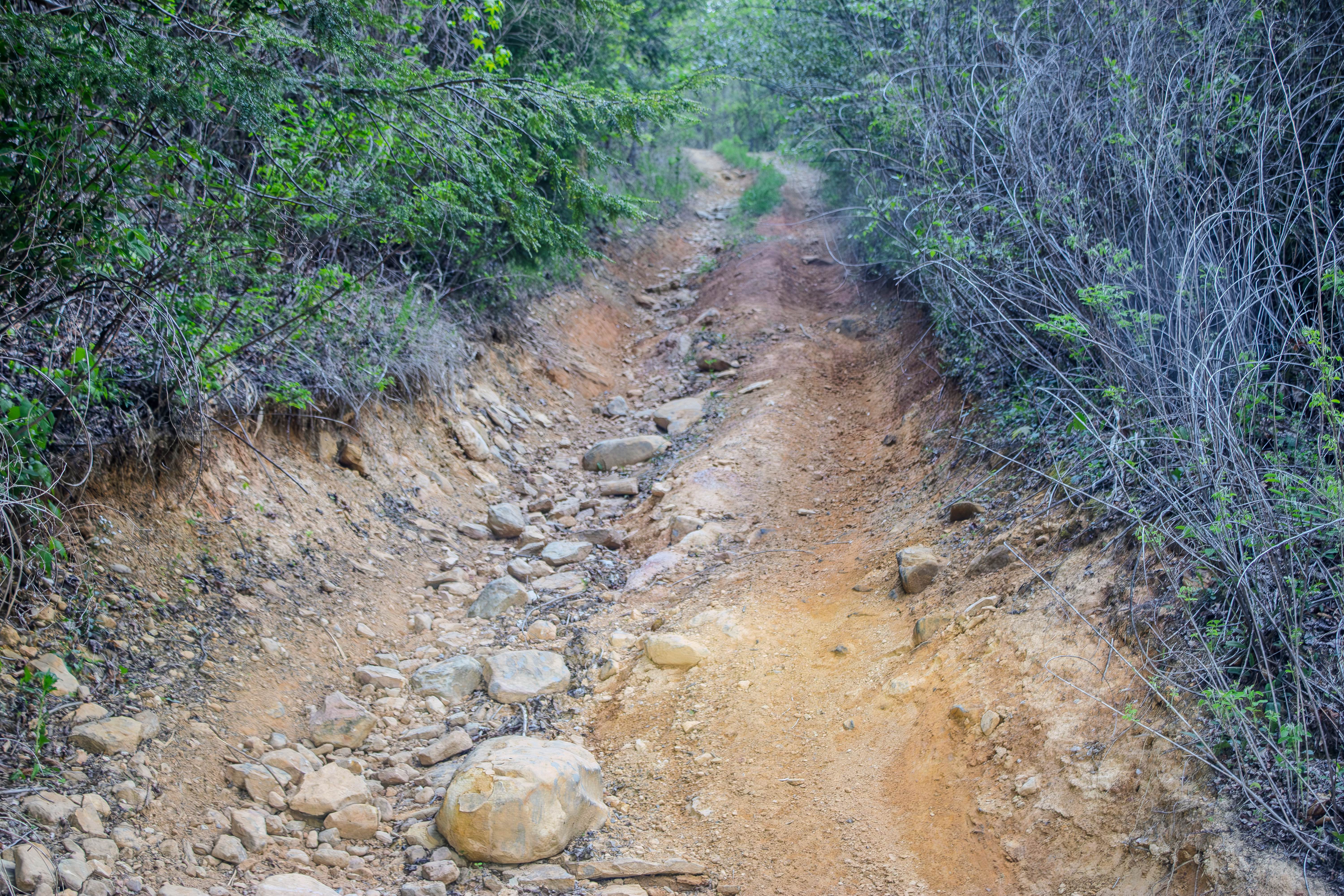
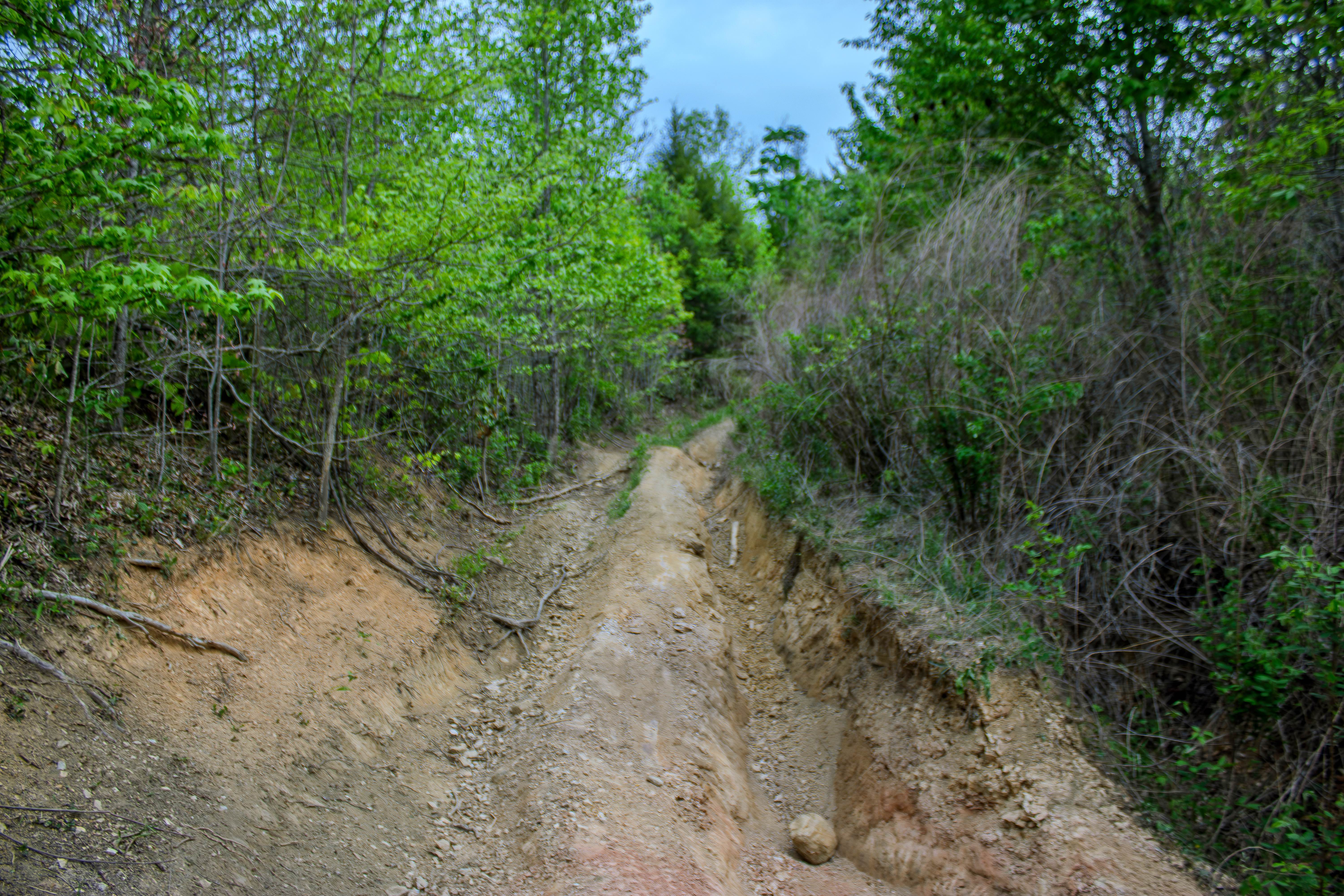
Trail Overview
R59 is a two-way dirt trail that connects Phillips Cemetery Lane to SWG1. This route is much tighter and more technical than the nearby gravel roads, with narrow sections, limited passing areas, and several obstacles that require careful tire placement. Overgrown trees line much of the trail and will drag along the sides of your vehicle, so light pinstriping is likely, especially in full-size trucks and SUVs. One of the first things to watch for is a water crossing that has washed part of the road out. This washed-out section can cause longer-wheelbase vehicles to drag, and it may become more difficult after rain or heavy use. Beyond that, the trail has several deep ruts and ledges that make progress slower and more technical. In one section, the ledges reach approximately 38 inches high, which can be a serious obstacle depending on your vehicle's clearance, wheelbase, and tire size. The deep ruts also create off-camber situations that can push the vehicle sideways and make it more difficult to stay on line through the obstacle. Combined with the narrow trail and overgrown vegetation, this route demands a more capable high-clearance 4WD vehicle and a driver who is comfortable navigating ruts, ledges, and uneven terrain. This is not a casual scenic road, and trail conditions can worsen quickly with rainfall.
Photos of R59
Difficulty
R59 earns a 6 rating because of the deep ruts, off-camber sections, washed-out crossing, narrow trail width, and ledges that reach roughly 38 inches. Those obstacles push this trail beyond a moderate route and into difficult territory, especially for longer-wheelbase vehicles or vehicles with limited ground clearance. Drivers should expect careful tire placement, possible underbody contact, and a real chance of body or rocker damage in the more rutted sections. Wet conditions will increase the difficulty even more.
Status Reports
R59 can be accessed by the following ride types:
- High-Clearance 4x4
- SUV
- SxS (60")
- ATV (50")
- Dirt Bike
R59 Map
Popular Trails
Sulfer Branch Road
End of the World
Peavine Sheeds - CR 221
The onX Offroad Difference
onX Offroad combines trail photos, descriptions, difficulty ratings, width restrictions, seasonality, and more in a user-friendly interface. Available on all devices, with offline access and full compatibility with CarPlay and Android Auto. Discover what you’re missing today!