GS1 Trail
Total Miles
3.8
Technical Rating
Best Time
Spring, Summer, Fall, Winter
Trail Type
Full-Width Road
Accessible By
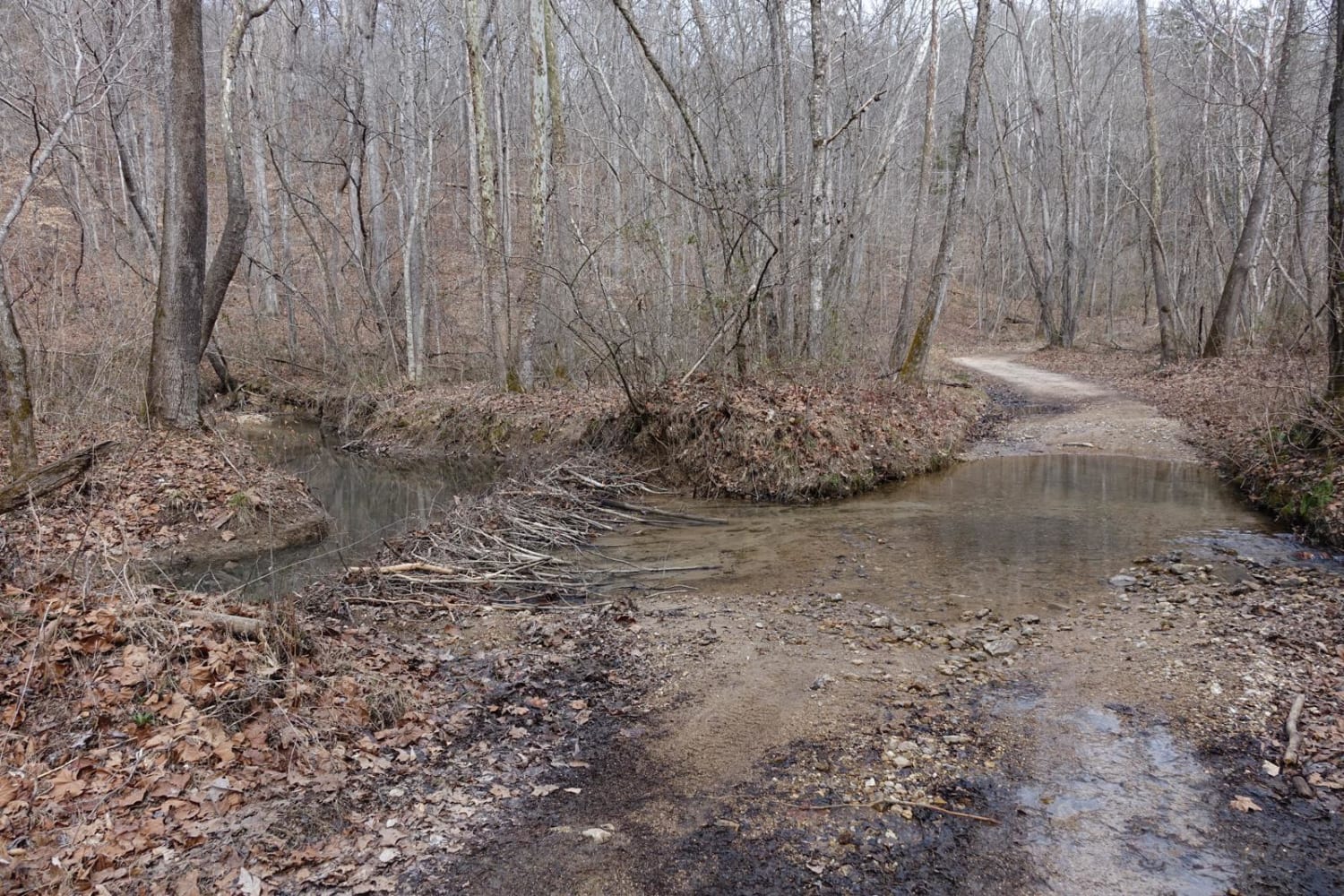
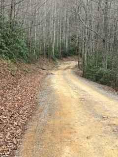
Trail Overview
GS1 Trail is a two-way, mostly dirt trail that starts near the boundary of Windrock Park's New River Trail area and continues past the SWG1 Trail. This trail has a rugged backwoods feel with a mix of dirt, ruts, washouts, standing water, loose rock, and overgrown sections. Several areas have deep ruts and erosion washouts that require careful tire placement, especially for smaller vehicles or drivers without much ground clearance. Picking the correct line is important in these sections to avoid dragging or getting hung up. Low-hanging trees are common along GS1, and taller vehicles should use caution. Some sections have become heavily overgrown, so expect brush and limbs to drag along the sides of the vehicle. Spring-fed water crossings and wet areas keep parts of the trail muddy or covered with standing water throughout the year. These water holes can reach up to around 18 inches deep, depending on recent weather. As you travel the trail, watch for pieces of old coal left behind from the mining history of the area. The trail also has several inclines with larger loose rocks, which can make traction difficult at times, especially when wet. GS1 is a good trail for drivers looking for a more rugged connector route with historic scenery, water, ruts, and some technical line choices.
Photos of GS1 Trail
Difficulty
Based on the ruts, washouts, loose rock climbs, overgrown areas, low-hanging trees, and spring-fed water crossings up to around 18 inches deep, GS1 fits best as a 4 out of 10 trail. Most built 4x4 vehicles should be able to complete the trail, but drivers will need to pay attention to tire placement in the deeper ruts and washed-out sections. Wet weather can make the trail more difficult because the standing water, mud, and loose rocks can reduce traction.
History
This area is great for trail riding, photography, exploring old coal mining history, and enjoying the wooded scenery around the Windrock and New River trail systems. The spring-fed crossings and shaded sections also make it a nice area to stop and take in the surroundings when there is room to safely pull off the trail.
Status Reports
GS1 Trail can be accessed by the following ride types:
- High-Clearance 4x4
- SUV
- SxS (60")
- ATV (50")
- Dirt Bike
GS1 Trail Map
Popular Trails
Coal Haul Road
Little Gassaway - Trail NF45
Lost Creek & Clear Creek
Flatwoods Road Extension
The onX Offroad Difference
onX Offroad combines trail photos, descriptions, difficulty ratings, width restrictions, seasonality, and more in a user-friendly interface. Available on all devices, with offline access and full compatibility with CarPlay and Android Auto. Discover what you’re missing today!