Buck Creek 2120
Total Miles
20.9
Technical Rating
Best Time
Spring, Summer, Fall
Trail Type
Full-Width Road
Accessible By
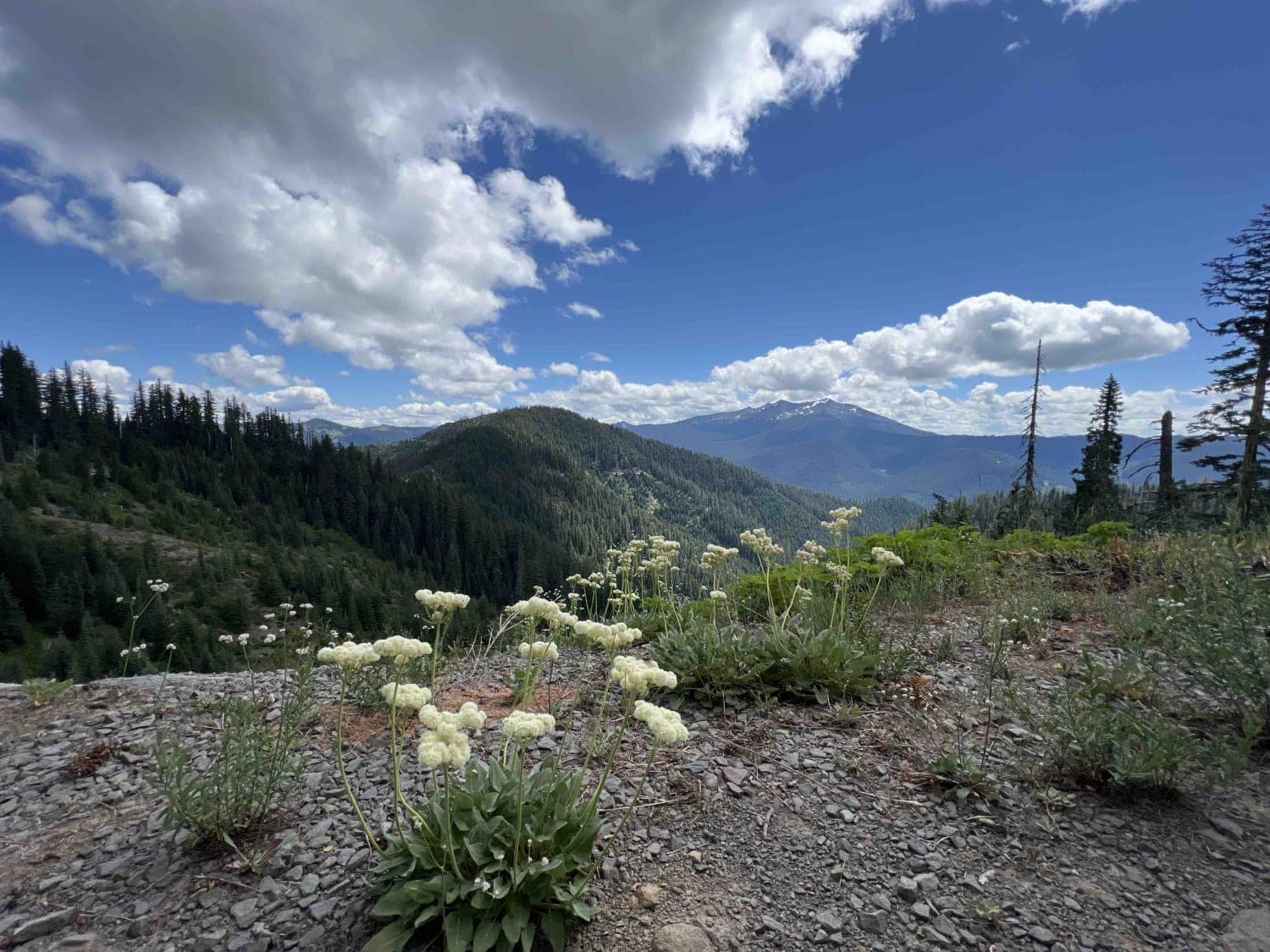
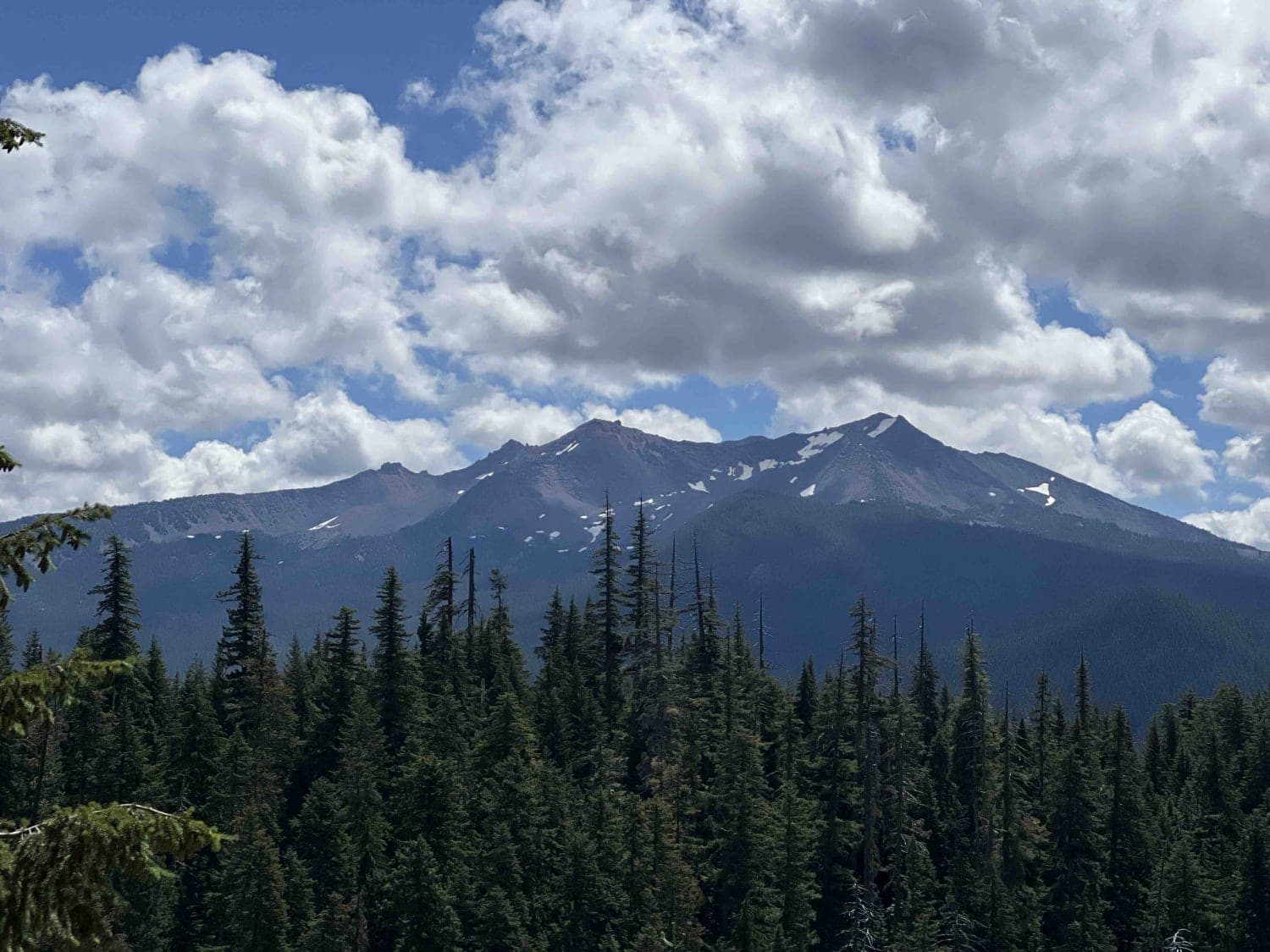
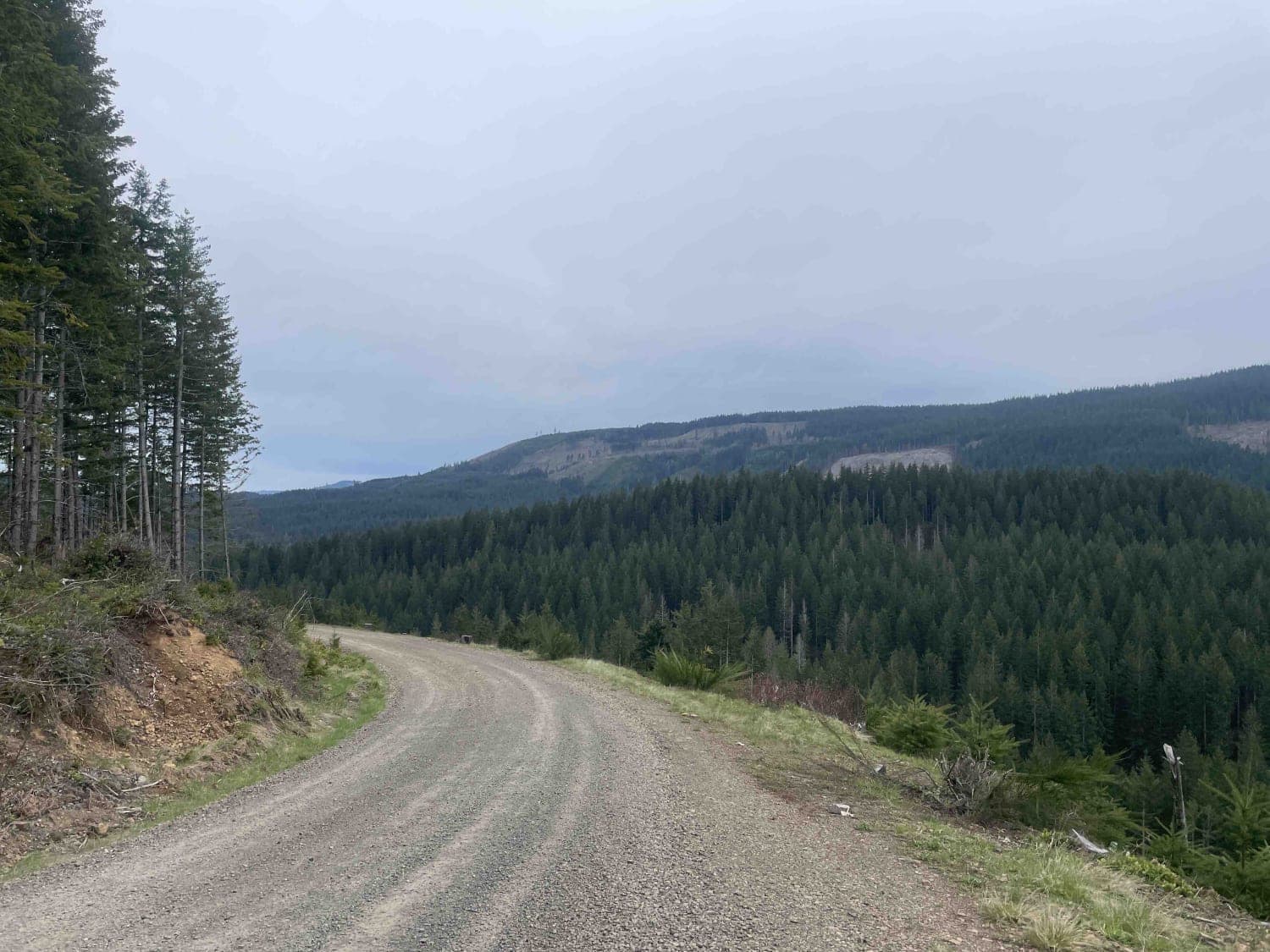
Trail Overview
Buck Creek Road 2120 takes you on a 20.9-mile journey through the 1.7-million-acre Willamette National Forest located in Oregon. This route is not recommended for low-clearance vehicles due to primitive and unmaintained road conditions. There is falling debris, rocks, landslides, rockslides, flash floods, vertical drop-offs of more than 1,000 feet, and boulders in the road the size of a small car. The Cascade Mountain Range provides endless adventure. In particular, this area is known for mountain biking trails. Happy Lake Trailhead leads you to Diamond Peak which is a 9.5-mile hiking, mountain biking, and horseback riding trail. At the end of this trail, you can take a left onto Hills Creek where you will find the Vivian Lake Trailhead which is 5.5 miles. There are dispersed campsites all along this route, which are first serve and come with no running water or restrooms. The Northwest Forest Recreation Pass is required at all trailheads that don't have a fee box. Black bears, cougars, spotted owls, chipmunks, blue-grouse, and black-tailed deer all can be found within this region. Be bear aware. The WNF posts signs about packing it in and packing it out along with tread lightly principles to protect habitats. Plant species are in the hundreds in this area, some of which are Pacific fireweed, Pacific trillium, Pacific bleeding heart, and pine trees with uniformed branches that are mesmerizing and line the roads for miles. Views of Cougar Mountain, Pinto Mountain, and Diamond Peak are breathtaking. Little creeks and streams flow off the cliffs in certain areas and can be accessed on the road to enjoy.
Photos of Buck Creek 2120
Difficulty
This route is not recommended for low-clearance vehicles due to primitive and unmaintained road conditions. There is falling debris, rocks, landslides, rockslides, flash floods, and vertical drop-offs of more than 1,000 feet. This route is not accessible during the winter months due to the heavy snowfall and rain. Gates may be closed and locked at any time.
History
There is so much rich history of how these towns were first discovered by settlers who were drawn to the area in hopes of a better future and life. Here is a website with more information on how the Willamette National Forest became protected through the forest preserve. https://www.oregonencyclopedia.org/articles/willamette_national_forest/
Status Reports
Buck Creek 2120 can be accessed by the following ride types:
- High-Clearance 4x4
- SUV
- SxS (60")
- ATV (50")
- Dirt Bike
Buck Creek 2120 Map
Popular Trails
Wheeler Run

Cross Canyon - FS 6217

Millican Plateau Trail 84
The onX Offroad Difference
onX Offroad combines trail photos, descriptions, difficulty ratings, width restrictions, seasonality, and more in a user-friendly interface. Available on all devices, with offline access and full compatibility with CarPlay and Android Auto. Discover what you’re missing today!