70 (North)
Total Miles
7.3
Technical Rating
Best Time
Spring, Fall
Trail Type
50" Trail
Accessible By
Trail Overview
Trail 70 is a fast and flowy route weaving through a ponderosa forest with trees closely lining the trail. It features huge whoops, banked corners, berms, tight turns, and small hills. The surface is mostly pea gravel and dirt with minimal rock, though a couple of sections include loose pumice stone and embedded rock layers forming 6-inch ledges that are still easy to navigate. A portion of the trail runs through a burn area, and the southernmost mile (south of Road 650) was closed due to fire hazards as of May 2025.
Photos of 70 (North)

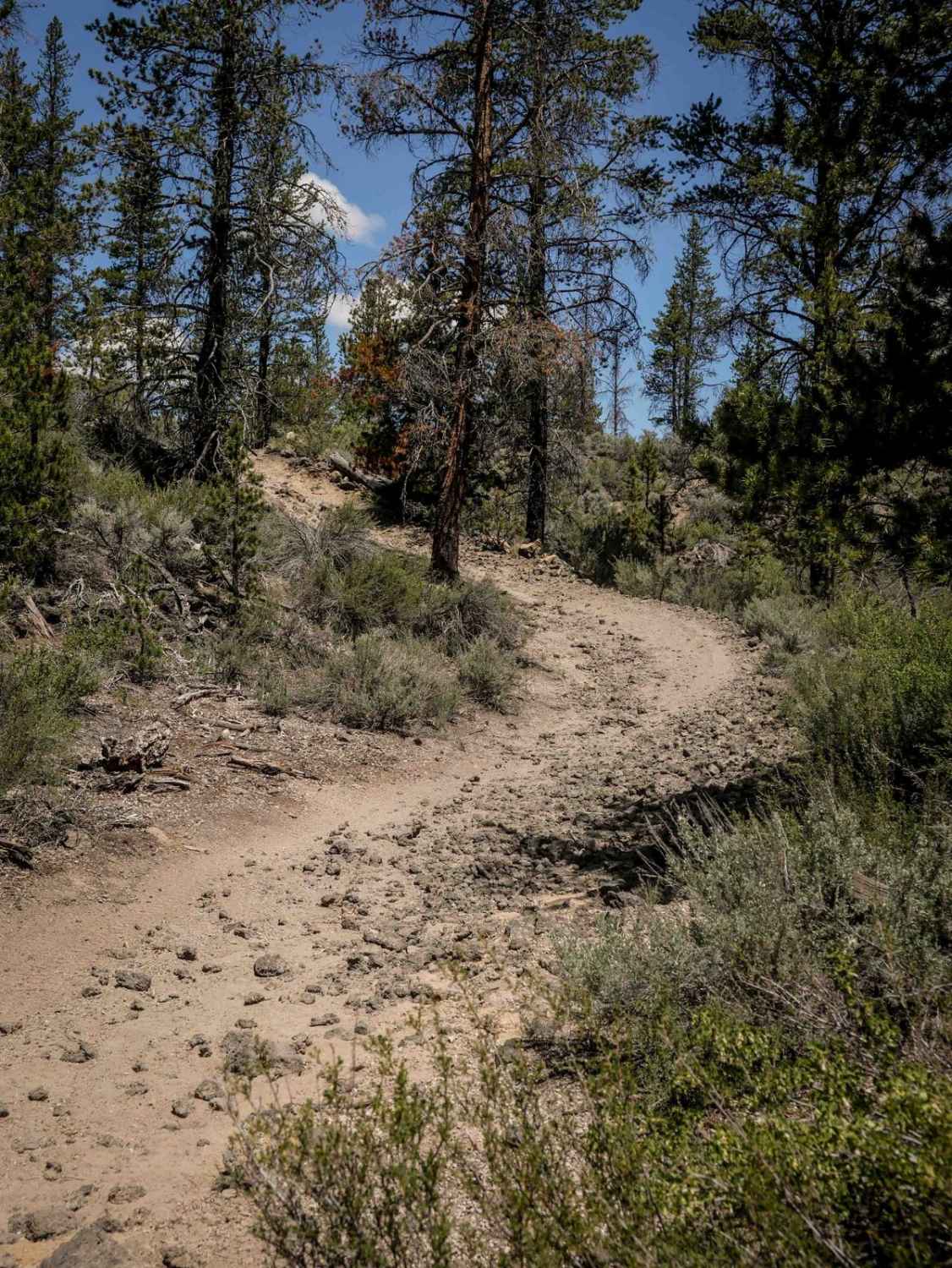
Difficulty
This is an easy and gradual trail with only a few sections of rock, ideal for most average riders. This is rated Moderate by the Forest Service.
Status Reports
70 (North) can be accessed by the following ride types:
- ATV (50")
- Dirt Bike
70 (North) Map
Popular Trails
Wellamockin Road North NF46
Abbott Road 6410 Quarry Split

The onX Offroad Difference
onX Offroad combines trail photos, descriptions, difficulty ratings, width restrictions, seasonality, and more in a user-friendly interface. Available on all devices, with offline access and full compatibility with CarPlay and Android Auto. Discover what you’re missing today!