52420
Total Miles
1.8
Technical Rating
Best Time
Summer, Fall, Winter, Spring
Trail Type
Full-Width Road
Accessible By
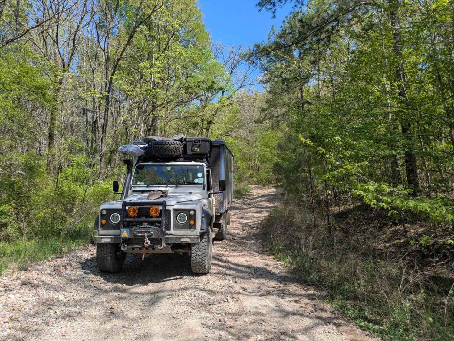
Trail Overview
This route commences with a rocky, off-camber descent toward a low-level water crossing, after which the path narrows and becomes increasingly rugged, requiring slow travel in low gear. Water damage has significantly eroded the surface, forming deep, off-camber ruts and heavily rutted ascents and descents, so conditions worsen as you progress, leading to a long rutted climb that demands a capable high-clearance vehicle, especially after rainfall or in wet conditions. Although a few dispersed campsites exist, amenities such as trash disposal and water supply are absent, and cell reception is limited.
Photos of 52420

Difficulty
Rocky, off-camber and unmaintained trail.
History
The Ouachita National Forest was established in 1907, making it the oldest national forest in the South. Long before that, Native American tribes like the Caddo and Choctaw lived and traveled through these mountains. In the late 1800s, settlers arrived for logging and mining, but concerns about preserving the land led to federal protection. Today, the forest covers over 1.8 million acres across Arkansas and Oklahoma. With its rugged ridges, clear streams, and diverse wildlife, the Ouachita remains a place where nature and history meet--and every trail tells part of the story.
Status Reports
52420 can be accessed by the following ride types:
- High-Clearance 4x4
- SUV
- SxS (60")
- ATV (50")
- Dirt Bike
52420 Map
Popular Trails

Blake's Trail 2.0


The onX Offroad Difference
onX Offroad combines trail photos, descriptions, difficulty ratings, width restrictions, seasonality, and more in a user-friendly interface. Available on all devices, with offline access and full compatibility with CarPlay and Android Auto. Discover what you’re missing today!