Lynch Creek Loop - FS 43275
Total Miles
6.3
Technical Rating
Best Time
Spring, Summer, Fall
Trail Type
Full-Width Road
Accessible By
Trail Overview
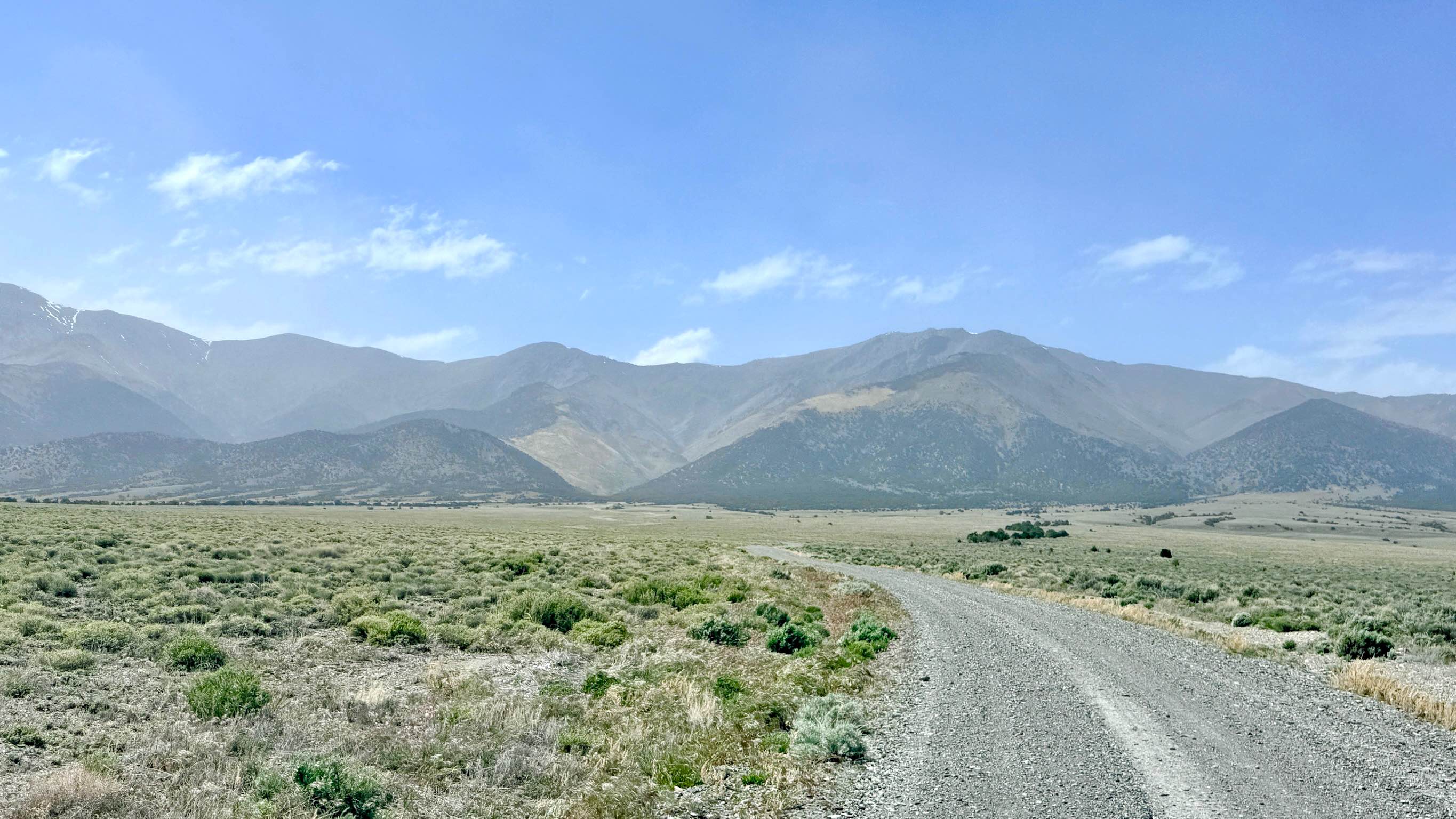
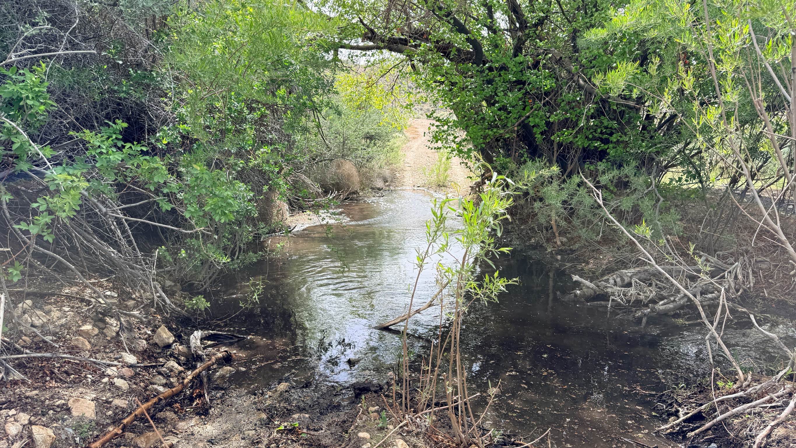
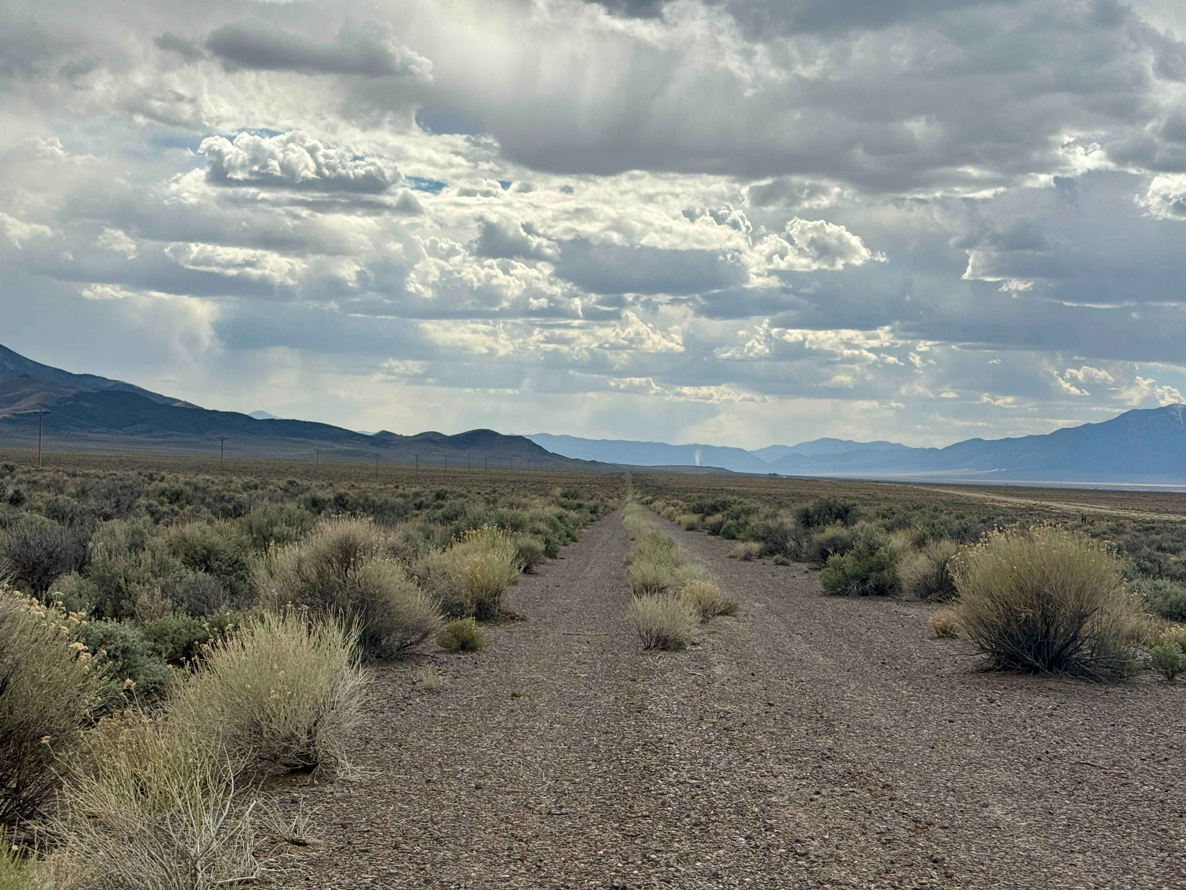
Lynch Creek Loop is an incredibly diverse tour of the lower Toiyabe foothills. The experience transitions dramatically based on your location: the southern section, leading up to the two local ranches, consists of smooth, wide gravel that allows for easy cruising. However, once you push north of the ranching properties, the trail's personality shifts into a rugged, technical backcountry track. This northern segment is characterized by narrow paths, steep off-camber hill climbs, and challenging descents. The landscape is a beautiful mix of high-desert scrub and riparian greenery fueled by the creek. The true "gatekeeper" of this loop is a significant water crossing at the northernmost section. This crossing features low-hanging branches and tight clearances; even vehicles equipped with rooftop tents may struggle to clear the overhanging canopy. The water can be deep, reaching the mid-rim on a 33-inch tire, and the transitions into and out of the wash are steep and off-camber. For those with the right equipment and experience, it is a fantastic, "twisty" route with rewarding mountain and valley views. The southern section passes near active ranches. Please maintain a slow speed to minimize dust, respect all private property boundaries, and leave all gates as you found them. Expect very limited to non-existent cell service throughout the loop. Download offline maps before leaving the Austin area.
Photos of Lynch Creek Loop - FS 43275
Difficulty
Rated a 4 due to the combination of the deep water crossing, steep off-camber hill climbs, and loose descents. Vehicles with high-profile accessories, such as rooftop tents or tall racks, should exercise extreme caution at the northern water crossing due to low-hanging trees.
History
Lynch Creek is named after the early settlers who recognized the value of the reliable water flowing from the Toiyabe Range. Since the 1860s, this area has been a cornerstone of the regional ranching economy. The smooth gravel roads on the southern end are a testament to the ongoing importance of these ranches today.
Status Reports
Lynch Creek Loop - FS 43275 can be accessed by the following ride types:
- High-Clearance 4x4
- SUV
- SxS (60")
- ATV (50")
- Dirt Bike
Lynch Creek Loop - FS 43275 Map
Popular Trails
Ralston Valley Road
Warm Springs Mountain Loop
Carp Road-Lyman Crossing to Elgin
Old Historic Route 93
The onX Offroad Difference
onX Offroad combines trail photos, descriptions, difficulty ratings, width restrictions, seasonality, and more in a user-friendly interface. Available on all devices, with offline access and full compatibility with CarPlay and Android Auto. Discover what you’re missing today!