Broad Creek Access - FS 44212A
Total Miles
2.7
Technical Rating
Best Time
Spring, Summer, Fall
Trail Type
Full-Width Road
Accessible By
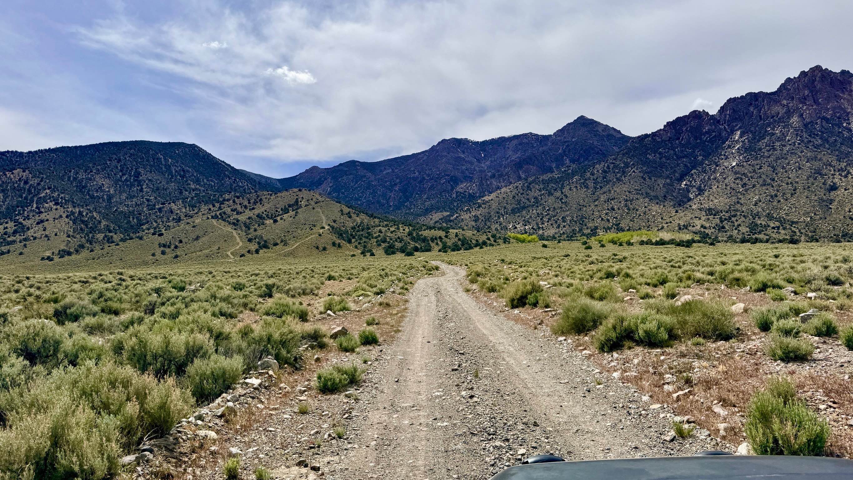
Trail Overview
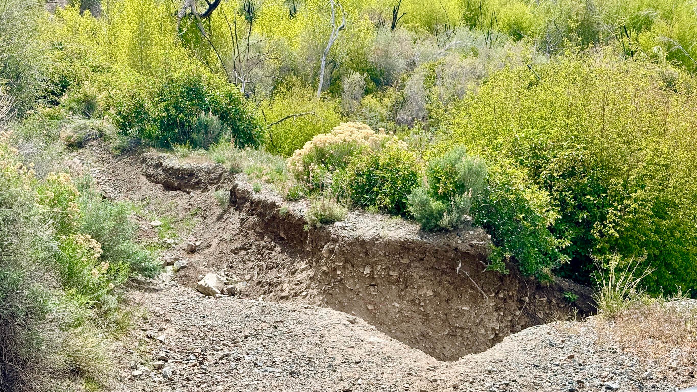
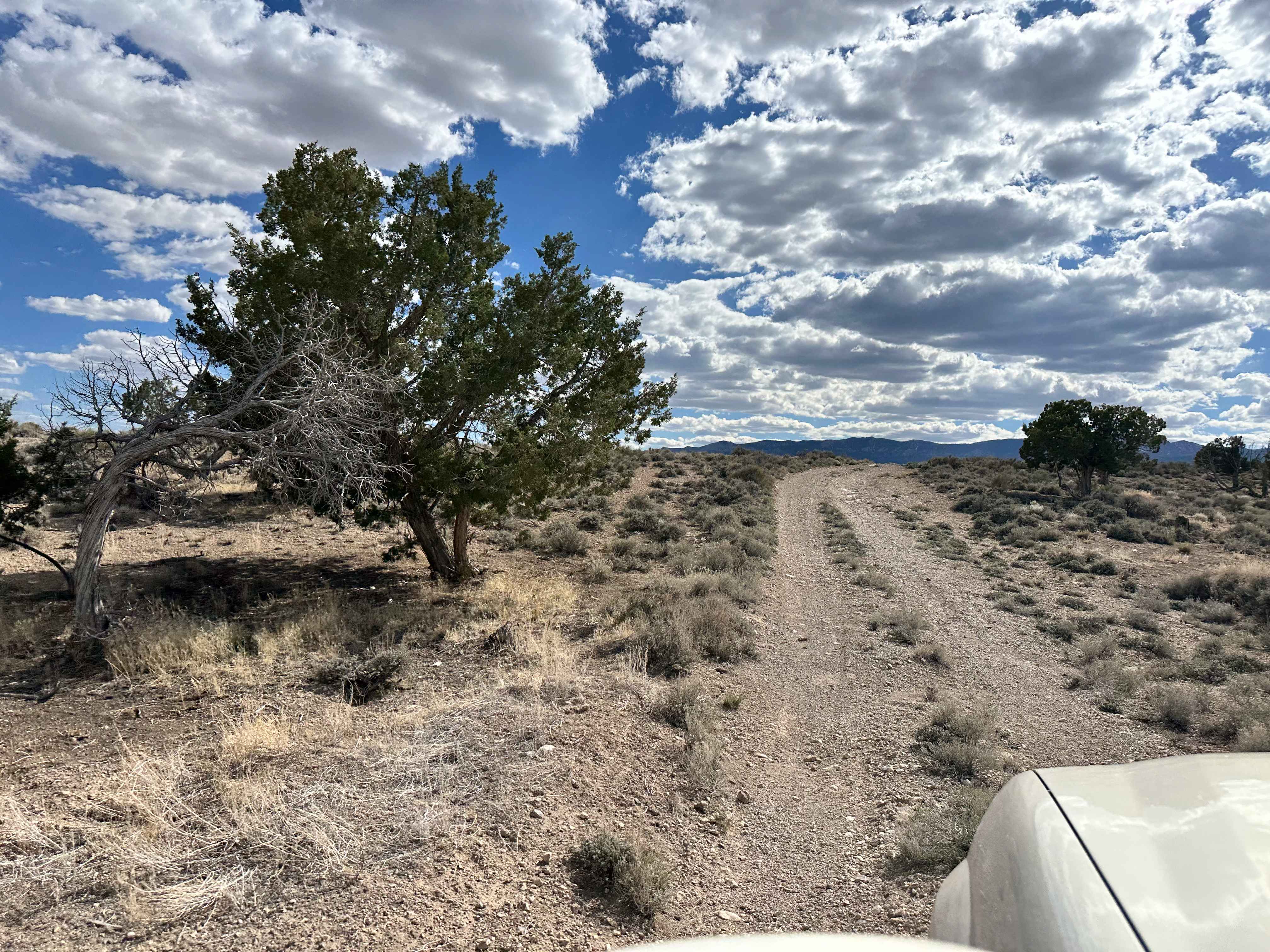
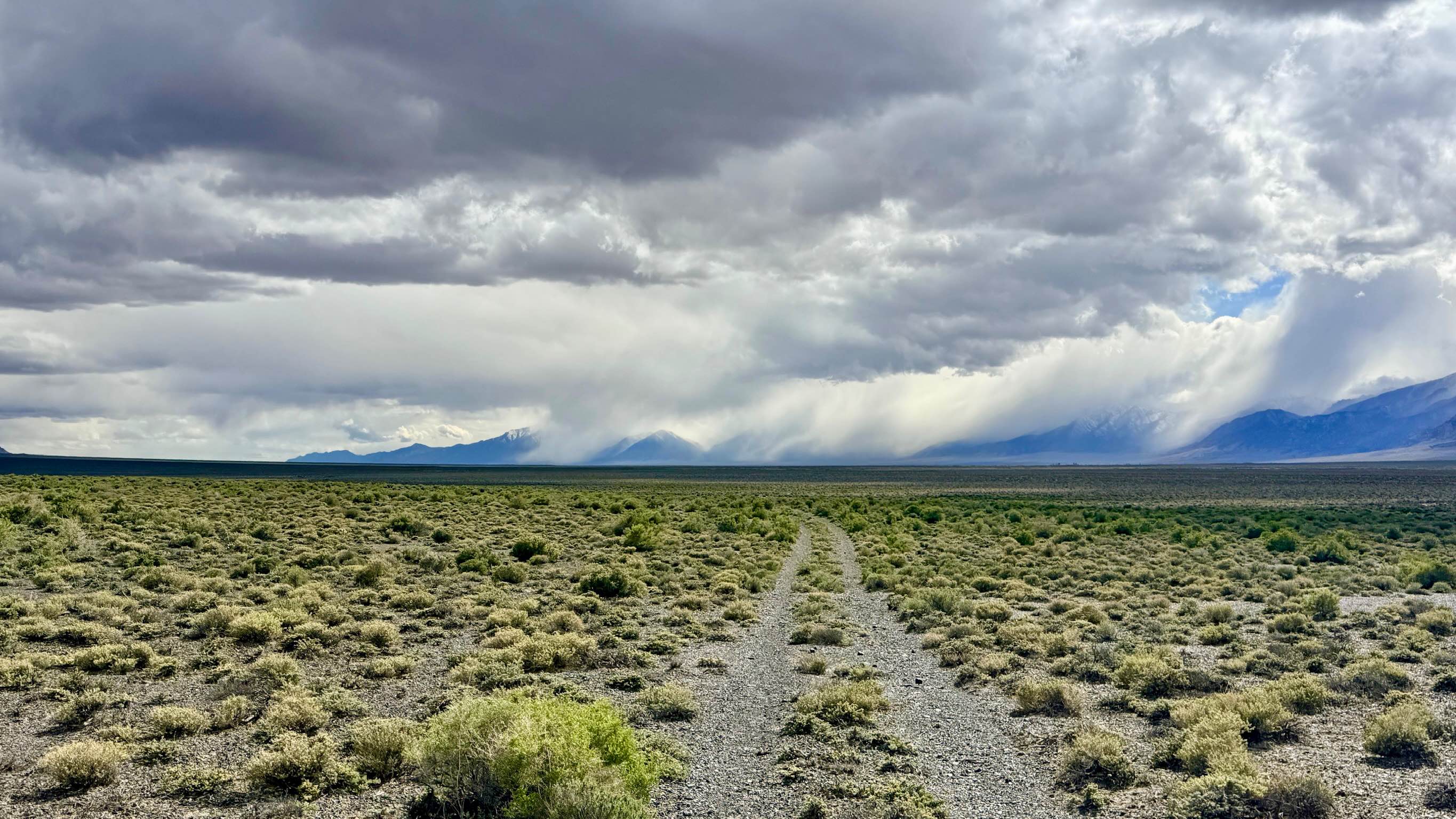
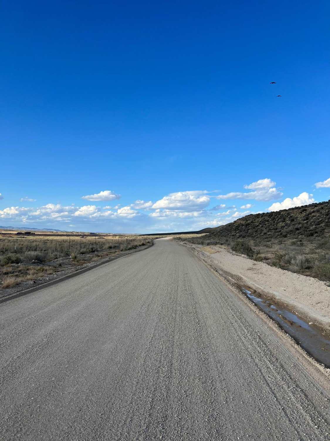
This trail is widely considered the "easy way" into the Broad Canyon system. The journey begins on the valley floor with a road so wide and impressively smooth that you feel as though you could land a plane on it. This expansive start quickly gives way to a more intimate experience as the road narrows into a single-lane two-track that climbs steadily into the rolling foothills. This area is a premier destination for those looking to stay a while. The trail is lined with numerous high-quality dispersed campsites, many of which offer easy access for larger rigs before the track tightens. The landscape is a classic Great Basin mix of sagebrush and rabbitbrush, teeming with local life. You are likely to flush Sage Grouse from the brush and may see Pronghorn Antelope on the lower flats. Adventurers should note that while the map indicates the trail continues, it ends abruptly at an incredible washout. A testament to the erosive power of the nearby creek. This terminus provides excellent foot access to the water below, making it a perfect spot to let the dog out for a walk or to enjoy a quiet splash in the rare desert creek. This is a very popular area for side-by-sides and ATVs. There is no cell service on this trail. The surrounding hills block all signals from the highway corridor. Download offline maps before leaving the Kingston area.
Photos of Broad Creek Access - FS 44212A
Difficulty
Rated a 2 for its generally smooth surface. While the lower section is very wide, the upper portion narrows and features some light rocky sections. Do not expect to reach the very end of the trail as shown on older GPS data; the final segment has been reclaimed by a massive washout similar to the Broad Canyon trail to the north. During the spring thaw or summer monsoon season, the trail can become soft and muddy near the creek access point.
History
The Broad Creek area is inextricably linked to the 1860s silver rush that built the town of Kingston. While the miners focused on the high-altitude veins, the "creek access" points were the true prize for the early ranchers who supplied the mining camps with beef and hay. The wide-open lower section of this trail likely served as a primary corridor for moving livestock and heavy equipment between the mills in the valley and the remote claims in the peaks.
Status Reports
Broad Creek Access - FS 44212A can be accessed by the following ride types:
- High-Clearance 4x4
- SUV
- SxS (60")
- ATV (50")
- Dirt Bike
Broad Creek Access - FS 44212A Map
Popular Trails
Mead Davis Powerline Road
Lexington Trail
Lower Canyon Cutover Trail - BLM 288
North Last Chance Road
The onX Offroad Difference
onX Offroad combines trail photos, descriptions, difficulty ratings, width restrictions, seasonality, and more in a user-friendly interface. Available on all devices, with offline access and full compatibility with CarPlay and Android Auto. Discover what you’re missing today!