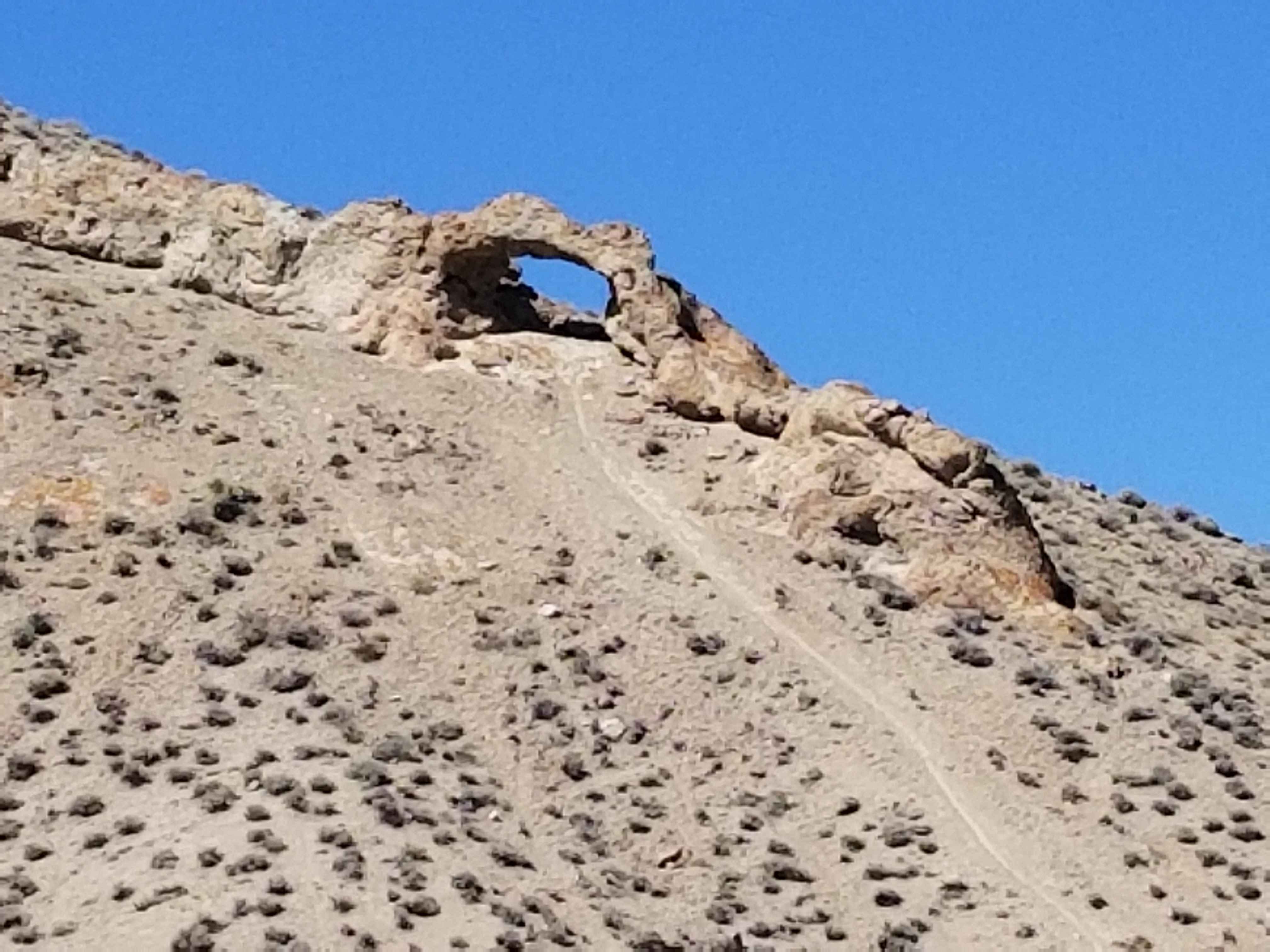
A Mountain - FS 43240
Total Miles
1.0
Technical Rating
Best Time
Spring, Summer, Fall
Trail Type
Full-Width Road
Accessible By
Trail Overview
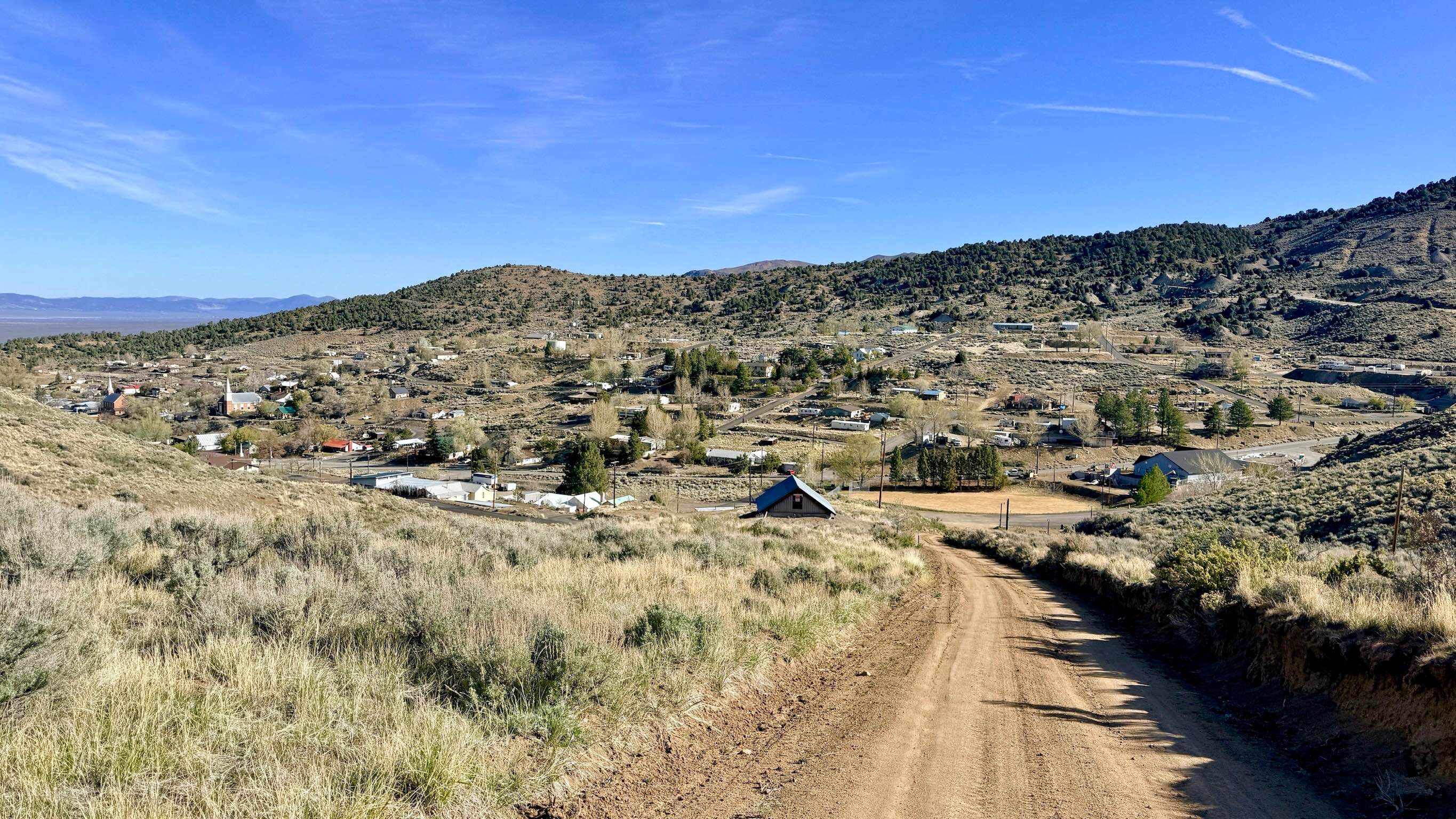
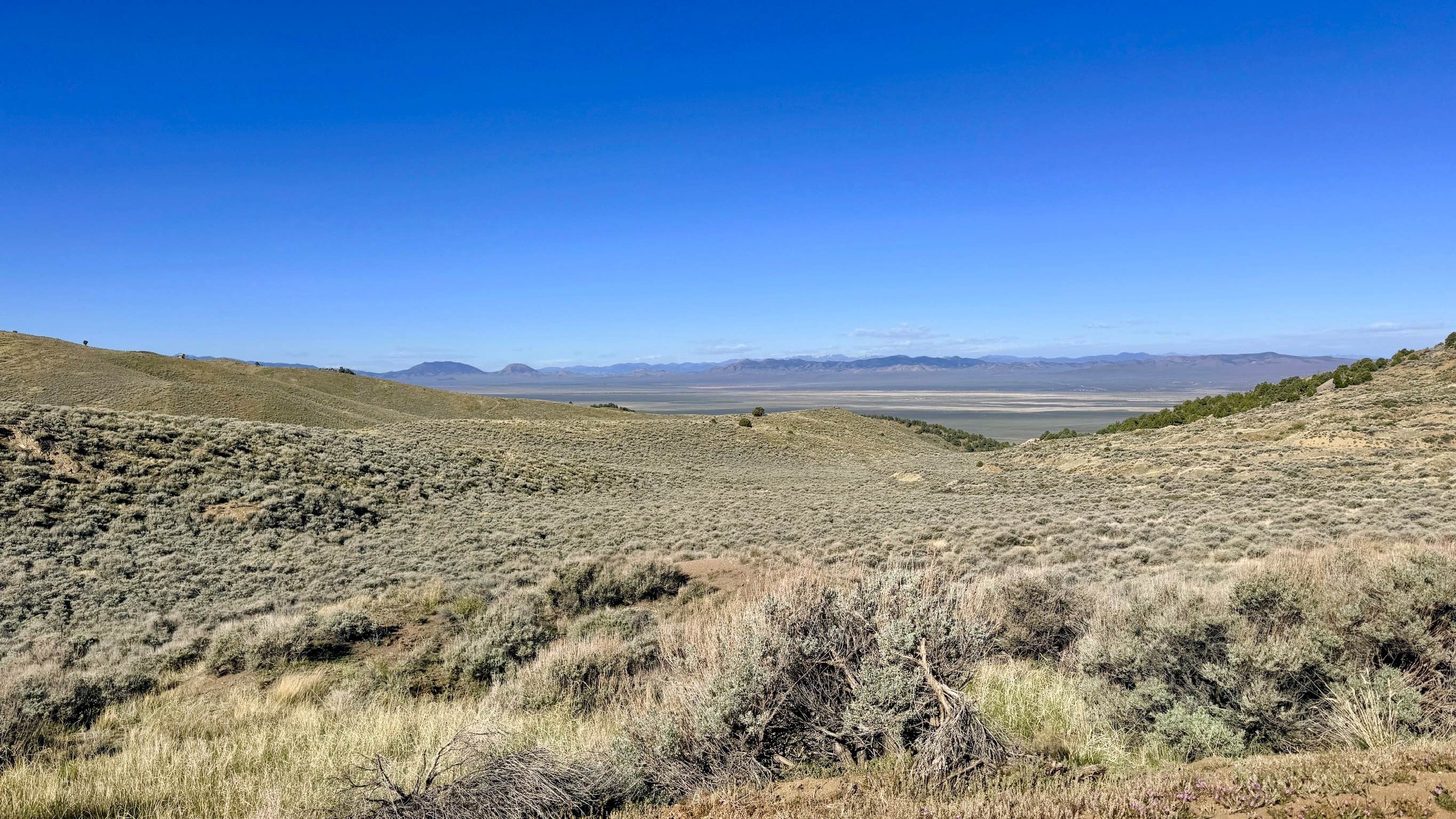
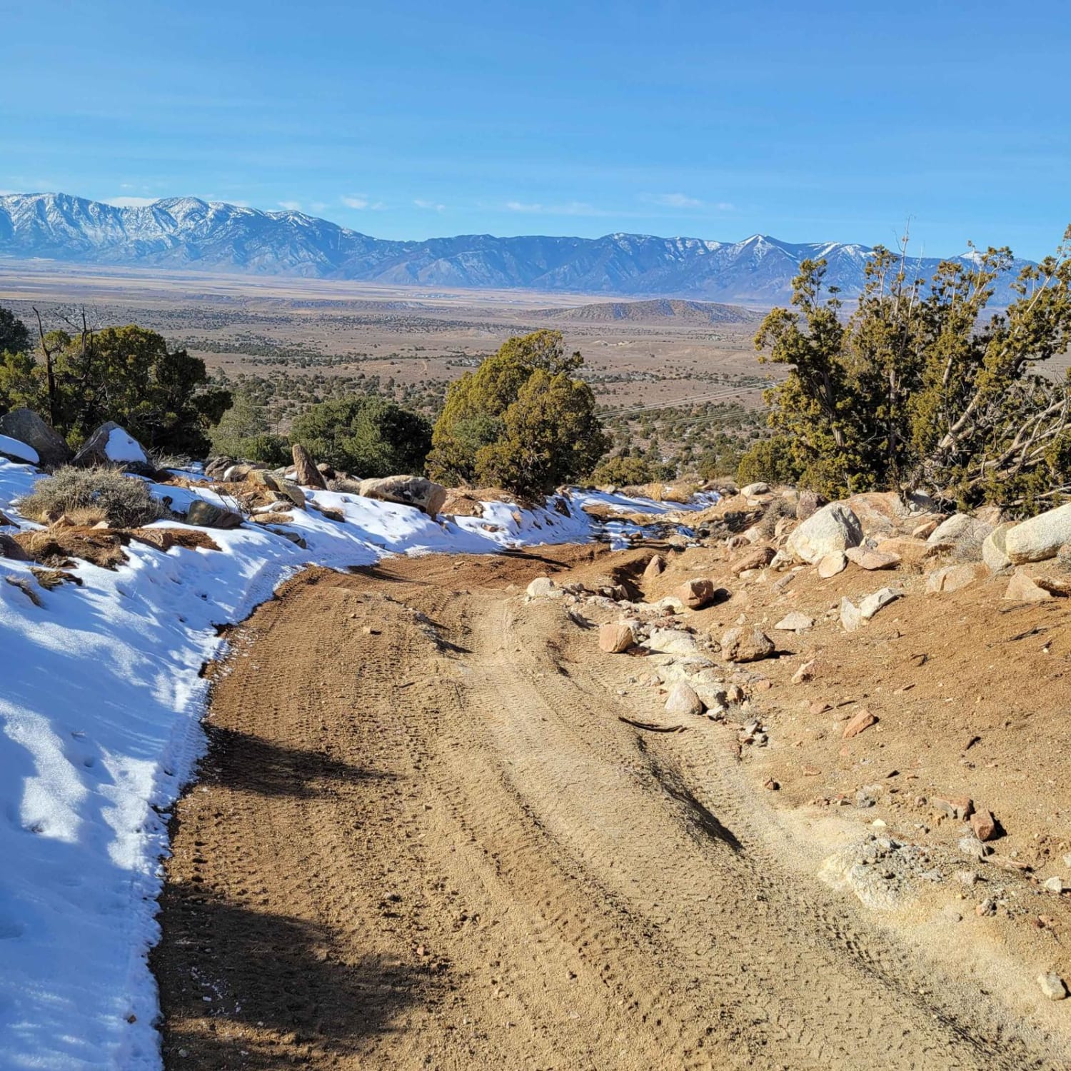
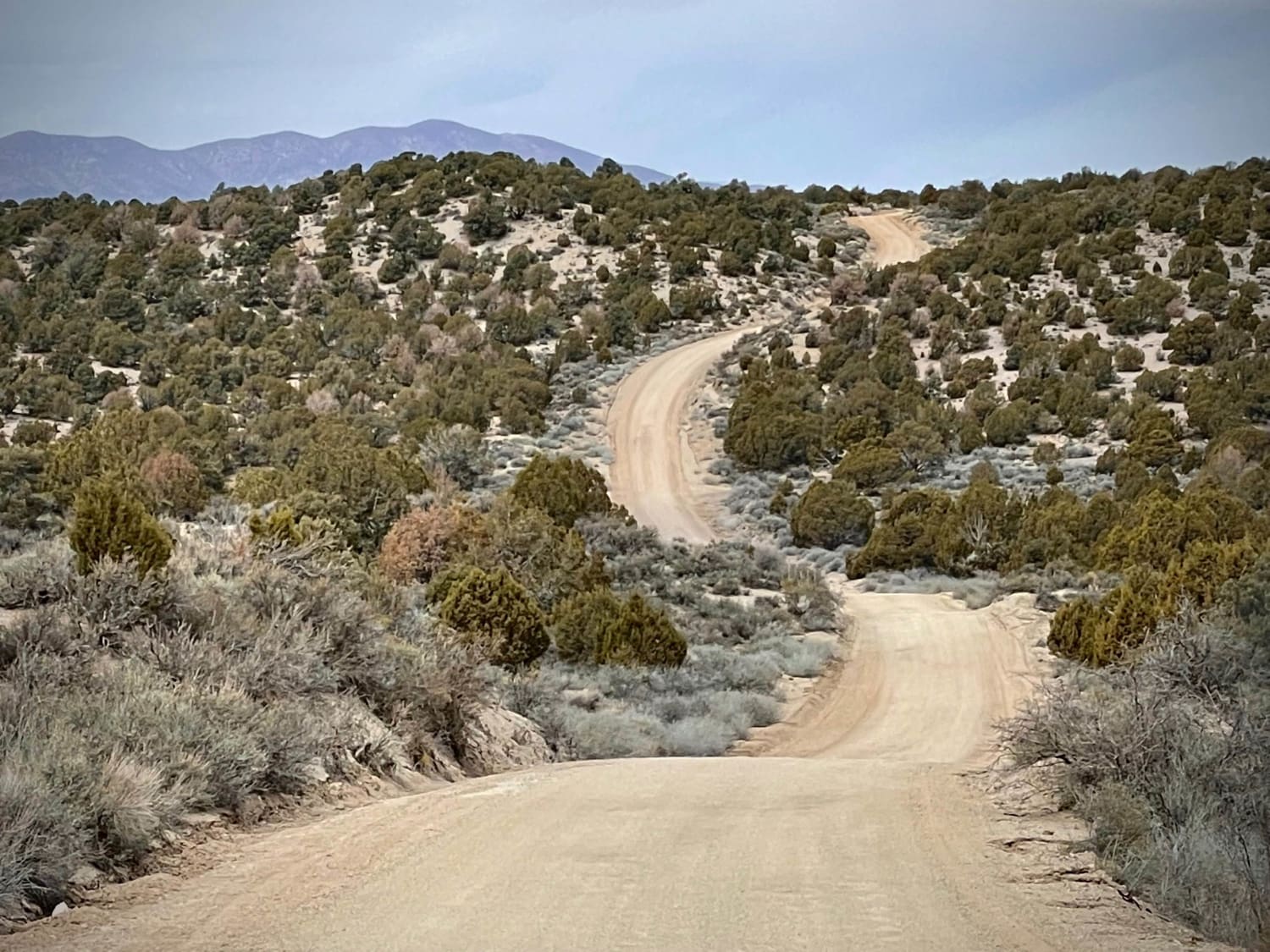
Named for the massive "A" on the hillside representing the town of Austin, this trail offers a high-vantage tour of the community's most recognizable landmark. Curiously, the trail doesn't lead to a specific peak, nor does it provide a clear view of the "A" from the very bottom; instead, you get a close-up perspective of the hillside as you ascend. As you reach the top of the initial climb near the municipal water tank, two spur trails branch off to the right--one passing above the "A" and one below--offering a chance for a closer look at the landmark. The official Forest Service route continues over the crest of the hill, zig-zagging down the backside through a landscape of dense sagebrush and mountain scrub. Once over the ridge, the town disappears, replaced by wonderful, expansive views of the distant valley. This area is prime habitat for Sage Grouse, which are frequently seen flushing from the brush as you weave your way down toward the junction with Marshall Canyon. The trail is exceptionally well-graded and serves as a perfect "link" in a larger system, making it an ideal choice for dirt bikers and mountain bikers looking to create a loop right from town. You will have reliable service on the side of the hill facing Austin, but it cuts out completely once you cross the ridge to the backside. Download offline maps to ensure you navigate the Marshall Canyon junction correctly.
Photos of A Mountain - FS 43240
Difficulty
While the surface is a smooth "1," the trail is narrow in several spots. Be prepared to use the few available turnouts to allow oncoming traffic to pass. The initial climb out of Austin is quite steep.
History
The "A" on the mountain is a classic example of Western "mountain monograms," a tradition that began in the early 20th century to show community pride.
Status Reports
A Mountain - FS 43240 can be accessed by the following ride types:
- High-Clearance 4x4
- SUV
- SxS (60")
- ATV (50")
- Dirt Bike
A Mountain - FS 43240 Map
Popular Trails
Backway to Wilson Spring Arch
Power Line Trail RSM

The Pass to Pabco
Beaver Dam Road
The onX Offroad Difference
onX Offroad combines trail photos, descriptions, difficulty ratings, width restrictions, seasonality, and more in a user-friendly interface. Available on all devices, with offline access and full compatibility with CarPlay and Android Auto. Discover what you’re missing today!