Timber Lane Spur B - FS 2514B
Total Miles
0.4
Technical Rating
Best Time
Spring, Summer, Fall, Winter
Trail Type
Full-Width Road
Accessible By
Trail Overview
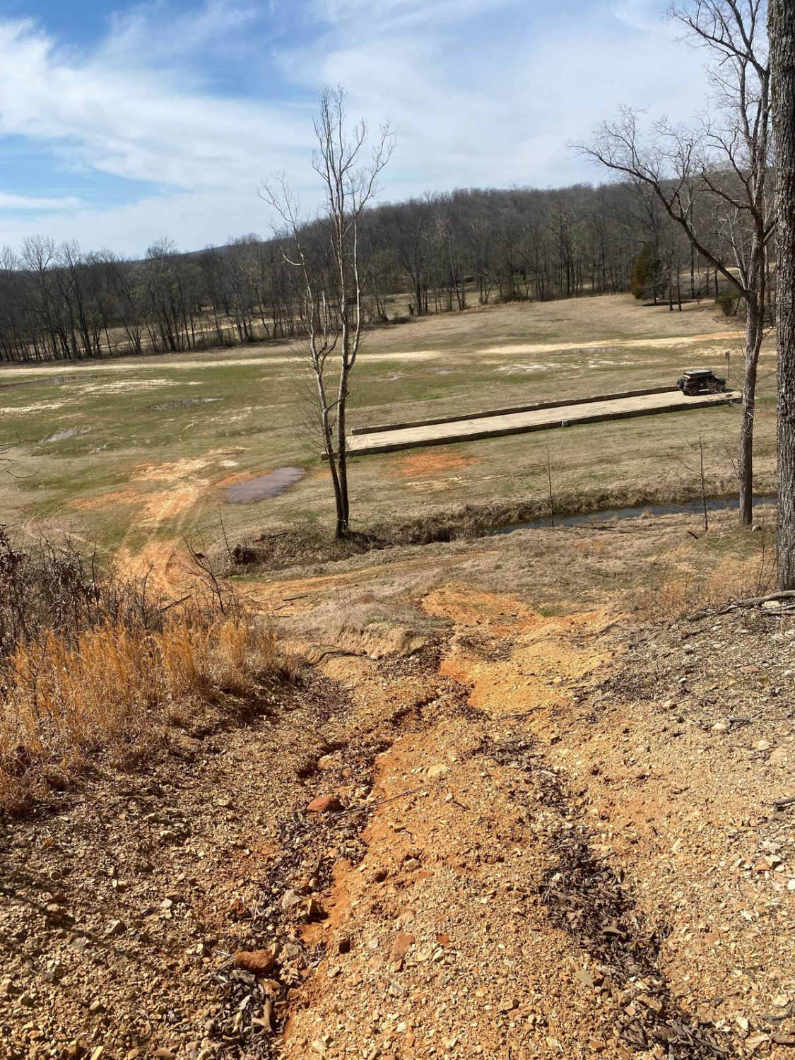
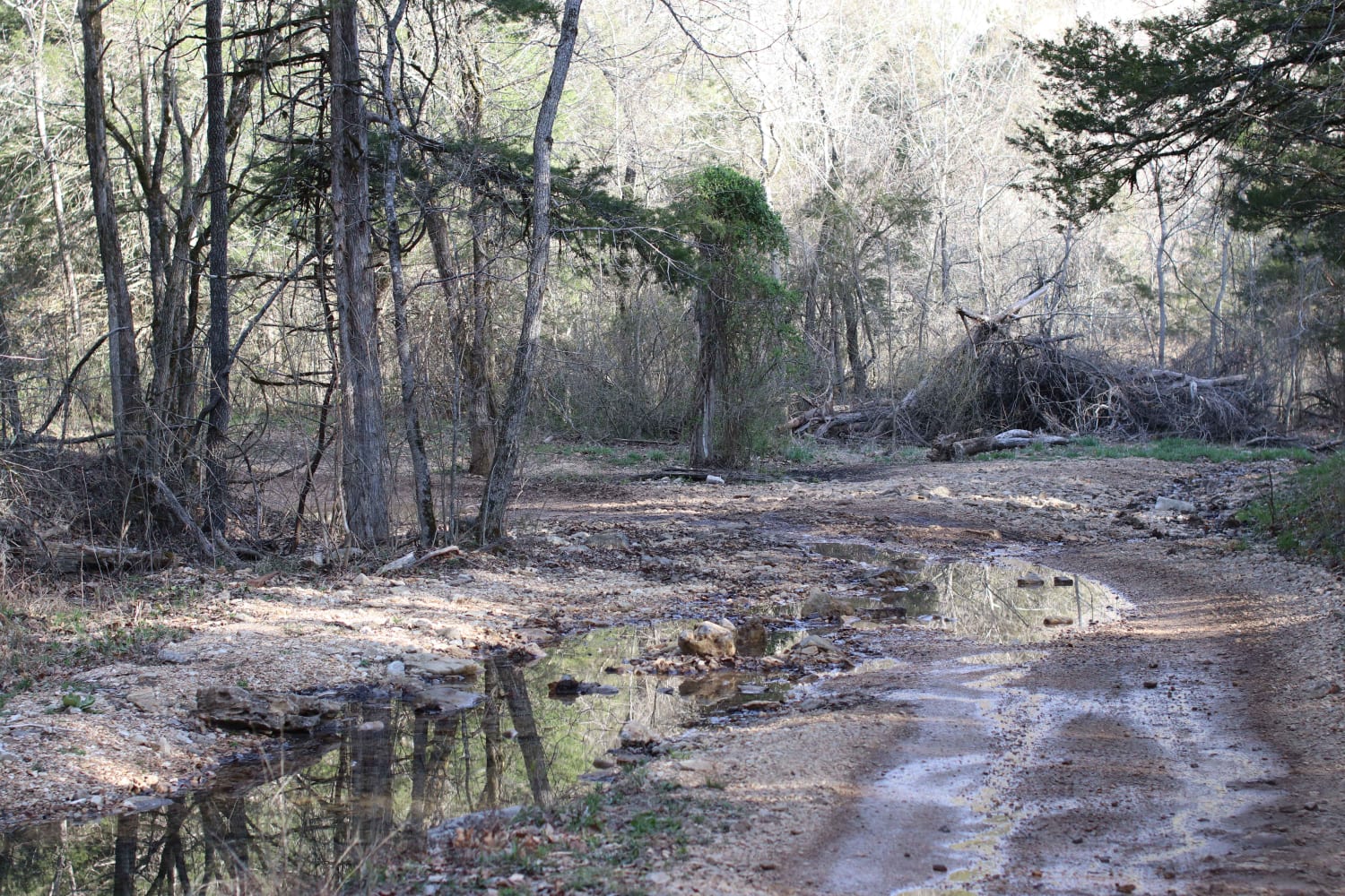
Timber Lane Spur B, FS 2514B, or simply Timberlane Lake, is a coarse gravel road within the Pigeon Roost Road area of the Potosi Unit of Mark Twain National Forest. The track starts at the ridge top that the FS 2514 follows, quickly dropping downhill towards Timberlane Lake, traversing mild erosion and natural rock sticking out of the surface. It ends at a little turnaround site and boat ramp at the lake's edge, a couple of rock fire rings are also present at this location. Ultimately drivers have to turn around and head back to the FS 2514 to exit. A quaint little spot, probably known and loved by few, but is very well kept, join the few in preserving it for others to visit and enjoy as well.
Photos of Timber Lane Spur B - FS 2514B


Difficulty
The FS 2514 Spur B is given a 2/10 base rating for the steep grade downhill to the ramps, featuring loose (up to 4") cobbles in the road's path, natural rocks sticking out at the surface, and mild active erosion crossing the road on the steep grade. 4WD is desirable to go uphill or get turned around at the ramp. Outside of this, expect all the normal gravel road complications in potholes, washboards, and mounding of the gravel.
History
In the 1945 and 1949 historical topo maps of the surrounding Berryman, MO area, it observed that a road used to run down in the bottom of the valley that Timberlane Lake now rests in, due to the area being plentiful in lead ore, and industry striking up rapidly when the ore was found, it is likely the valley was once striped and used as a lead mining operation. This is backed by the Forest Service disclaiming that fishing and consuming large sums of fish from this lake could result in mild forms of lead poisoning. The Timberlane Lake dam was completed in 1959, yet in research, the lake didn't show on historic topo maps until the 1978 edition of the Berryman, MO area. The 1949 Rolla, MO topo map also suggests that this area was once part of the Clark National Forest, rather than the now-known Mark Twain National Forest. In an odd, yet repetitive fashion, the Forest Service has a way of misnaming things in the most subtle ways, with the reasoning being unknown, the FS calls this road Timber Lane Spur B, despite the lake being known as Timberlane Lake.
Status Reports
Timber Lane Spur B - FS 2514B can be accessed by the following ride types:
- High-Clearance 4x4
- SUV
Timber Lane Spur B - FS 2514B Map
Popular Trails
Commitment Hill Climb 6
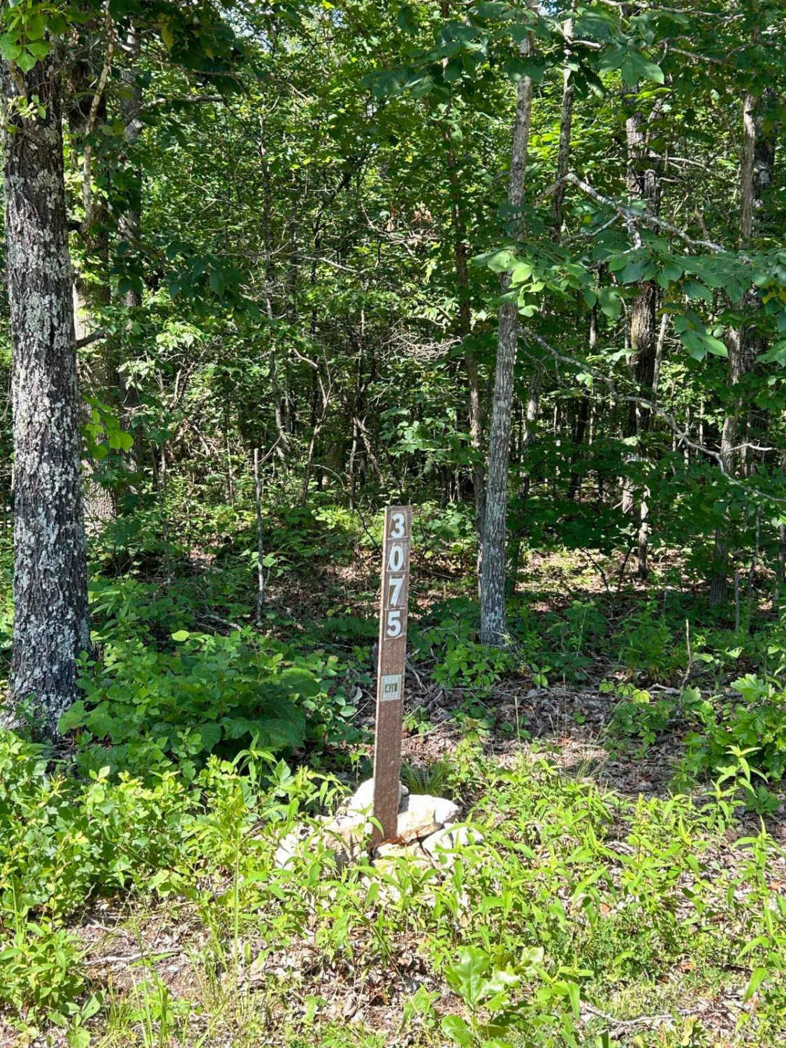
Kelly Ridge- FSR 3075

Pointed Rock
Lookout Road
The onX Offroad Difference
onX Offroad combines trail photos, descriptions, difficulty ratings, width restrictions, seasonality, and more in a user-friendly interface. Available on all devices, with offline access and full compatibility with CarPlay and Android Auto. Discover what you’re missing today!