Spool Ridge Trail
Total Miles
1.9
Technical Rating
Best Time
Spring, Summer, Fall, Winter
Trail Type
Full-Width Road
Accessible By
Trail Overview
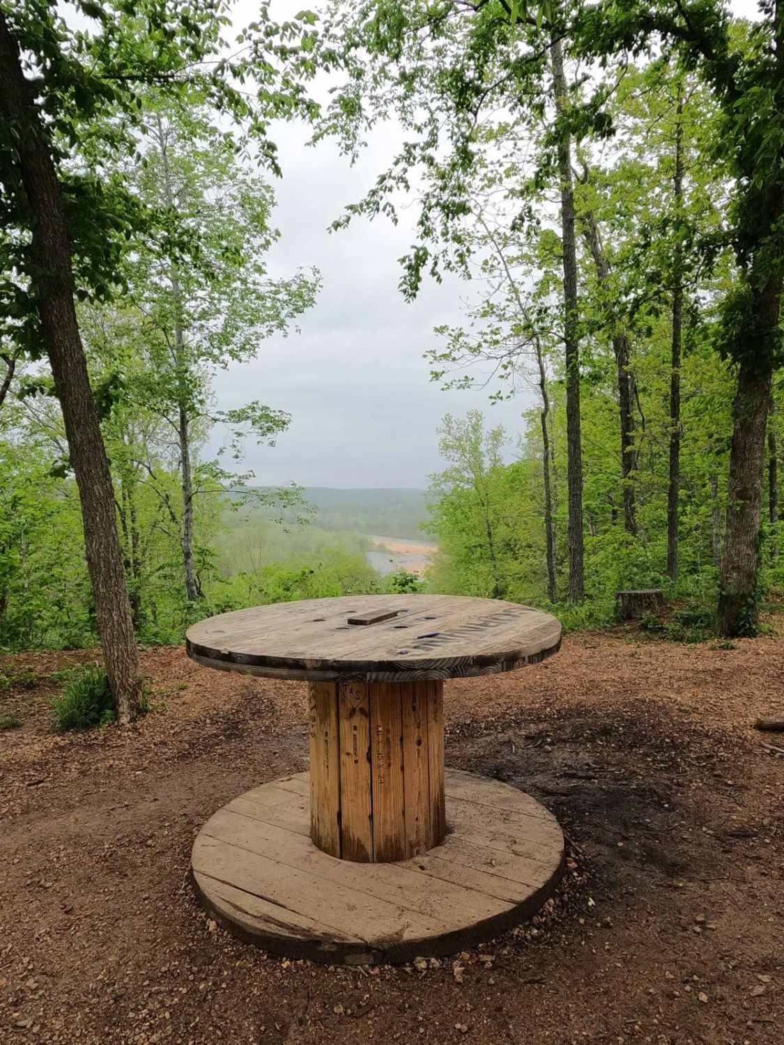
Spool Ridge Trail, or simply The Spool Trail, is a natural dirt/coarse gravel and small rock trail through the north center portion of the Black River Bottoms area within the Clearwater Lake U.S. Army Corps of Engineer Land. The Spool Trail rides ridge tops overlooking the Black River below, tracking down the hillside to the river level in the valley south of the ridge, featuring a dirt-based road with natural rock at the surface, loose coarse gravel, and cobbles scattered throughout the track. Expected thrills include hard-bottomed water collection holes on the ridge, rutting and loose terrain on the grades, soft red clay, and muddy sections near the valley and the Central Bluffs Trail. Even at a moderate and higher flood stage level (8 feet+ of the river depth via the Annapolis gauge) when the valley bottoms begin to flood, the Spool Ridge Trail is always available and open when approached from the ridges to the north. The trail features a few landmarks, the most notable being the electric spool the trail gets its name from at 37.28561, -90.77044. On the ridge top overlooking the Black River to the northwest for 1.5 miles, there is also the "Trails End" rock house found at the bottom of the main hill of the trail at 37.27374, -90.77941. A nostalgic trail showing the character, history, and dynamics of the highs and lows in the area, don't leave the Black River Bottoms without seeing the spool overlook at some point.
Photos of Spool Ridge Trail
Difficulty
The Spool Ridge Trail is mostly dirt and loose coarse gravel-based trail. The difficulty is mild but is found in the easy 6 to 12-inch depth of the hard-bottomed water holes in the ridge tops, and the spread of loose 4- to 10-inch rock cobbles, hard natural rocks, and large tree roots sticking out at the surface level up to 12 inches, creating small obstacles--easily earning a 3/10 rating. The biggest spots to note giving the 4/10 rating to the trail are the heavy erosion rutting at the bottom of the main grade of the trail yielding a solid 18-inch depth to navigate and cross, the bottoms of which can be soft mud and wet. The second 4/10 rating point is at the south entry of the trail, where there is a V-notched rut with heavy mud on a hard corner, requiring precise tire placement, straddling the rut with the high potential to slide in. The trail can yield an easier rating when the graded section gets mended after heavy use, or when the area gets dry in deep summer. The difficulty can also increase after heavy use, overly wet seasons, or rainy conditions, and could be closed on the southern end of the trail at a moderate and higher flood stage. If so, don't enter the flood zone, as the flooded water section would become unpredictable and reshaped by the water.
History
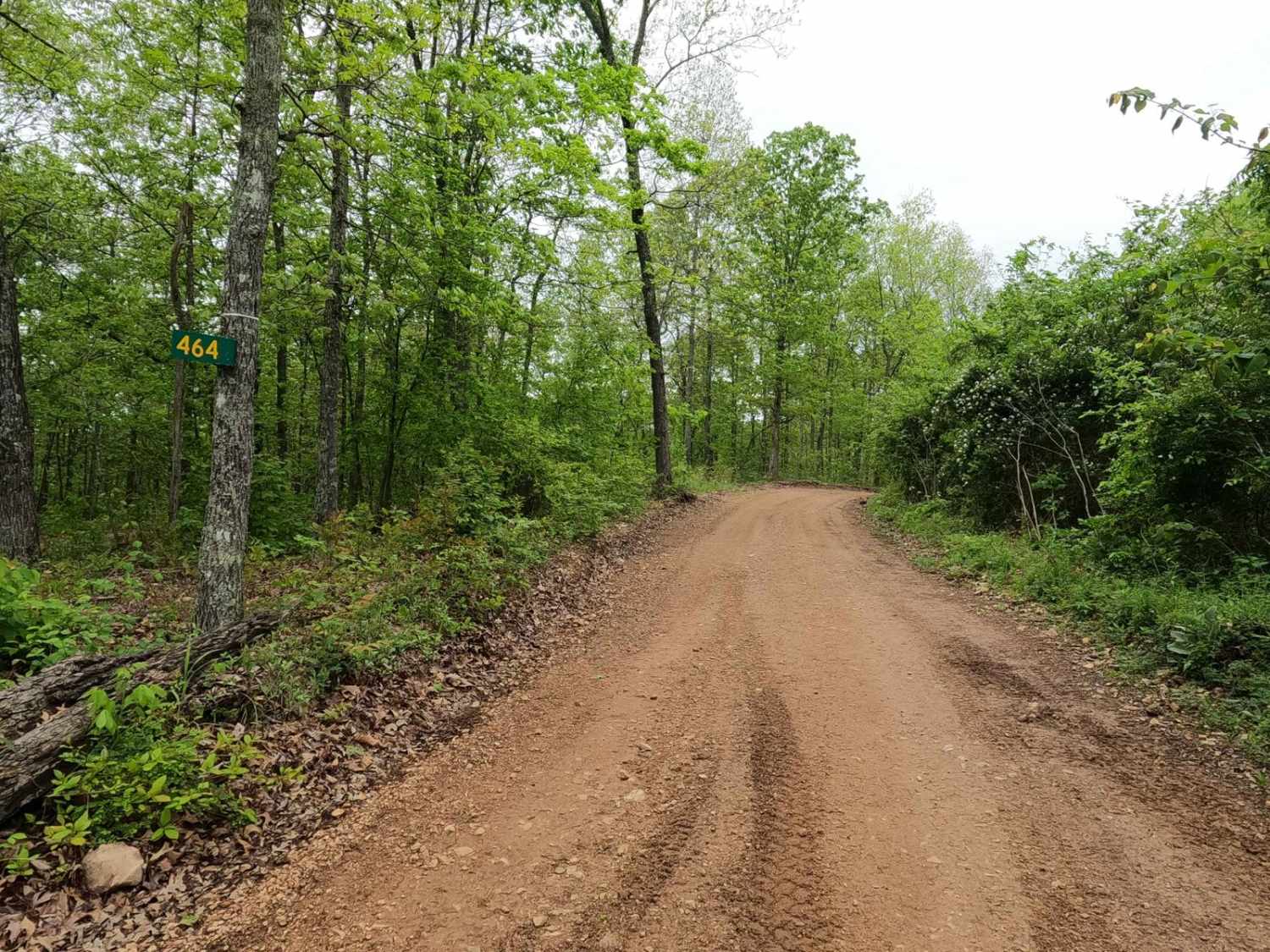
Historically this is part of the Reynolds County 464 and features access to several privately owned plots of land along side the Corps land. This includes the Avery family's "Trails End" house found at the bottom of the main hill (37.27374, -90.77941). In the steps of the remaining concrete porch ruins, you can see rock pebbles forming letters and the words/names, "Trails End", "Avery", "Ann", and "Tommy". The history surrounding the bottoms is one of fighting for public access. This is an example where the presence and public use of Reynolds County Roads 464, 462, 460, 458, 456, 446A, and more have been the driving force keeping these trails open. Locals refuse to let their historic roads be taken away, yielding a place we all can enjoy and use. Please do your part in keeping this place alive; pack it in/pack it out, follow the green and red route markers as marked, and don't drive in the Black River or form new trails.
Status Reports
Spool Ridge Trail can be accessed by the following ride types:
- High-Clearance 4x4
- SUV
- SxS (60")
- ATV (50")
- Dirt Bike
Spool Ridge Trail Map
Popular Trails

Little Gravois Creek South Trail #2

Upper Field Woodlands Trail

Logging Trail #3
The onX Offroad Difference
onX Offroad combines trail photos, descriptions, difficulty ratings, width restrictions, seasonality, and more in a user-friendly interface. Available on all devices, with offline access and full compatibility with CarPlay and Android Auto. Discover what you’re missing today!