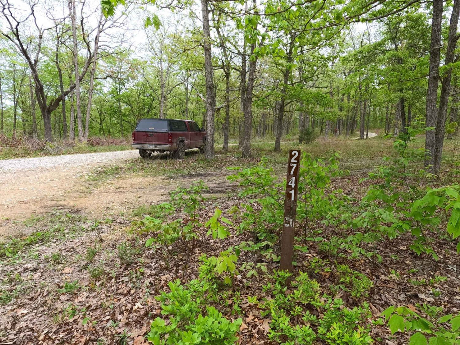
James Branch - FS 2741
Total Miles
1.8
Technical Rating
Best Time
Spring, Summer, Fall, Winter
Trail Type
Full-Width Road
Accessible By
Trail Overview
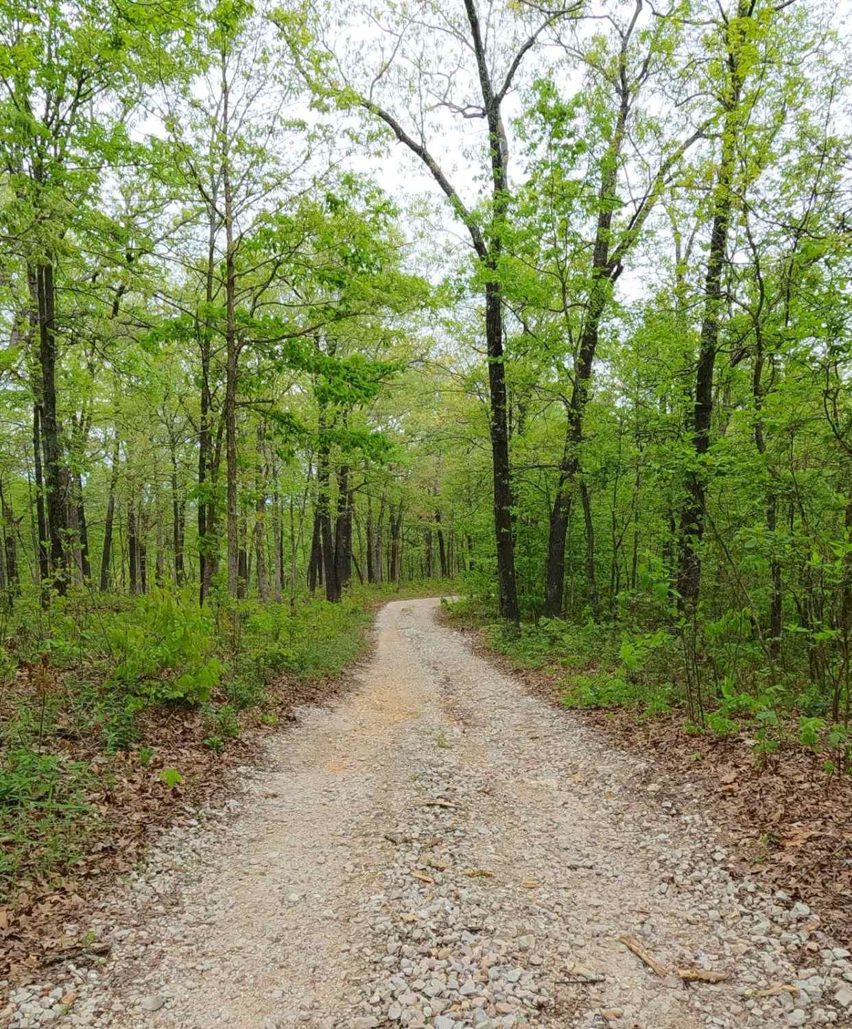
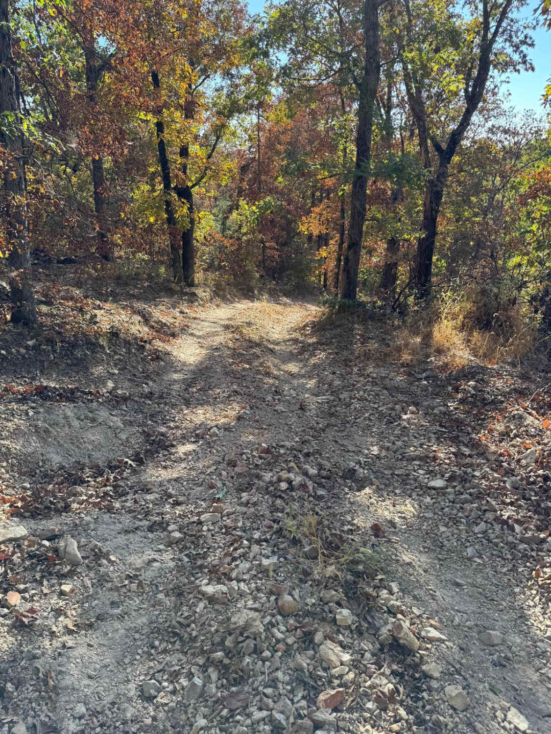
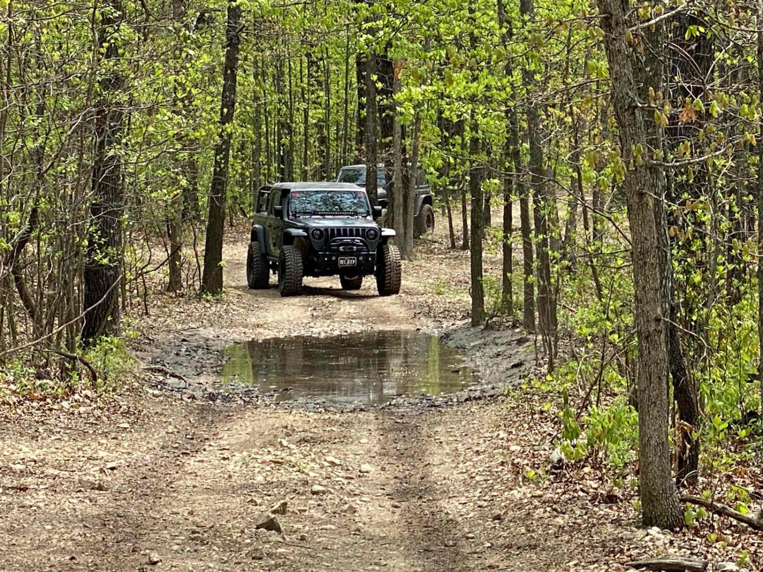
James Branch FS 2741 is a gravel forest road, leaning natural-improved in spots, within the Salem Unit of Mark Twain National Forest. James Branch shows its popularity right from where it comes off the Crooked Tower road, having a large dispersed camp at its entry, with the road being the northern perimeter of said camp, taking off as the main thoroughfare to disperse the likely hunters that frequent this road. The overall lay of the road from entry to dead end is a slow ride downhill, showing signs that water washing repair has been done with fresh gravel being brought in. Eventually, the track parallels an intertwined tree line and fence row dividing the road from large open fields to the northeast of its path. After this, the road crosses the valley bottom, passing a small fire ring camp right next to the James Branch low water crossing. The track then climbs a mild grade back uphill, passing an open gate, crossing decent water-washed eroded dirt ruts, before leveling out quickly on what turns out to be a man-made levee, with swamps on the left, and a drop off to the valley on the right. This levee leads to the point of interest, Lost Lake, just 150 feet past the boulders of the turnaround loop, it quickly defines itself. The levee that held this lake failed, and the lake was lost as a result. The former lakebed has sparse growth of trees, rather grows plenty of dense wet soil foliage, and overall is a swamp-like meadow, with the James Branch flowing through like nothing ever had contained it. Where James Branch broke the levee, an exposed drainage pipe lies in ruin, once installed to regulate the lake water level. From this levee, the water flows east to lead to the low water crossing used just before the levee section of the trail. Well, look no further, you've found Lost Lake, but for more details, look into this trail's History section. "Roulons".
Photos of James Branch - FS 2741
Difficulty
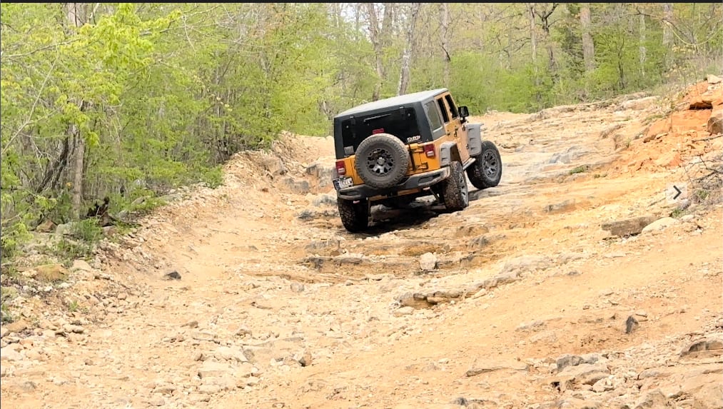
James Branch is given a bass rating of 2/10 for water crossing, having a depth of 6 inches, surface mud, water collection holes, dirt eroded ruts, over mildly graded hills, all within the 12 inches or less 2/10 rating criteria. This was observed during documentation on 4/2025. Difficulty can increase in seasons of wet conditions and heavy rain. Be prepared for deeper water at the James Branch crossing and in the water collection holes, as well as the surface soil being wet at the natural leaning parts of the trail, or difficulty can also decrease if the road were to be mended, or if it is completely dried out in deep summer.
History
The destination of the James Branch FS 2741 leads to what is historically known as Chandler Hollow, the valley's name, and more recently, Lost Lake, of which the name alludes to its current status, being a former lake lost to dam failure, with only the James Branch creek running through it now. Seemingly a mystery on the surface as to why a lake was built, then only to be destroyed by dam/levee failure, but when looking at the levee's shear size, it doesn't seem possible that it could fail with such a small body of water behind it especially with spillway pipes built into the levee to keep it at bay. So my research began, when looking at old maps searching for the answer, a 1967 West Viburnum, MO topo map gave the first piece to the puzzle, showing a black dashed line illustrating "Old Railroad Grade" going through the Chandler Hollow valley on the north side of Lost Lake. Is this it? My first conclusion, perhaps the dam/levee was built to avoid any major grade change for the train tracks, but ultimately had to cut right through James Branch creek? Digging for more research, to find that the train used a bridge/trestle to cross James Branch creek, but with no clarity as to how long the trestle was. Regardless, this is history related to the FS Road, even though it doesn't directly mention the Dam/Levee, or Lake. So let's figure out what railroad this was, when it existed, and where it went.. And nothing pops up searching keywords Dillard or Crawford County Railroad, so I begin to doubt I will find anything more than what the old topo maps had to offer, but let's try a more modern map.. Upon digging into OnX Offroad's hybrid map, it comes in clutch, having the name of the Dam on the map, "Mononame 352 Dam". This was then researched via a "popular search engine" to find another name right alongside "Mononame 352 Dam" on their webmap, being "Sligo & Eastern Railroad Trestle," both pinned along the modern Lost Lake. Now we are cooking, there is now a name to search for both the dam and the railway line. The Sligo & Eastern Line ran from the western start at a stop called Goltra, midway on the Frisco-owned line that connected Salem to Steelville, Missouri, first stop going eastward was Sligo, passing through Chandler Hollow, to the stops at Dillard, Viburnum, Bixby, and lastly Roulon, what eventually became East End, MO as this is what the rail line workers called it. The word "Roulons" in French translates to "Let's Ride", fitting. Sligo, Missouri, is where the railroad transported iron ore, to then be smelted and refined in a furnace. Sligo existed from the late 1880s (its post office being established in 1886) to 1922, when the Sligo Iron Works company folded. At this pivotal point of 1922, Sligo's population of 4000 collapsed near overnight due to the iron ore drying up, the railroad soon met a similar demise, with the tracks laying for years until the 1930s when they were torn up and scraped, except the many trestles used along the rails track, including the one at Chandler Hollow, we'll get back to that one soon. After the 1930s, parts of the former rail bed and grade became stretches of what is now Missouri Route 49 between Dillard to Viburnum to Bixby, and Missouri Route 32 from Bixby to East End. Eventually, in Viburnum, the Frisco Line acquired other parts of the old rail bed in 1967 and reused it for the new Lead Line. This moves us into the Lost Lake era. Once the "Mononame 352 Dam" name was used, research yielded data and photo-rich context to the history of Lost Lake. In 1970 the local community had completed the 26-foot-tall Dam utilizing (now confirmed at this point in my research) the original long levee made of mining soil, slag, and earth with a relatively short Sligo & Eastern Rail Trestle made of whatever log and lumber the rail workers could find, now converted to hold back a fisherman's dream fishing hole, being 9 acre in surface size, 125 acre-feet of water max capacity, with it on average being around 83 acre-feet of water capacity. The locals used it as a hidden recreational fishing hole, as well as to fulfill the needs of water along the way to the Huzzah, and overall ecological sustainability, with it covering a drainage area of 314 square miles. Ultimately, the 352 Dam remained intact for 45 years, practically built around what the railroad left behind, until on March 15, 2016, a slide was reported on the downstream eastern side of the Trestle structure of the discharge zone, deemed non-failure at this point. Fast forward to May of 2018, looming and consistent rain showers pelted the region, filling the Lake to its failure limit, to which the unleashed water took the current fish population on a swift 2-plus-mile ride to the Huzzah Creek, somehow avoiding any human life. After this, local Forest Service agents surveying the remains of the Dam sourced the failure point, water forcing its way along what appeared to be burnt pier of the original trestle, eventually forming a void in the dam and with water bypassing the drain pipes leading to the slide and eventual failure. These same Forest Service agents also witnessed beavers trying to make their own dam at the same location as the trestle, able to hold some water back for a time, but ultimately the beaver dam failed too. Thus, "Mononame 352 Dam Lake" or "Railroad Lake" became "Lost Lake", now a swamp-like wetland full of lush wet soil plants growing, with few small trees being resilient enough to take root, right along side James Branch now making a winding little pathway, etching its way through the old lake bed to the blown Dam, where the old discharge pipe lies exposed in the bottom. This story is that of nature reclaiming its old identity, in this case, as James Branch Creek running through Chandler Hollow. Will the Lake and Dam be rebuilt? Only time will tell, but as of 4/2025, James Branch Creek is wild and free. Documentation done by Christopher Menz - Missourian OnX Expert Trail Guide 6/2025.
Status Reports
James Branch - FS 2741 can be accessed by the following ride types:
- High-Clearance 4x4
- SUV
James Branch - FS 2741 Map
Popular Trails
Power Wagon Trail 75
High Mountain Road

The onX Offroad Difference
onX Offroad combines trail photos, descriptions, difficulty ratings, width restrictions, seasonality, and more in a user-friendly interface. Available on all devices, with offline access and full compatibility with CarPlay and Android Auto. Discover what you’re missing today!