Solana Loop
Total Miles
13.2
Technical Rating
Best Time
Spring, Summer, Fall
Trail Type
60" Trail
Accessible By
Trail Overview
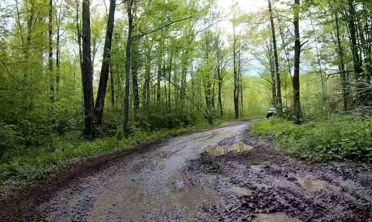
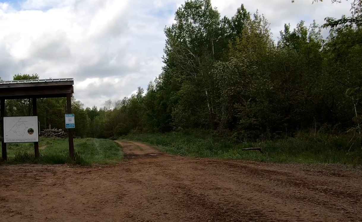
The Solana Loop has roughly 15 miles of rideable trail with the main loop being about 14 miles. The trail also provides access to the Solana State Forest, which includes an additional 25+ miles of trail. The Solana Loop provides a mostly level ride through the forest with occasional rolling hills. The trail is located between the communities of Isle and Moose Lake, both of which provide opportunities to refuel the body and machine. The Solana Loop is primarily comprised of packed dirt with some embedded rock. The trail is 8-10 feet wide, allowing for bidirectional traffic to pass with care. As with most trails in the region, the trail will be muddy after inclement weather with standing water present in low-lying areas of the trail. There are a couple of wooden bridges missing railings, be sure to slow down when crossing. The trail can be accessed from several different points to include the Soo Line Trails, Giese Forest Road, and Herubin Forest Road. The trail can be run in either direction and is open to Class I and II ATVs as well as OHM vehicles. The trail network is part of the Minnesota Department of Natural Resource managed areas, and the network is maintained by the White Pine Riders ATV Club. Established in 2004, the club's goal is to provide ATV training and maintenance of the local trails. The club is based out of McGrath. Expect lots of water and mud in the May/June timeframe and dusty dry trails in the early fall before seasonal rains begin. The trail is normally open from 15 May to 31 October for wheeled off-roading. OHV riding in Minnesota requires either a vehicle registered with the state or the purchase of a non-resident OHV state trail pass. Food and fuel can be found to the south along the Soo Line in Isle or Moose Lake. The trail is rated easy to moderately difficult by the Minnesota Department of Natural Resources.
Photos of Solana Loop
Difficulty
Mostly level, moderately rated trail. Parts of trail are narrow and tightly treelined. Standing water is possible in low areas.
Status Reports
Solana Loop can be accessed by the following ride types:
- SxS (60")
- ATV (50")
- Dirt Bike
Solana Loop Map
Popular Trails
Gandy Dancer Trail

Richards Drive Northeast

Parking & Wash Road

Cadotte Lake
The onX Offroad Difference
onX Offroad combines trail photos, descriptions, difficulty ratings, width restrictions, seasonality, and more in a user-friendly interface. Available on all devices, with offline access and full compatibility with CarPlay and Android Auto. Discover what you’re missing today!