Forest Service Road 90221
Total Miles
2.3
Technical Rating
Best Time
Spring, Summer, Fall, Winter
Trail Type
Full-Width Road
Accessible By
Trail Overview
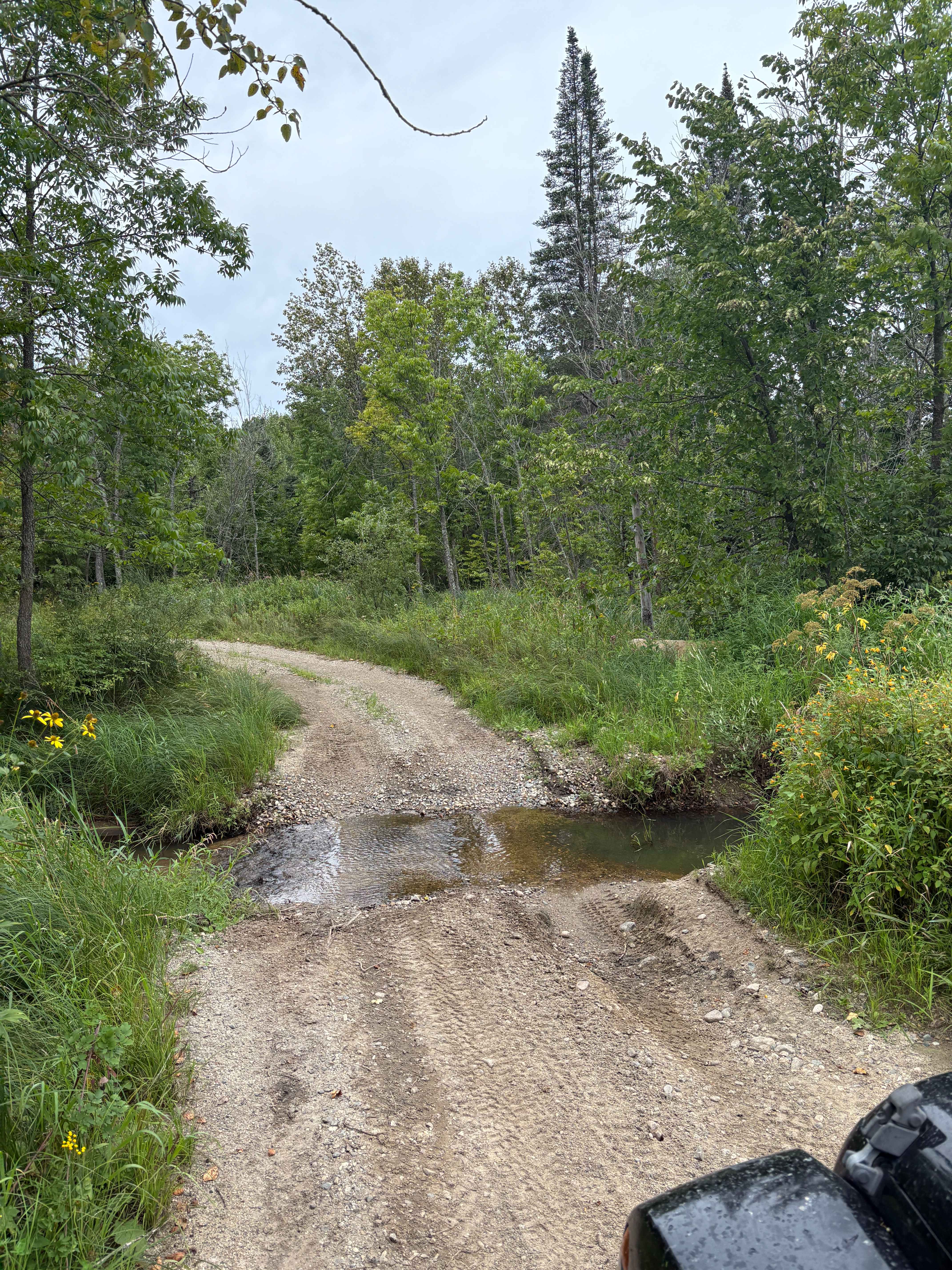
This trail begins at Tomahawk Trail and eventually connects with the Prospectors Trail. It is unmaintained and follows a two-track route through a scenic stretch of pine forest. The trail is mostly gravel, but it's rough and eroded in places, with off-camber sections and occasional rocky patches that require attention while driving. Early on, there is a small bridge crossing; drivers should approach with care due to a noticeable drop-off at the end of the bridge deck. The route continues with a series of moderate ascents and descents as it winds through the woods. The rest of the route is relatively straight and eventually ends at a narrower ATV-only path, despite a sign at the trailhead stating that ATVs are not permitted. It appears that ATV traffic is expected to access the area via Trail 1472 instead. There are no formal campsites or facilities along this trail, and like many areas in the Superior National Forest, it lacks restrooms, potable water, and trash disposal. Dispersed camping is typically permitted outside the Boundary Waters Canoe Area Wilderness, but it's advisable to verify current regulations with the Forest Service.
Photos of Forest Service Road 90221


Difficulty
This forested route is lightly maintained and typically sees use during peak seasons. Expect occasional fallen limbs, narrowing sections from plant growth, and minor obstacles.
Status Reports
Forest Service Road 90221 can be accessed by the following ride types:
- High-Clearance 4x4
- SUV
- SxS (60")
- ATV (50")
- Dirt Bike
Forest Service Road 90221 Map
Popular Trails
Old Many Point Trail

Fall River Spur E


Powers Lake
The onX Offroad Difference
onX Offroad combines trail photos, descriptions, difficulty ratings, width restrictions, seasonality, and more in a user-friendly interface. Available on all devices, with offline access and full compatibility with CarPlay and Android Auto. Discover what you’re missing today!