Breda Road
Total Miles
3.7
Technical Rating
Best Time
Fall, Winter, Summer, Spring
Trail Type
Full-Width Road
Accessible By
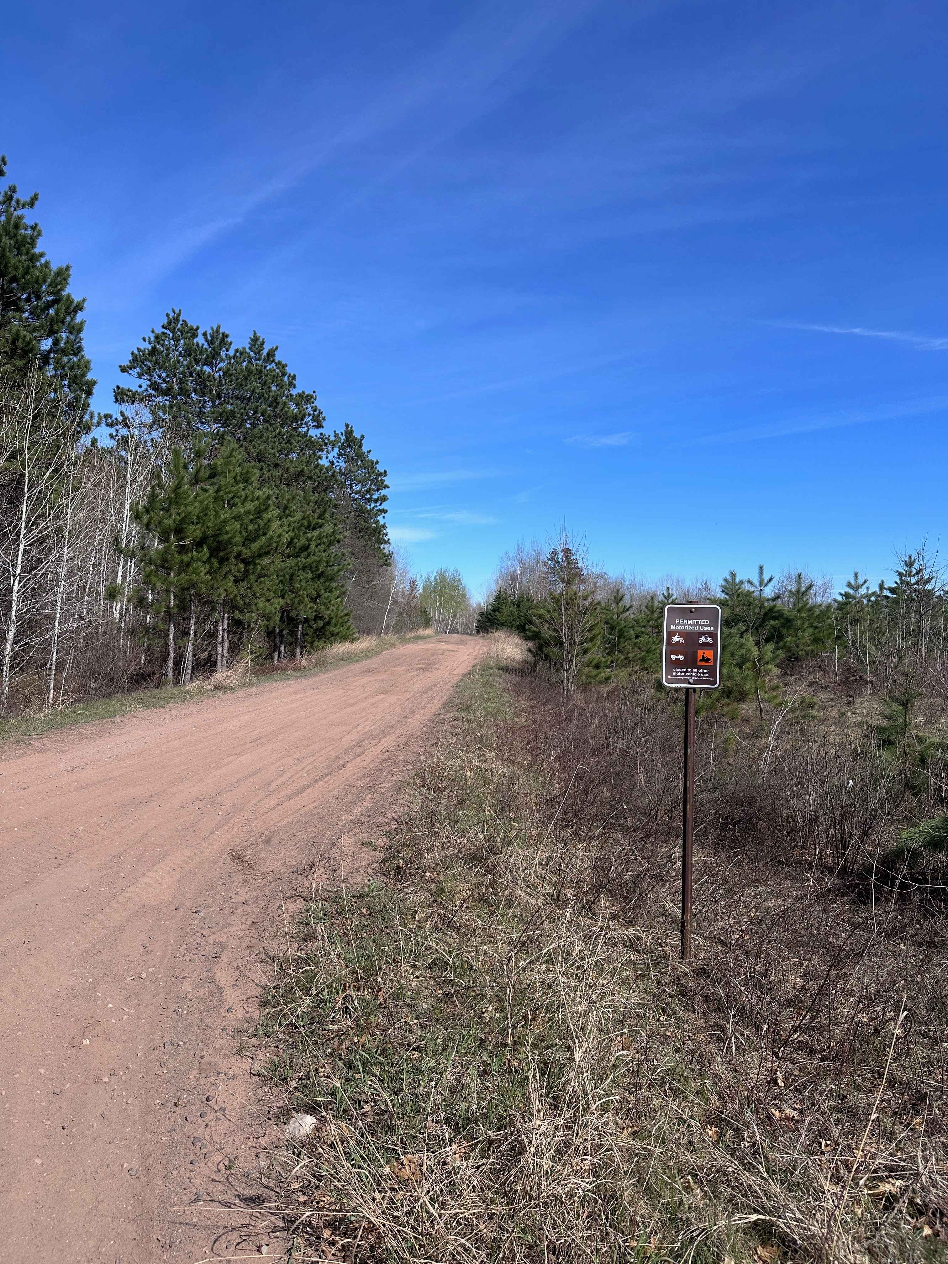
Trail Overview
This narrow but well-kept trail begins at paved Highway 44 and continues through forested terrain until it reaches a set of railway tracks. Along the way, numerous side trails branch off from the main route, though most are blocked by gates or chains, restricting access. The first half of the route is officially designated as Minimally Maintained, but the surface is surprisingly smooth and easy to navigate. After crossing the railway tracks, the character of the trail changes noticeably. It becomes narrower, with tighter curves, muddy patches, and more uneven terrain. Near the end of the route, a small dispersed campsite can be found, identifiable by an old fire ring, although it appears to have seen little recent use. At the trailhead, a privately placed sign reads, "Protect Deer, Not Wolves," a reference to the estimated 300 to 400 wolves that inhabit the Superior National Forest. While there are no formal campgrounds along this trail, dispersed camping is generally permitted in the Superior National Forest outside the Boundary Waters Canoe Area Wilderness. However, it is recommended to confirm with local authorities before setting up camp. The trail offers no services, including restrooms, water sources, or trash facilities, and cell coverage may be unreliable or nonexistent. Campers should be prepared and follow Leave No Trace principles during their stay.
Photos of Breda Road


Difficulty
This forest trail is well-maintained and used daily by residents and adventurers. The route is wide and clear of debris, with established tread and minimal overgrowth--ideal for a smooth and scenic ride or hike.
History
Superior National Forest, established in 1909, covers over 3 million acres of rugged boreal forest in northeastern Minnesota. While much of the forest is protected wilderness, designated areas offer incredible OHV and multi-use trail opportunities, especially outside the Boundary Waters Canoe Area. Historic logging roads and old mining routes now serve as access points for trail riders, offering a mix of forested paths, rocky sections, and scenic overlooks across the Iron Range and beyond.
Status Reports
Breda Road can be accessed by the following ride types:
- High-Clearance 4x4
- SUV
Breda Road Map
Popular Trails


Trigstead East

Elbow Creek
East Arm Forest Road
The onX Offroad Difference
onX Offroad combines trail photos, descriptions, difficulty ratings, width restrictions, seasonality, and more in a user-friendly interface. Available on all devices, with offline access and full compatibility with CarPlay and Android Auto. Discover what you’re missing today!