2103
Total Miles
6.9
Technical Rating
Best Time
Summer, Fall, Winter, Spring
Trail Type
Full-Width Road
Accessible By
Trail Overview
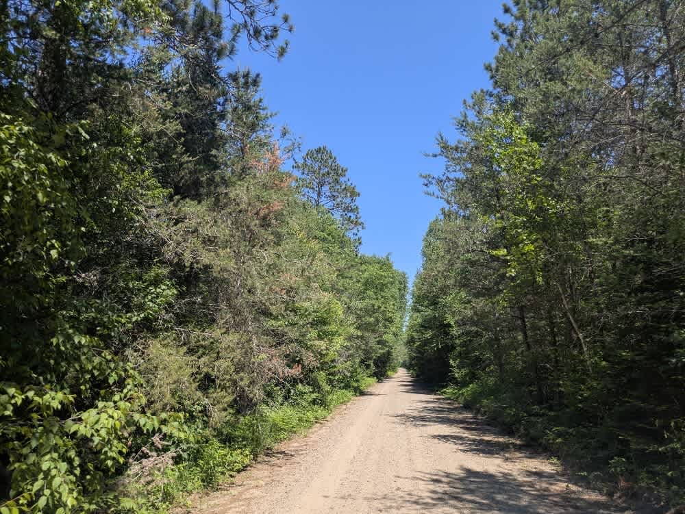
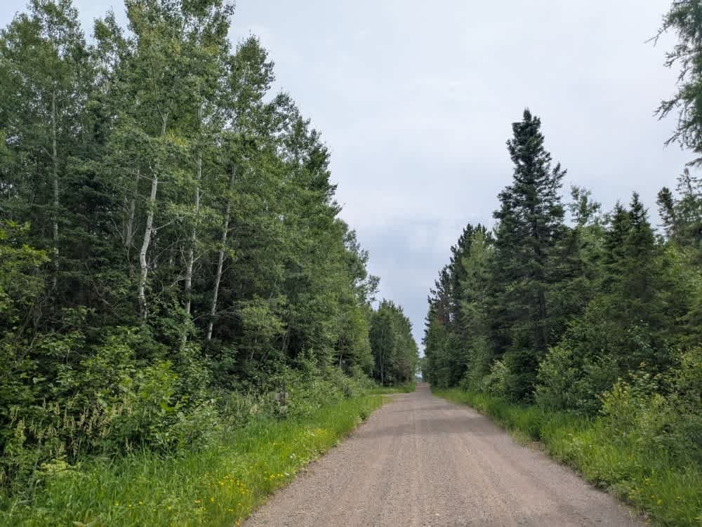
From the south, this trail begins at a large, open parking area with a boat launch located beside a lake bordered by reeds and grass. Prominent signage in the area makes it clear that camping is not permitted, and the presence of a parked ranger vehicle suggests regular patrols. From the launch, the trail enters a narrow forested section before merging with a wider, well-maintained gravel road that runs alongside a lake lined with attractive residential properties. This portion of the trail includes a few gentle curves and sees frequent use, so caution is advised, especially when crossing the single-lane bridge situated along this stretch. The route then transitions into a more open area that has been logged and is now regenerating with young trees. A small wetland borders this segment, and while the road remains smooth, some corrugation is present. The trail continues into a flat, densely forested section before ascending a sandy hill that shows signs of water damage and rutting. After the climb, the trail widens again and undulates over wooded hills with gradual ascents and descents. Toward the end of the route, the trail connects to a paved road and intersects several smaller offshoots, including one designated snowmobile trail that is noticeably narrower, muddier, and more overgrown. There are no designated or informal campsites along this trail, and amenities such as water or waste disposal are absent. Cell service may be unreliable or unavailable in certain areas.
Photos of 2103

Difficulty
This trail is well-maintained and regularly used by OHV users, so be cautious of other off-roaders and adventurers.
History
Covering more than 1.6 million acres of glacial lakes, red-pine uplands, and sphagnum bogs, Minnesota's Chippewa National Forest lets motorists experience the North Woods at an unrushed pace. Paved state highways soon yield to a lattice of numbered forest roads, most of them well-graded gravel that thread between kettle ponds and stands of towering white pine, the tree that helped earn the forest its 1908 designation as one of America's first national forests. The forest harbors one of the highest breeding densities of bald eagles in the continental United States, and patient drivers often glimpse loons, black bears, and white-tailed deer as they move from shoreline to clear-cut regrowth and back again.
Status Reports
2103 can be accessed by the following ride types:
- High-Clearance 4x4
- SUV
- SxS (60")
- ATV (50")
- Dirt Bike
2103 Map
Popular Trails


The onX Offroad Difference
onX Offroad combines trail photos, descriptions, difficulty ratings, width restrictions, seasonality, and more in a user-friendly interface. Available on all devices, with offline access and full compatibility with CarPlay and Android Auto. Discover what you’re missing today!