Honker Lake - FS 177
Total Miles
0.4
Technical Rating
Best Time
Fall, Spring, Summer
Trail Type
Full-Width Road
Accessible By
Trail Overview
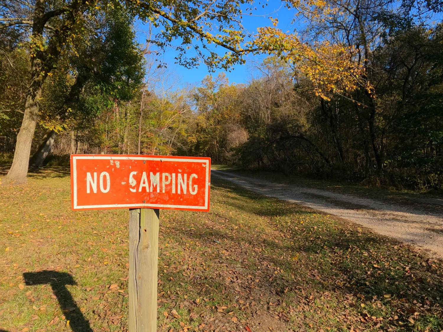
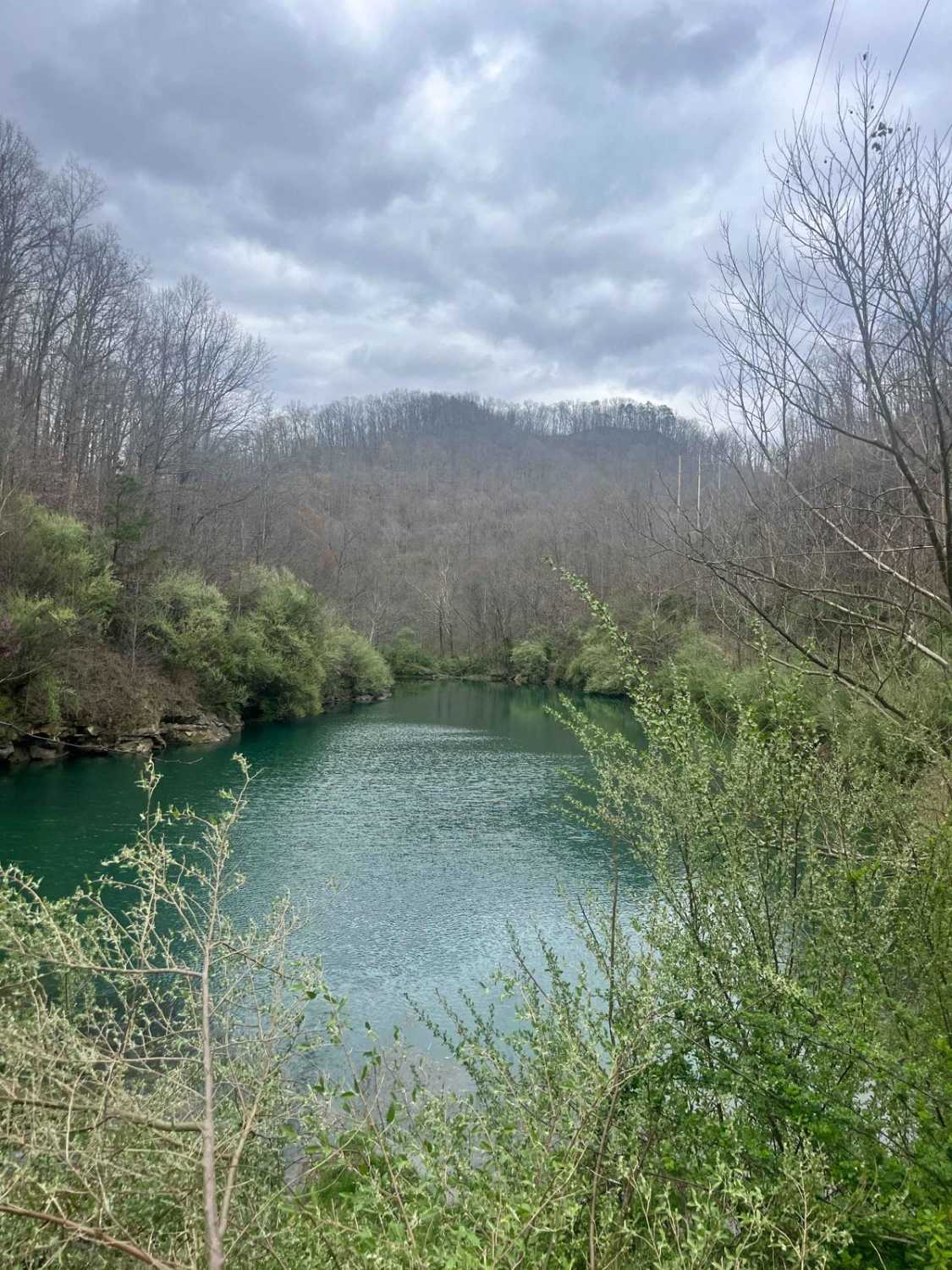
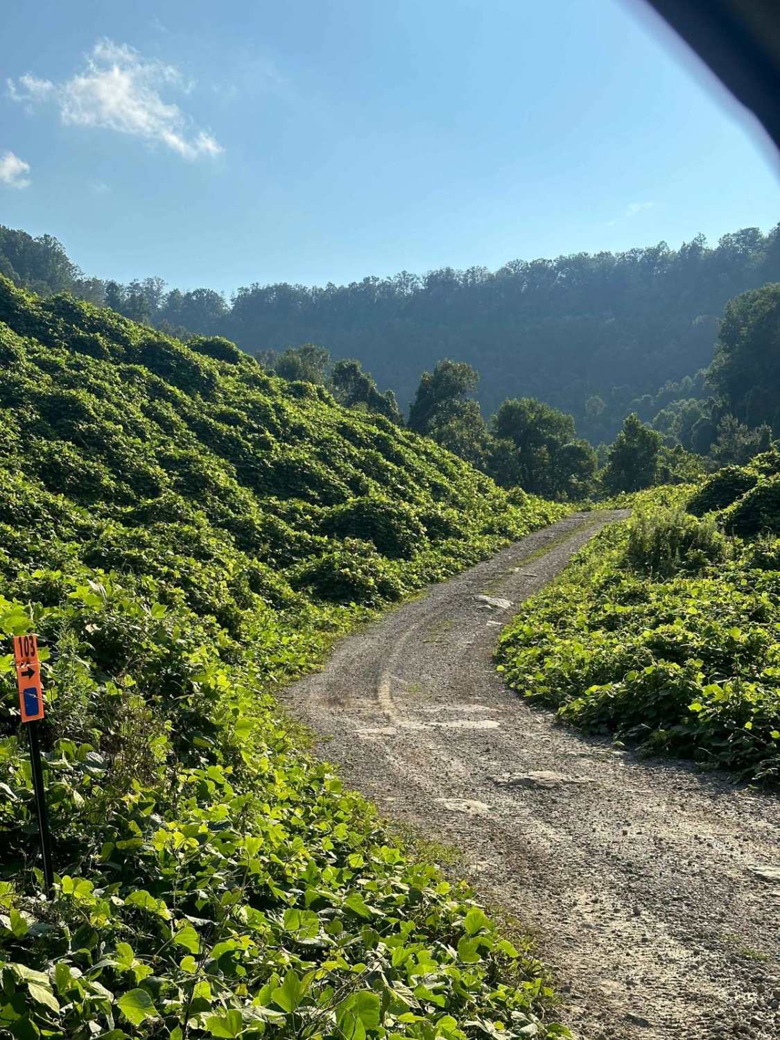
Honker Lake - FS 177 is a gravel forest road through the center-east Kentucky section, Lake Barkley side, of the Land Between the Lakes National Recreation Area. Due to the Wildlife Refuge that exists at the Lake, the road is annually closed to motorized use from 10/31 to 3/15, though it still allows parking on the first 500 feet of the road before the closure gate, foot traffic is allowed year-round. This road is a simple straight stretch that provides access to the point of interest called Honker Lake, the 4.4-mile Honker Lake hiking trail loop, and the boat ramp. The lake itself is a great place to witness nature from the lily pads, and water vegetation, to the wildlife that inhabits this man-made lake, such as beavers and Canadian geese. The road has historical context too, to that of the Center/Hematite Furnace found across the paved road from the FS 177's entry. The ties to the furnace show in the road's surface, which features scattered fragments of slag (rock-like objects of blue glass), this is the byproduct of the iron smelting process that once happened here at the former settlement of Hematite, KY. After slag was pulled from the furnace, it would be shattered and then used as gravel on roads and paths, lasting as such to the present day. A scenic and historical place that would be great to see the sunrise, enjoy a mid-day lunch, use as a meeting point, or to stage vehicles.
Photos of Honker Lake - FS 177

Difficulty
Honker Lake is a simple gravel road. Being generally maintained, it is given a base rating of 1/10, consisting of a flat gravel road with the expected washboards, potholes, mounding of the gravel, and spots where the gravel fades to dirt in between gradings. When documented in 10/2024, there were dried-out hard-bottomed water collection holes, some being repaired previously and others not, it is safe to assume they are usually dry in the summer months, but could feature up to 12" water splashes in Spring and early Fall, leaning into a 2/10 rating in those wet seasons or rainy conditions.
History
Before the lakes (Kentucky, Barkley, or Honker) were created from the Cumberland and Tennessee being dammed up, flooding the lower valleys, the road that is now the FS 177 used to go 2.25 miles east from the current day entry. It concluded at a Watson Cemetery which was located on the western bank of the original Cumberland River channel. This cemetery was roughly located at 36.96506, -88.03076 (now in the middle of Lake Barkley), which is due east of where the FS 138 and FS 138B are now. Honker Lake's history started in the 1930s when a levee was built by the CCC to create a water flow management spot, this levee separated the 180-acre lake from the rest of Honker Bay. Promptly the Canadian Geese took notice of the lake and showed up in droves, giving the lake and bay their unique name, hence, Honker.
Status Reports
Honker Lake - FS 177 can be accessed by the following ride types:
- High-Clearance 4x4
- SUV
Honker Lake - FS 177 Map
Popular Trails
White Oak Branch Raod


DBBB - Green Pond Ridge Road
The onX Offroad Difference
onX Offroad combines trail photos, descriptions, difficulty ratings, width restrictions, seasonality, and more in a user-friendly interface. Available on all devices, with offline access and full compatibility with CarPlay and Android Auto. Discover what you’re missing today!