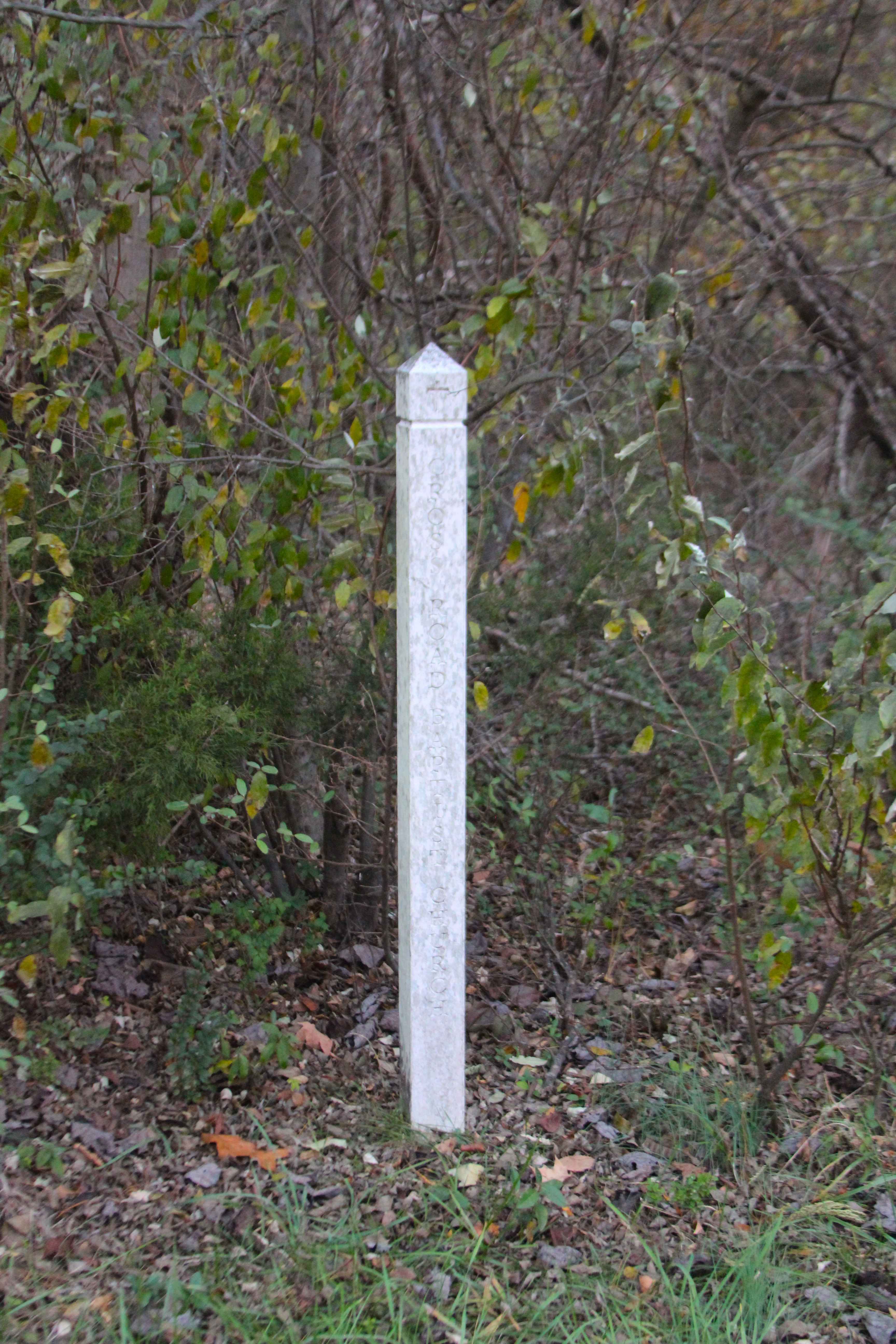
Crossroad Church - FS 123
Total Miles
1.5
Technical Rating
Best Time
Spring, Summer, Fall, Winter
Trail Type
Full-Width Road
Accessible By
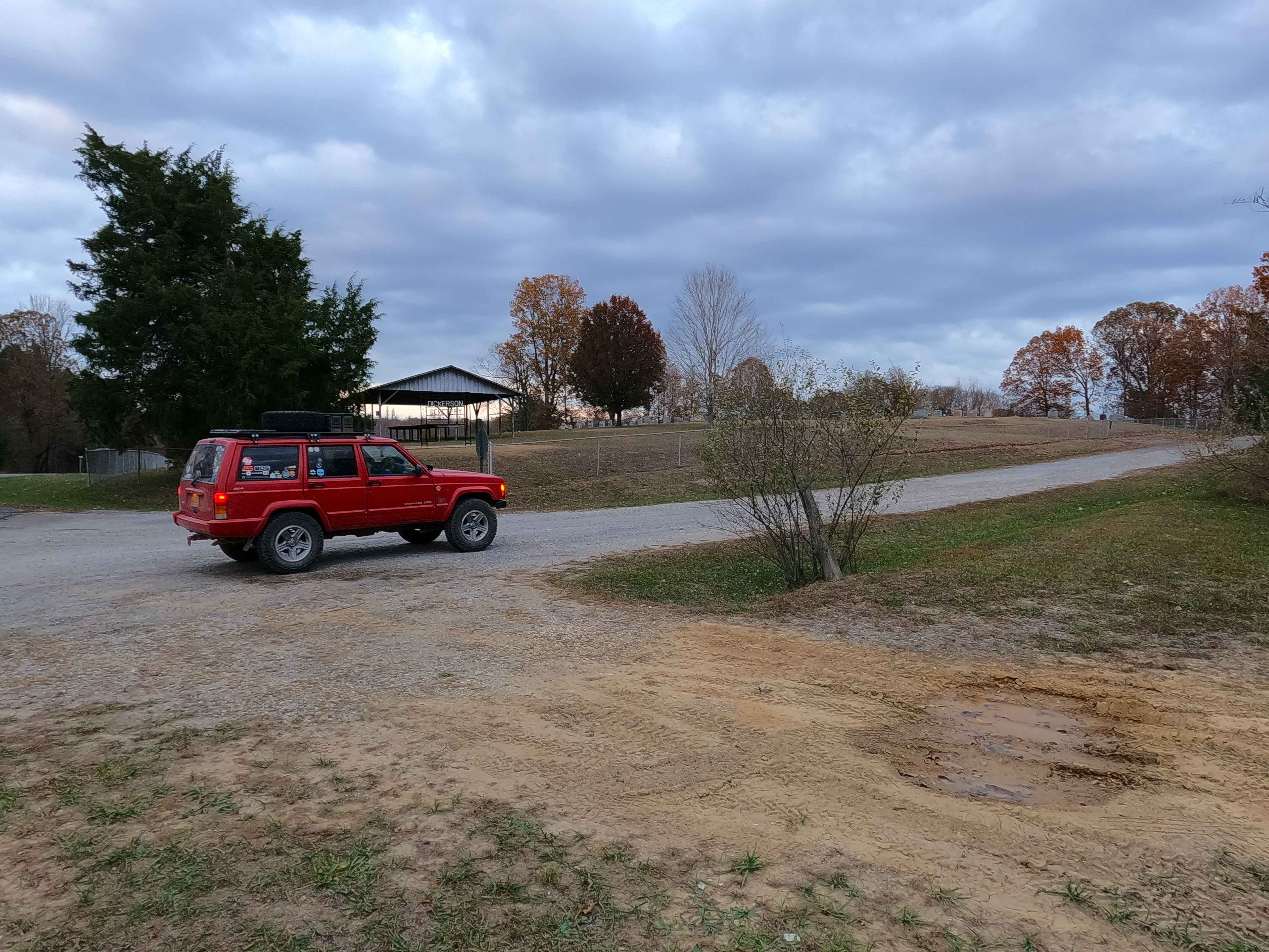
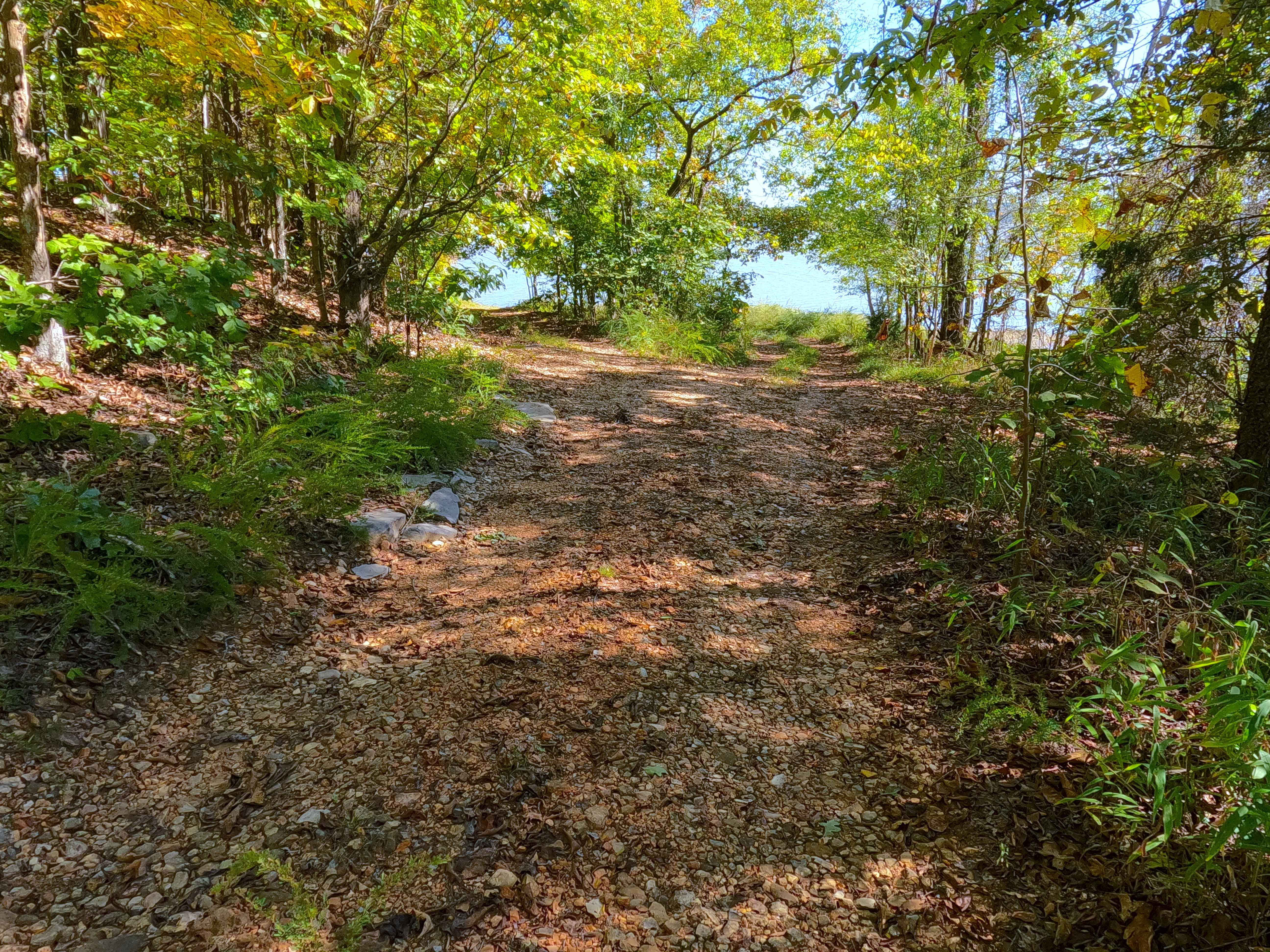
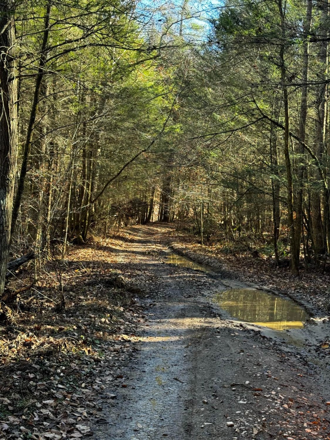
Trail Overview
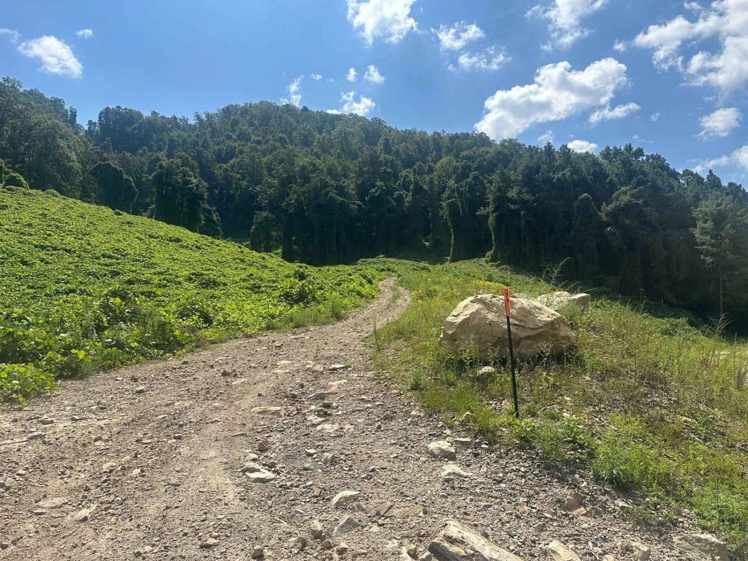
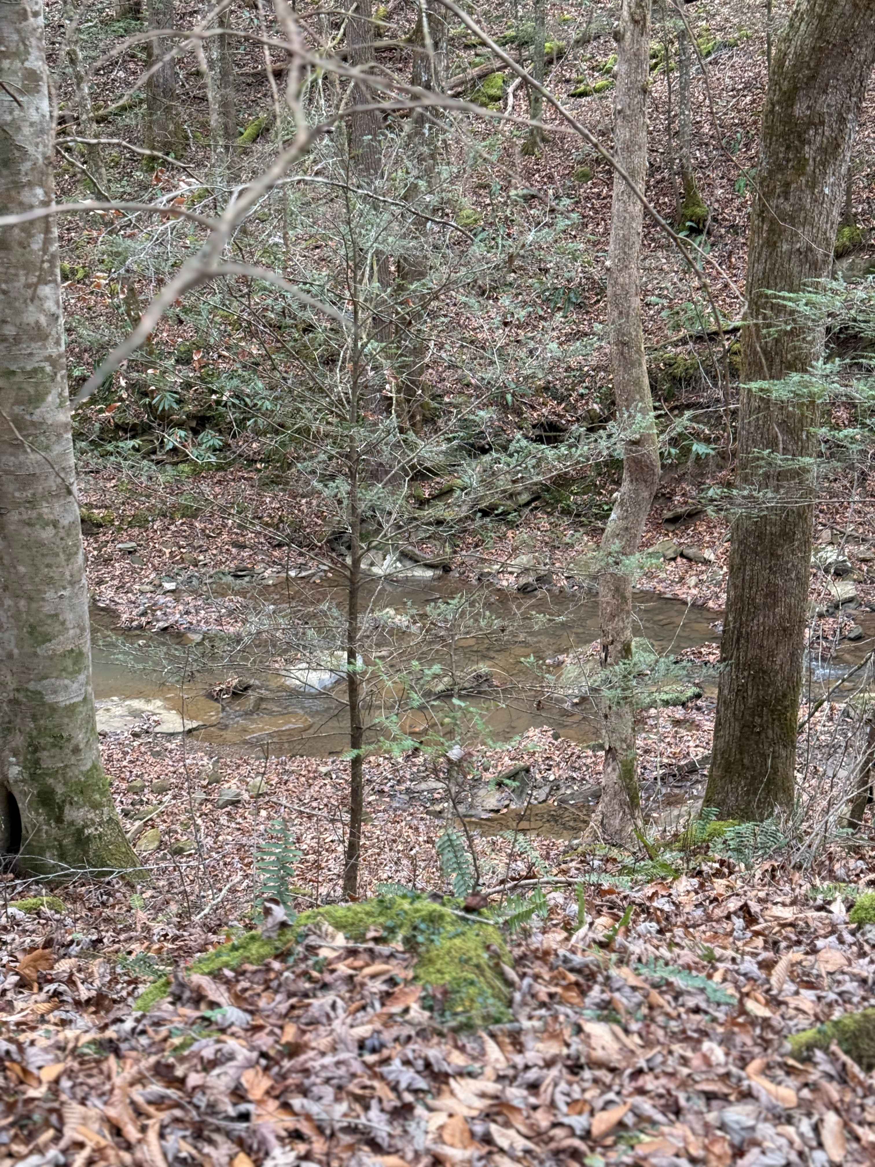
Crossroad Church Road (FS 123), or as it was formerly, the Old Kentucky Route 289, once paved, is now a broken pavement, mended with gravel forest service road, through the northeast corner of the Kentucky section, Lake Barkley side, of the Land Between the Lakes National Recreation Area. The road starts gently, as an aged paved road starting at the former settlement called Cross Road, going east between the former Crossroad Baptist Church and the Dickerson-Dixon Cemetery. As the road meets the first bend in its track, the road shows its first gravel, filling in the gaps of the lacking pavement. From here on, as the track goes, the more the gravel seems to replace the old pavement, in places creating man-made curb-size drops and ledges from active erosion washing gravel away from around the pavement sections along the mild graded hill portions of the track. Once along the valley bottoms of the track, it passes the Barnet Spring, being placed on the south side of the track, slowly trickling water to the east, where it and the FS 123 meet the Clay Bay. The FS 123 rides along the north shore of Clay Bay, before hitting a turnaround loop about halfway to Lake Barkley's main body of water. If hiking the north shore of Clay Bay east from the turnaround, more of the Old Kentucky 289 pavement can be seen going east until it meets Lake Barkley's edge. To most, on the surface, this would seem like some lacking project road on the Forest Service's part, but in reality, it is a time capsule to come and witness a former very purposeful road with evidence of its past life.
Photos of Crossroad Church - FS 123
Difficulty
The Crossroad Church (FS 123) is given a base rating of 2/10, despite it's unique terrain, being tied to its history, it was once paved with asphalt, likely when it was the Old Kentucky 289, thus scattered fragments of this old pavement remain, with majority of the road now being gravel, which was used to fill in the broken and lacking sections of former pavement. The sections of pavement create unique features such as small drop-offs/ledges, loose coarse pavement chunks, and active erosion surrounding the pavement. To top all this off, it is also safe to expect all the normal gravel road complications like mounding of the gravel, washboards, and potholes, with sections in the lower bottoms of the road even fading to dirt, and potential surface mud. The road could be mended and revert to a 1/10 rating, but until the pavement is removed or redone, this road will likely return to the shape it is currently in, being a 2/10. Difficulty could increase if there was an extended lack of maintenance, heavy use, or in extreme wet and inclement conditions.
History
The name of the FS 123 comes from the settlement called "Cross Road" that was settled around the intersection of the Old Kentucky Routes 289 and 58 (now being the Old Ferry Road East FS 117). On the northeast corner of the intersection is the Dickerson Cemetery. Based on some old maps from the 1950's this was once called the Dixon Cemetery. It is the final resting place of over 225 people, with lives ranging from 1815-2025 (as of 2025). Please respect those who came before us, leave the cemetery as it is, or better than it was found. On the Southeast corner of the intersection once stood the Crossroad Baptist Church, built in 1946. It survived until it was removed in roughly 1965 during the final clearing stages of the TVA takeover along the Lake Barkley side of Land Between the Lakes. The Crossroad Baptist Church's stone door mantle is placed on a slab on the ground where the front entry doors used to be. --- Midway down the track on the north side of the road was once a Wake School; this can be seen on the 1928 and 1931 Eddyville, Kentucky, topo map, before being removed from all future editions of the Eddyville topo. --- The FS 123 is the northern end of the former Old Kentucky Route 289. This shows in the road terrain itself, with the road still (in 11/2025) being made up partially of sections of old broken asphalt, filled in with gravel where the asphalt isn't. This broken road leads to Clay Bay, where the Old Kentucky 289 historically made a near 90-degree turn south to follow along the eastern ridge line that now makes up the eastern shoreline of Lake Barkley. At the eastern end of the FS 123, this old asphalt continues east, and can be followed at winter pool all the way to the end of the south-facing shore at 37.01427, -88.06637. Here is where the former road turned hard south to meet the far east point of the southern ridge that lines Clay Bay. This Lake Barkley side - northern section of the 289 road ended the modern US-68 / former Kentucky Route 80, with the 289 technically paralleling going west to its Kentucky Lake - southern section along the former Kentucky Route 453 / modern Woodland Trace (FS 100), south of modern US Route 68 / former Kentucky 80. For more historic and visual context to this road, search Chris Nails Historic Trails Shorts Ep. 2 on YouTube, Documented By Christopher Menz 12/2025.
Status Reports
Crossroad Church - FS 123 can be accessed by the following ride types:
- High-Clearance 4x4
- SUV
Crossroad Church - FS 123 Map
Popular Trails
Wallace Road - FS 156
Clifton Ridge Road
Whoopfalerea
The onX Offroad Difference
onX Offroad combines trail photos, descriptions, difficulty ratings, width restrictions, seasonality, and more in a user-friendly interface. Available on all devices, with offline access and full compatibility with CarPlay and Android Auto. Discover what you’re missing today!