Bethlehem Cemetery - FS 122
Total Miles
1.5
Technical Rating
Best Time
Spring, Summer, Fall, Winter
Trail Type
Full-Width Road
Accessible By
Trail Overview
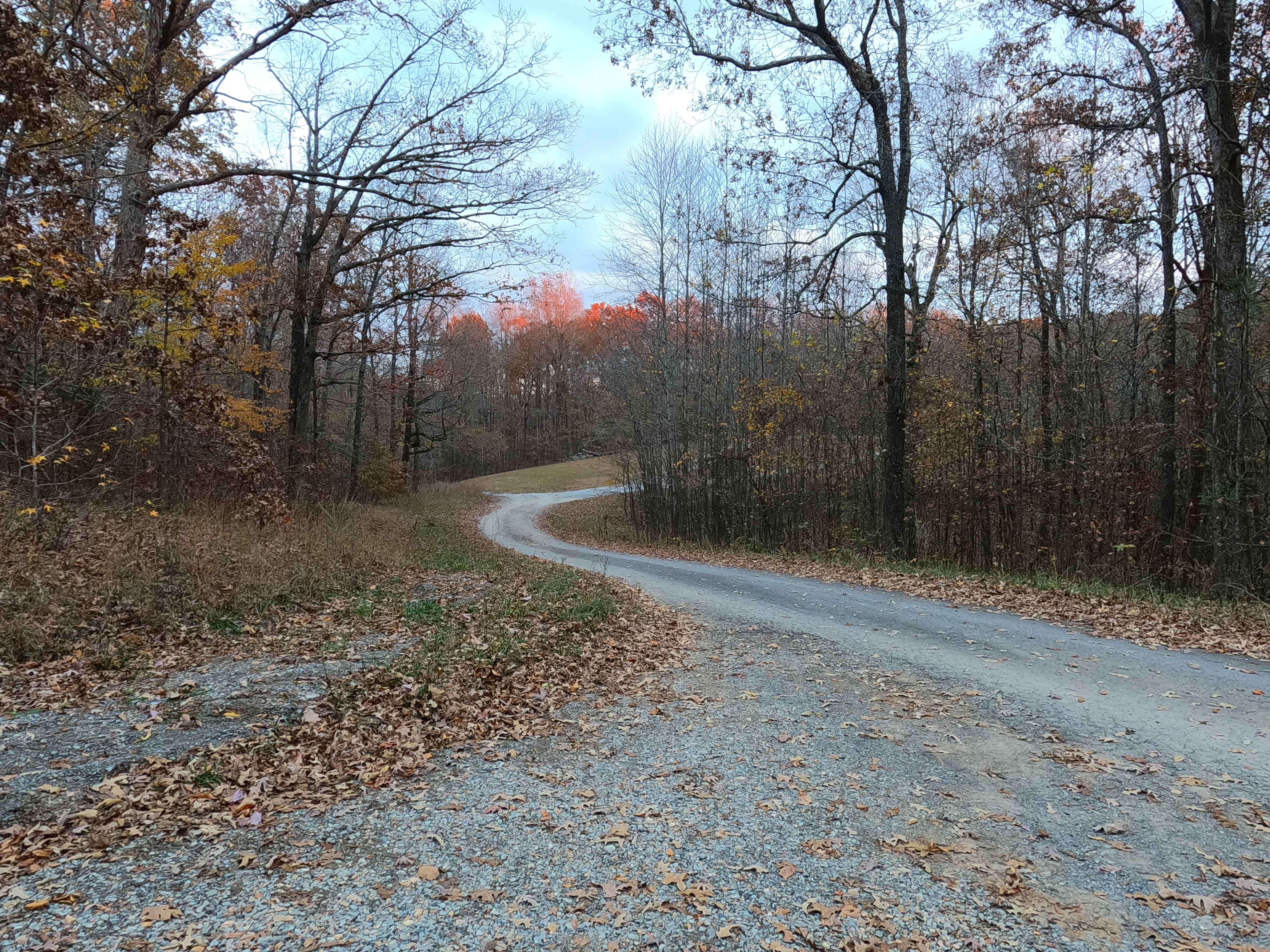
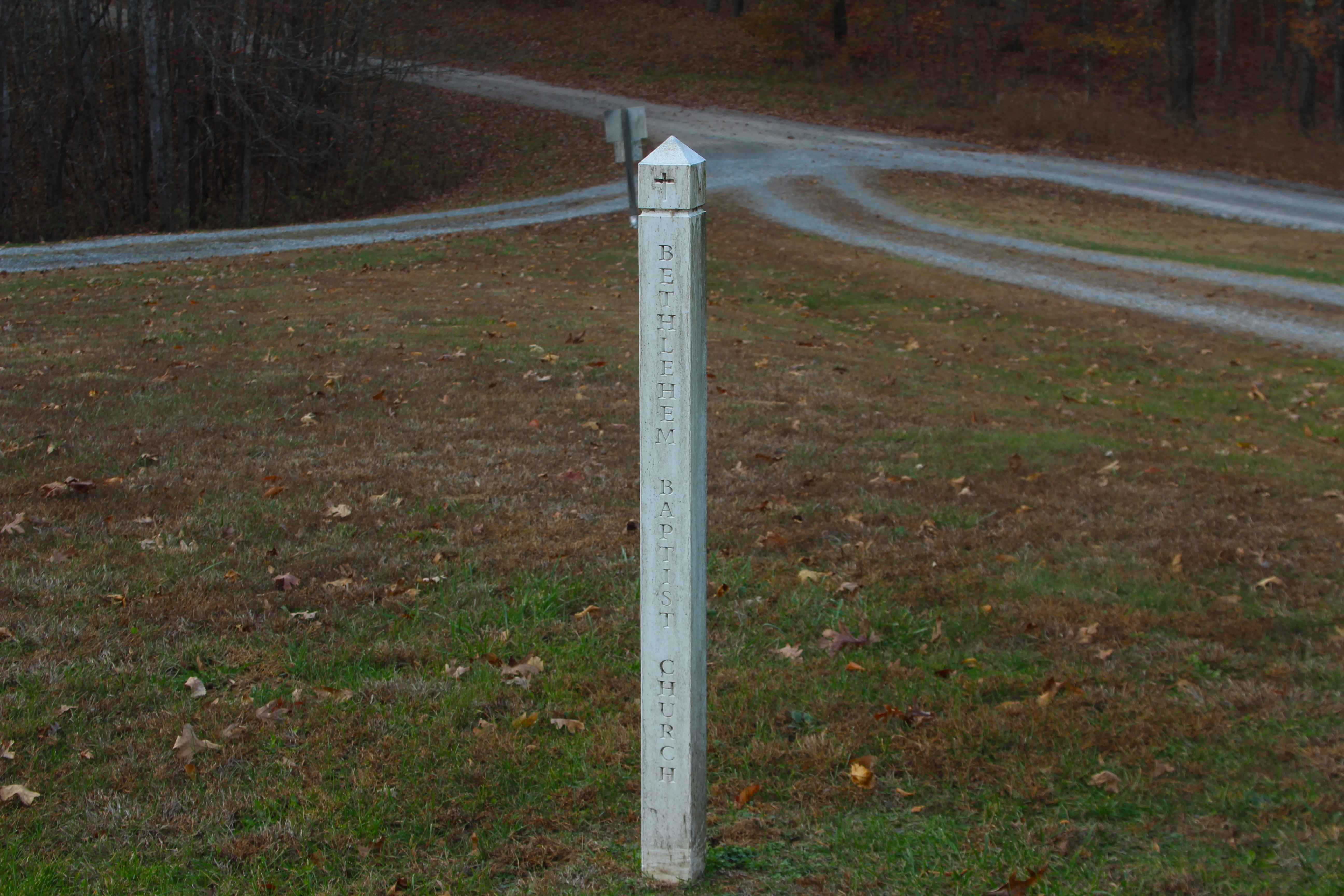
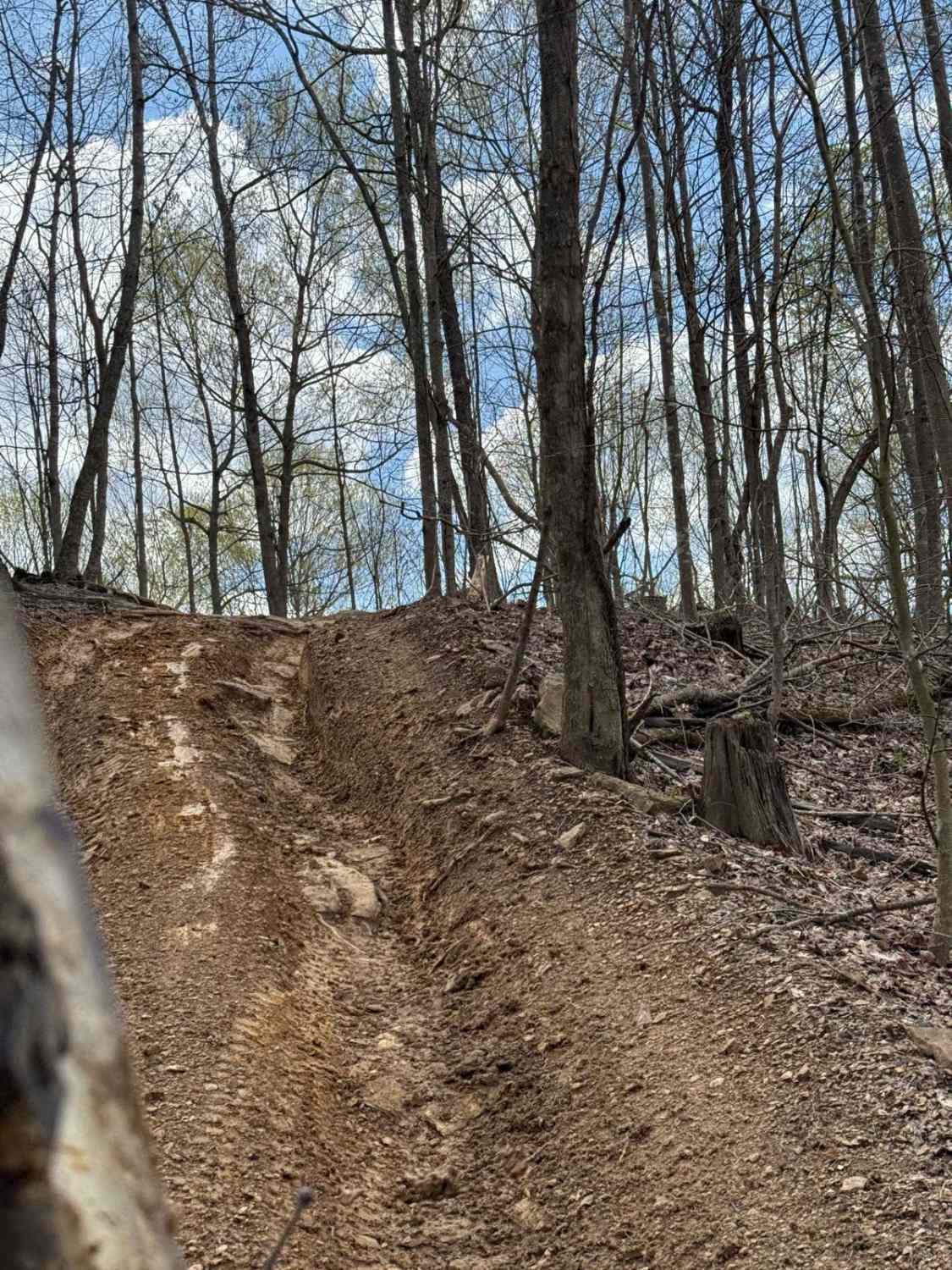
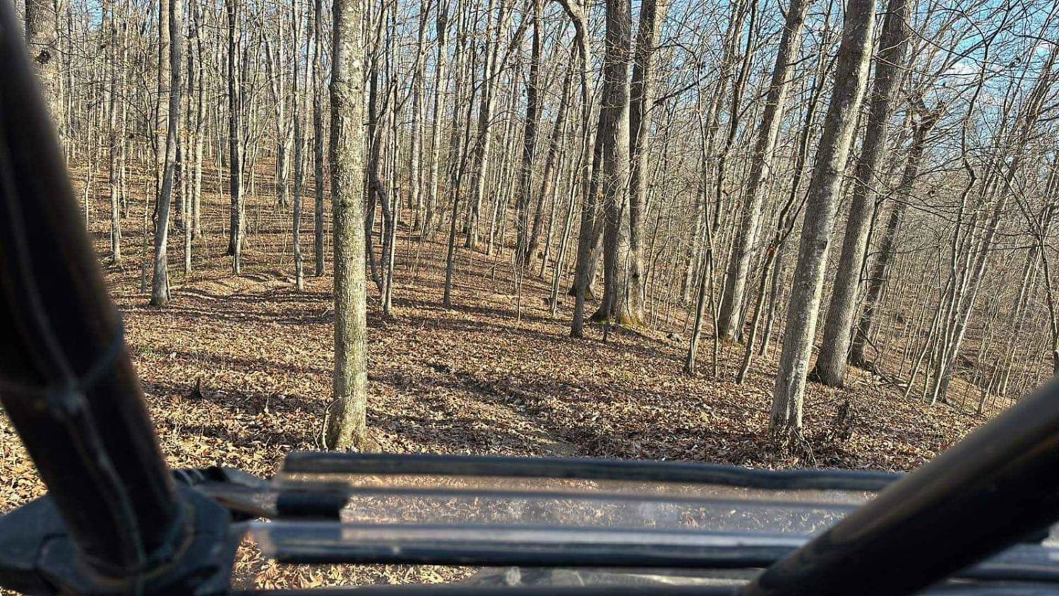
Bethlehem Cemetery Road (FS 122) is a Forest Service Road, paved for the first 0.6 mile western section, transforming next into a 1-mile-long gravel eastern section, placed in the northeast corner of the Kentucky section, Lake Barkley side, of the Land Between the Lakes National Recreation Area. The paved section of the road begins at the Old Ferry Road East (FS 117), going southeast, curving through the low valley, crossing over creeks via concrete bridges, before it climbs a small hill to the intersection with Stephens Chapel Road (FS 415), shortly after which it transitions to the gravel section of the FS 122. This paved-to-gravel transition happens near the former site of Bethlehem Church, and still present Bethlehem 1 Cemetery, these two points of interest are located on a loop going south and uphill from the FS 122. The now gravel track quickly goes downhill from the Cemetery loop, showing signs of erosion and washes along the first gravel hill, before slightly leveling out, cresting a small hill, and dropping down a second small hill into the valley bottoms along the Mammoth Furnace Creek. Along the Mammoth Furnace Creek section of the road, there are signs of heavy use, from the many potholes and washboards, along with water-related damage, shown by sections of the gravel road washed away, being faded to dirt, with potential to be surface mud in wet seasons. This leads shortly to where the road and creek both meet the Mammoth Furnace Bay, with the road continuing along the north shoreline passing by several rock bluffs to the north of the road, with one larger turnaround cut out going into the tree line amongst said bluffs. The final stretch of the track goes past some well-placed rows of bushes along the water's edge, right before the road meets the shore gravel. During winter pool level this ending point is a pretty large open gravel shoreline to turn around on, but in summer is likely very small, if not completely underwater. Please don't drive into the lake water or on any potentially soft shoreline soil, as it is illegal and has a high potential to result in being stuck. A short road that packs in a lot of Land Between the Lakes vibes. Approximately 0.7 miles east of the end of this road was the former Mammoth Furnace along the same north shoreline the road tracks along; the ruins of the furnace are underwater right at the edge of the Bay's waterline, but can still be seen in the winter pool level. For more info on the historical context, check out the history section.
Photos of Bethlehem Cemetery - FS 122
Difficulty
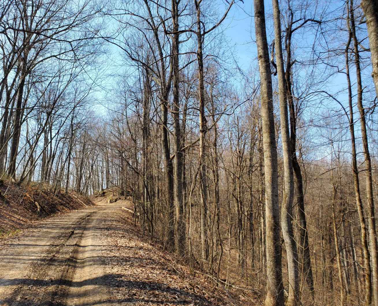
FS 122 is given a base rating of 1/10, for being a semi-maintained gravel road only traversing mild-graded hills, having active erosion present, but nothing requiring crossing any of the deep ruts, rather just the smaller washes of gravel, though if the erosion were to spread into the road, it could easily bump up to a 2/10. In the bottoms, there are spots along the nearby creek where the gravel seems to thin, sometimes all the way down to dirt, potentially becoming surface mud. It is safe to expect all the gravel road complications, such as mounding, washboarding, and potholes. Difficulty could increase in heavy use, or times of wet and inclement conditions, but would likely always return to a 1/10, either naturally or after being mended. Several spots along this road show that the US Forest Service has done repairs to this road before, using 2-inch minus chat to fill water collection holes.
History
Mammoth Furnace is a significant historical point of interest just to the east of the area that the FS 122 road traverses. In fact, the paved entry of FS 122 was the former host of a Kentucky Historical Society Marker (#1364) along the right of way at the intersection with FS 117, that is before the December 10-11, 2021 Tornado removed and displaced said cast iron marker. The marker had this information about the Furnace, "Built in 1845 by Charles and John Stacker, a stone stack 31.5 feet high, 9 feet across inside at widest. Steam-powered, charcoal-fueled, it made white unusually hard pig iron from ore deposits near the furnace, producing 1514 tons in 48 weeks, 1857. CSA Army obstructed the Tennessee River at Fort Henry with iron spikes made here. Last blast 1874." When referencing old topos from the 1950's the old road that the modern FS 122 replaced historically ended at the Bethlehem Church (basically what is paved now and the cemetery loop), with the TVA later pushing it out to the modern endpoint somewhere between 1970-1986, yet it doesn't end at or relatively next to Mammoth Furnace. So, when looking at what road serviced the Mammoth Furnace, it becomes quickly apparent that the road servicing much closer to the Furnace was the former Old Kentucky Route 289 to the east. The Old KY-289 actually went through the center valley, now a small water cove, amongst the two ridges that make up the modern northern shore of Mammoth Furnace Bay, also including a former mine designation in this same valley, roughly at 36.98889, -88.06042. When looking at the 1950's topo again, at the most southern point of this same valley, a spur road shoots to the south, ultimately going the Hurricane Creek valley, but right where it leaves the Old KY-289 it crossed the tip of the ridge and shortly met the Mammoth Furnace Creek, an optimal spot to have a Furnace, when cross referencing the modern satellite view of this location shows some debris in the edge of the water with trees growing from it, every modern picture of the Furnace ruins as such, rock blocks with small trees growing around them amongst the water. If this is the location, it is roughly at 36.98577, -88.05912 --- Bethlehem Cemetery is the final resting place of over 210 people who lived between 1809-2023 (Current as of 2025). Please respect those who came before us, leave the Cemetery as or better than you found it. --- Bethlehem Baptist Church was a popular name in the Land Between the Rivers region before the lakes were created, specifically, there were two in Kentucky. Bethlehem Baptist Church (north) was located in the northeastern Kentucky section of LBL off the modern FS 122, located right alongside the historic church cemetery, on modern maps simply called "Bethlehem 1 Cemetery". Bethlehem Baptist Church (south) was located in the southeastern Kentucky section of LBL, off the modern FS 355, a short distance from where it begins spurring off the FS 174. There are concrete ruins of this one in the treeline along FS 355, though its cemetery was located on the west side of the 174, roughly 700 feet away from the church. Both Churches and Cemeteries were displayed in the 1950s era of topo maps for the two separate locations, but in the 1960s, both Churches lost their designation on the map, with the two cemeteries remaining marked simply as "cemetery". In modern LBL recreation maps, more specific names were given to the two cemeteries, being Bethlehem 1 & 2. Documented By Christopher Menz 12/2025
Status Reports
Bethlehem Cemetery - FS 122 can be accessed by the following ride types:
- High-Clearance 4x4
- SUV
Bethlehem Cemetery - FS 122 Map
Popular Trails
Kingston S-Tree Area
The onX Offroad Difference
onX Offroad combines trail photos, descriptions, difficulty ratings, width restrictions, seasonality, and more in a user-friendly interface. Available on all devices, with offline access and full compatibility with CarPlay and Android Auto. Discover what you’re missing today!