Bogard Road - FS 157
Total Miles
0.9
Technical Rating
Best Time
Spring, Summer, Fall, Winter
Trail Type
Full-Width Road
Accessible By
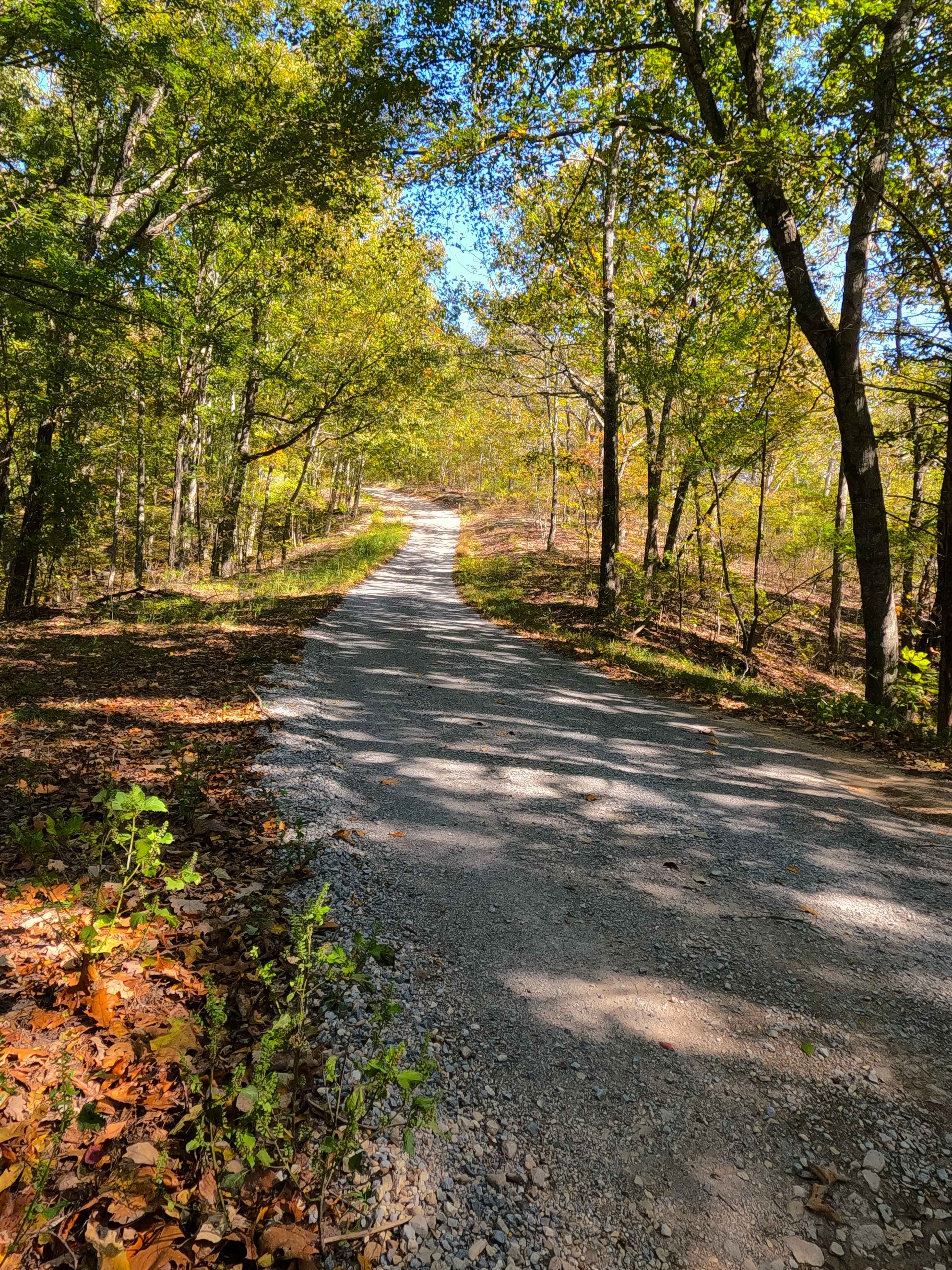
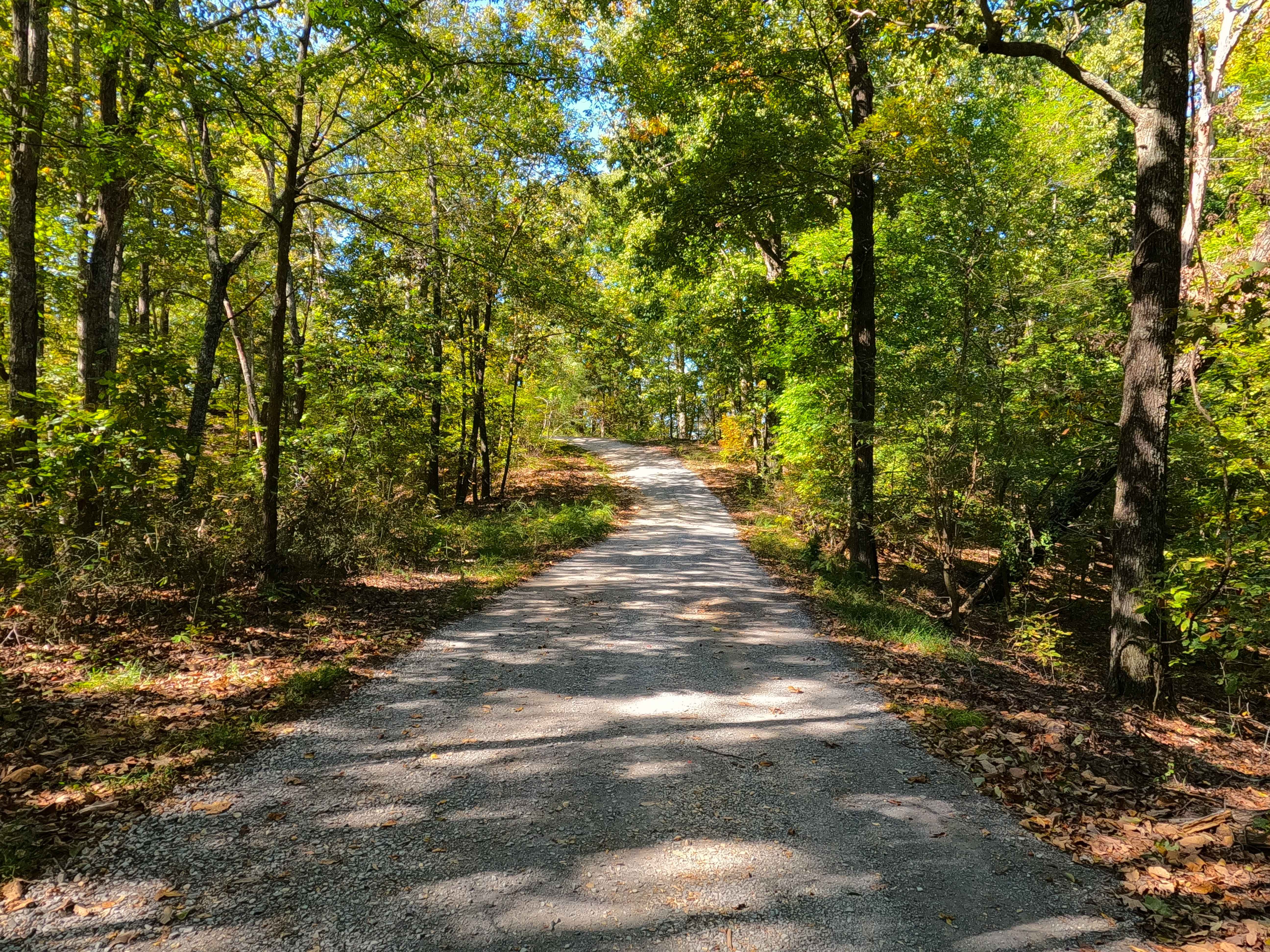
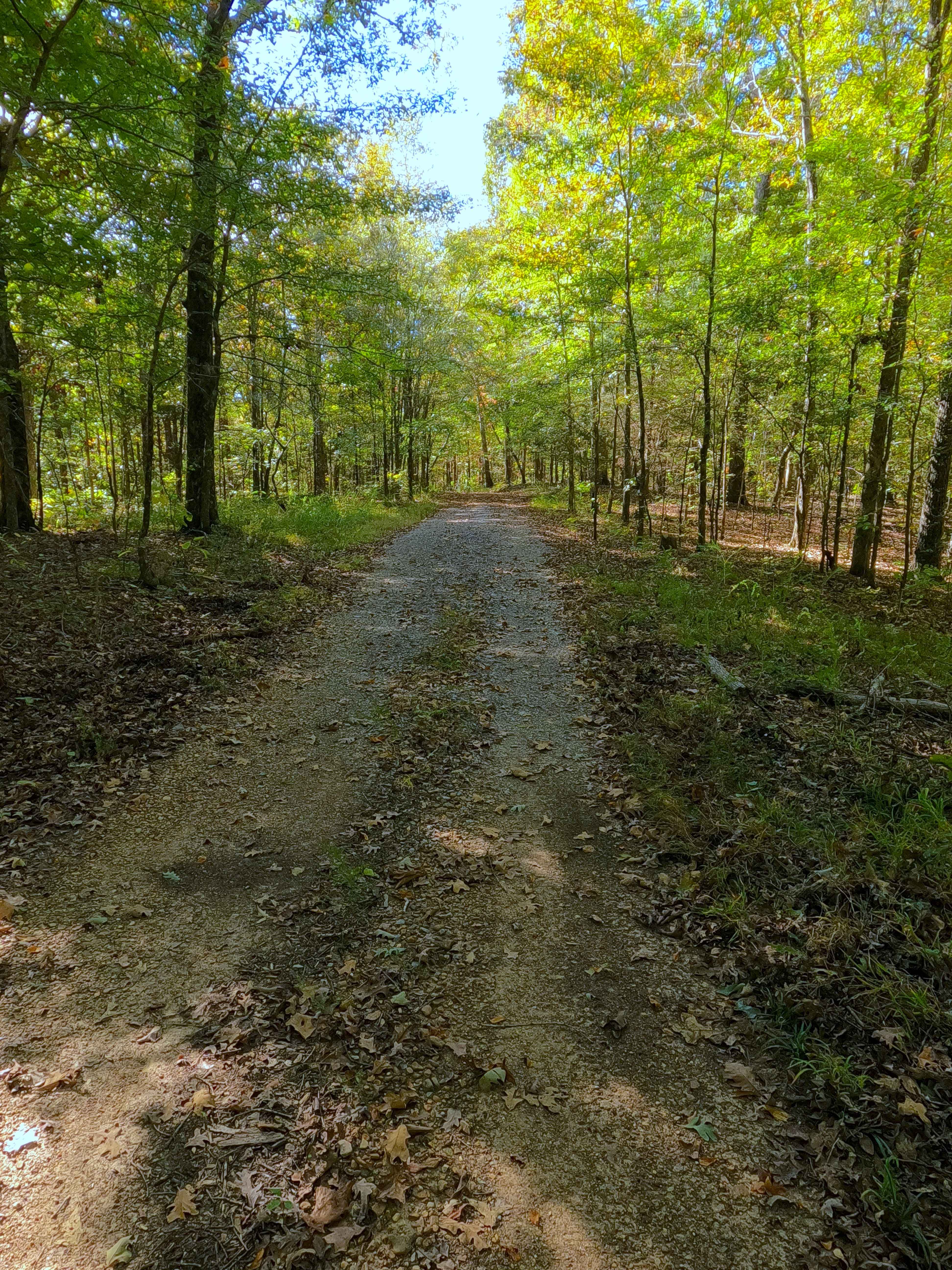
Trail Overview
Bogard Road (FS 157) is a gravel forest service road through the center-east Kentucky section, Lake Barkley side, of the Land Between the Lakes National Recreation Area. This route comes off from the Energy Lake Road (FS 134) heading east to the shorelines of Lake Barkley just south of Pond Bay. The ride tracks downhill over a couple of steep hills paired with a valley in between before meeting the last steep hill section, while passing old concrete foundations built into the hill on the left side, to conclude at a turnaround before the shoreline. Along the way, there are sections of clean gravel, suddenly changing to coarse natural gravel or fading to clay-like dirt, with active erosion ruts and occasional natural rock cobbles poking out at the surface. The Joe Bogard homestead features 3 concrete foundations and an overgrown loop road that used to service said homestead. Down near the turnaround and shoreline is an additional concrete retaining wall, with what appears to be a small opening up on the hill it is supporting. Check out the history section for more details. FS 157 is gentle with a dash of thrill, leading to a cool artifact of the past lifestyle that once existed before the TVA takeover.
Photos of Bogard Road - FS 157
Difficulty
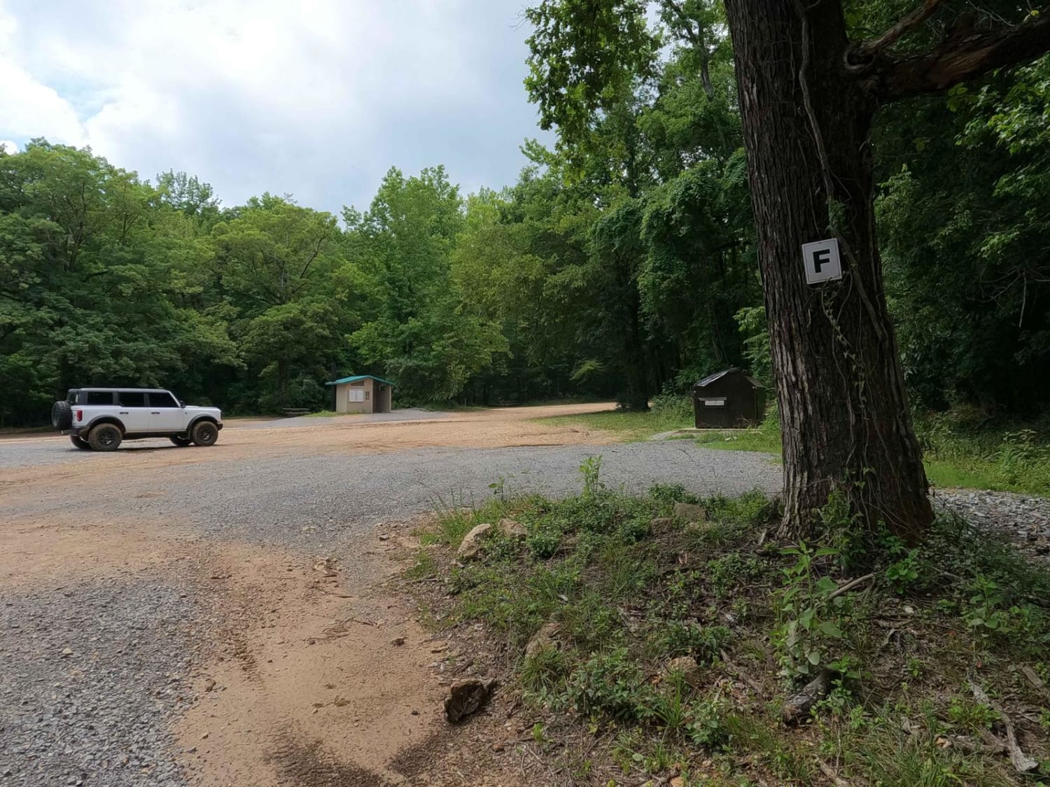
Bogard Road is given a base rating of 2/10, for having ruts with 12 inches or less of depth, and cobble-sized (10 inches or less) natural rock laying on the road, over natural sections of coarse gravel and dirt/clay mix and last for the erosion rutted steep grade present on the last hill, with (potentially loose unpacked) sand at the bottom right before the shoreline. Full-size vehicles can traverse the trail; just be warned that the turnaround could be tight, and there are low-hanging and tight trees. Difficulty could increase in wet conditions, heavy use, or a lack of maintenance.
History
The Homestead at the end of FS 157 belonged to Joe Bogard, regarded as the "Kingpin of the Golden Pond Still Men". LBL Heritage had this to say about him and the prohibition-era Golden Pond. Prohibition agent William "Big Six" Henderson held so much respect for the moonshiners of Golden Pond, Kentucky, that he wrote a letter detailing their role in the moonshine industry to Bob Howes, the director of Land Between the Lakes, in 1969. In the letter, Big Six states that "during the early prohibition era from 1919 to the late 1920s, the Bogards, the Higgins, the Joyces, the Mitchusons, the Calhouns, and various other family units who were early settlers of the community plied their trade or illicit traffic in moonshine whiskey almost unmolested." Big Six highlights Joe Bogard as the Kingpin of the Golden Pond still men. Joe was highly respected for his honesty in his dealings and was very discerning in the quality of the moonshine being sold. He is credited with organizing and supervising the sale and distribution of all the liquor that came out of Golden Pond. The unique close-knit quality of Between the Rivers communities likely played a big role in the renown and success of Golden Pond moonshine. A former resident of Between the Rivers likened the quality of Golden Pond whiskey to that of Jim Beam. Many stillmen from this community took such pride in their product that it was treated as a science and was not drunk during operations. This quality control was likely due to Joe Bogard's efforts." In my own research using the 1953 Canton, KY topo, a county road can be seen that tracks nearly unchanged from the modern FS 157, with the house and its turnaround loop being illustrated in the same spot as the foundation shows today. The house is shown again in the 1967 version, before being dropped off in 1970s map updates, but the turnaround loop still exists to the present day, up to the most recent 2022 Canton, Kentucky, topo. It is most likely that the TVA takeover in the early 1960s forced the last resident off this property. The history of the roads FS 154-158, is all connected in one way, that being the old Kentucky Road 289, which historically ran right along the bottom of the eastern ridges of LBL or the western shore of Lake Barkley, connecting all the old county roads that either became or were replaced with FS roads. These roads connected to the old 289 at roughly 25-200 feet in the water from the modern shoreline. The south end of old 289 started at the US-68 and KY-80, at 36.80202, -87.98454, going north all the way to the Crossroad Church (FS 123), which completely rests on the old 289 track, and hosts its northern endpoint, at 37.01368, -88.09205. The old Crooked Creek Bridge, part of old 289, can still be seen in the winter pool at the end of the FS 154. Documented by Christopher Menz with help from the Exploring The Land Between the Lakes Facebook Group and LBL Heritage, 10/2025.
Status Reports
Bogard Road - FS 157 can be accessed by the following ride types:
- High-Clearance 4x4
- SUV
Bogard Road - FS 157 Map
Popular Trails

New Hope Lookout Tower Road - DBBB
Boardinghouse Access - FS 333

Pinnegar Road
F to E Road
The onX Offroad Difference
onX Offroad combines trail photos, descriptions, difficulty ratings, width restrictions, seasonality, and more in a user-friendly interface. Available on all devices, with offline access and full compatibility with CarPlay and Android Auto. Discover what you’re missing today!