Otter Pond FSR 345A
Total Miles
0.4
Technical Rating
Best Time
Summer, Fall
Trail Type
High-Clearance 4x4 Trail
Accessible By
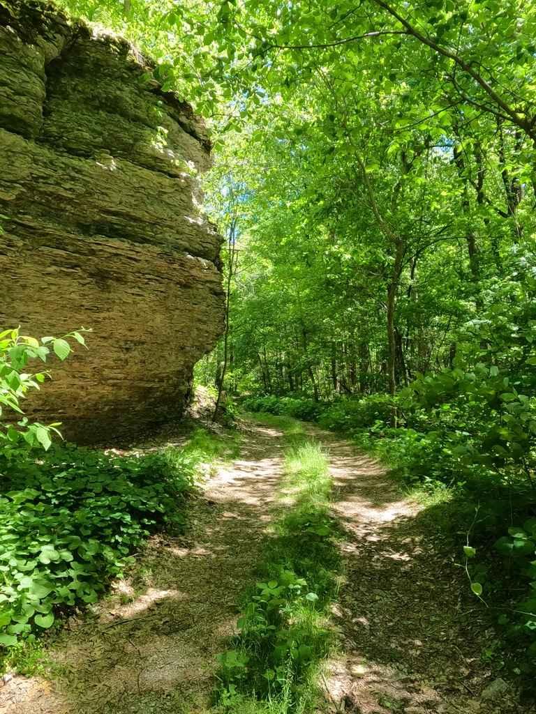
Trail Overview
The Otter Pond FSR 345A is a natural forestry road in the Mississippi Bluffs Sector of Shawnee National Forest. The trail is in a very ecologically preserved area and closes yearly during the winter (December 9th to May 9th). It features a quick dose of offroading, mixed with a lot of scenery, featuring the rock bluffs on the east side of the road, and the wetland ponds to the west, both of these being so close that you have to navigate around both in a vehicle. Trail features rock, washes, a water crossing, and off-camber water erosion along the road surface. The end of the trail features a little turnaround at the end, but no more than two vehicles should go to the end at once.
Photos of Otter Pond FSR 345A

Difficulty
The difficulty of this road is surrounding the natural ascetics paired with minimal maintenance yielding a fun forestry road. It features a natural surface of rock, gravel, and dirt, and could feature mild mud if wet, it features heavy water erosion washes as deep as 12-18", off-camber leaning and ruts being as much as 18" difference from side to side, with mild inclines, tight treelines, loose rock, and at least a 12" deep water crossing at the edge of the wetlands. If picking wise lines the road can be mostly easy to navigate but features intermediate difficulty when driving over the heavy washes. The difficulty is amplified if conditions are wet.
History
The yearly migration involves the hibernation of the animals during the winter months in the bluffs. These animals then move to their feeding grounds in the swamp during the summer months. Herpetologists have reported that the main factor in triggering seasonal migration is ground temperature. This road was open to traffic year-round prior to 1972. This resulted in the death of many animals that were crossing the road. Consequently, the Forest Service decided to close a 2.5-mile segment of the road during the seasonal migration to protect the reptiles and amphibians. The road is now being closed for two months in the spring and fall to further ensure the protection of early or late migrating species. The number of animals protected by this action is unknown, however, far fewer reptiles and amphibians are found dead on the road. LaRue-Pine Hills/Otter Pond Research Natural Area (RNA) became our nation's 250th RNA in 1991. RNAs are permanently protected to maintain biological diversity and to provide places for research and monitoring of undisturbed natural areas. Info sourced from https://www.fs.usda.gov/Internet/FSE_DOCUMENTS/stelprdb5106391.pdf
Status Reports
Otter Pond FSR 345A can be accessed by the following ride types:
- High-Clearance 4x4
Otter Pond FSR 345A Map
Popular Trails

South Forest Road
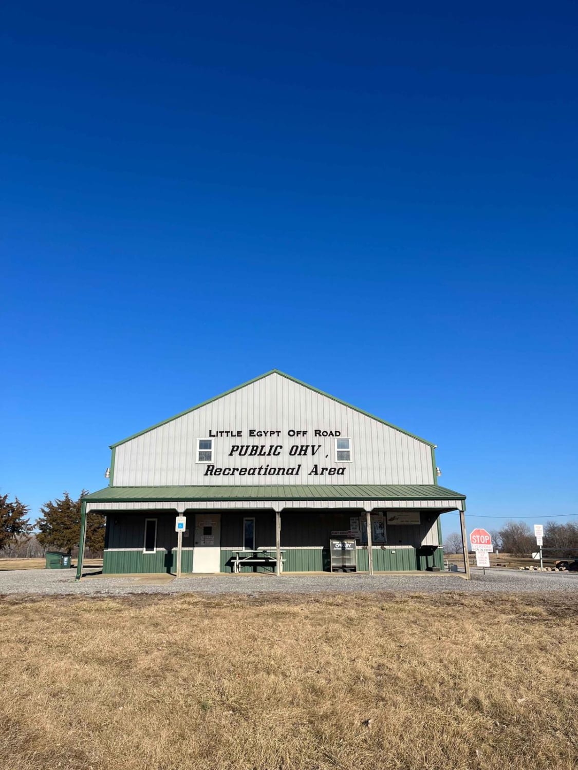
Little Egypt Off-Road OHV Park Entrance

Rattlesnake Ferry - FS 345
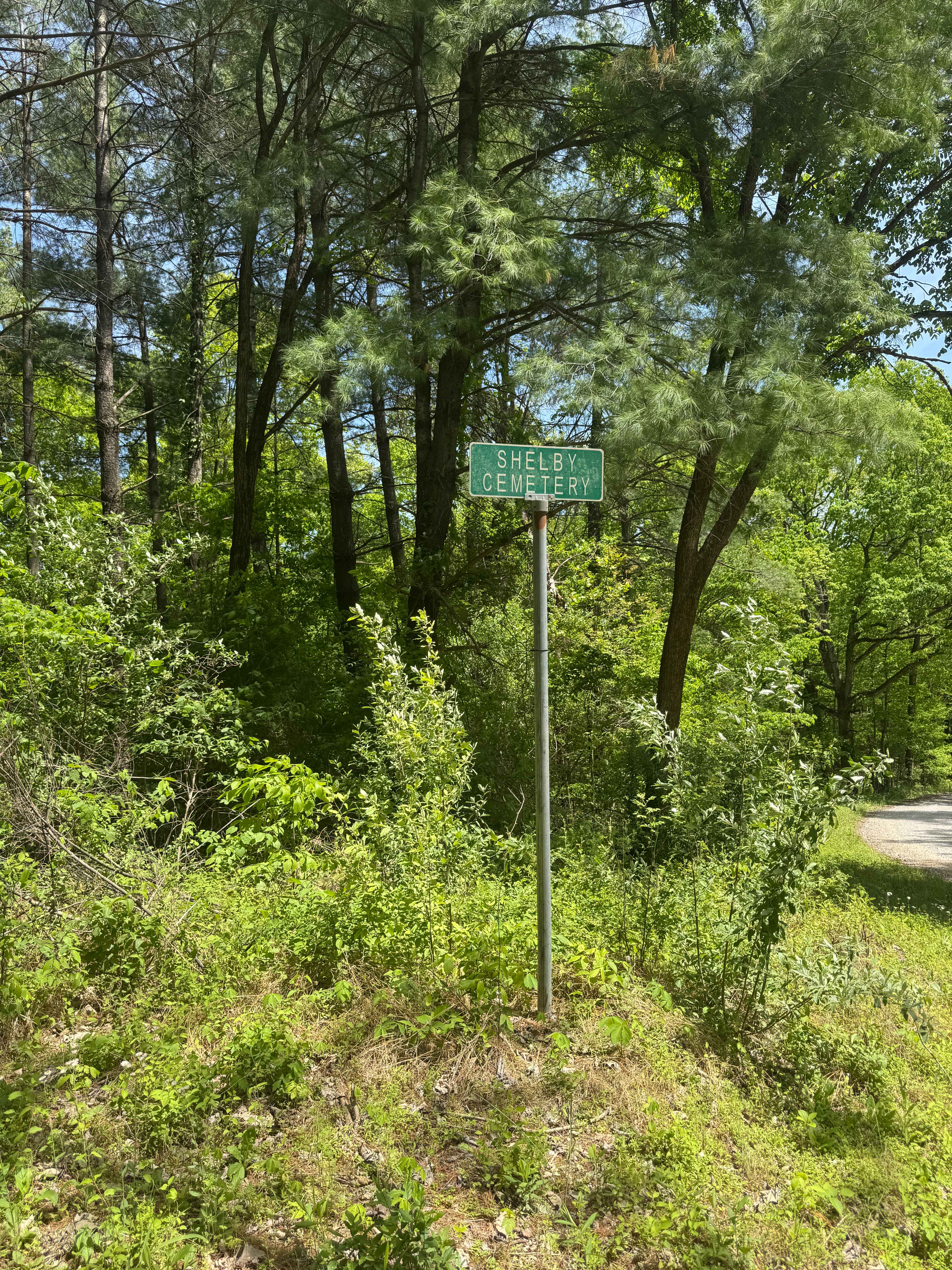
Shelby Cemetery Trail
The onX Offroad Difference
onX Offroad combines trail photos, descriptions, difficulty ratings, width restrictions, seasonality, and more in a user-friendly interface. Available on all devices, with offline access and full compatibility with CarPlay and Android Auto. Discover what you’re missing today!